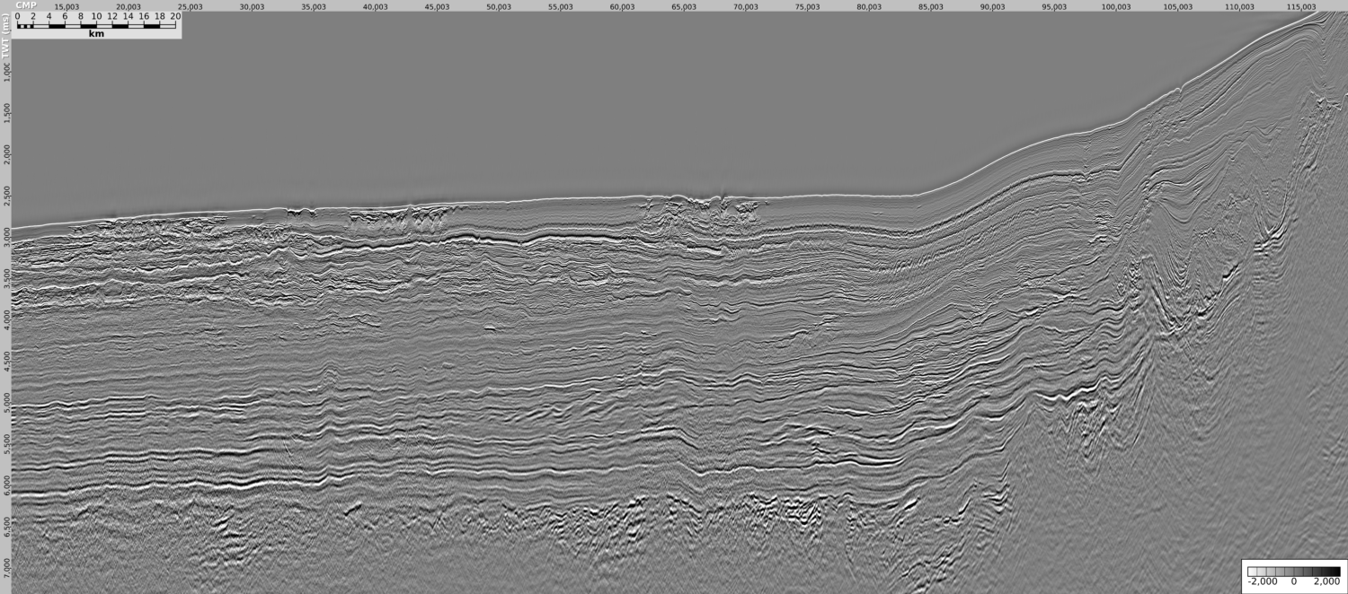
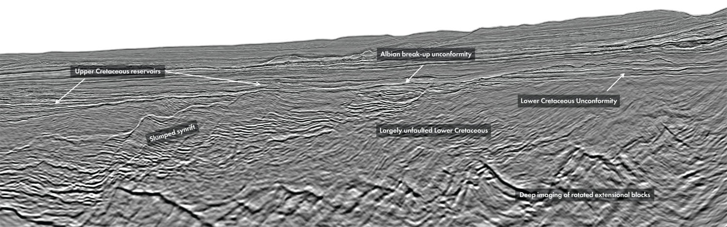
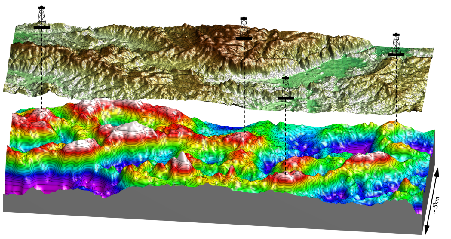
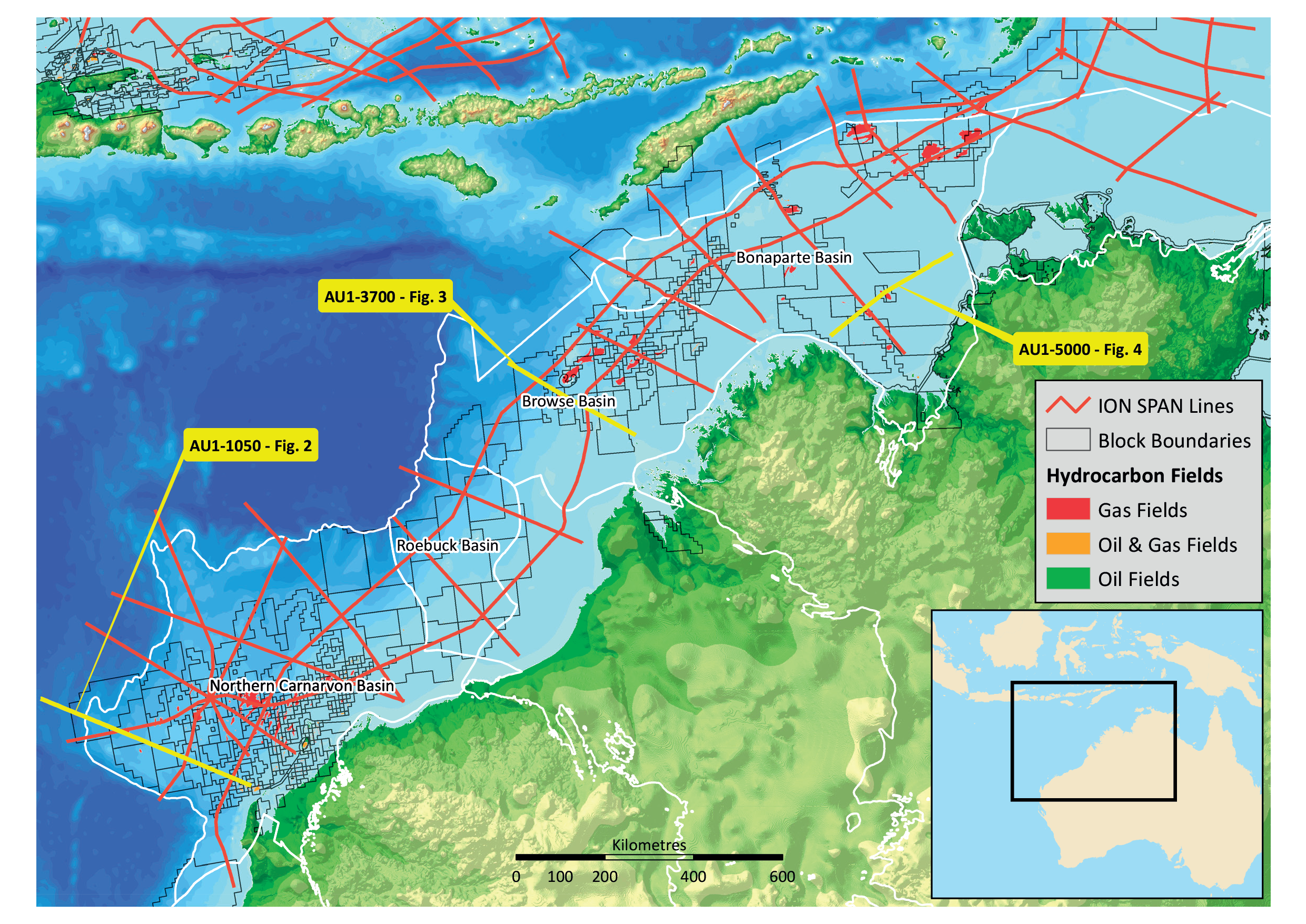
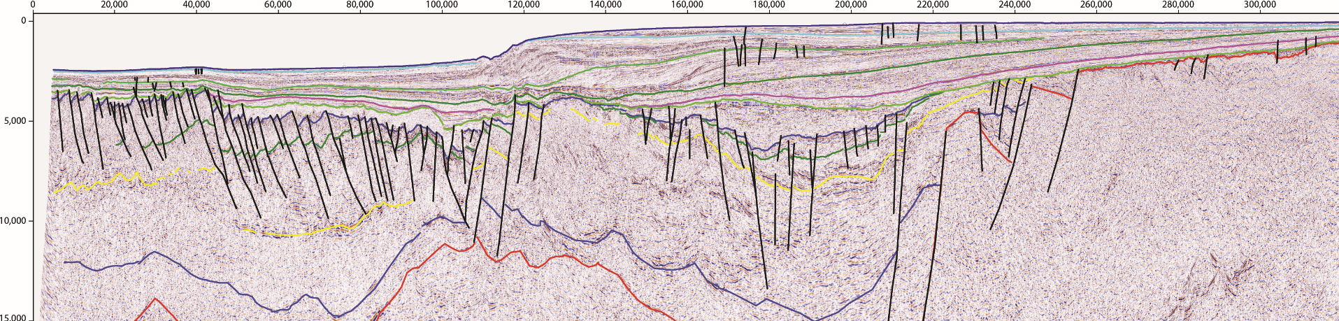
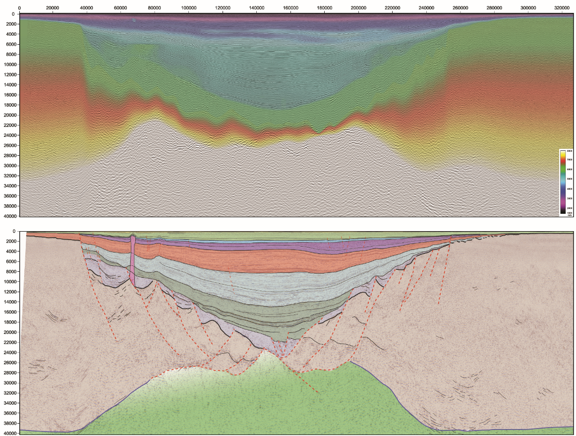
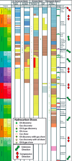
The North West Shelf of Australia is a diverse petroleum province that has remained enigmatic over a prolonged period of exploration. Offshore drilling started in the late 1960s with shelfal wells in the Carnarvon and Bonaparte Basins. More than 2,000 wells have since been drilled, resulting in discoveries of over 3 Bb of liquids and 100 Tcf of gas resources. In 2011, the USGS estimated a remaining undiscovered potential of 4.6 Bbo and 225 Tcfg for the basins from the North Carnarvon to the Bonaparte. With an estimated remaining undiscovered potential of 4.6 Bbo and 225 Tcfg, there is still much to explore for in the North West Shelf of Australia The North West Shelf (NWS) can be divided into four major basin areas (Figure 1), each with a number of working petroleum plays from Permian to Cretaceous: The NWS and its constituent basins and sub-basins have been subjected to, and modified by, multiple tectonic events with different orientations and extents, each well defined in the ION WestraliaSPAN data (Figure 5). Key to progressing our understanding of the NWS has been the availability of long- offset (10km), long-record (18s TWT), regional seismic data that have been pre-stack depth migrated (Figures 2–4). The WestraliaSPAN line layout includes true dip lines orientated so as to accurately image the structural grain of the NWS, while regional strike lines link the constituent basins of the Westralia Superbasin, providing regional links between the provinces of the NWS. This enables construction of regionally consistent models for the geological evolution of the NWS. Beyond careful planning and acquisition, the use of ION’s latest imaging and velocity modelling capabilities are the basis for the results. Depth imaging enables complex structures to be viewed with true depth perspective, and permits the regional links between the different provinces to be calibrated. The improved imaging combined with better velocity modelling allows interpreters to see for the first time the full sedimentary section and underlying crustal architecture, distinguishing between what had previously been considered to be continental basement, and sediment. Both the North Carnarvon and Bonaparte Basins (Petrel sub-basin) are characterised by thick sediment accumulations, up to 20 km and 24 km respectively. Multiple rifting phases have resulted in hyper-extension of the crust and possibly extensive mantle exhumation in these basins. Sediment supply has generally kept pace with the creation of accommodation space, with sediment having been deposited directly onto exhumed continental lithospheric mantle (Figures 2 and 3). A striking feature of the NWS is that it contains an almost complete record of sedimentation throughout the entire Phanerozoic (Figure 5). This is due to the protracted and polyphase nature of stretching events along the NWS, and the comparatively limited periods of uplift and erosion. The thick sediment sections raise a number of questions and implications for the prospectivity of the basins. The anomalous sediment thicknesses are difficult to balance with traditional crustal extension and subsidence models. Models of hyper-extension and/or mantle exhumation are required to isostatically provide the accommodation space to allow for such deep basins. These models have significant uncertainties as the process of serpentinisation of the underlying lithospheric mantle is extremely difficult to constrain in terms of its extent and impact on density and heat flow. In general, serpentinisation will decrease density and thus suppress subsidence. In addition, the process of multiphase extension with relatively long time periods between events (see Figure 5) means that the thermal effects of previous rift events will be largely dissipated by the time of the next event, and that both deep sediment and partially serpentinised lithospheric mantle from previous events may be acting essentially as continental crust in later events. Finally, once the sediment pile reaches a certain thickness, progressively higher grade metamorphism will occur. We can see evidence for this on AU1-5000 (Figure 3) where reflections that appear to be characteristically sedimentary have seismic velocities in the region of 5.5 – >6 kms-1. This increase in seismic velocity (and implicitly density) will serve to drive additional subsidence, creating accommodation space for further sediments. These competing factors driving the subsidence of the margin at different times and in different ways have implications for heat flow and thermal maturation of source rocks. Interpretation of the deep seismic data of the WestraliaSPAN survey provides an image of the architecture, allowing explorers to constrain the structural evolution and integrate existing heat flow and geochemical data to better understand petroleum system history.
The Australian North West Shelf: new insights from deep seismic
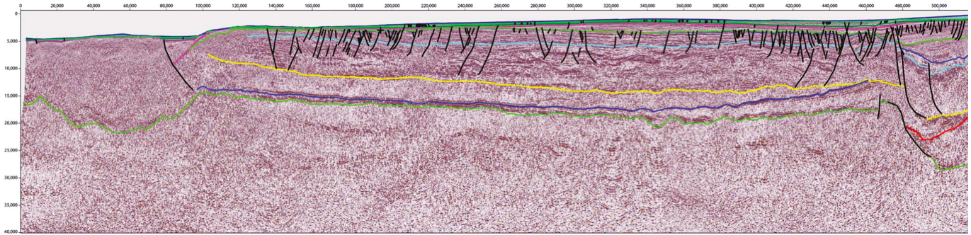 Figure 2: North-west to south-east line across the North Carnarvon Basin, imaging the full sedimentary section down to 20 km depth. The full Permo-Triassic Mungaroo delta is imaged with its small-scale extensional faulting, which appears to detach down onto the underlying Permo-Carboniferous strata. The majority of the section across the Exmouth Plateau is interpreted to be underlain by exhumed mantle. The inboard transition from continental crust to exhumed mantle is also the focal point for the later development of the Exmouth sub-basin at the south-east end of the line. The north-west end of the line records the eventual Jurassic break-up event with important volcanic and intrusive features diagnostic of a volcanic margin. See Figure 5 for horizon correlations.
A developing province
The importance of quality data
Implications for future prospectivity
Related Articles