ION

Can sparse OBN equal savings and data quality?

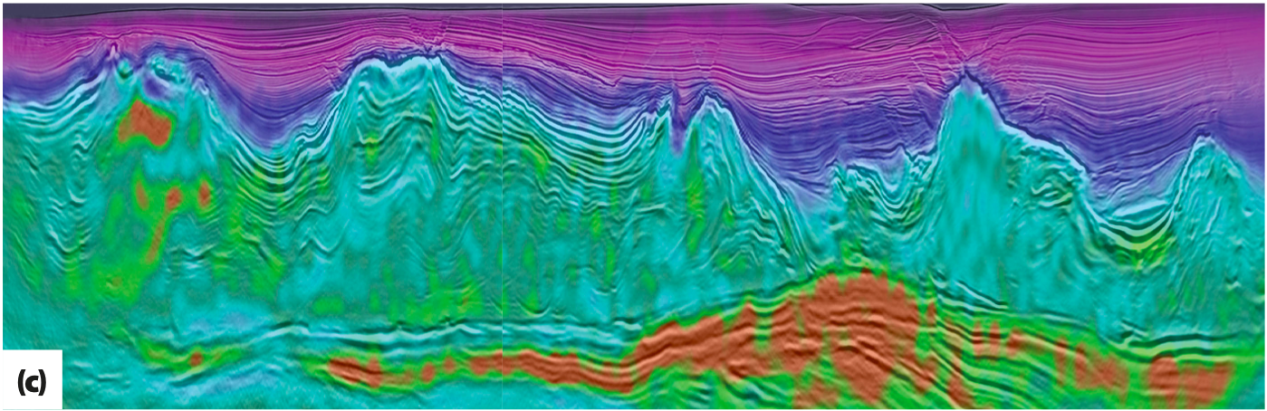
Geology The study area is in ultradeep waters (2 km) of the Santos Basin and the geology is comprised of a 2–4 kilometer-thick sequence of mostly clastic sedimentary rocks overlaying evaporite layers and thick salt comprised mostly of halite, with…
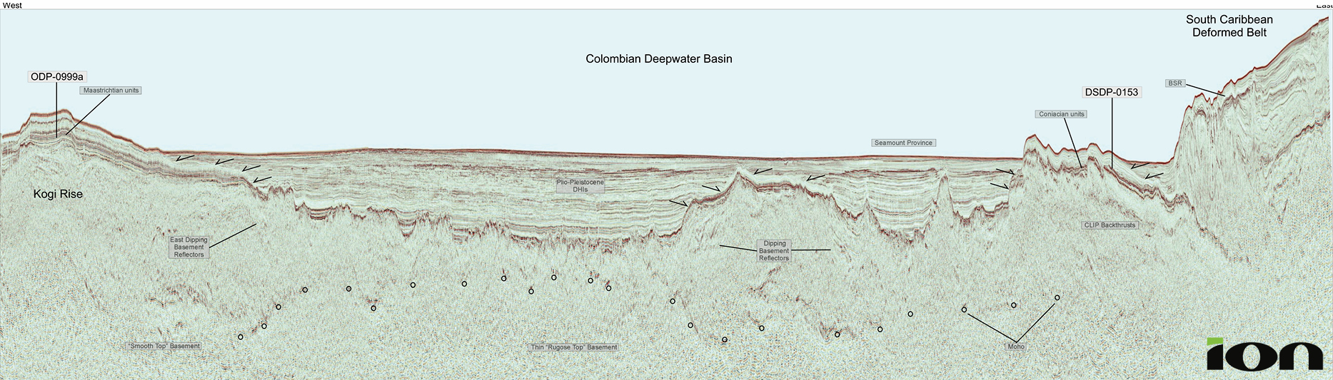
Offshore Colombia: discovering new value in legacy data using modern workflows

Figure 2a: Basemap showing ION’s Colombia Caribe Reprocessing project, highlighting the 18 vintage surveys in offshore Colombia, PanamaSPAN and AntillesSPAN of the western Caribbean.   Figure 1: Regional tectonic framework map of the western Caribbean. Seismic coverage for the region…

Refining exploration opportunities in Mexico

Detail a). For location see main seismic panel above. Detail b). For location see main seismic panel above. Detail c). For location see main seismic panel above. Detail d). For location see main seismic panel above. Regional framework for GoM…

The Australian North West Shelf: new insights from deep seismic

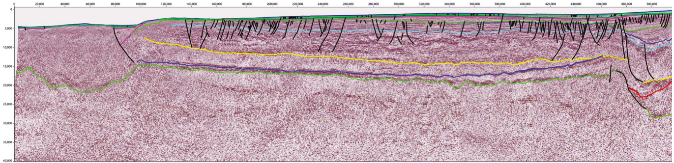
Figure 1: Map of the Australian North West Shelf showing the location of the main basins and the ION Westralia SPAN data. Lines from Figures 2–4 are highlighted. A developing province With an estimated remaining undiscovered potential of 4.6 Bbo…

New insights into Australia’s Bight Basin

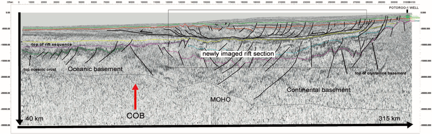
The eastern Bight Basin showing the 2009 acreage S09-5 S09-6 Ceduna Sub-basin release area, sub-basins, wells, and 2007 dredge sample locations. Index map of the 315 km long foldout line shown in red and the remainder of the 5,000 km regional…

The Canadian Beaufort Sea

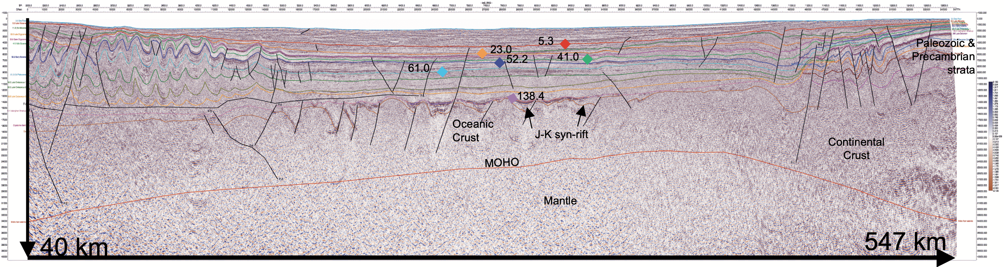
Line 5600 is the most seaward ‘strike’ line in the ArcticSPAN Beaufort survey. The 547-km-long line shows the variable basin architecture of the Canadian Arctic passive margin (vertical exaggeration is 2.5). Arctic conditions can put man and equipment to the…