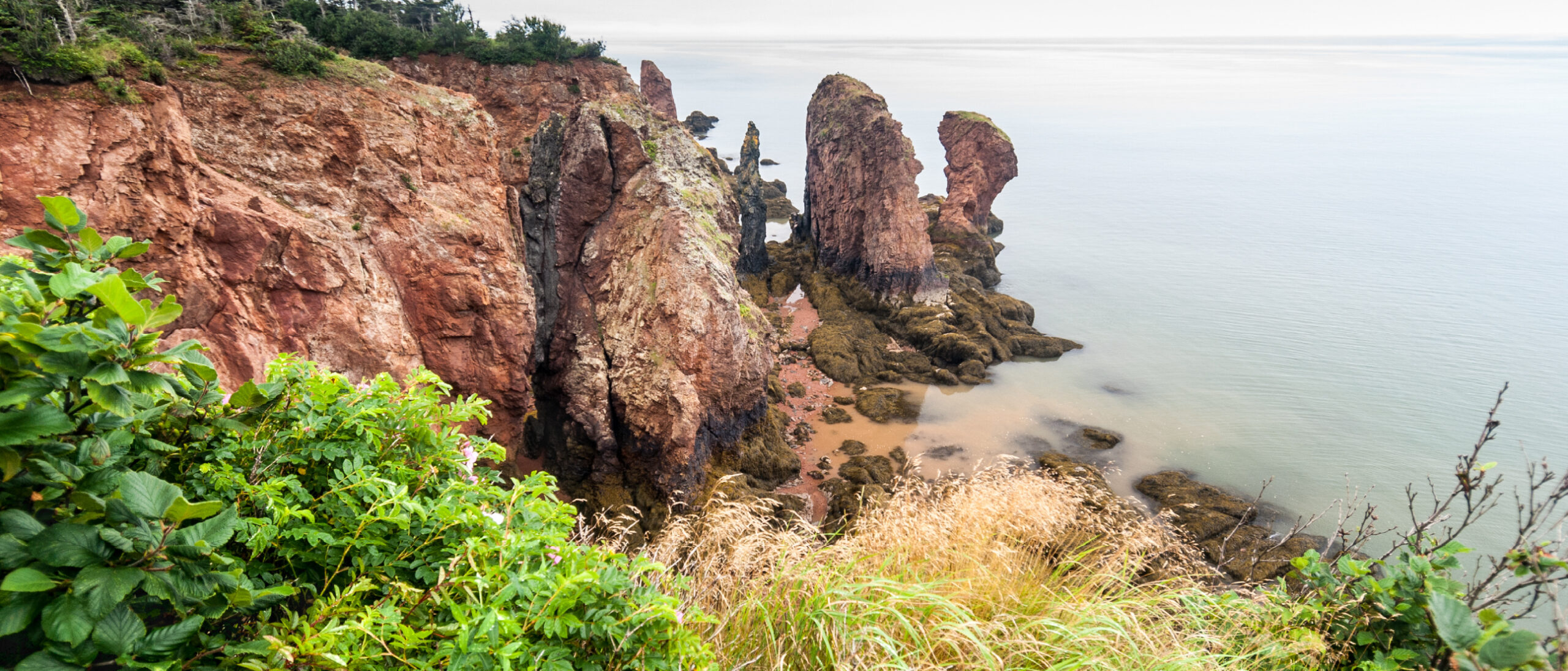
Red sandstone outcrops at Cape Chignecto, Nova Scotia, just outside the Advocate license area. Photo: George via Adobe Stock.
Exploring deep-seated hydrogen fluxes in Nova Scotia
Canadian company Québec Innovative Materials Corp. (QIMC) has drilled hydrogen exploration wells into a major fault zone. But how much hydrogen could potentially be produced from such a play?

QIMC’s hydrogen exploration campaign focuses on the Cobequid-Chedabucto fault system in Nova Scotia, a crustal-scale fault zone approximately 250 km long and 25 km wide that separates two ancient tectonic landmasses: The Avalon Terrane to the north and the Meguma Terrane to the south. Earlier studies have described the zone as a series of sub-vertical strike-slip faults that locally branch into thrust-fault and flower structures. QIMC holds three natural hydrogen exploration licenses in Nova Scotia, of which Southampton and Advocate are on the fault zone itself. Although the complex geology could potentially create hydrogen traps, for example in steeply dipping footwall strata underneath thrust faults or against salt diapirs, QIMC’s principal target appears to be migration pathways along the deep-seated faults themselves.
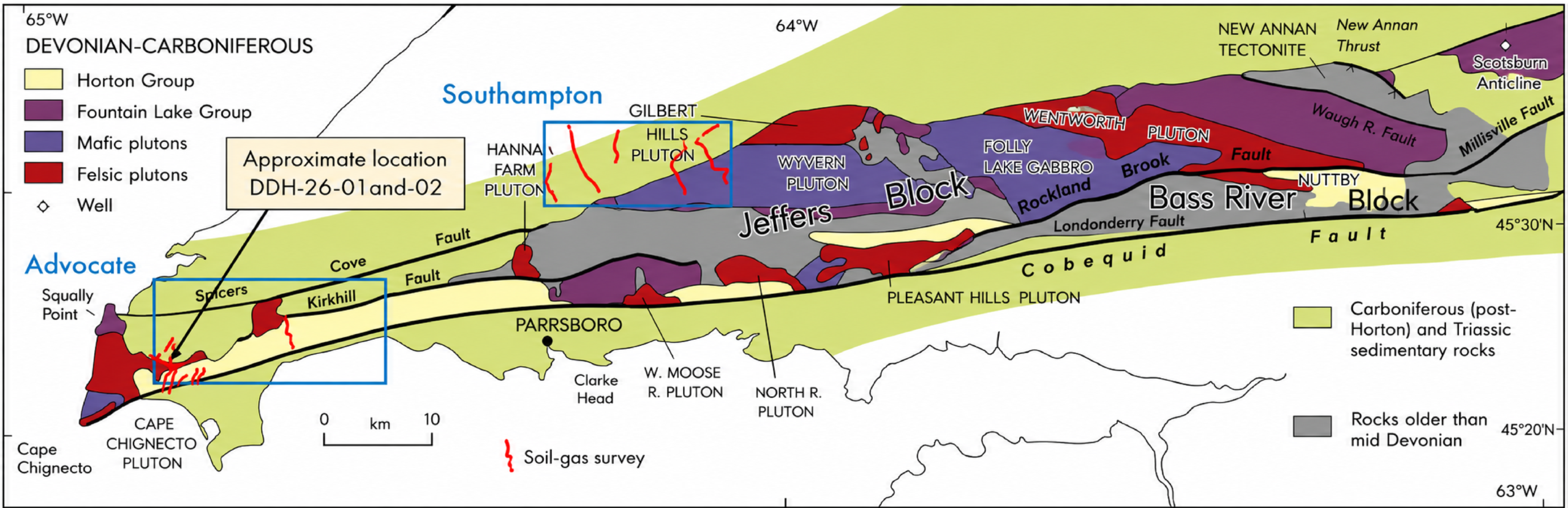
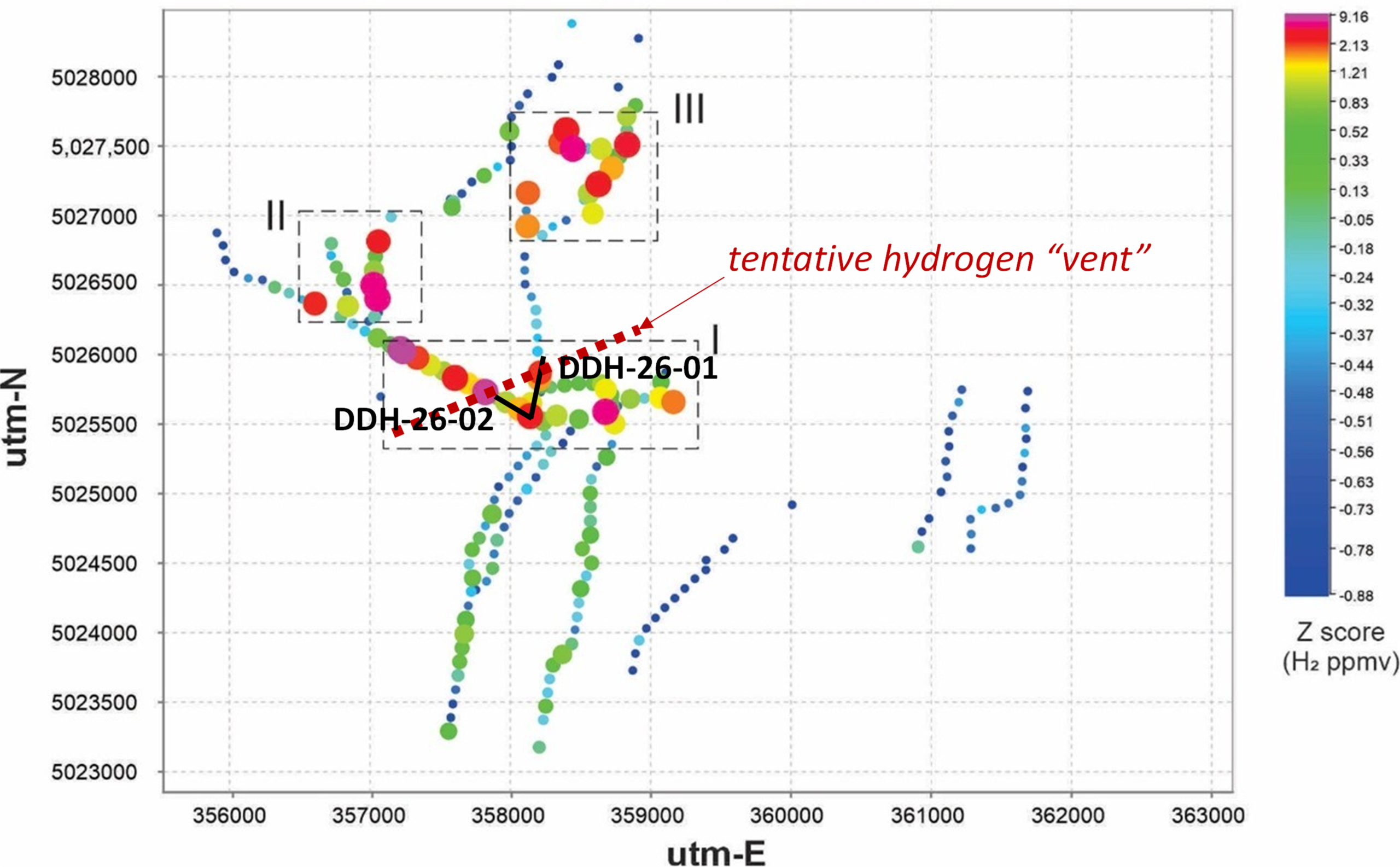
QIMC started its exploration with soil-gas sampling along a number of 2D transects. Anomalously high hydrogen readings were locally noted in all QIMC’s licenses: West Advocate (5,558 ppm peak), East Advocate (2,247 ppm peak), Southampton (4,125 ppm peak) and Springhill (4,850 ppm peak). QIMC interpreted these anomalies as “discoveries of four prospective hydrogen corridors” which, in their opinion, “confirmed the Cobequid Fault as a first-order hydrogen system”.
QIMC then continued with drilling two wells, in a planned campaign of 5, in West Advocate. DDH-26-01 and -02 are relatively shallow, deviated wells that presumably delineate the subsurface underneath some of the highest hydrogen anomalies noted in QIMC’s surface sampling. Hydrogen anomalies sampled at surface (headspace gas) were again recorded but unfortunately, no LWD or wireline logs were released. Based on the detailed geological descriptions released by QIMC, hydrogen anomalies in the wells appear associated with fault zones which, in the cross sections of Figure 3, are assumed to be sub-vertical. As indicated in Figure 2, high hydrogen readings in the lower part of DDH-26-01 and the toe of DDH-26-02 could reflect a tentative SWS-ENE trending hydrogen “vent” along a fault zone some 60-70m wide.
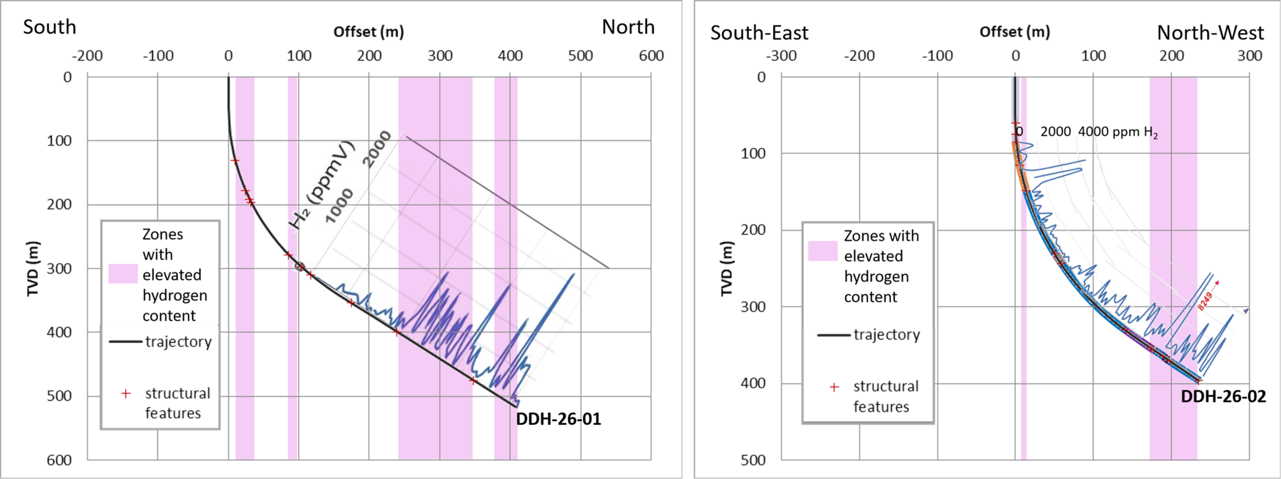
QIMC’s drill campaign is ongoing. At the time of writing only the results of DDH-26-01 and -02 were released. Since then, results for well DDH-26-03, located approximately 2.5km from the initial 2 wells, revealed hydrogen along the same order of magnitude, 0.9%. Subsequently, well DDH-26-04 was drilled at Bennett Hill, 15km further along the Cobequid–Chedabucto Fault Zone, still within the Advocate license. It found a maximum mud gas show of 24.3% H2 at 707m. Work on well DDH-26-05, also at Bennett Hill, is ongoing but has already found hydrogen concentrations similar to DDH-26-04. Again, no MWD or wireline log suites were released (probably not obtained because these wells are slimholes) and more critically, no flowrates were measured.
A key question remaining is, how much hydrogen are these fault zones venting? Prolific venting sites described in literature report hydrogen venting rates of 200 ton-per-annum (Bulqizë, Albania) to 800 ton-per-annum (Nagsasa, Philippines) for clusters of vents, and a few 10s of ton-per-annum per individual vent. Since no flow rates were measured in any of QIMC’s wells, it remains unclear whether hydrogen vents in Nova Scotia are as prolific as these analogues.
Another, more critical question is: how much of this seeping hydrogen could be captured, by diverting hydrogen flux into wells? There is no straightforward answer. Hydrogen migration pathways like deep-seated faults have hydrogen-saturated brine in the pores with a few percent of migrating hydrogen gas. A well drilled into a migration path would only capture the migrating gas bubbles that coincidentally intersect the well trajectory; applying a pressure drawdown would merely pull in additional water. However, continuous lifting of water with dissolved hydrogen may eventually deplete pressure enough to release significant amounts of additional hydrogen from solution. How much of this hydrogen would then flow into the well, rather than escaping towards the surface, remains a further uncertainty.
Estimates of static, in-place, hydrogen volume in a fault zone in combination with pressure depletion assumptions can give an indication of the quantities of recoverable hydrogen. Assuming a fault zone of 2km long, 1km high and 70m wide, with a hydrogen-rich migrating gas (80% purity) hosted in rather tight rock (5% porosity, consistent with QIMC’s geological descriptions), the zone’s indicative in-place hydrogen potential may be around 900 ton. If continued fluid lifting could deplete pressure in the fault zone by 1,000psi, around 100 ton of hydrogen may be recoverable (11% recovery factor).
These are theoretical figures that require validation with real data. What is needed next are quantified reservoir properties from wireline logs and core, measured fluxes along the fault, and an attempt at fluid lifting to demonstrate actual hydrogen recovery.
Whilst QIMC’s drilling programme remains scientifically intriguing, its commercial significance awaits further validation.