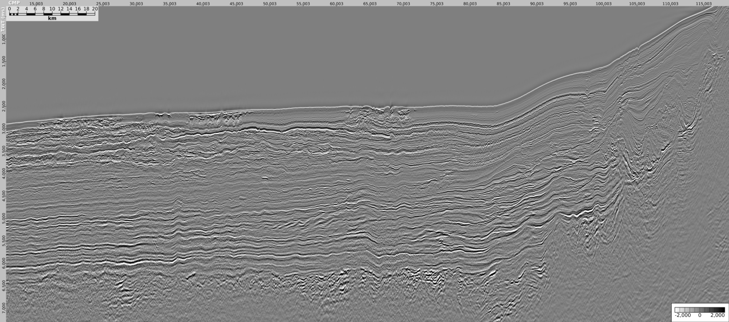
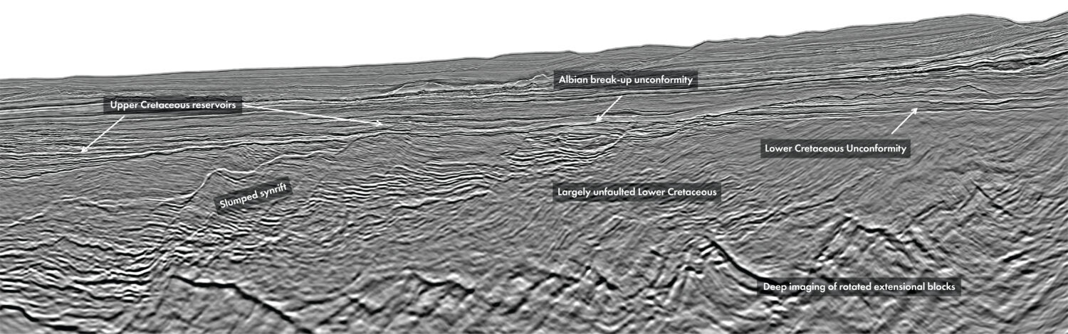
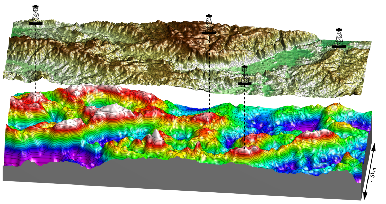
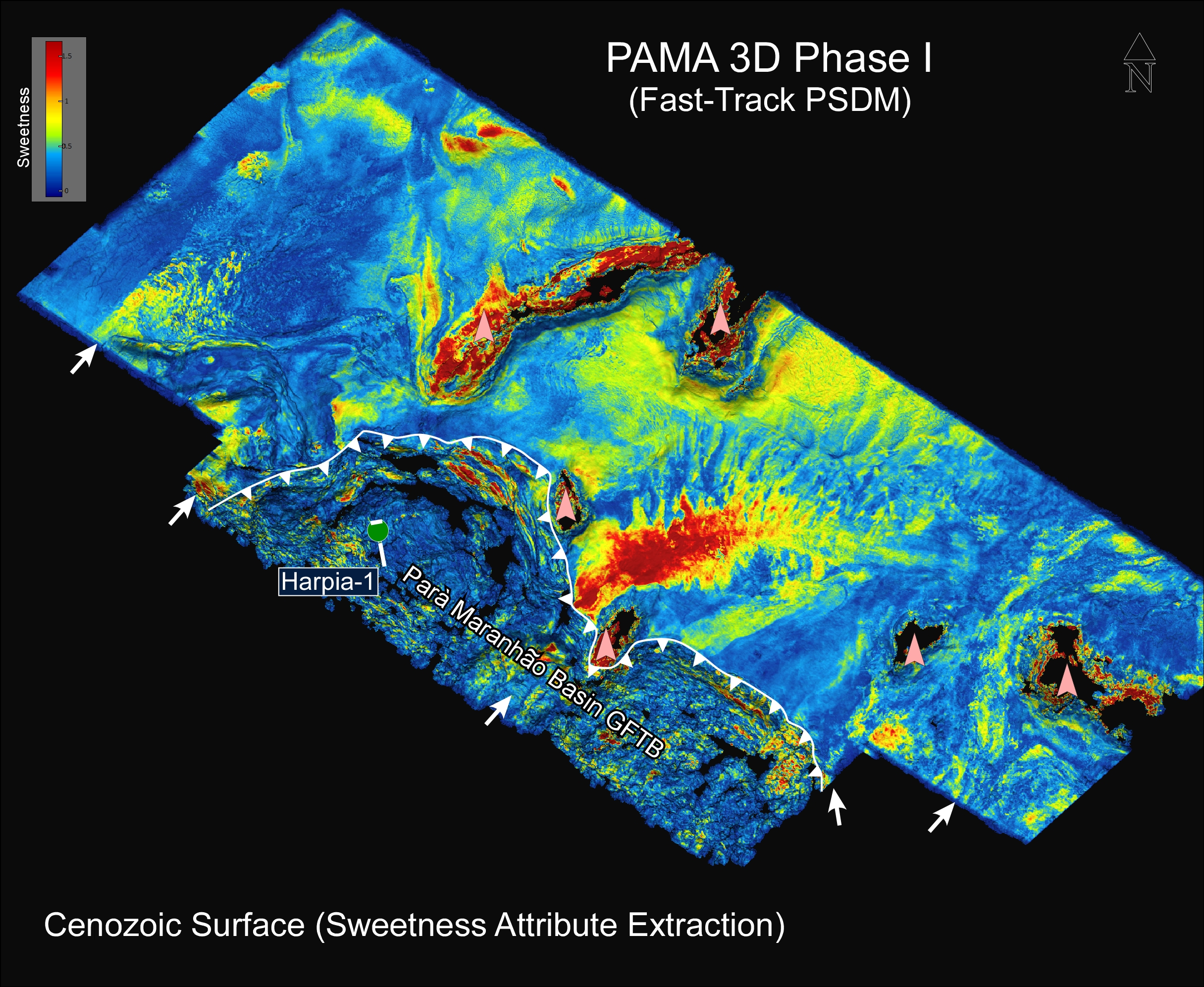
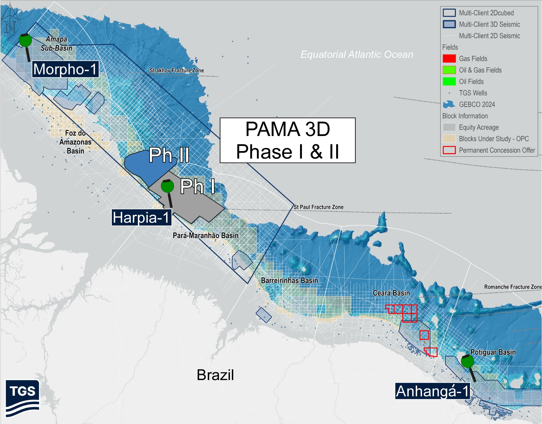
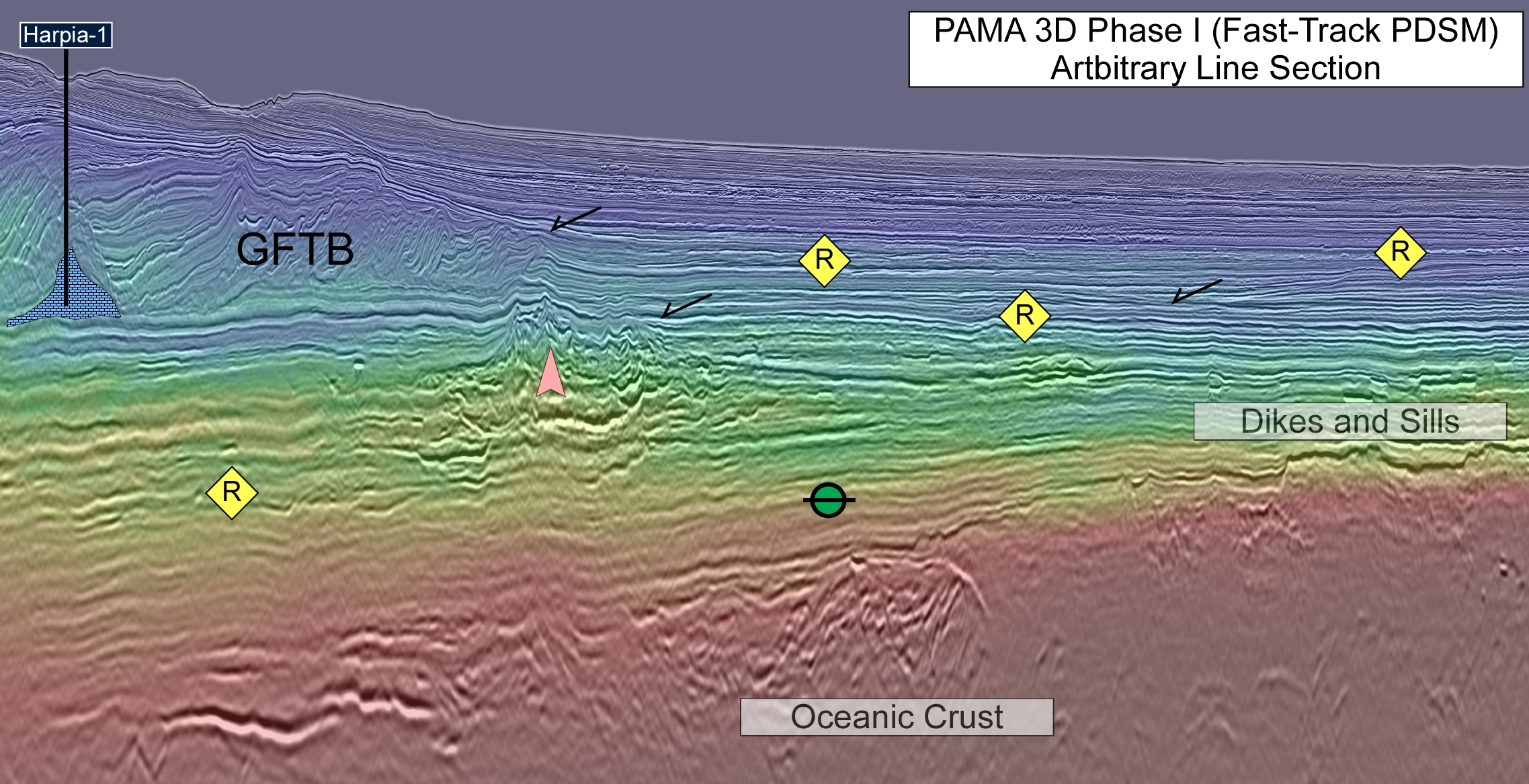
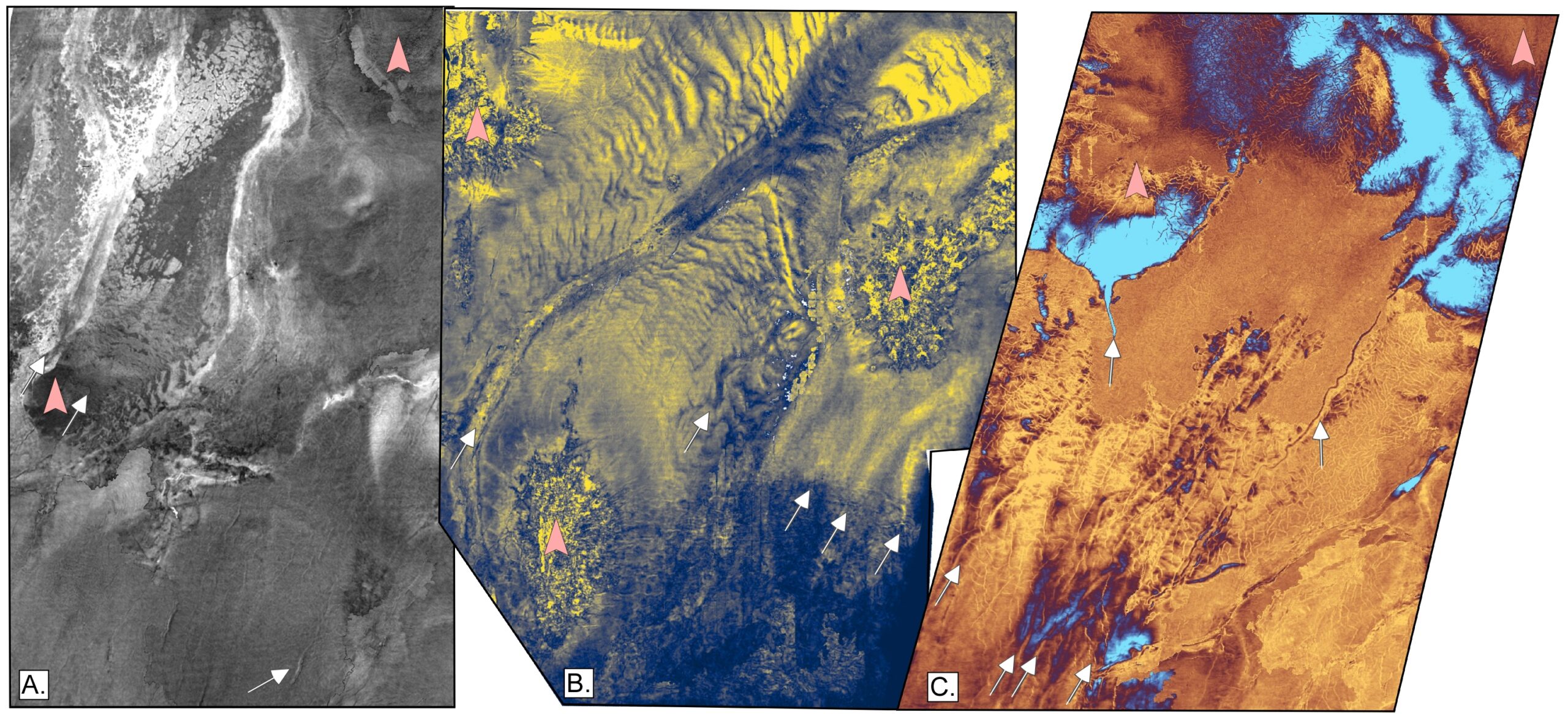
The Pará-Maranhão Basin on Brazil’s Equatorial Margin is an underexplored but promising deepwater frontier, where modern high-resolution 3D seismic data is critical for reducing exploration risk and imaging complex subsurface geology. Recent PAMA 3D surveys by TGS, covering over 30,000 km², provide unprecedented detail from basement to shallow stratigraphy, improving understanding of basin evolution and reservoir distribution. The basin, situated along the St. Paul Fracture Zone, contains complex structures, including gravitational fold-and-thrust belts, magmatic intrusions and varied depositional systems. These new data have provided insights into influences on sediment pathways and trap formation, while seismic attributes reveal channels, fans and amplitude anomalies indicative of hydrocarbons. Recent discoveries in nearby basins and historical drilling confirm an active petroleum system in the region. Overall, integrated seismic interpretation highlights strong exploration potential and suggests that the deepwater basin may be nearing a transition from frontier to discovery phase. New PAMA 3D seismic unlocks clearer imaging and reveals significant untapped hydrocarbon potential in Brazil’s Pará–Maranhão Basin As oil and gas exploration heats up in the Equatorial Margin of Brazil, the need for modern, high-resolution 3D data continues to grow. The process of de-risking frontier deepwater plays requires the use of advanced processing algorithms to adequately image the subsurface. Clear visualisation is a critical tool for maximising discovery successes that are increasingly targeting subtle stratigraphic targets in complex geological settings, such as the Pará-Maranhão Basin of Brazil. This centrally-located basin is positioned between the Zaedyus discovery in French Guyana, the Morpho prospect in the Foz do Amazonas Basin, the recent Anhangá discovery in Potiguar Basin, and many other data points to support evidence of an active petroleum system in the region (Figure 2). Historically, the lack of quality data in basins gives the perception of an area being high-risk or frontier. The recently acquired 3D surveys address this and have revealed new details of the basin opening, localised magmatism, tectonostratigraphic units and petroleum prospectivity. Recently, TGS has acquired two phases of the PAMA 3D seismic program (Figure 3). The PAMA 3D Phase I survey spans over 19,000 km2, covers the Harpia-1 well and more than 25 future exploration blocks in the prospective deepwater region of the central Pará-Maranhão Basin. Phase I is currently at the fast-track processing stage at the time of writing. The more recently acquired 11,500 km2 PAMA 3D Phase II is positioned to the northwest of Phase I and is in the earliest stages of processing. This dataset provides unprecedented imaging of both crustal and sedimentary features, allowing for integrated interpretation from basement to shallow stratigraphy. This multi-client survey was acquired with a Ramform Titan-class vessel equipped with TGS GeoStreamer Technology and is currently being processed utilising proprietary TGS workflows. The Pará–Maranhão Basin, spanning more than 150,000 km² along the Equatorial Atlantic margin of northern Brazil, represents a key frontier deepwater province with significant hydrocarbon exploration potential. The margin segment was formed during the Early Cretaceous rifting associated with the breakup of Gondwana, as part of the larger Equatorial Atlantic rift system. Structurally, it lies within a complex transform margin, shaped by significant lateral tectonic movements. A defining feature of this system is the St. Paul Fracture Zone, which bisects the basin and plays a fundamental role in crustal segmentation, structural compartmentalisation, and basin evolution. The basin exhibits a wide range of depositional environments, from shallow continental shelf areas to ultra-deepwater settings exceeding 4,000 m in water depth. Historically, regional 2D seismic data has been used to study the basin’s crustal architecture, tectono-stratigraphic evolution, and petroleum system elements. The new PAMA 3D has provided a more detailed understanding of those elements and furthered our understanding of the timing of key geologic events and how the geological processes governed reservoir development and distribution. A defining feature of the deepwater Pará–Maranhão Basin is its oceanic crust, particularly in relation to the St. Paul Fracture Zone. Observations in seismic data reveal that magmatic activity is significantly enhanced along fracture zones, where structural weakening facilitates magma ascent in the form of dikes and sills, whereas volcanic constructs are more prevalent away from the fracture zones (Figure 1). Volcanism is multi-phased, affecting both Mesozoic and Cenozoic intervals. Volcanic constructs seem to have developed in long-lasting sequential stages, controlling the deposition of lateral growth strata. Igneous intrusions, flows and sills locally modify the sedimentary architecture, influencing depositional pathways and potentially creating structural and stratigraphic traps. In some areas, volcanic loading contributes to flexure of the oceanic crust, while regionally, sediment loading from the Amazon Cone further modifies basin geometry. Both types of loading created the optimal conditions for the development of a regional kitchen to the northwest and of local kitchens in the basin, respectively. One of the most striking structural elements in the basin is the presence of two major gravitational fold-and-thrust belts (GFTBs), developed during the Santonian and Miocene (Figure 4). These structural belts cover thousands of square kilometers within the survey and exhibit classic zonation from extensional to compressional domains, including listric faults, rollover structures, reverse and thrust faults, sitting atop detachment surfaces. The formation of these GFTBs is likely linked to a combination of carbonate loading and reactivation of pre-existing syn-rift faults. The strong perennially active Saint Paul Oceanic Fracture Zone probably also imparted instability in the sediment deposits, triggering the gravitational failure of continental slopes. Importantly, the deformation had implications for reservoir connectivity and created potential structural traps, though their complexity necessitates careful seismic interpretation and risk assessment. Seismic attribute analysis from the PAMA 3D dataset reveals a diverse range of depositional features. Oligocene to Miocene intervals are characterised by sediment waves, polygonal faulting, and well-developed channel and fan systems in deepwater settings. Cretaceous sequences also host channel–fan complexes, indicating long-lived sediment delivery systems. Notably, volcanic features appear to influence depositional fairways, steering sediment pathways and controlling the distribution of reservoir facies. Amplitude anomalies observed in seismic data—such as brightening over structures and dimming beneath—may indicate hydrocarbon presence and support the interpretation of an active petroleum system. Velocity anomalies and inversion results further enhance interpretation, suggesting contrasts consistent with lithologic variation and possible fluid effects. The Harpia-1 well, drilled in 2011 in approximately 2,200 m water depth, provides a key calibration point (Figure 4). This well confirmed the presence of petroleum system elements, including migrated hydrocarbons and complex stratigraphy involving allochthonous carbonate debris. These results underscore both the promise and the challenges of exploration in the basin, where structural complexity and stratigraphic variability must be carefully integrated to reduce risk. The integration of seismic, structural, and stratigraphic observations leads to several key insights (Figure 5 A-C). First, the mid-Cretaceous depocenter is better defined, improving regional understanding of source and reservoir distribution. Second, igneous activity plays a role in shaping depositional systems, requiring its explicit incorporation into exploration models. Third, the recognition of multiple phases of gravitational fold-and-thrust deformation provides new perspectives on trap formation and timing. Finally, consistent seismic amplitude anomalies with AVO responses suggest that a functioning petroleum system exists in the deepwater region of the Pará–Maranhão Basin, reinforcing its attractiveness as an exploration target. The Pará–Maranhão Basin represents a complex but highly prospective deepwater system shaped by the interplay of rifting, transform tectonics, volcanism and gravitational compressional deformation. The new PAMA 3D seismic data significantly enhances the understanding of the basin’s diverse reservoir systems and displays evidence of active charge. The evolving comprehension of the geological framework positions the basin as a compelling frontier for future exploration. With modern seismic tools, a refined understanding of the conjugate play model, and growing interest in Brazil’s equatorial margin, the Pará Maranhão Basin may finally be approaching the inflexion point that transforms a basin of ‘shows’ into a basin of discoveries.
Seeing the unseen: New 3D seismic insights from the deepwater Pará-Maranhão Basin
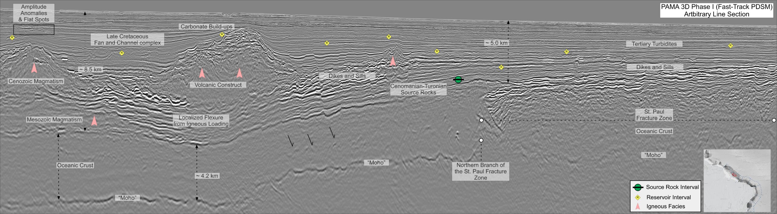 Figure 1: An arbitrary seismic line that captures key elements from the prospective deep-water Pará-Maranhão Basin.
Pará–Maranhão Basin: New insights from PAMA 3D seismic
Oceanic crust and volcanic influence
Structural architecture: Fold-and-thrust belts
Stratigraphy and reservoir systems
Exploration
From a basin of ‘shows’ into a basin of discoveries
Related Articles