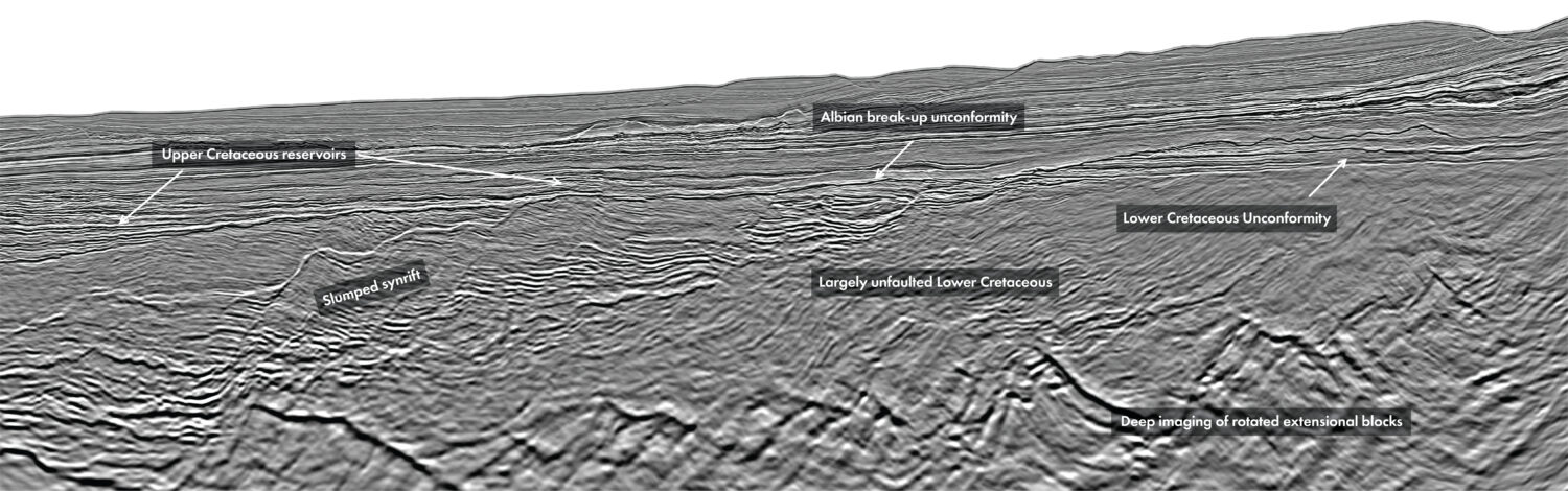
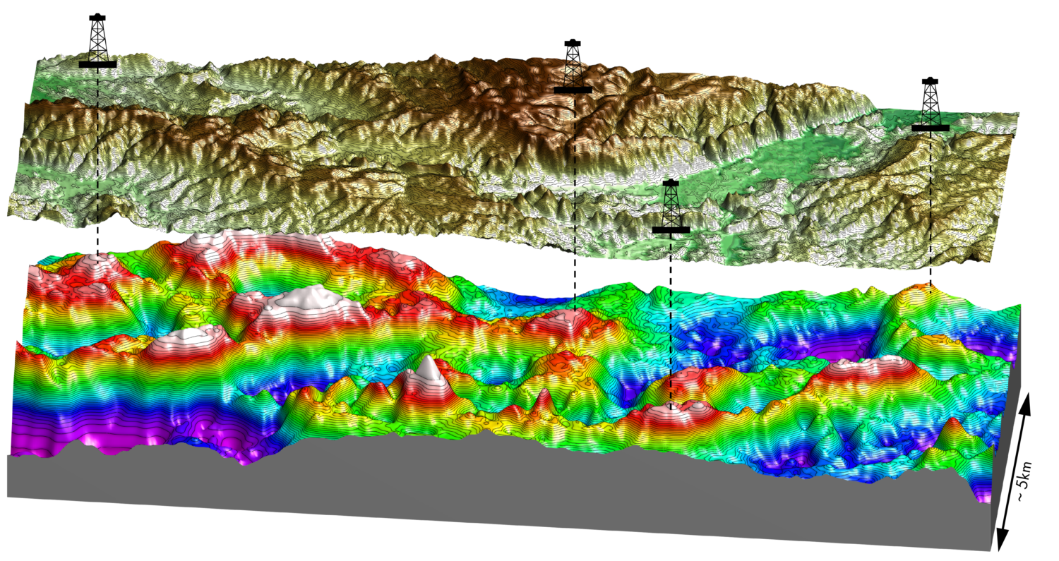
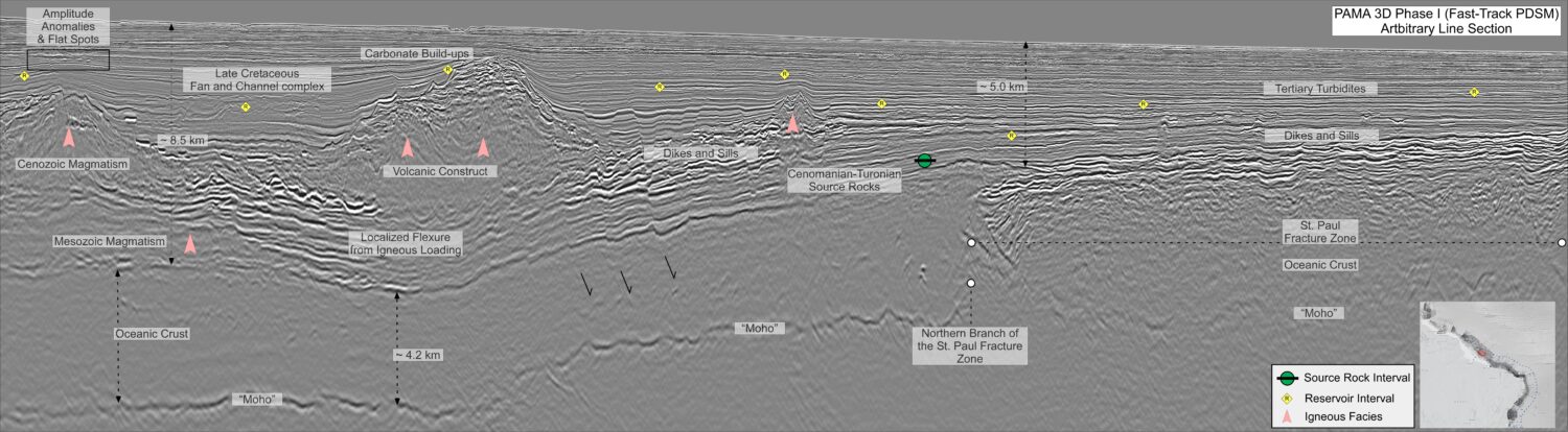
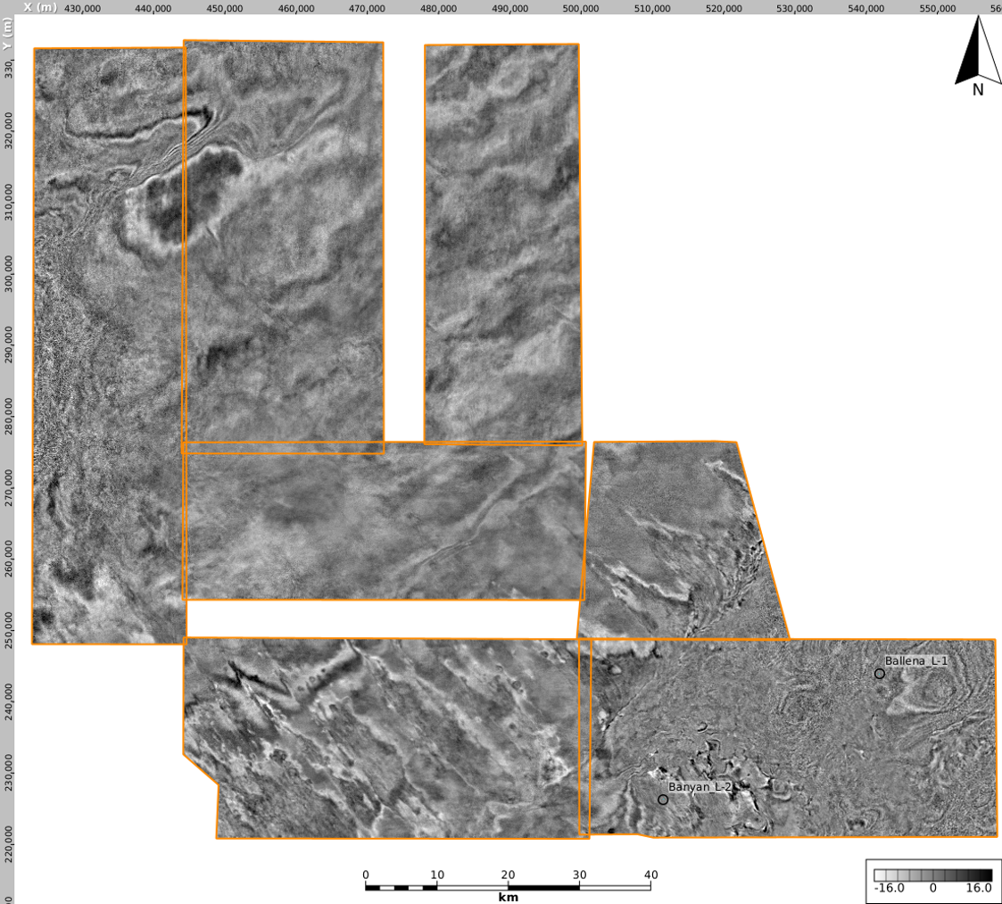
In frontier environments there is an added degree of risk with exploration. To mitigate the possibility of a dry well and make more informed exploration decisions, the best available data is required. Equatorial Guinea (EG) is a frontier with a twist. The central section of the offshore (Geoex MCG’s AOI, (Figure 1) remains considerably underexplored. Two wells have been drilled in an area spanning >9,600 km2. However, the surrounding proximal locations have had a series of discoveries namely Zafiro, Asen / Aleng and Ceiba / Okume. Distally, in Sao Tome & Principe, the technical success of Falcao-1 and the oils found within the Ubabudo-1 well, suggest that the petroleum system elements in the AOI are present. Geoex MCG in association with the MHME (Ministerio de Hidrocarburos Minas y Electricidad) and partners Perceptum & DUG Technology (DUG) have embarked on the reprocessing of 6 x 3D volumes as well as a regional 2D dataset that ties over 30 wells to ensure the best possible imaging and velocity model is created for this frontier domain. The improvements in imaging reflect a step-change compared to the vintage data. As a result, the possibility of successful exploration in this region has increased significantly. Exploring in frontier domains is seldom offered the benefit of existing infrastructure, available seismic and 30+ wells to tie but due the success of the periphery of the offshore Equatorial Guinea, this is a reality. Discoveries in Equatorial Guinea were first made in the 1990s with the successful drilling of the peripheral Niger Delta in the NW of offshore EG. This was followed thereafter by the discovery of the Ceiba and Akume field in the southeasterly domain. The Aseng and Alen fields were drilled in the 2010s in the NE. Geoex MCG’s AOI in EG does not yet have any discoveries but was drilled by the Ballena-1 (L-1) & Banyan-1 (L-2) exploration wells. These efforts demonstrated hydrocarbon shows but did not encounter commercial discoveries, although exploration decisions were made on the 2010 legacy PSTM data. Encouragement of a working petroleum system in the AOI is further provided by distal drilling in Sao Tome and Principe where hydrocarbon shows and reservoir sands have been encountered demonstrating a possible petroleum system beyond the AOI. It is believed therefore that this area does demonstrate good prospectivity which has been reflected by a recent “license stampede” with Chevron, ENI, ConocoPhillips and Galp all accessing acreage in the area or in close proximity, highlighting the current industry feeling towards the AOI. Geologically, the offshore of EG is complex. Categorised as an oblique passive margin, the break-up and subsequent rifting began in the Neocomian (145-130 Ma) resulting in oceanic crust development in the Aptian (~120 Ma) period. The margin is characterised by four main tectonic phases. These include a pre-rift (pre-early Cretaceous), syn-rift (Berriasian-Aptian), transitional / early post-rift phase between the Aptian-Turonian and finally, a passive margin phase extending from the Turonian to the Paleogene. The margin is then significantly influenced by the advent of the Cameroon Volcanic line which is a 700 km-long NNE-SSW trending linear belt of volcanic islands and seamounts. These tectonic phases have led to a considerably favourable environment for hydrocarbon generation. During the Albian-Turonian, restrictive environments created excellent source rocks with a predominant deposition of oil-prone, marine shales coeval with many of the worlds famous “ACT” source rocks. Other basins in the area, such as Rio Muni, have also indicated that source rocks are in the correct maturity window, aided by post-Senonian deposition. A further active source rock inferred in the Paleocene-Eocene is also postulated in the AOI as an additional interval of interest. Numerous sedimentary input points have been identified and established as high-quality reservoirs throughout various geological timeframes. Examples of this are outlined by the following: The above sands are primarily interpreted as variably confined, upper to middle fan turbidites which require both the regional reprocessed 2D data to understand the regional entry point into the basins as well as the new 3D volumes to explore where these large sands may have subsequently been dispersed / deposited. As is clearly demonstrable, there are multiple source and reservoir pairs which provide a plethora of exploration opportunities offshore Equatorial Guinea. From a trapping perspective, the NE-SW trending fracture zones demonstrated across the basin, have contributed to the routing, rerouting or cessation of large channel systems and are key crustal features that require improved imaging. The syn-kinematic reactivation of these large structures provided a critical control on the deposition of reservoir sands, formation of structural or combination traps and provides insight into the Late Cretaceous-Tertiary burial and the subsequent maturation history (Lawrence et al, 2016). Due to these complexities, developing a key understanding of the relevant timings of deposition, heat flow and formation of petroleum systems requires data that provides the best imaging. Prior to the reprocessing of this data, only a PSTM volume was available. Now, with the combination of over 30 wells, Geoex MCG with our associated partners are able to provide the industry with the data required to unlock this prospective margin. To understand this complex interplay of the tectonic framework and depositional environments in more detail, a thorough reprocessing campaign of both 2D and 3D data is required. This has allowed for the transformation of legacy data to a modern DW- & MP-FWI dataset in PSDM resulting in the identification and subsequent mapping of channel fan sands out onto oceanic crust. The reprocessing is set to improve the continuity of the reflectors allowing for the mapping of clinoforms and distal sand channels and fans (see foldout). DW- & MP-FWI is implemented to ensure an accurate velocity model. This is further improved by the reprocessing of two regional 2D well tie surveys, acquired in 2005 and 2010. Offsets of these surveys are 8 km and 10 km respectively which represents the longest offsets in the margin. The orientation of these lines is well positioned to ensure maximum imaging of the key fracture zones that significantly impacted the sedimentary routing pathways. While the examples shown clearly highlight a step-change in enhanced broadband, high-resolution structural imaging from the available legacy data, further improvements can be expected from the final products. The data shown in this foldout utilises a fast-track demultiple workflow, un-regularised migration input data migration, limited post-migration processing, and a not yet final migration velocity model, with further FWI & anisotropic tomography passes to follow. By imaging these topographic changes in the deeper section, lateral facies terminations can be discerned in a higher definition as well as providing an appreciation of the lateral continuation of key features. Despite the spatial continuation of the 3D surveys, the acquisition varies in orientation. To combat this, DUG’s reprocessing teams are ensuring that comprehensive survey matching is undertaken to reduce the acquisition impact producing a seamless blend. An example of timeslices through the data prior to survey matching can be seen in Figure 2, here demonstratable continuations across the blocks are observed. THE MOST MODERN DATA IN THE MARGIN By utilising both DW-FWI and MP-FWI (3D) to drive the velocity model, a stateof- the-art PreSDM product is available representing the most modern 3D reprocessing in the margin. Geoex MCG and partners have complimented these data by reprocessing a regional 2D dataset which represents the longest offsets and the most thorough reprocessing flow of any present 2D data available. Exploration in deeper (still <2,400 m) waters, offshore EG requires high-quality velocity models to accurately map and delineate key structures and petroleum system elements. This dataset provides the needed definition to undertake a task of this nature. We believe that this will ultimately provide the catalyst required to make discoveries in the central portion of offshore Equatorial Guinea.
Equatorial Guinea: Douala and Rio Muni risk reduction
 Seismic line: Fast-Track. This data currently utilises a fast-track demultiple workflow, un-regularised migration input data migration, limited post-migration processing, and a not yet final migration velocity model, with further FWI & anisotropic tomography passes to follow.
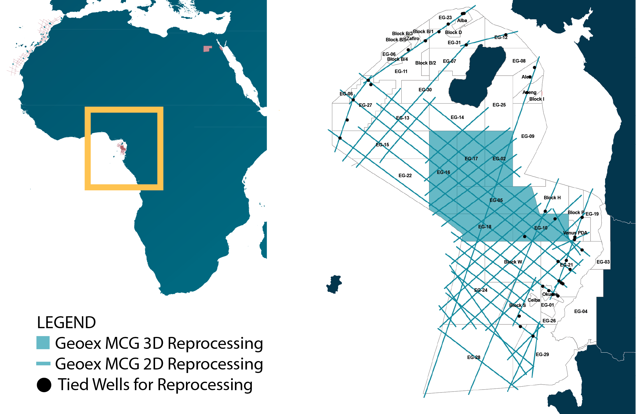
DW-FWI and MP-FWI to deliver the margin’s most advanced datasets
Frontier meets opportunity – high operator interest
Complex geology, exceptional data
Meticulous methodology – solving the subsurface
Related Articles