Gulf of America: Integrating technologies to see beyond the salt The Gulf of America (GOA) remains a central pillar of US energy infrastructure, and its future potential is increasingly tied…
Unlocking deepwater potential Exploration in the Mauritanian coastal basin has historically focused on the Cenozoic salt-draped channel plays, as proven by the discovery of the Chinguetti Field in 2001. Since…
Sharper imaging, smarter exploration How cutting-edge seismic techniques are transforming risk assessment in the GOA Since 2019, long-offset Ocean Bottom Node (OBN) technology has become a cornerstone for advanced imaging…
TGS 3D seismic data coverage in the Norwegian Sea. PGS23M02NWS GeoStreamer 3D seismic and location of composite foldout line. Outer Vøring Basin – what is required? To unlock the prospectivity…
Kyle Reuber, Pedro Zalan and Henri Houllevigue, TGS
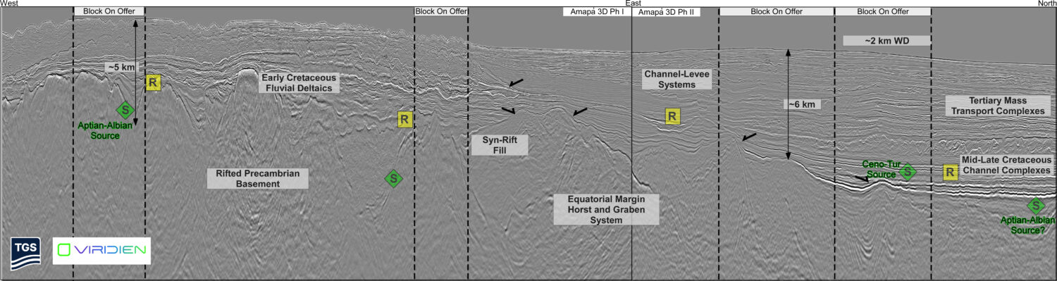
Figure 1: TGS data library map, basins, 2025 OPC Blocks, exploration wells and fields for the Equatorial Margin of Brazil. Key and recent discoveries marked with a green dot. The…