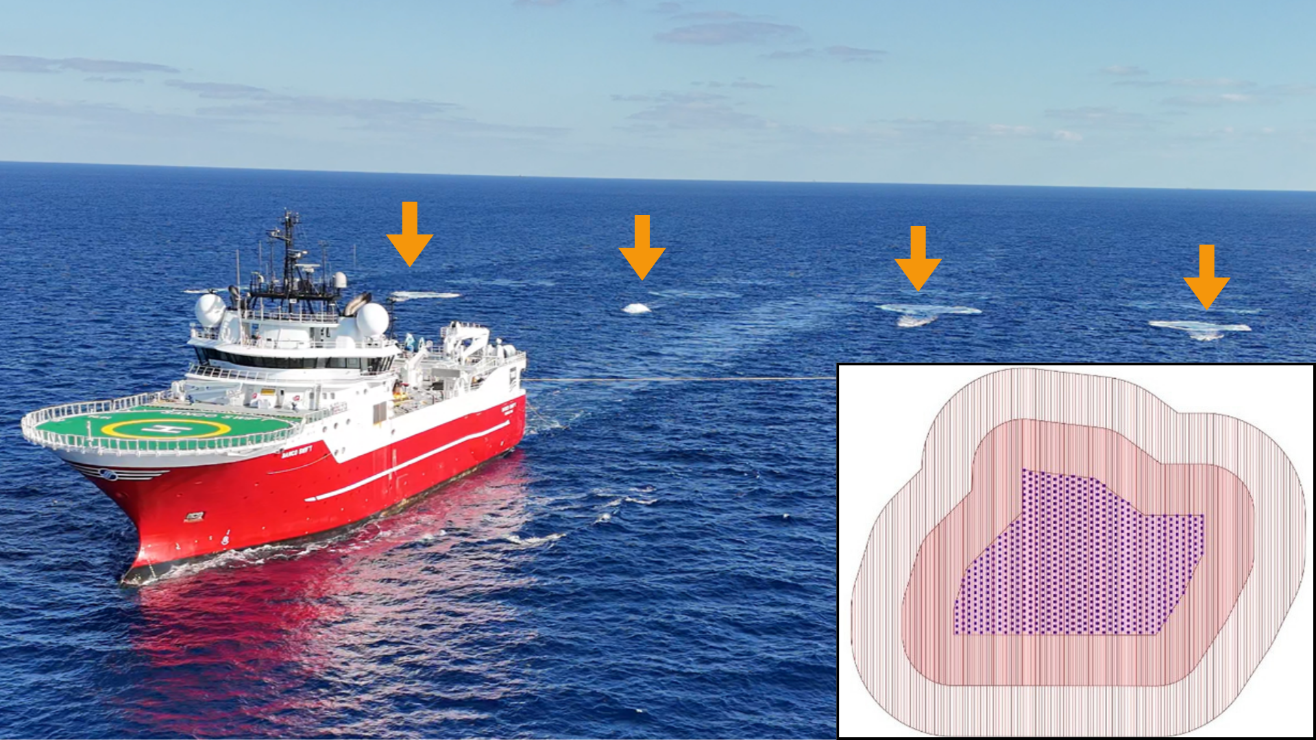
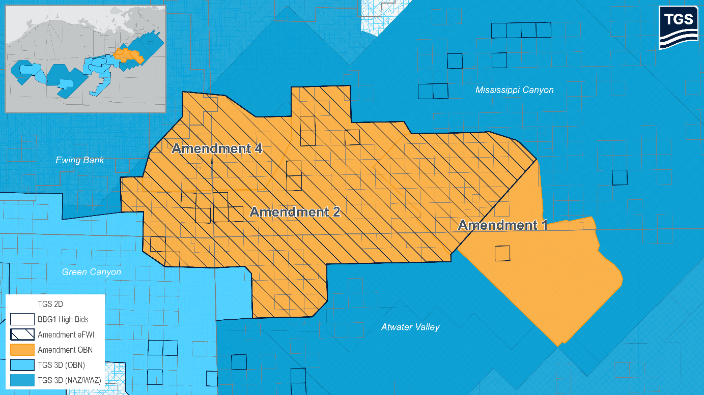
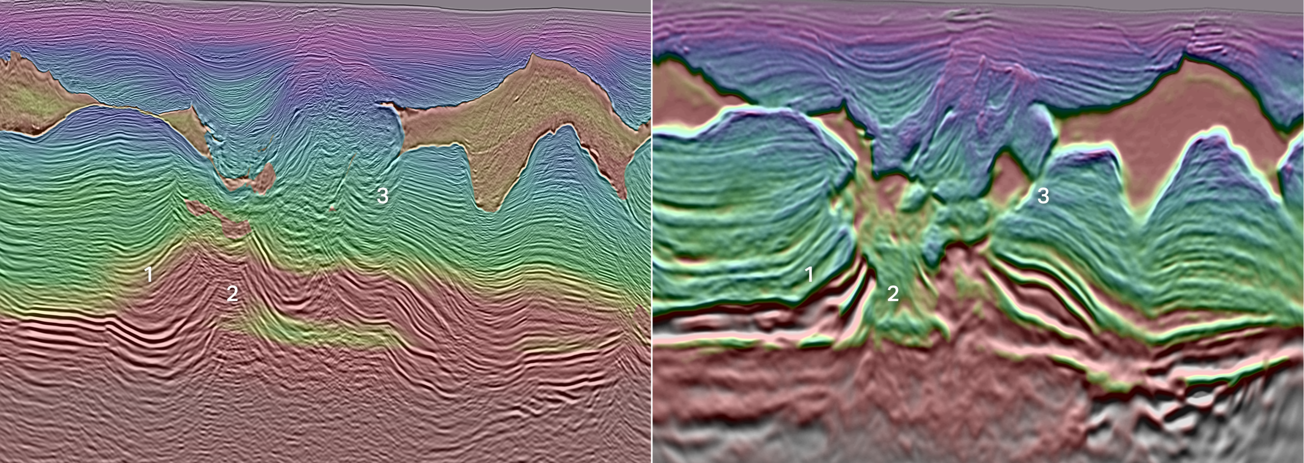
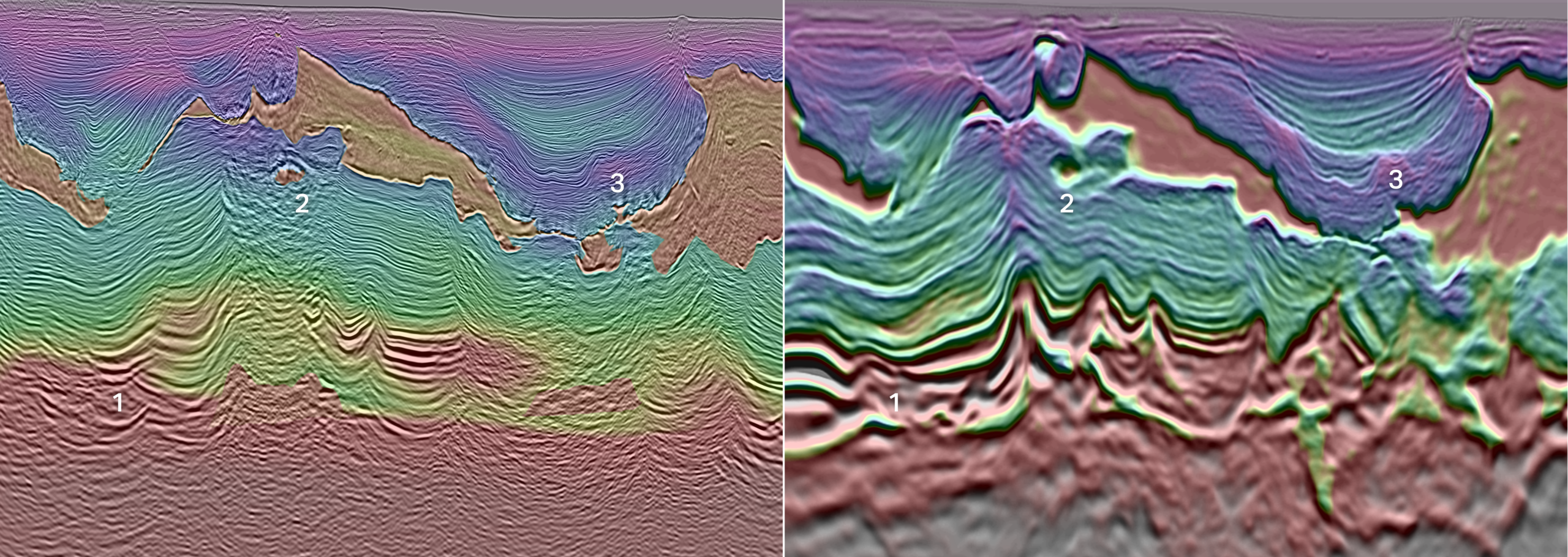
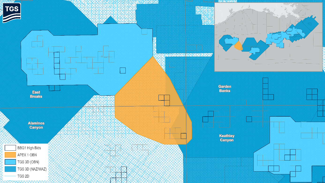
The Gulf of America is a vital part of US energy infrastructure, with its future increasingly dependent on new seismic technologies to tackle complex geology. As exploration advances into salt-dominated regions, operators are relying on advanced imaging and novel acquisition technologies to better map subsurface formations, improving visibility beneath salt layers and deepwater sediments that previously hid critical structures. The Gulf of America (GOA) remains a central pillar of US energy infrastructure, and its future potential is increasingly tied to the integration of new seismic technologies that can address the region’s complex geology. As exploration moves deeper into salt-dominated provinces, operators are turning to advanced acquisition and imaging solutions capable of resolving the entire subsurface column, from the seafloor through thick, rugose salt and into pre-salt and basement intervals. These integrated technologies, which combine innovative source designs, ultra-long offset acquisition, and high-end imaging workflows, are dramatically improving illumination beneath salt and deepwater sediments, revealing structures that were previously obscured by complex velocity regimes and challenging overburden. TGS’s Amendment 4 program in Mississippi Canyon (Figures 1 and 3), Gulf of America, represents a major advancement in deepwater seismic imaging, demonstrating the impact of integrating multiple next-generation technologies into a seamless acquisition and processing workflow. By pairing Gemini enhanced frequency source (EFS) technology with ultra-long offset OBN acquisition, the project generates a broadband, high-energy wavefield capable of penetrating thick salt and illuminating deeper, structurally complex targets. When combined with elastic dynamic matching FWI (E-DMFWI), this dataset achieves a level of subsurface clarity and velocity model fidelity that conventional app-roaches cannot match. The result is a premium seismic product engineered to resolve challenging geological features across the shelf, slope and deepwater domains. Amendment 4 was acquired using quad‑towed Gemini’s deployed from two source vessels. The design aimed to increase operational efficiency while delivering even better offset coverage compared to previous multiclient long-offset OBN surveys. This new configuration achieved longer halo offsets by providing full 10 km shot halo coverage, complemented by a strategically decimated 10– 20 km extended halo (Figure 2). The result is a more efficient survey that captures more ultra‑long offsets needed for complex velocity model building in deepwater salt provinces. This enhanced acquisition geometry directly improves velocity model convergence, particularly in areas dominated by thick, rugose, or multi-layered salt. The combination of long offsets and multi-azimuth illumination strengthens the inversion of complex velocity fields, enabling a more accurate representation of salt bodies and the sediments that surround them. With these improvements, interpreters gain clearer visibility into basement heterogeneities, which historically have been poorly imaged due to limited subsalt illumination. This represents a fundamental shift in subsurface interpretation, as structures previously obscured beneath salt can now be resolved with greater confidence. Salt-related geometries, including welds, canopies, feeders, and subsalt traps, become more coherent, while the salt-sediment interface is imaged with sharper definition, reducing uncertainty in structural mapping (Figure 4). Beyond salt imaging, the improved illumination compared to legacy streamer data enhances the resolution of overpressured and mobile shale bodies (Figure 5), which are common in deepwater Gulf settings. These shales often create drilling hazards, influence pore pressure regimes, and complicate well placement. Better imaging of their geometry and internal fabric provides critical insight into operational risks and well planning considerations, enabling more accurate prediction of pressure ramps, potential wellbore instability zones, and areas prone to fluid migration. Additionally, clearer delineation of shale and sediment boundaries helps identify pressure baffles and trap seal elements, which are essential for evaluating hydrocarbon trapping mechanisms and reducing exploration risk. Amendment 4 demonstrates how a carefully engineered combination of advanced source technology, long offset OBN acquisition, and state-of-the-art imaging workflows can fundamentally reshape subsurface interpretation in the deepwater GOA. The program delivers clearer velocity models, sharper salt sediment interfaces, and improved visibility into basement and shale-related features relative to legacy streamer data. These gains translate directly into operational value: better-defined drilling targets, improved hazard assessment, and a more reliable understanding of trap integrity and pressure architecture. As operators continue to pursue increasingly complex reservoirs, Amendment 4 stands as a benchmark for how integrated seismic innovation can reduce uncertainty and unlock new opportunities in mature deepwater basins. When we ask where long-offset OBN solutions are headed next, TGS already has the answer with APEX. Building on the latest technological breakthroughs, the APEX acquisition concept represents the new generation of multiclient seismic in the GOA, with APEX 1 now delivering the first full implementation (Figure 6). Designed as a true OBN-only survey with denser node spacing and enhanced spatial sampling, APEX removes the dependency on legacy streamer data and delivers a premium standalone subsurface product built for the complex salt provinces driving the next exploration cycle. By uniting Gemini-enhanced frequency source technology, a purpose-built OBN geometry, and high-end imaging from the outset, APEX sets a new benchmark for multiclient seismic and provides a scalable solution for unlocking frontier potential across the most complex subsurface areas in the GOA and beyond. With this survey currently underway, the industry is already watching closely and eager to see the first results from APEX 1 coming this summer.
Salt of the Earth: Imaging the Gulf’s hidden structures
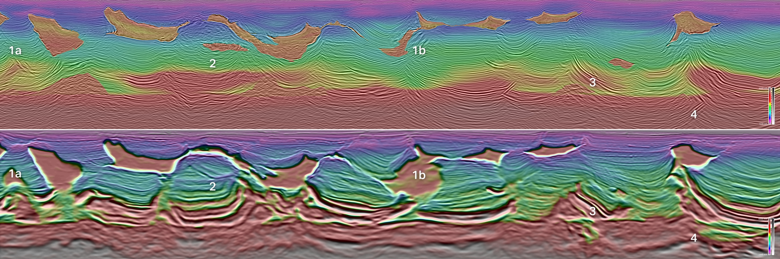 Figure 1: Legacy WAZ Streamer RTM (top) and Amendment 4 E-DMFWI 10 Hz FDR (bottom). The FDR shows clear advantages to structural mapping, including salt canopies (1a,1b), primary and secondary basins (2), deep Mesozoic carapaces (3), and basement heterogeneities (4).
Gulf of America: Integrating technologies to see beyond the salt
Amendment 4: Low frequencies, deep insight
A new standard for deepwater subsurface imaging
Apex: The next leap in multiclient exploration
Related Articles


