“If we look back at the years before the pandemic and the Ukraine invasion, the only countries where we saw a consistent search for gas were the countries around the…
Christian Niño*, Francisco Silva, Diana Rocha, Teresa Martins, Sara Pestana, Martin Zubiri* - GALP
*Christian Niño currently works at Petronas and Martin Zubiri works at Pan American Energy. For a long time, exploring for hydrocarbons in the deep waters of the Gulf of Guinea,…
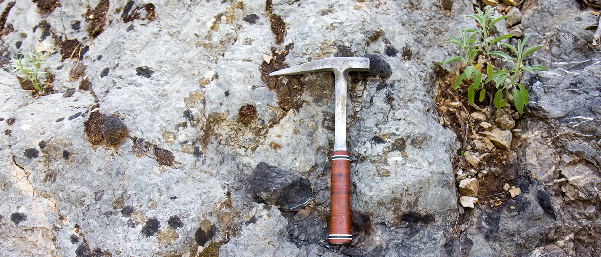
Last week, I was struck by a headline published by media outlet OGV. It read: CNOOC makes world largest offshore hydrocarbons discovery in special rock formation. Reading through the article,…
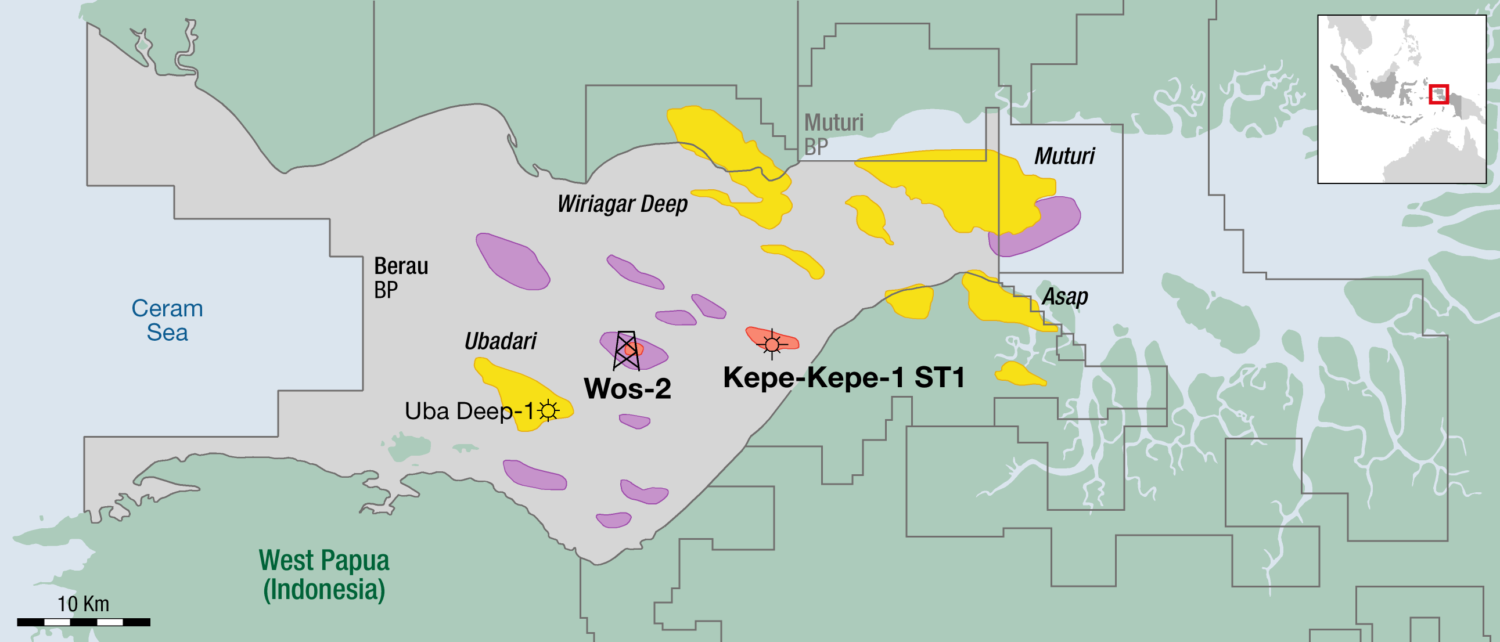
BP reportedly made a significant new offshore gas discovery in the large West Papua Berau PSC, Indonesia, with the Kepe-Kepe-1 sidetrack, according to oil and gas regulator SKK Migas. The…
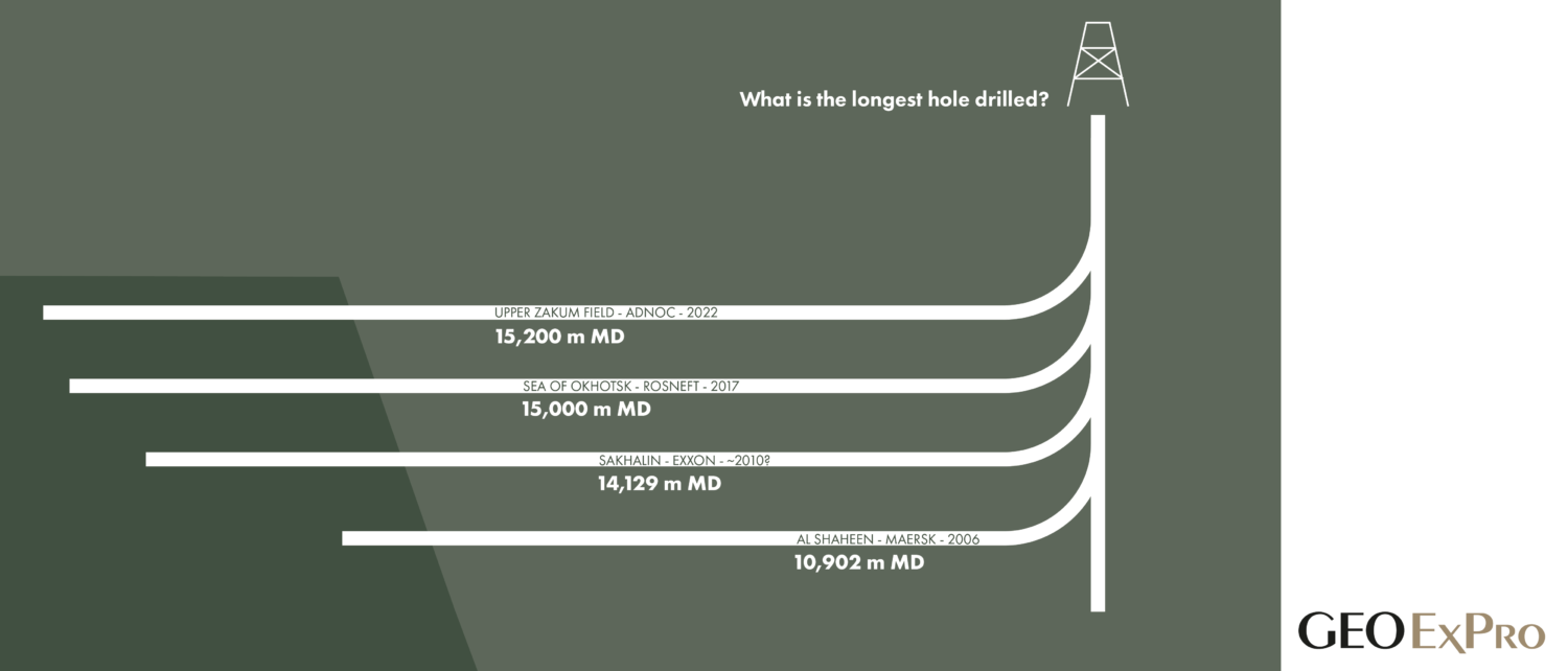
Based on a post on social media, in which we asked our followers to name the well with the highest step-out ratio – the ratio between horizontal distance and vertical…
“We went from two to nineteen mudlogging units recently”, said a representative from Geolog at the IPTC Conference in Saudi Arabia this week. “It is obvious that things are picking…
Molly Turko, Cameron Thompson and Kourtney Brinkley - Devon Energy; Julia Gale and Sara Elliot, Bureau of Economic Geology
Is a refrac worth the investment? That is what we investigated in an extensive study. A key piece of data in the study included a horizontal core adjacent to a…
Nestled in the vast brushlands of West Texas and New Mexico, the Permian Basin quietly outstrips the oil production of countries like Iraq, Iran, or Canada, a fact that often…
We received quite a few comments on our short story about the commencement of tight gas production from the Ghawar field in Saudi Arabia. Thanks to that, there is an…
Every year in January, the Norwegian Offshore Directorate – which until the turn of the year was called the Norwegian Petroleum Directorate – summarizes the activities on the Norwegian continental…
Theresia Maria Citraningtyas and William Reid, Earth Science Analytics
Project structure and objectives The initiative was divided into two major tasks: Task One – Integration of PETRONAS myPROdata with EarthNET The objective was to enable seamless data integration and…
Karyna Rodriguez, Lauren Found and Neil Hodgson, Searcher
Blue skies over Malabo Time for Equatorial Guinea’s next day in the sun Figure 1: License blocks in EG. Equatorial Guinea, “EG”, is a unique land in a myriad of…
Matt Tyrrell, DDMS & Trois, James Dodson, GeoPartners, and Eunice Oliveira, ANPG
How broadband pre-stack depth reprocessing, with a post-stack survey merge for the migrated OBC and streamer volumes, has enabled the development of 50-year-old gas fields Multiclient reprocessing of recovered legacy…
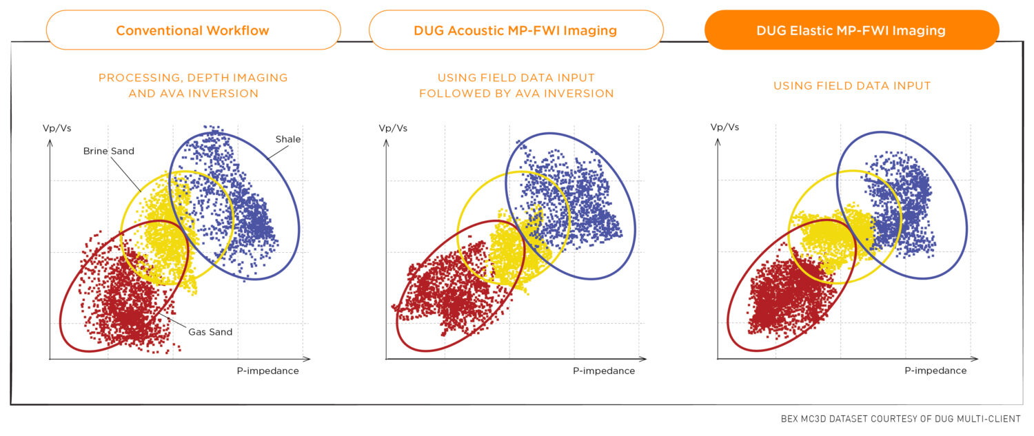
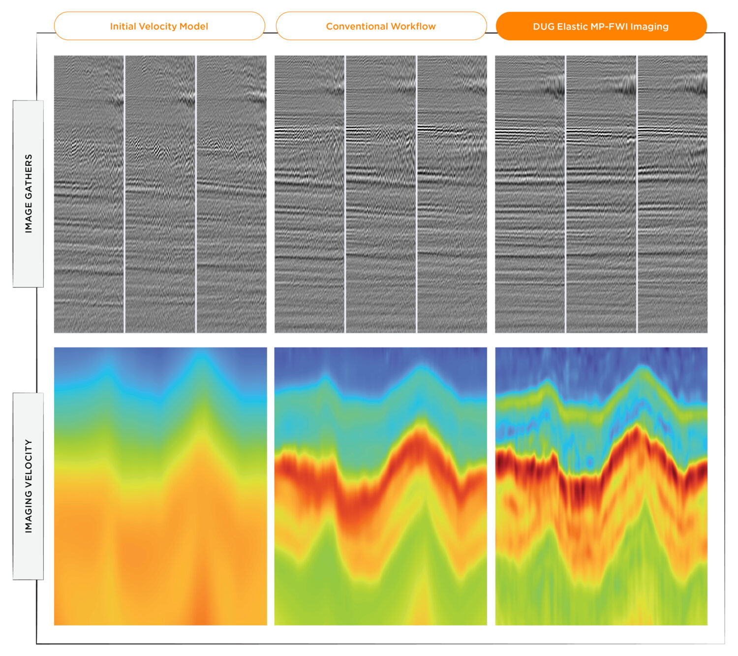
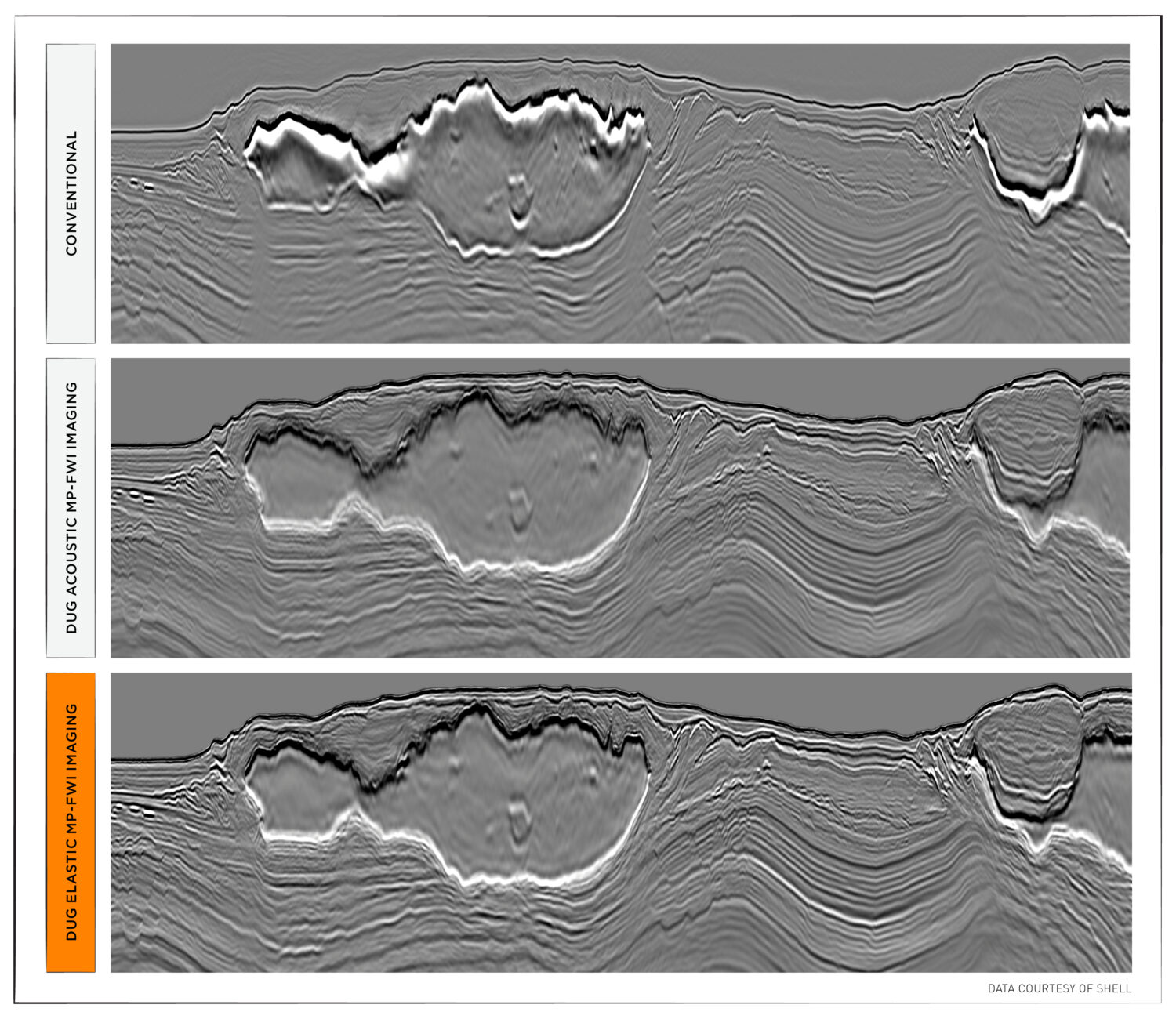
DUG Elastic MP-FWI Imaging delivers high-resolution elastic rock property outputs for quantitative interpretation — directly from field data. DUG Elastic MP-FWI Imaging is a unique approach to seismic processing and…
The Earth is inherently elastic. As data processing has advanced to better honour physics, we have continually refined our ability to understand the subsurface. Land seismic data, such as the…
High impedance contrasts a problem? Never fear. DUG Elastic MP-FWI Imaging is here! DUG Elastic MP-FWI Imaging is a unique approach to seismic processing and imaging which turns the traditional…
It was about a year ago that I heard about a deep geothermal drilling project in Finland (St1 Deep Heat Project), during which a couple of 6 km deep wells…
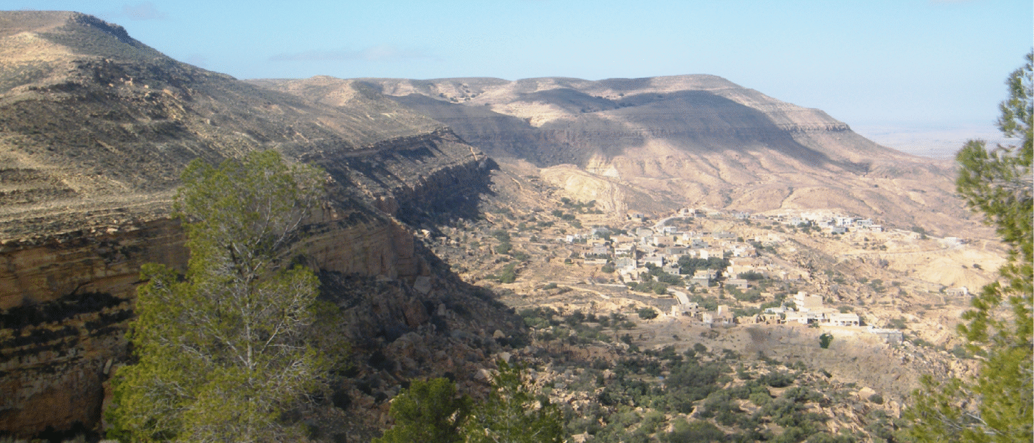
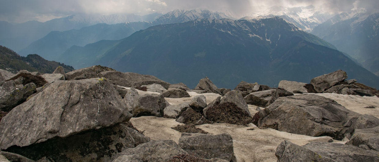
Despite receiving just 165 mm of rain annually, Coopers Creek flows year-round, an anomaly that has lured generations of explorers in pre-history to early European settlers. Exploration by geologist Reg…
“Claims of universal geographical scalability of Closed Loop Geothermal Systems (CLGS) in power generation at competitive prices are not supported by simulation results,” is what the authors conclude in a…
“We are changing the world of exploration,” says Denis Krysanov from Heologic, when we meet on Teams. “I’m now planning on expanding Heologic’s operations in the United States,” he says.…
As our 30-minute conversation took place on a Tuesday morning in early September, three emails arrived in Bastian’s inbox. Three separate and unrelated enquiries from customers in Switzerland, Germany, and…
“I spent days, if not weeks, trawling through high-resolution photos,” a geoscientist from an oil and gas company recently told me. Why did he do that? He carried out this…
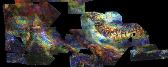
This study was undertaken by PetroStrat in collaboration with Stratum AS (QEMSCAN), Barnwell Parker Geoscience Limited (seismic interpretation) and HM Research Associates (heavy mineral provenance analysis). Together, we have completed…
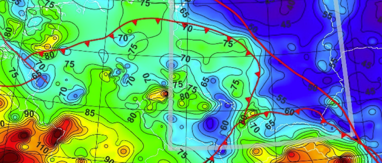
Many exploration geologists who work in data-lean basins or who do not have access to well data turn to published heat flow data as a calibration for basin models. More…
Traditionally, geomodels are built in a simplistic fashion, taking into account the inherent degree of uncertainty in the input data. Attempting to accurately depict an unseen geological object, often multiple…
“I’m probably the only tape machine specialist left in northwest Europe”, says Egil Simones from ET Works when we meet at the EAGE Conference in Oslo this week. Egil is…
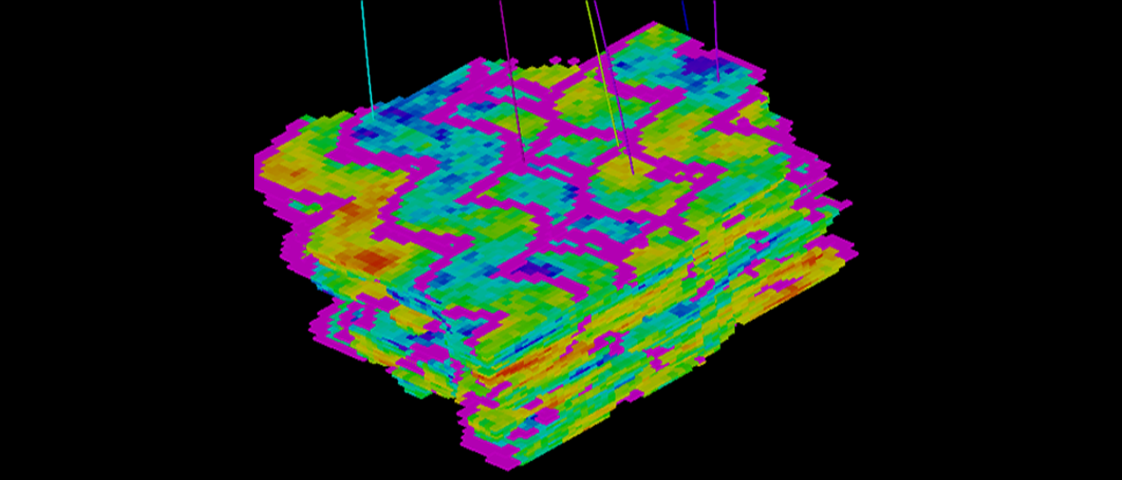
Åsmund Drottning, Per Avseth, Tore Nordtømme Hansen, Dig Science AS
The seismic signature of a sedimentary rock is strongly influenced by the geological history of the rock, e.g., the depositional environment, whether it has experienced tectonic burial and uplift, etc.…
Steve Morse and Gerrard Spear, Lyme Bay Consulting
During the pandemic, Lyme Bay Consulting took the opportunity to download all the Operator-released 3D seismic data in the UKCS to produce a series of Post-Stack Merged Seismic Volumes covering…
Looking out of the plane window when approaching Dammam, Saudi Arabia’s oil capital, the darkness of the desert is interrupted by star-shaped lights in places. I wondered what they were…
As many people will have headed back to either their (home) office today – brutally ignoring all of those who have continued working on site regardless of whether it is…
A catalyst for deals to be struck and new ventures to be undertaken, BEOS will bring together Oil and Gas Majors, IOCs, NOCs, Independents, E&P firms and Governments, whilst also…
“It’s funny, says Iain Brown, “I had been an avid reader of the magazine for years when I was asked to take over the editor position from Jane Whaley, but…
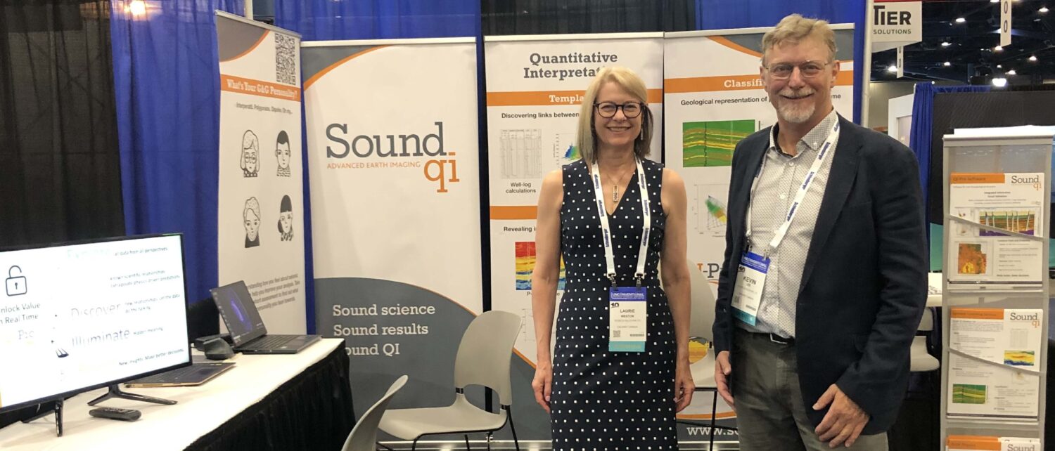
“We need this,” said a geoscientist from a major operator in Houston once Laurie Weston had finished one of her presentations as part of the Canadian SEG distinguished lecturer tour.…
When thinking about exploration geology in the oil and gas sector, most people will envisage going to places unknown, map the big bumps, and get them drilled. That’s not how…
“I was the first generation of students that graduated in the Soviet Union without having a job lined up for me,” says Svetlana Bidikhova. “When I started university, few people…
“A lovely little department dedicated to geothermal energy. That’s what I found when I started at the International Geothermal Association (IGA) in 2017,” says Marit Brommer, who had left a…
“The production of paleogeographic maps is an economically useful exercise for consultancy companies such as ours”, says Andy Horbury from Cambridge Carbonates. His company has been involved in constructing, editing,…
The initial nodes from the company’s rental pool have already seen successful service on one North Sea project and are now being deployed on a second for a different OBN…
The traditional model of survey design uses a survey design tool to create geometry which is passed to a different program – often Excel – to estimate cost. Iterating to…
Alan Bembridge, Geo Resources Consultancy International
Dedicated software programs employ several techniques, including non-linear traveltime tomography, land-specific FWI, bending ray Kirchhoff migration, anisotropic depth imaging, and horizon-consistent velocity modeling, to achieve obtaining accurate earth models. The…