
What is the longest well drilled along hole?
Based on a post on social media, in which we asked our followers to name the well with the highest step-out ratio – the ratio between horizontal distance and vertical depth – we got a good number of replies. The graphic above reflects the results, with the 15.2 km well drilled on the Upper Zakum field in 2022 as the likely winner at the moment, even though the step-out ratio could not be calculated because of the unknown depth of the well.
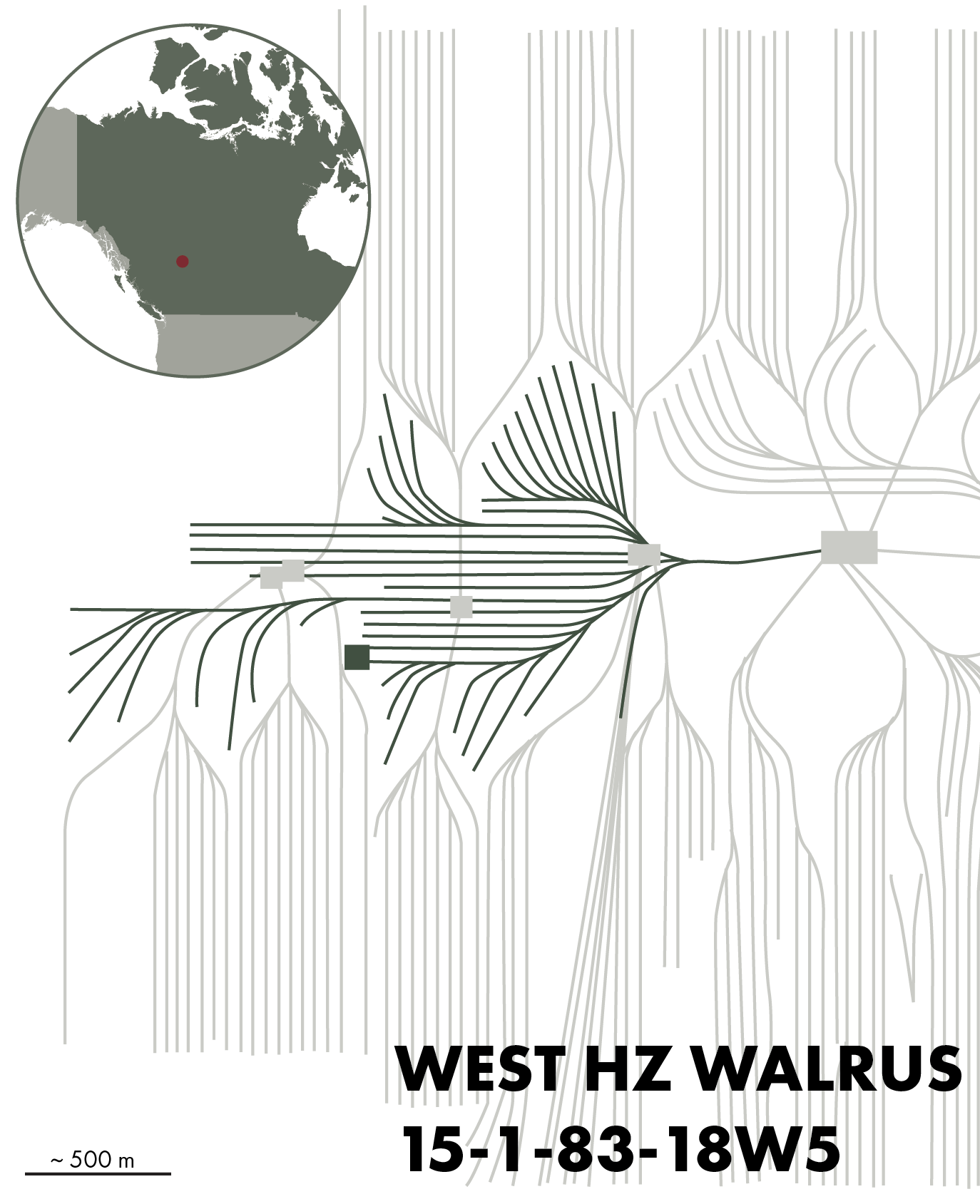
Calin Dragoie from Chinook Consulting Services in Calgary, Canada, also added a great bit of information in the comments and drew attention to the major number of horizontal wells that have been drilled in the Canadian oil sands in recent decades. There is one particular well that stand out, he commented. When all lengths of the 47 legs of the so-called PENN WEST HZ WALRUS 15-1-83-18W5 well in the Bluesky sand of the Walrus field would be added up, he argued, this well would certainly be beating all the other wells drilled in the world, arriving at a step-out ratio of more than 24.
On his company’s website, Calin writes that the Walrus well is a collector multilateral well, a type of well that was drilled before fishbone and feather wells became more common. The long straight legs act as collectors, from which a series of curved legs branch off into previously undrained areas.
This type of well was drilled to drain areas between already existing pads, as the map here nicely illustrates. In that sense, the collector type well can be seen as an infill well to ensure that any remaining oil left behind after the first phase of development can be produced.
Peace River Oil Sands
The Bluesky Formation is a Lower Cretaceous marine transgressive sandstone that was deposited during an Albian sea-level rise that caused the western Canadian foreland basin to drown from north to south. The formation attains a maximum thickness of 46 m and is buried to around 4,000 m close to the Rocky Mountain deformation front, but is found at much shallower levels – less than 1,000 m – in areas where the sandstones form the reservoir for the Peace River oil sand deposit. It is in the latter area where the Walrus field is located. Initial in-place volumes of the Peace River oil
sand deposit – hosted by the Bluesky and underlying Gething Formation was estimated to be 69 billion barrels of oil. Commercial production of oil in the Peace River area commenced in 1986.