Adriana Citlali Ramirez, Simon Baldock and Stuart Fairhead, TGS
Map of Offshore Liberia with project location in orange. Figure 2: a) Tomography and 15Hz DM FWI (refraction) velocity model; b) Additional higher frequency DM FWI run up to 40Hz…
Neil Hodgson, Lauren Found and Karyna Rodriguez, Searcher
Two for the price of one: Source rocks aplenty fuel South America’s next exploration frenzy Across the globe, explorers are waking from a disturbing dream where the oil and gas…
Joint PGS/TGS MultiClient data library. The study area is located in the Salar Basin. The South Bank 3D survey is shown in orange. Estimating reliable earth properties using PGS Ultima…
Map: CAMDI Seismic Lines over T&T Bid Round Blocks T&T: A closer look at oil and gas exploration prospects The Caribbean Atlantic Margin Deep Imaging seismic survey (CAMDI) spans 16,348 km, with…
Bent Kjølhamar, Adriana Citali Ramírez and Reidun Myklebust, TGS
Gas to Europe: Refocusing exploration efforts in the Atlantic Margins According to the World Economic Forum, Europe has enough gas for the first quarter of 2023. However, there is no…
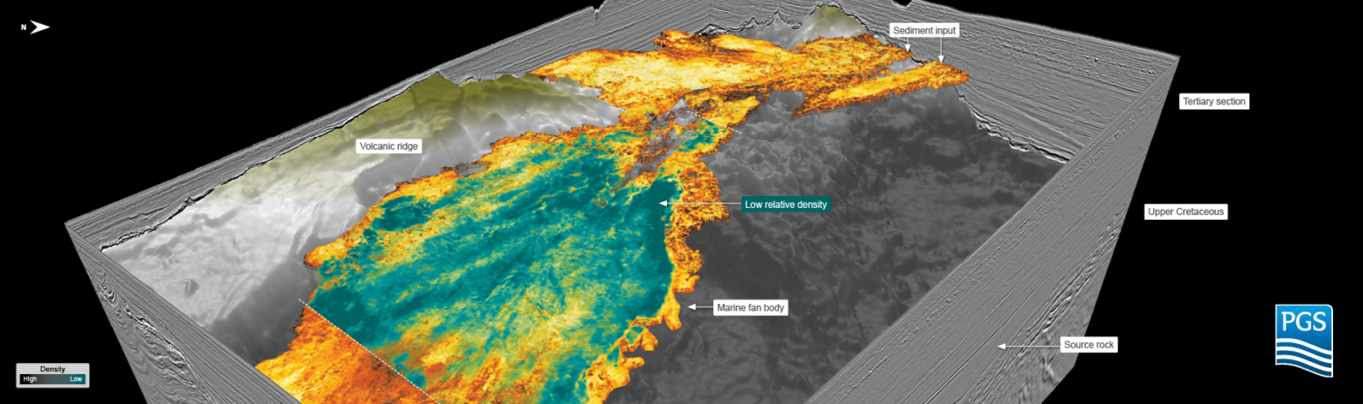
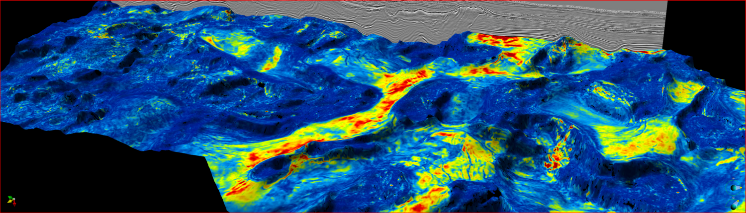
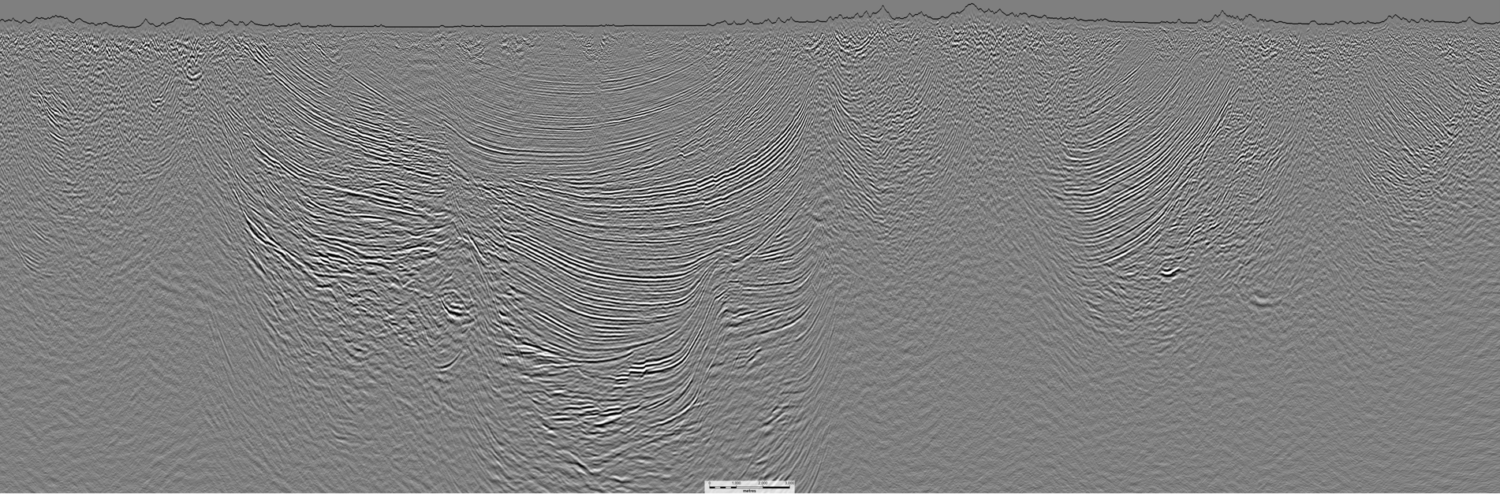
Fast and slow catastrophes trapping slope and basin floor plays How slumping, sliding and folding of passive margin stratigraphy creates the elements for successful exploration while the latest seismic imaging…
Kjetil Roverud, Stefan Möller and Jens Beenfeldt, PGS
The GeoStreamer X 2022 survey is shown in orange with the main seismic section highlighted. The survey area for the ongoing GeoStreamer X 2023 and the 2024 program is outlined…
Map showing Blocks available in the 2022-2023 Bid Round and available seismic data from Searcher. Evidence-based exploration on the slope of Nova Scotia In his definitive book on the form,…
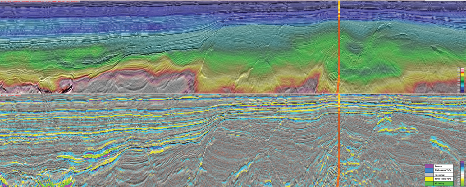
Jaswinder Mann-Kalil, Anna Rumyantseva and Idar Kjørlaug, CGG
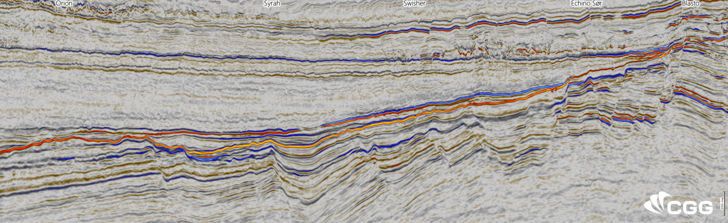
Left: Location map showing CGG’s legacy north-south, new east-west and dual-azimuth seismic coverage in the Northern Viking Graben. Right: TL-FWI velocities with frequencies up to 14 Hz, draped over dual-azimuth…
AOI with conditioned, integrated data, extent ranges from High Island to Brazos. The US GoM and beyond A clear candidate for CCUS is the US Gulf of Mexico (GoM).…
Coloured Pre-Salt Isopach Map relating mature Lagoa Feia source rock presence with Base of Salt structure contours displaying the fetch and hydrocarbon migration pathways to the pre-salt lead. Interpreted seismic…
Location of area of interest and data available for Searcher’s reprocessing project onshore Colombia. Shale or Salt – diapiric dance onshore Colombia Despite having positive well results in the 1920’s…