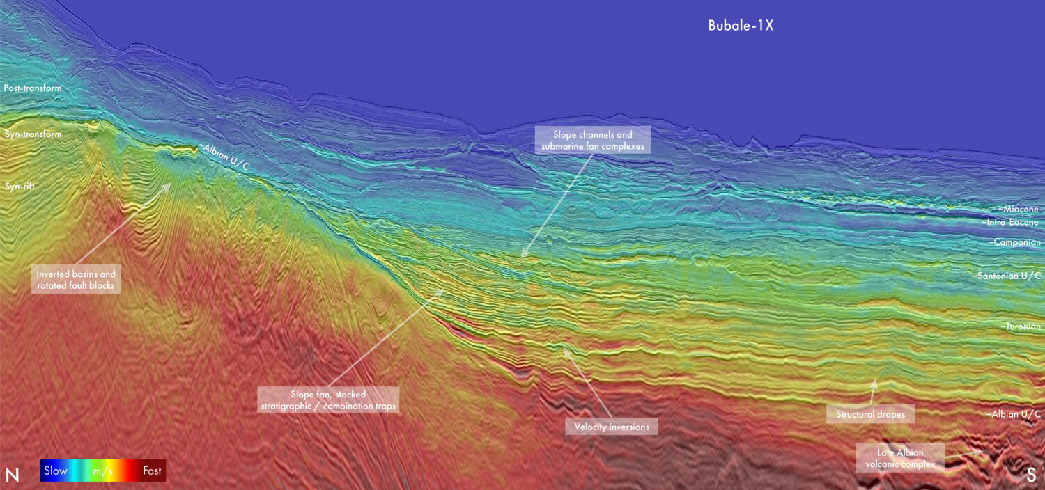
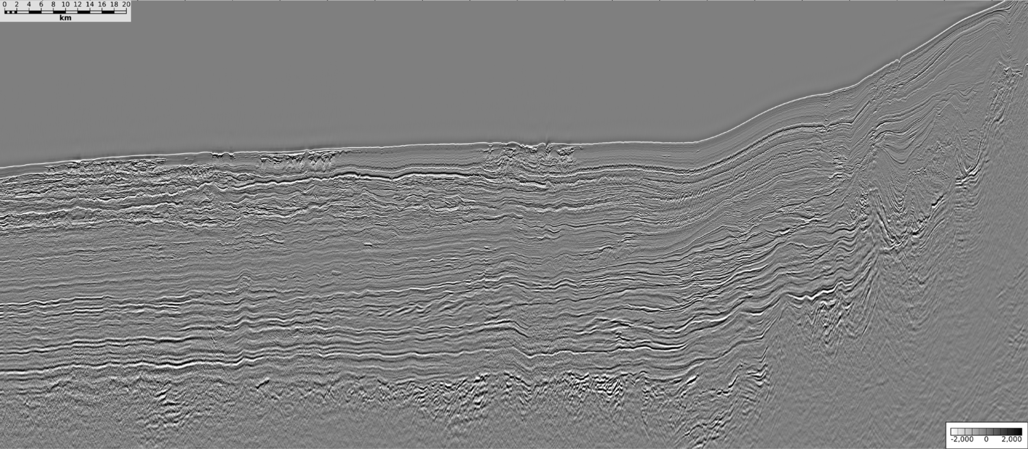
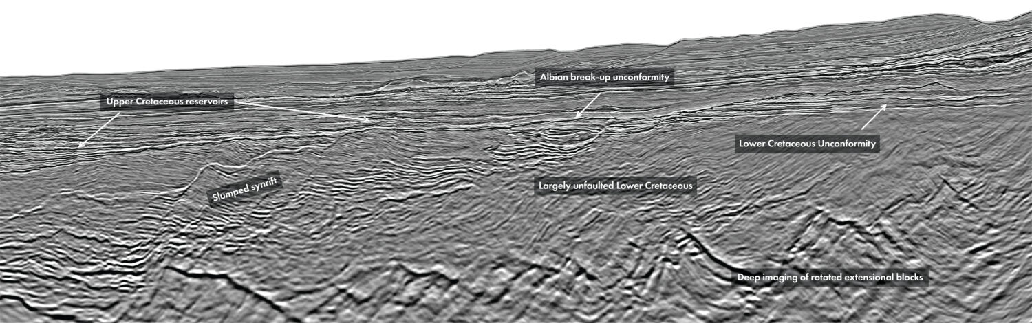
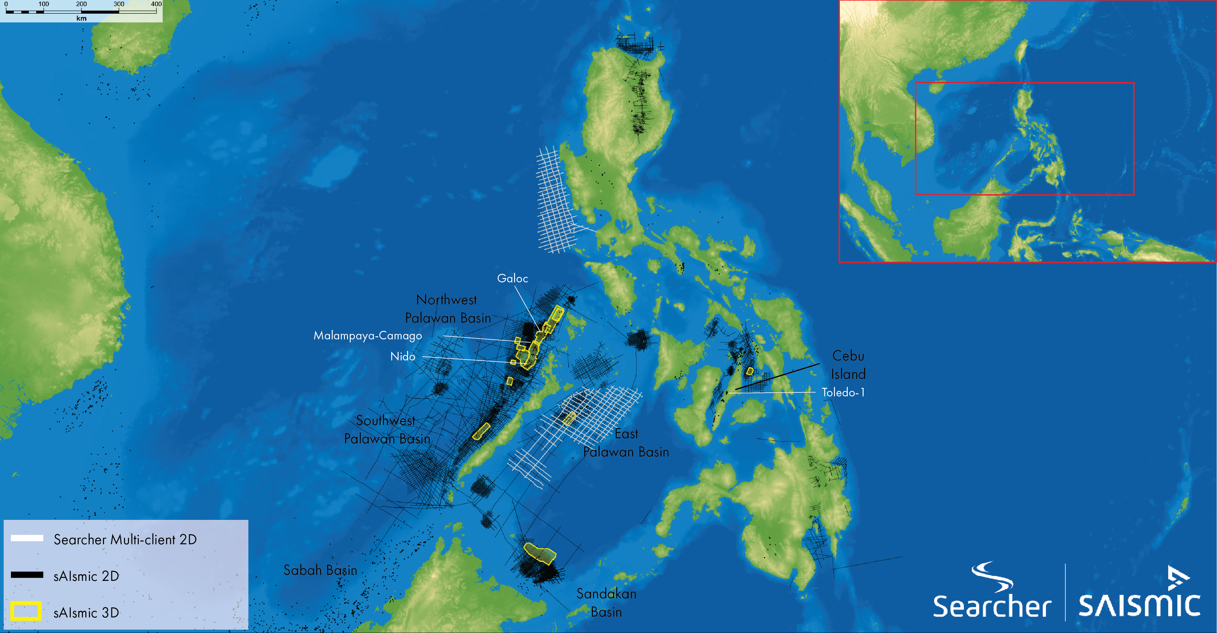
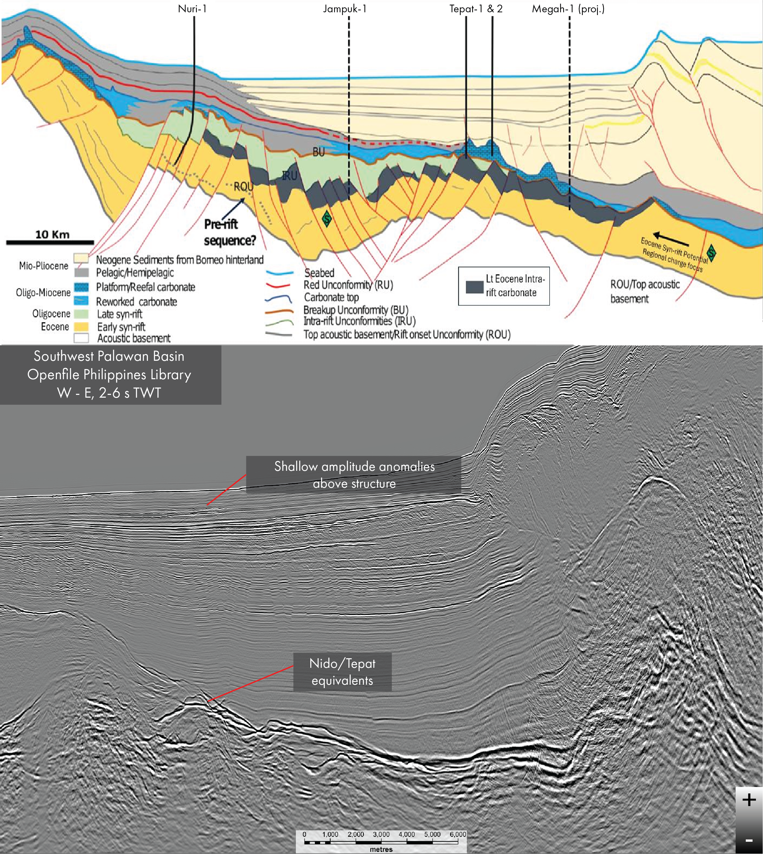
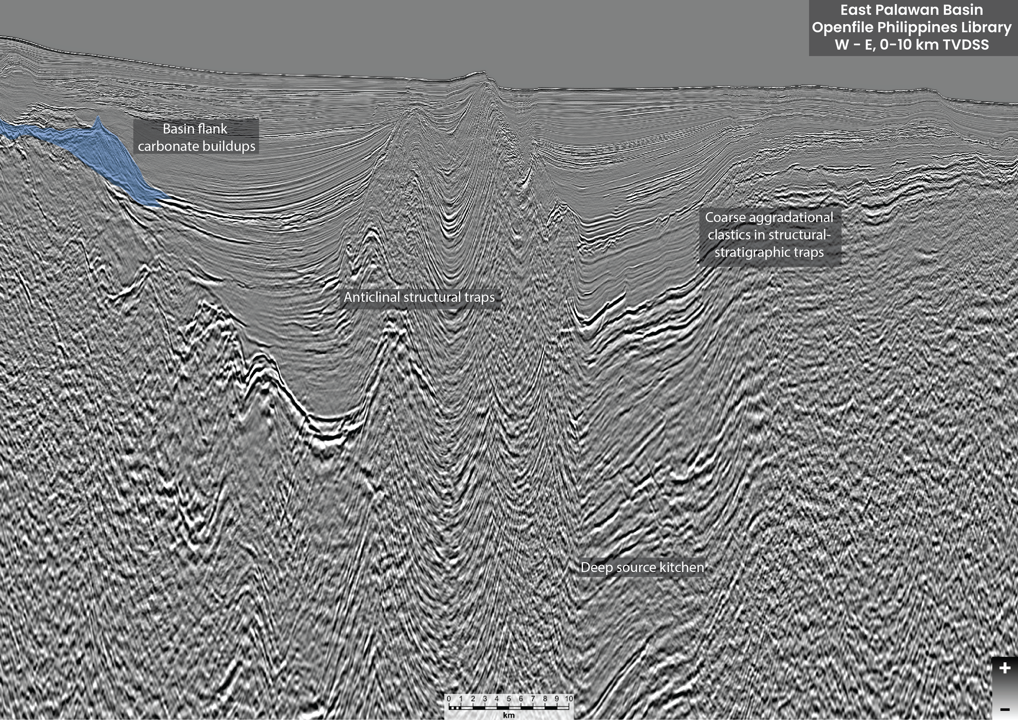
The keys to play success in the Philippine basins have already been found and include the newly available and improved datasets. An epic journey awaits; to locate the doors behind which lies the astonishing potential remains and unlock them “Sing, O Muse, of the basins hidden beneath the seas of the Philippines, of oil and gas-soaked reefs that rise as towers beneath the subsurface, of the heroic explorers who, having seen nearby analogues work repeatedly, would return to further targets with sharp eyes, and of the new opportunity to access data that will guide us through our journey of exploration around the islands.” This is undoubtedly how Homer would have begun to describe the underexplored prospectivity of the Philippines after the government announced the easing of the dissemination of the open-file seismic database. A critical moment in the Philippines exploration journey, the revelation that comes from the availability and close inspection of such a database is to marvel at how much low-risk exploration there is still to be done in the Philippines following proven trends and using solid analogues. Exploration in the Philippines, like The Odyssey itself, is one of the greatest stories ever told. The scene is laid in the late 1890s as clever and resourceful explorers find active oil seeps onshore the beautiful island of Cebu (Figure 1). This leads to the first onshore exploration well in 1896 (Toledo-1). Eighty years later, the successful discovery of oil in large quantities by Cities Service, drilling offshore Northwest Palawan with Nido No. 1 (1976), proved the carbonate pinnacle reef hydrocarbon system, leading to a plethora of similar targets being drilled in shallow water. This story, though, is about what happened next. In Homeric terms, after the initial success, it is on the journey home that things get really exciting. With the West Linapacan oil field (1990) and the huge Malampaya gas (Figure 1) and condensate discovery (1992), West Palawan proved to be a prolific basin. And indeed, it’s still delivering – Prime Energy resources announced the Malampaya East discovery in 2026. This proves that new data and new ideas can bring success in even well-explored areas, and the Philippines has many more carbonate buildup / pinnacle reefs still to be explored (Foldout). For today’s exploring Odysseus, new data brings new islands of prospectivity to explore. Specifically established to make data more accessible to explorers, in a collaboration between the Philippines Department of Energy (DOE) and Searcher, the DOE seismic archives have been collated, standardised and rigorously quality controlled to create a contiguous database of open-file seismic data across the sedimentary basins of the country (Figure 1). At the time of publishing, 94,000 km of 2D and 19,500 km2 of 3D seismic across 130+ surveys have been hosted on the sAIsmic platform, allowing rapid screening and exploration of proven and frontier basins. New explorers now need not sail blindfolded, strapped to a mast of hope, avoiding the siren calls of sparse and poorly imaged prospectivity. Perhaps the most recognisable play in the Philippines is the Northwest Palawan Basin’s “String of Pearls”, a series of Miocene-aged pinnacle reefs that include the country’s largest oil and gas fields, including the Nido, Malampaya and Galoc complexes (Foldout and Figure 1). Since the first of these treasures was discovered, advances in seismic technology have been extraordinary, as seismic processing and imaging are so much faster and clearer in 2026; it has been the area of greatest advance for our industry in the 21st century. Sometimes the dreams of an aspiring explorer, an Odysseus of our time, are not new but simply newly imaged. Indeed, many carbonate buildups of a variety of ages remain undrilled (Foldout), with more being revealed and mapped as an infilled seismic grid is made available for the first time. The Nido play dives into deeper water to the south, which would have been rendered too difficult to pursue in the past. Though the sea has changed little, the explorer’s mindset has changed dramatically as drilling technology advanced – the other greatest advance in our industry in the 21st Century! So much has it advanced that water depth is no longer a deterrent – if the prize is big enough – with carbonate buildups now located in deep water becoming one of the most intriguing and strongly pursued plays across Southeast Asia. In what is turning out to be a hot trend, TotalEnergies’ planned wildcat Jampuk-1 is targeting a similar carbonate play in the neighbouring Sabah Basin, which is proven with the Tepat discovery in 2017/18 (Figure 2). The Tepat and Nido plays meet in the Southwest Palawan Basin, with a string of carbonate buildups which are in deeper water until they dive underneath the fold and thrust belts in the east. An important risk reduction in this play is the recognition of shallow hydrocarbon-bearing anomalies located above the deeper buildups, which are telltale signs that the hydrocarbon system is working. In the East Palawan and northern Sandakan basins (Figure 1), continent-continent collision in the Early to Middle Miocene initiated foreland loading and clastic sedimentation, later than the deposition of the western Nido Limestone and its equivalent. Clastic plays, of drape and stratigraphic trapping styles, are abundant in the East Palawan Basin, located on the flanks and over the top of source rock-bearing synrift grabens and offer large and repeatable prospectivity. The continued subsidence and decreased sedimentation rates resulted in some later carbonate development along the basin edges, remaining prospective where top seal is intact (Figure 3). Only five wells have been drilled in the East Palawan Basin (GEO EXPRO Vol. 21, Issue 3, 2024), where the thick sedimentary succession and strong hydrocarbon indicators leave the frontier basin primed to yield the success of its western and southern cousins. In a world where national energy security has proven to be a key driver for governments, the rejuvenation of exploration activities in basins previously considered mature and overlooked is a welcome initiative. Having a reliable and readily available open-file seismic library, such as the one now available for the Philippines, is but one of many tools that can give a wily explorer a fair wind on their adventures. Working with the DOE and Searcher on that dataset will surely inspire any aspiring Odysseus to shortcut through years of wandering and rapidly take a pinnacle-shaped journey to exploration success.
Using new data to unlock prospectivity in the Philippines
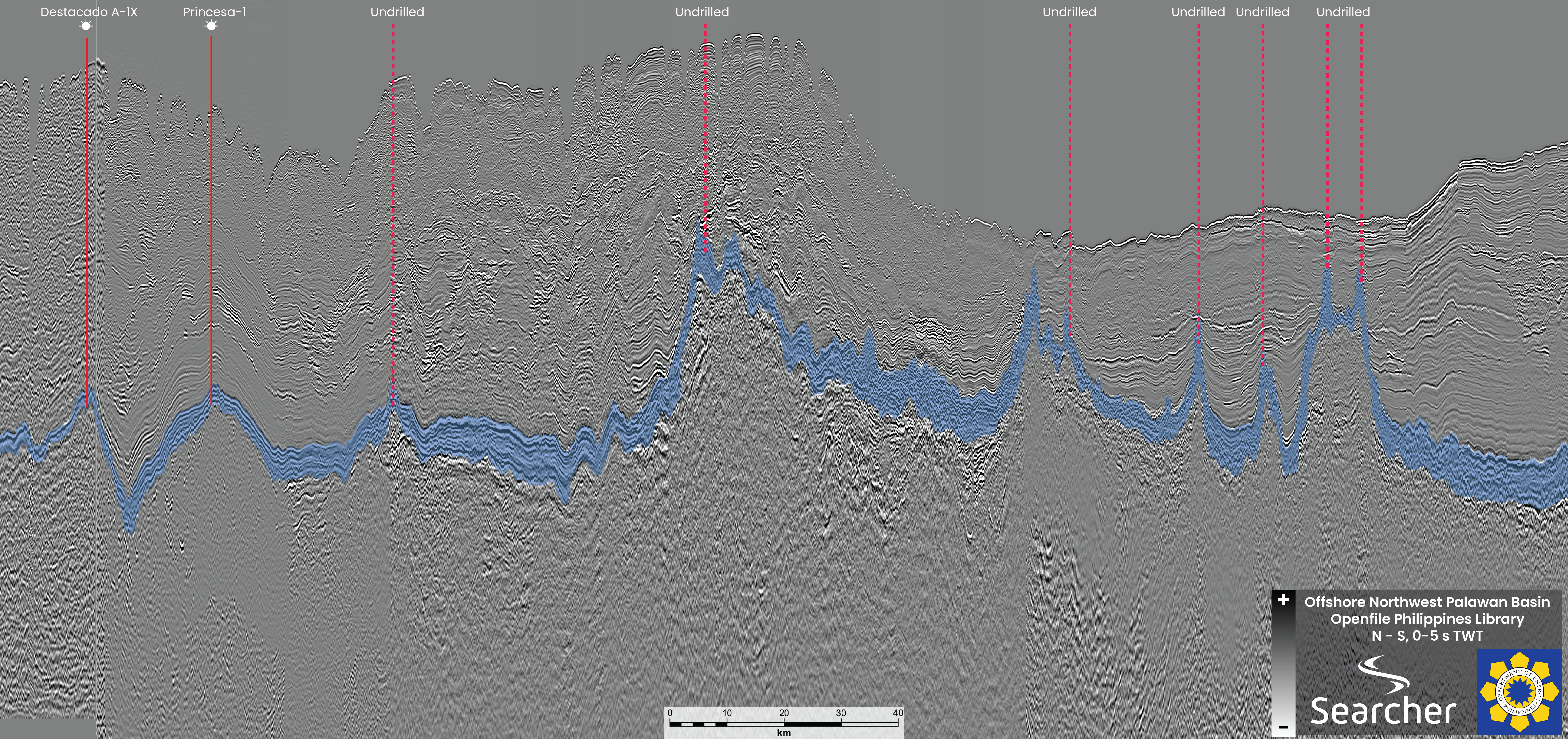 300 km composite arbitrary line across the Northwest Palawan Basin, highlighting the “String of Pearls” carbonate pinnacle play. Data courtesy of the Philippines Department of Energy.
Odysseus of the Philippines
Related Articles