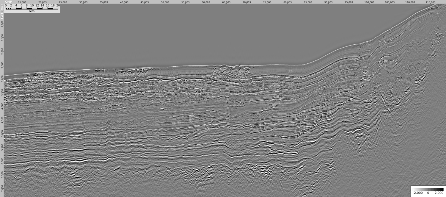
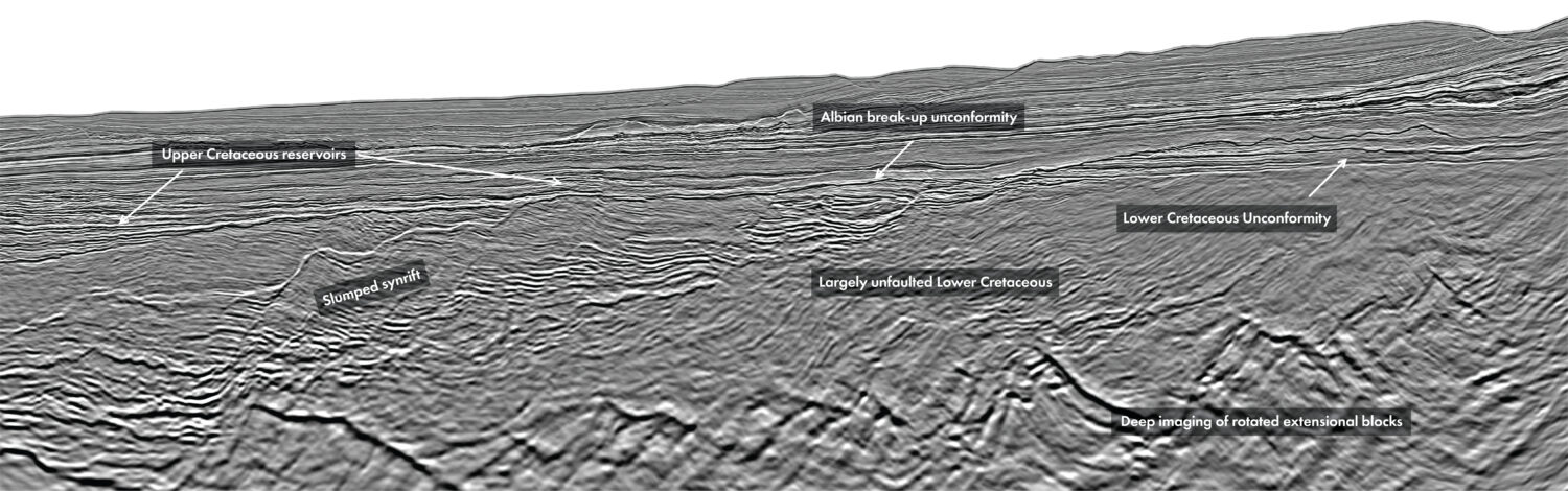
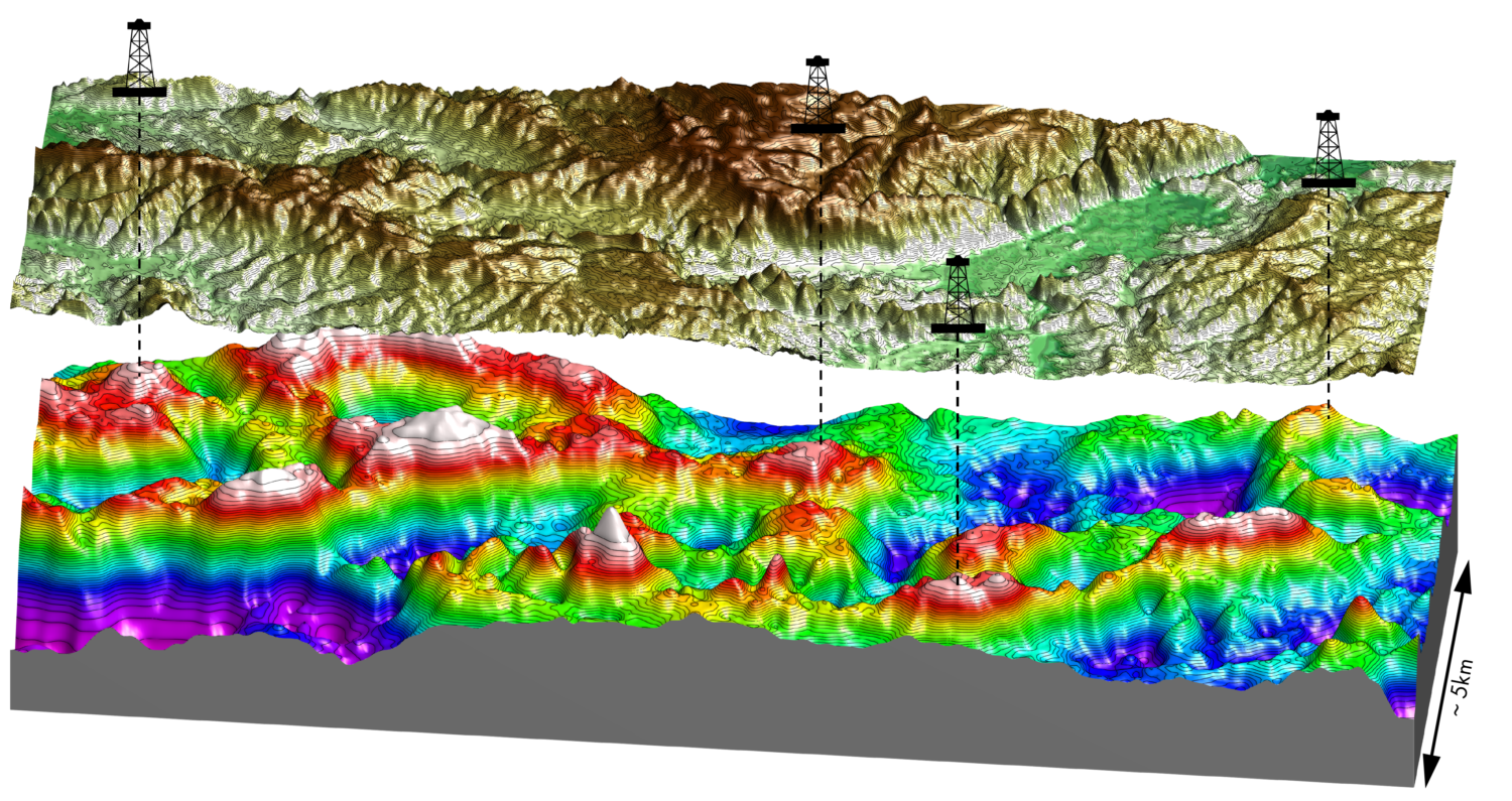
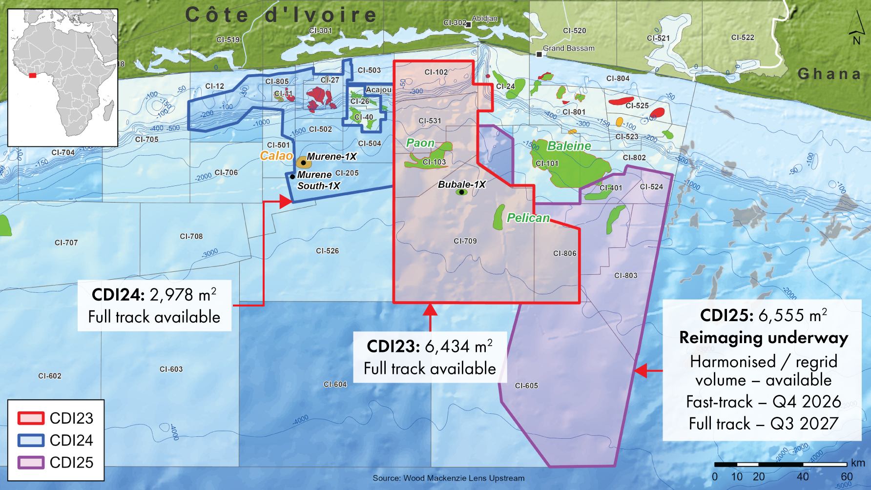
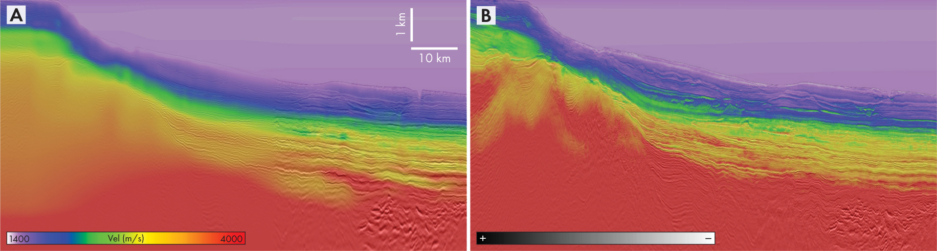
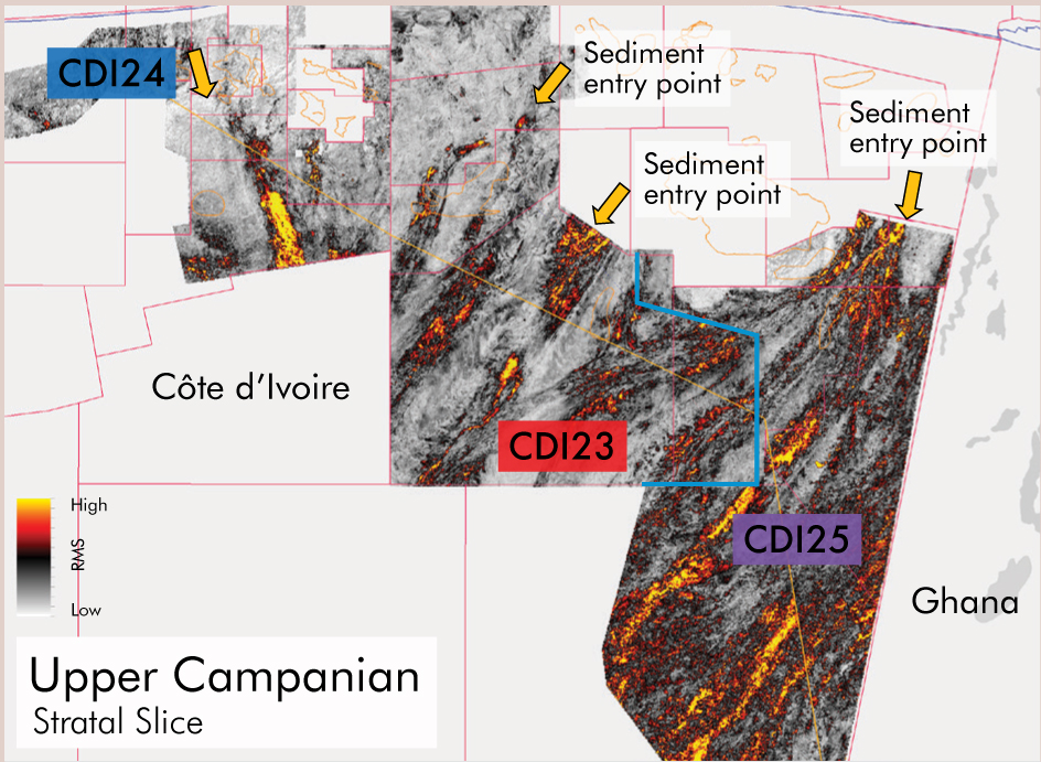
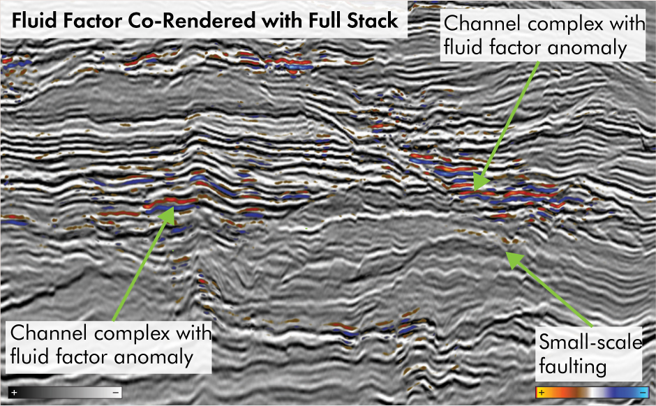
Côte d’Ivoire’s Tano Basin offers significant exploration opportunity, with multiple recent discoveries including Bubale-1X, Murene-South-1X within Upper Cretaceous deepwater slope channels / fan systems, and Baleine, a shelf-edge carbonate discovery. The extensive play diversity and prospectivity is highlighted by a new 16,000 km2 high-resolution reimaged dataset derived from 19 legacy surveys. The seamless dataset enables detailed structural, stratigraphic and petroleum system analysis at a regional scale, with stratal slicing enabling basin-scale analysis of the depositional fairways. The improved imaging, high-resolution velocity model, and robust Amplitude Versus Offset (AVO) response enhance the identification and maturation of a prospect portfolio. Figure 1 highlights the prolific Cretaceous syn- and post-transform plays, together with Bubale-1X, a discovery made on Viridien’s CDI23 reimaged seismic (Figure 2). The Tano Basin, offshore Côte d’Ivoire continues to deliver significant discoveries, including Bubale-1X and Murene-South-1X (2026) within Upper Cretaceous deepwater slope channel / fan systems as well as the Baleine carbonate discovery (2021). These discoveries emphasise the region as one of the most prospective hydrocarbon provinces in West Africa and a global exploration hotspot. In 2023, Viridien, in association with Direction Générale des Hydrocarbures (DGH) and PETROCI Holding, initiated a comprehensive reimaging program (Figure 2) over several key legacy surveys in the Tano Basin covering more than 9,400 km2. This program is being extended to incorporate a total of 19 legacy datasets acquired between 1994 and 2017, with varying azimuth and streamer length, with reimaging from field tapes to create a seamless and contiguous high-resolution volume over a total 16,000 km² area. This new basin-scale dataset is already revealing new geological insights into the depositional systems, structural framework and petroleum system of the Tano Basin, with the high-resolution velocity model, improved imaging, and robust Amplitude Versus Offset (AVO) response enhancing the identification and maturation of a prospect portfolio, as demonstrated with the discovery of Bubale-1X, drilled on the CDI23 dataset. The processing sequence was designed to address the specific imaging challenges posed by the legacy datasets, including merging multiple surveys. Amplitude fidelity was a primary consideration, with every step applied to preserve the relative amplitude relationships between offsets and angles, fundamental to AVO analysis. Two technologies proved instrumental in delivering the imaging improvements shown. The first is 3D Ghost Wavefield Elimination (GWE), performing simultaneous source- and receiver deghosting. By addressing both ghost components within a unified 3D framework, GWE removes offset-dependent wavelet distortions that could otherwise masquerade as genuine AVO effects, while harmonising datasets acquired with different configurations, broadening the effective bandwidth, and delivering a consistent amplitude response across surveys. The second key technology is Time-Lag Full-Waveform Inversion (TLFWI), integrated with multi-layer tomography. By incorporating reflected energy alongside diving waves, TLFWI overcame the limitations imposed by streamer lengths of 4 to 8 km, resolving lateral and vertical velocity variations that conventional approaches could not capture. Operating at frequencies up to 15 Hz further increased model resolution, delivering substantial improvements in both structural and stratigraphic imaging (Figure 3) and, critically, producing flat gathers, an essential AVO prerequisite. The Lower Cretaceous syn-rift play (Figure 1) comprises rotated fault blocks and compactional drapes of Apto-Albian terrestrial to shallow marine reservoir sands with associated source facies. The Upper Cretaceous post-rift plays comprise laterally extensive and stacked slope channel and turbidite fan systems (Paon, Murene and Bubale discoveries), primarily within stratigraphic and combination traps (Figure 1), with shelf-edge carbonate deposition over crests of fault blocks as seen in the world-class Baleine Field. Primary source rocks include the Albian, Cenomanian and Turonian (ACT) deepwater marine shales, adjacent to the deepwater reservoir systems (Figure 1). Stratal slicing was performed regionally, across the 16,000 km2 volume, at multiple stratigraphic levels, enabling clear delineation of depositional architecture and associated reservoir distribution and underpinning the identification of prospects and leads including subtle stratigraphic and combination traps. Within the Upper Campanian interval, for example (Figure 4), clearly defined sediment entry points in the north supply multiple large-scale stacked slope channel systems. Analysis at multiple stratigraphic levels, including the Murene, and Paon channel systems, highlights the highly variable deepwater sediment distribution systems, and significant stacked reservoir potential throughout the Turonian-Campanian, reflecting the complex evolution of the Late Cretaceous section. Significant uplift in fault imaging has been achieved, improving structural framework evaluation and ultimately trap definition. The extensive stacked reservoir potential of the deepwater clastic systems and carbonates coupled with their proximity to the prolific ACT source rocks offers significant prospectivity potential, which is reinforced by the recent discoveries. AVO analysis is key for reducing uncertainty and refining exploration risk for prospects in the basin. The flat, low-noise gathers allow stable AVO diagnostics across the full region, leading to the identification of consistent Class II-p and Class III responses, improving the ability to differentiate fluid effects from lithology-driven amplitude variations. In Figure 5 the fluid factor generated from the Shuey-derived intercept and gradient is co-rendered with the full angle stack, highlighting anomalies associated with potential hydrocarbon-bearing sands. The project has delivered high-resolution and AVO-compliant regional seismic volumes from multi-vintage legacy datasets using Viridien’s technology. These datasets are utilised in active exploration programs, leading to discoveries, demonstrating a robust and cost-effective alternative to acquisition, and potentially expediting the exploration and appraisal phase. The amplitude fidelity, together with the high resolution of the data, enhances the regional structural stratigraphic evaluation of the basin, with improved trap definition and AVO response, together revealing a more geologically coherent set of exploration opportunities and reaffirming the offshore Côte d’Ivoire margin as one of West Africa’s most prospective regions. Looking ahead, higher-frequency FWI could further sharpen velocity resolution, improving definition of fine-scale stratigraphic features. Ocean Bottom Nodes (OBN), even with a cost-effective sparse node geometry, complementing existing streamer surveys, would allow a reliable simultaneous inversion of P- and S-waves, that would directly feed into seismic inversion workflows, delivering a robust platform for prospect evaluation.
Côte d’Ivoire: Reimaged datasets provide new geological insights within an exploration hotspot
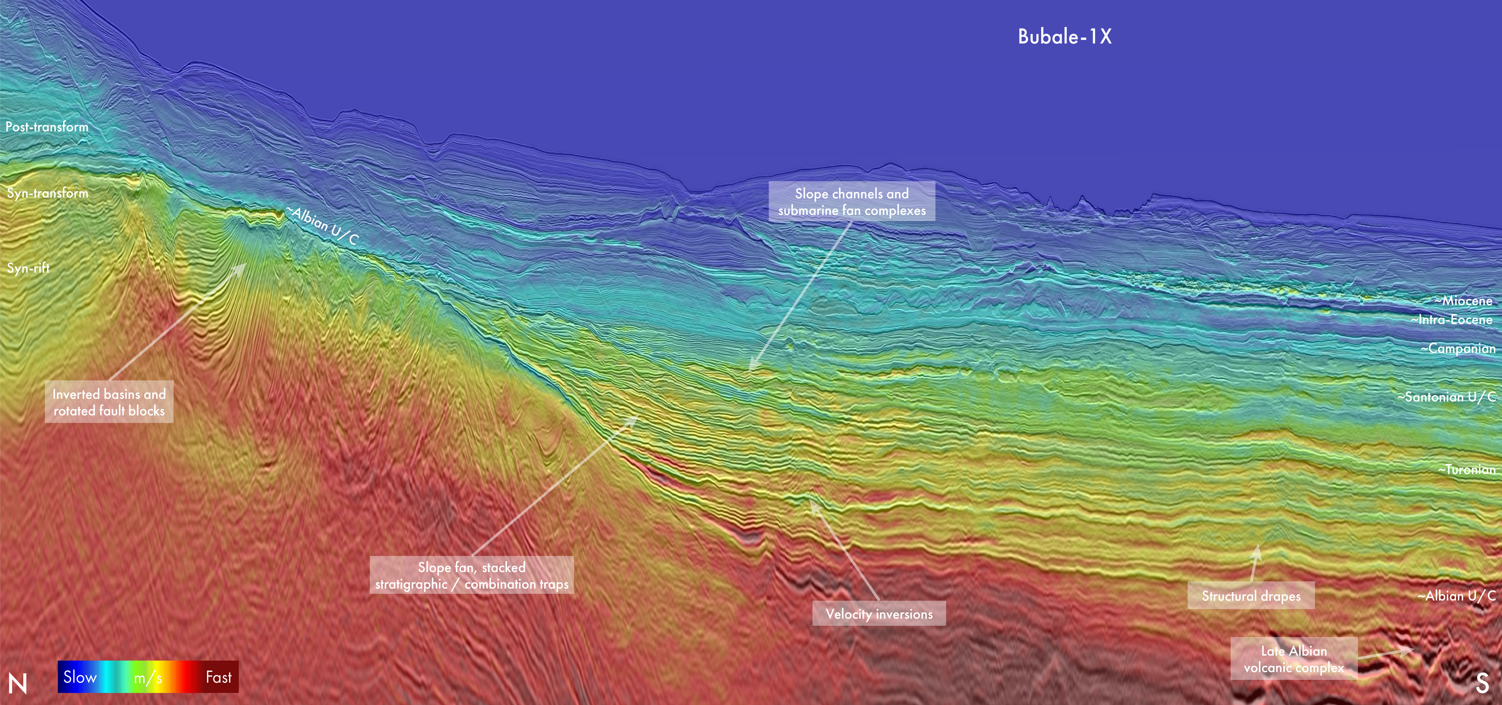 Figure 1: Arbitrary seismic line (final stack depth, with velocity co-blend) from the Tano Basin, highlighting key plays.
Modern reimaging – A catalyst for exploration in the Tano Basin
Reimaged data drives discoveries
Building the foundation for reliable interpretation
Underexplored region with a wide play diversity
AVO analysis driving prospect identification
High-resolution and AVO-compliant processing expediting the exploration phase
Related Articles