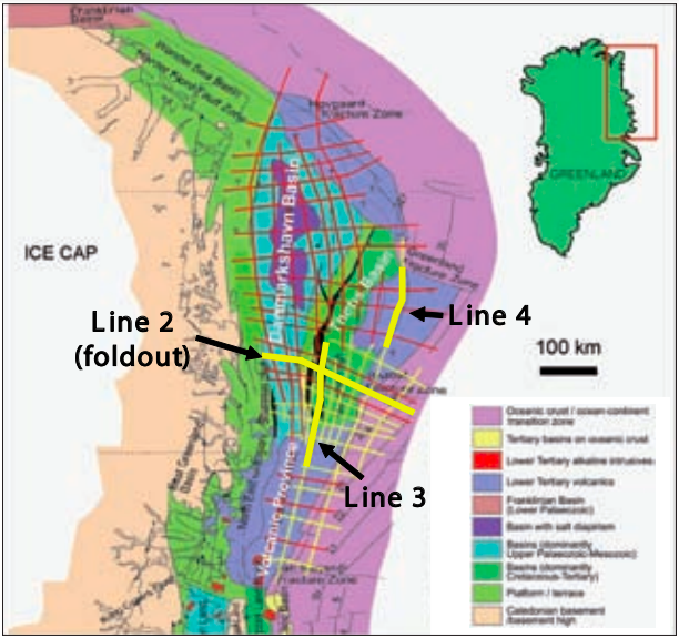
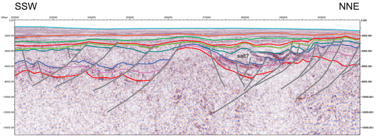
Recently completed regional 2D seismic reconnaissance data adds new insights on the hydrocarbon potential of this challenging unexplored frontier area. With an estimated 31+ Bboe of oil and over 86 Bcf of undiscovered gas resources, exploration across the Arctic is heating up, notwithstanding the area’s sparse geotechnical data base, considerable geological uncertainty, harsh and often rapidly changing weather and oceanic conditions and the enormous technical challenges. The North East Greenland shelf and slope is the conjugate margin to the Lofoten and Vøring Margins of Mid-Norway and the adjacent region. Pre-stack depth migrated (PSDM) seismic lines were used for the interpretation, which was tested iteratively against gravity and magnetic modeling. The seismic data also images intra- and sub-basalt reflectors in the volcanic province and on the marginal high where seaward dipping reflectors are interpreted. Several of the lines cross the Continent Ocean Transition (COT) where they clearly show deep reflectors at around 10 km which may represent the Moho. These deep reflectors plunge west to about 22-25 km depth towards the Greenland continental crust. The data show a very thick sedimentary sequence in the southern part of the Danmarkshavn and Thetis Basins which is at least 9 km thick. Both basins are interpreted to include a thick Mesozoic section. Older Palaeozoic sediments are also thought to be present in the Danmarkshavn Basin and subcrop along the Danmarkshavn Ridge which forms a prominent structural high separating the two basins. Extensive syn-rift faulting is interpreted along the eastern and western margins of the Danmarkshavn Ridge and large scale folding and doming have affected the area since break-up, leading to the development of potentially large hydrocarbon traps. These observations, together with comparisons with the conjugate Mid-Norway margin, reinforce previous interpretations that the area has excellent hydrocarbon potential. Information gained from the new deep long-offset seismic survey in NE Greenland also provides input for a revised plate tectonic model of the North Atlantic.
The NE Greenland Continental Margin
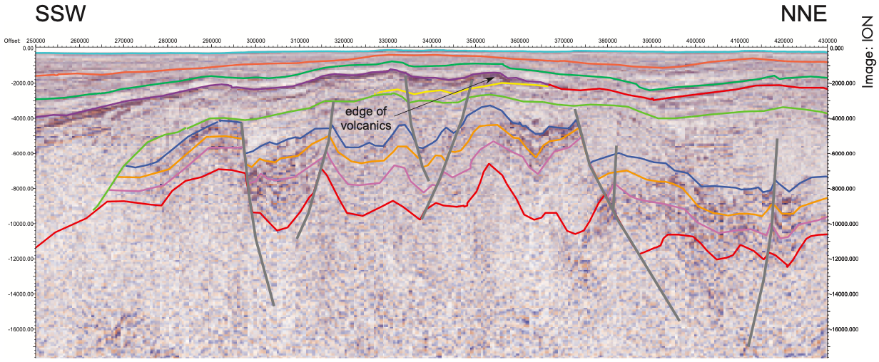
 Representative full crustal seismic profile (PSDM) across the NE Greenland Shelf illus- trating the relationships of the Danmarkshavn Basin, Thetis Basin, and oceanic crust. Of particular note are the thickness of the strati- graphic section and the interpreted presence of a Mesozoic section in the Thetis Basin which is evident on the new data. The likely presence of Mesozoic strata is strong evidence that rich oil-prone Jurassic source rocks are present in the outer Greenland shelf area. The survey also images intra- and sub-basalt reflectors on the volcanic margin where seaward dipping reflectors (SDRs) are interpreted. Line position shown on map on page 39.
Under the Ice floes of Greenland
Related Articles


