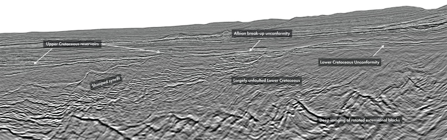
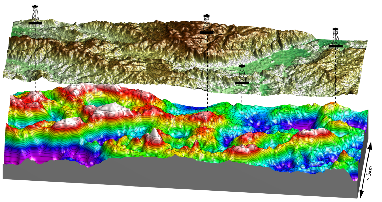
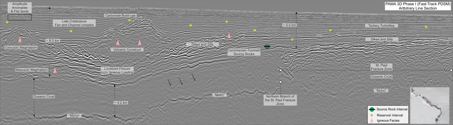
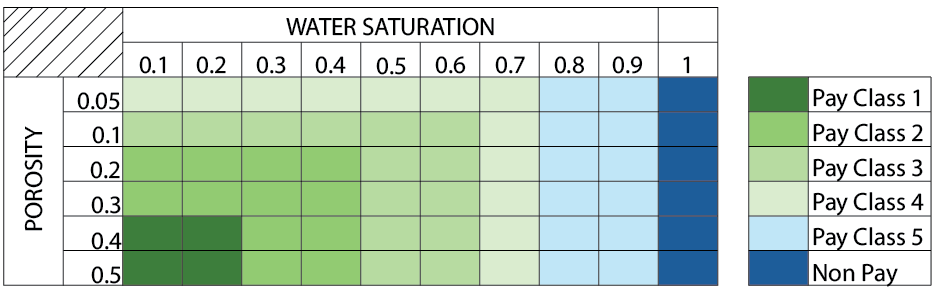
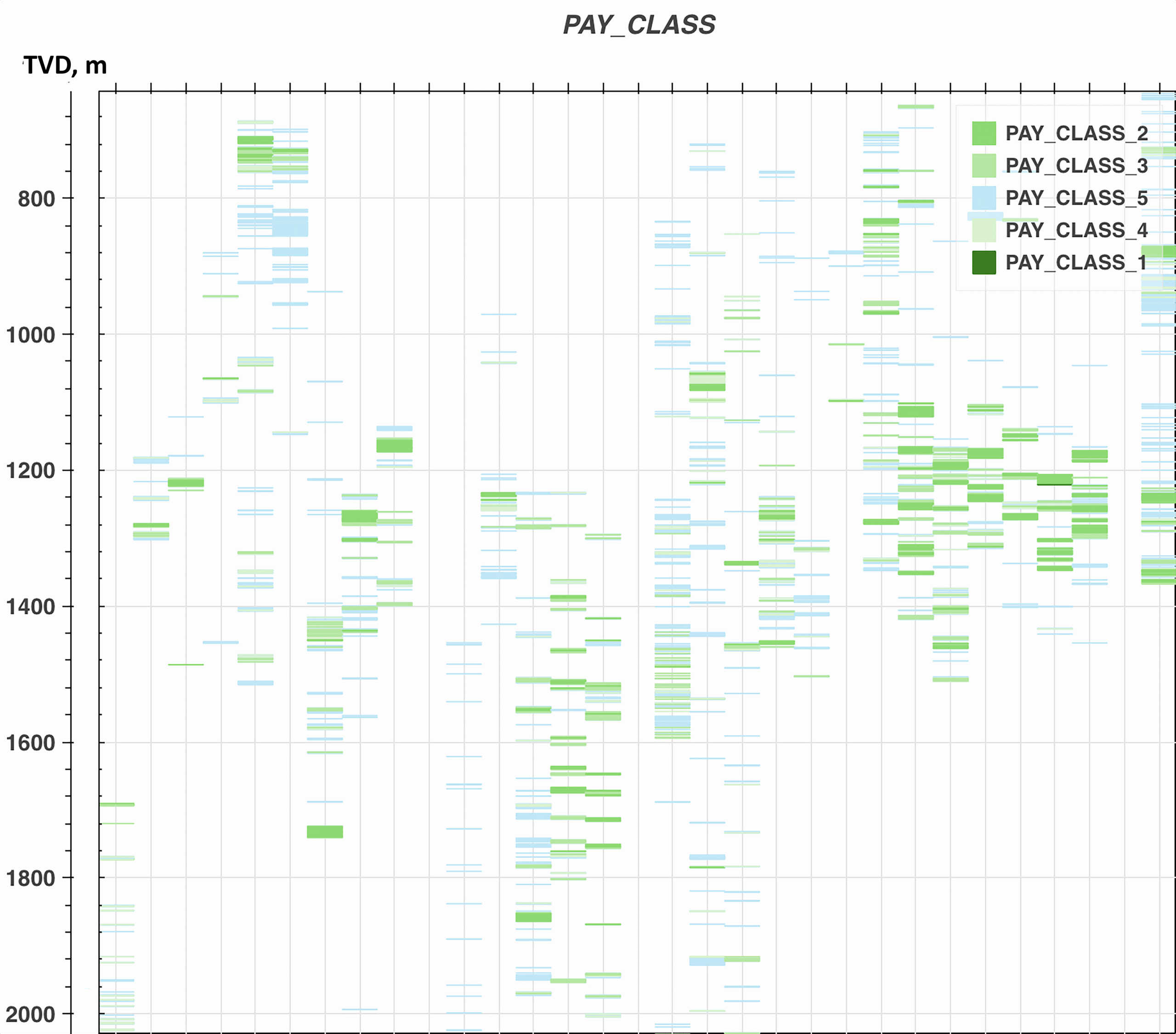
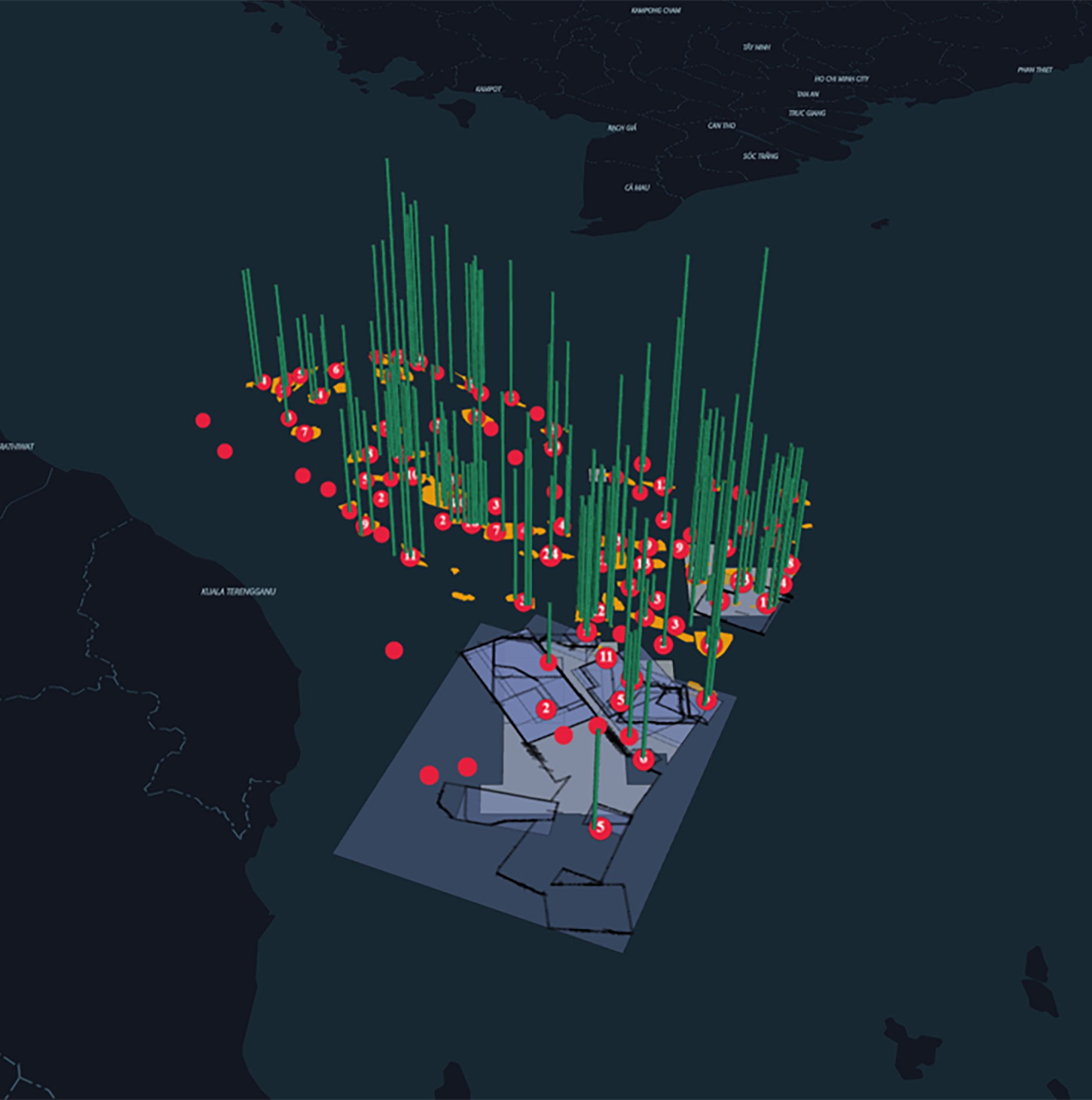
The oil and gas industry is undergoing rapid digital transformation, and nowhere is this more apparent than in subsurface analysis. With the increasing complexity of geological data and the need for faster, more accurate decision-making, artificial intelligence (AI) and machine learning (ML) are becoming indispensable tools. This article provides a comprehensive overview of a pioneering project conducted in collaboration with PETRONAS MPM, focusing on the integration of PETRONAS myPROdata with EarthNET for AI-powered geoscience and subsurface reservoir characterization. The project, executed in two tasks and multiple phases, demonstrates how digital technologies can expand data coverage, reduce uncertainty, and unlock new hydrocarbon opportunities in East Coast Peninsular Malaysia. EarthNET provided powerful tools to visualize both measured and ML-predicted datasets: These cut-offs were determined in close collaboration with PETRONAS MPM. Class 1 represents high-quality reservoirs (porosity > 0.4, Sw < 0.2), while subsequent classes represent progressively lower reservoir quality. This combination of predictive modelling and advanced visualization provides exploration teams with actionable insights at both well and basin scales. One of the most critical outcomes of this project is the focus on traceability and uncertainty quantification. Each predicted interval can be traced back to: This ensures that predictions are not “black boxes” but instead come with context, enabling geoscientists to judge their reliability. Such transparency is vital for building trust in AI-driven workflows in exploration and production. By integrating PETRONAS myPROdata with EarthNET and applying AI-driven subsurface analysis, this project has shown how machine learning can transform traditional workflows. From harmonizing thousands of wells to predicting missing logs and quantifying reservoir properties, the approach significantly accelerates exploration while maintaining rigor and transparency. Ultimately, the initiative demonstrates that AI is not just a tool for automation, but a partner in discovery — helping turn well data into the next hydrocarbon opportunity in East Coast Peninsular Malaysia. Interested in accessing our AI-powered East Coast Peninsular Malaysia results?
Harnessing AI-driven analytics for subsurface insights in East Coast Peninsular Malaysia

Project structure and objectives
The initiative was divided into two major tasks:
Task One – Integration of PETRONAS myPROdata with EarthNET
The objective was to enable seamless data integration and transfer between PETRONAS myPROdata repositories and EarthNET, ensuring that geoscientists could visualize, analyze, and interpret well and seismic data efficiently.
Task Two – Subsurface Analysis Using Machine Learning
This task focused on applying modern data management and AI-driven data analytics methods for well data harmonization, log infilling, and reservoir property prediction.
Phase One: Well-based analysis including ingestion, quality control, harmonization, and reservoir characterization of more than 2,000 wells.
Phase Two: Expansion from well-scale to seismic-scale interpretation, with AI-powered quantitative interpretation for elastic and reservoir properties.
PETRONAS myPROdata and EarthNET integration
One of the primary challenges in subsurface exploration is ensuring that well and seismic data can be accessed, visualized, and analyzed in a seamless workflow. The integration between PETRONAS myPROdata dashboards and EarthNET addresses this by allowing geoscientists to select wells and seismic surveys within myPROdata, and then instantly visualize them in EarthNET’s browser-based environment.
Machine learning for subsurface analysis
Phase one: Well data ingestion and harmonization
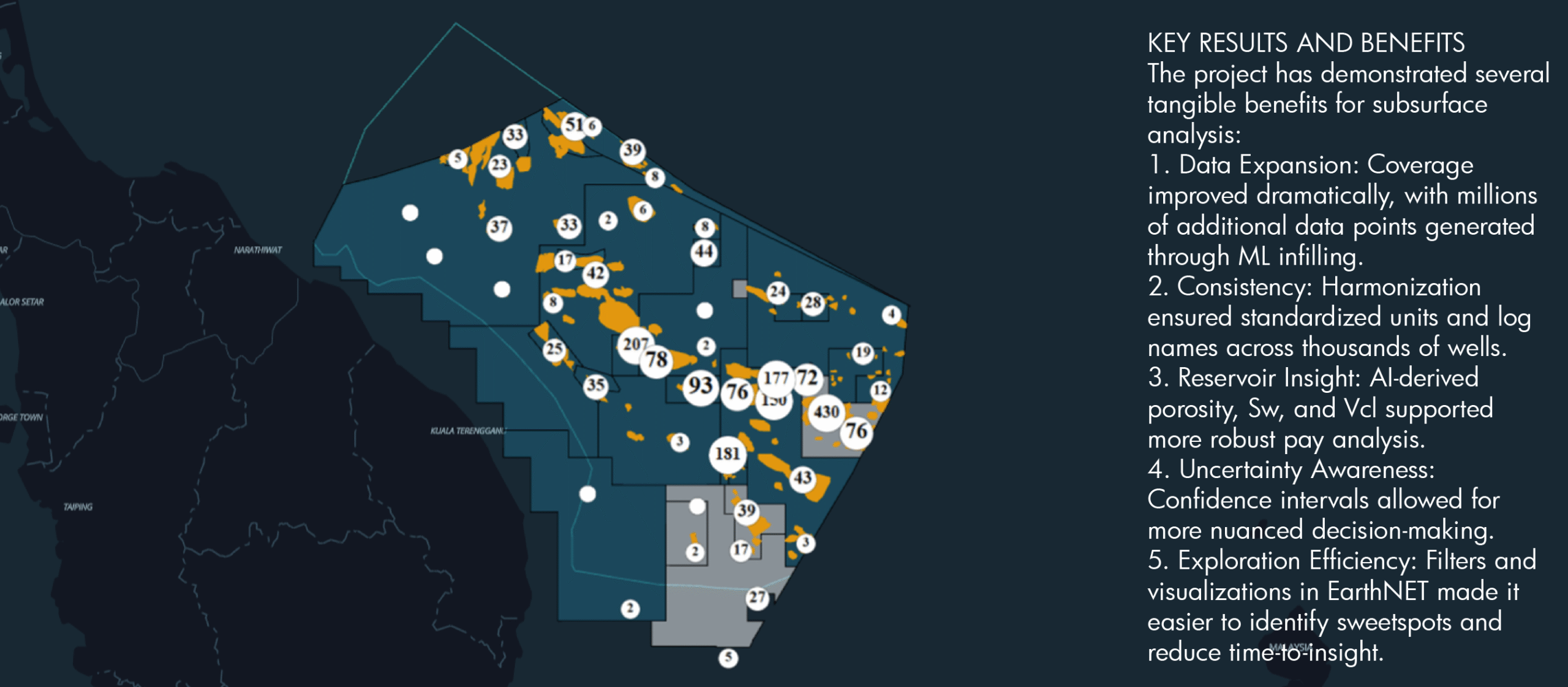
The project began with the ingestion and harmonization of 2,200 wells, comprising ~1,600 development wells and ~550 exploration wells. Because the data originated from multiple sources with varying formats and units, significant effort was devoted to:
Once cleaned and standardized, the dataset was prepared for machine learning workflows to expand coverage.
Log infilling using machine learning
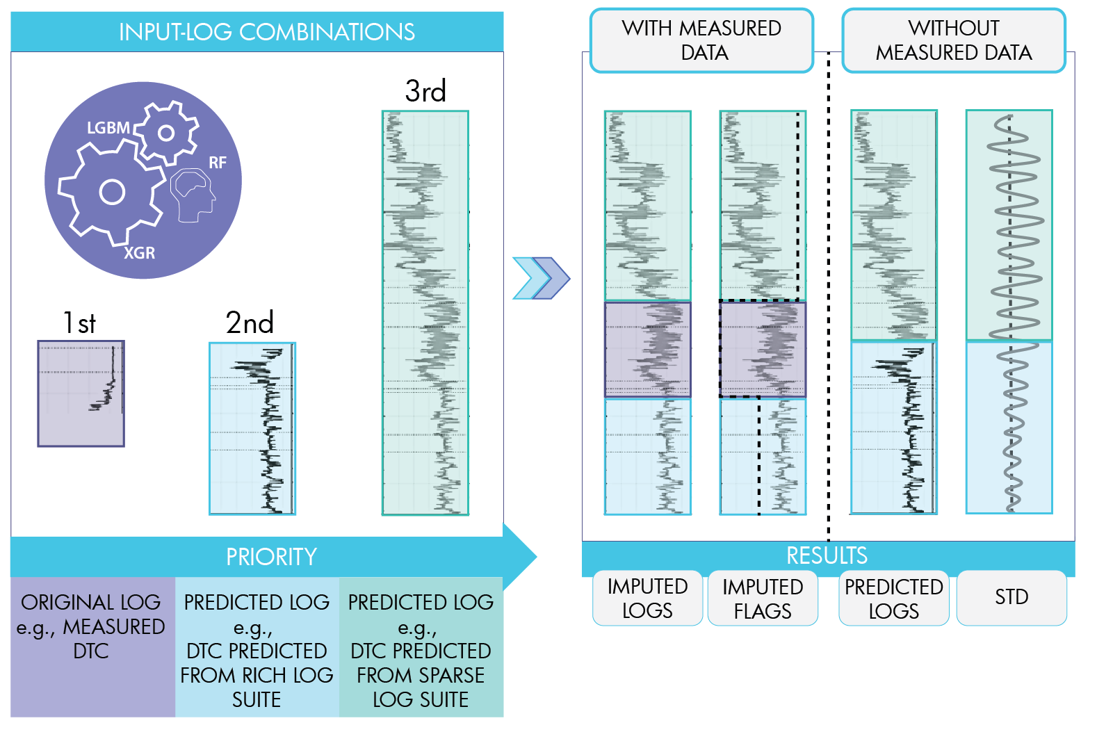
A central component of Phase One was supervised machine learning for log infilling. The goal was to fill gaps in well logs to increase coverage and reliability, enabling consistent reservoir characterization.
The methodology involved:
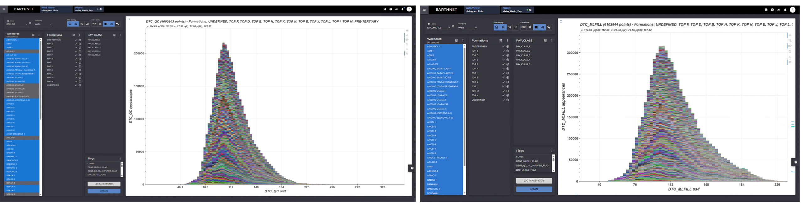
This approach significantly expanded data coverage — for example, DTC (Figure 4) coverage improved from 57 % to 87 %, and density logs expanded from 4 million to 6 million data points.
Reservoir characterization
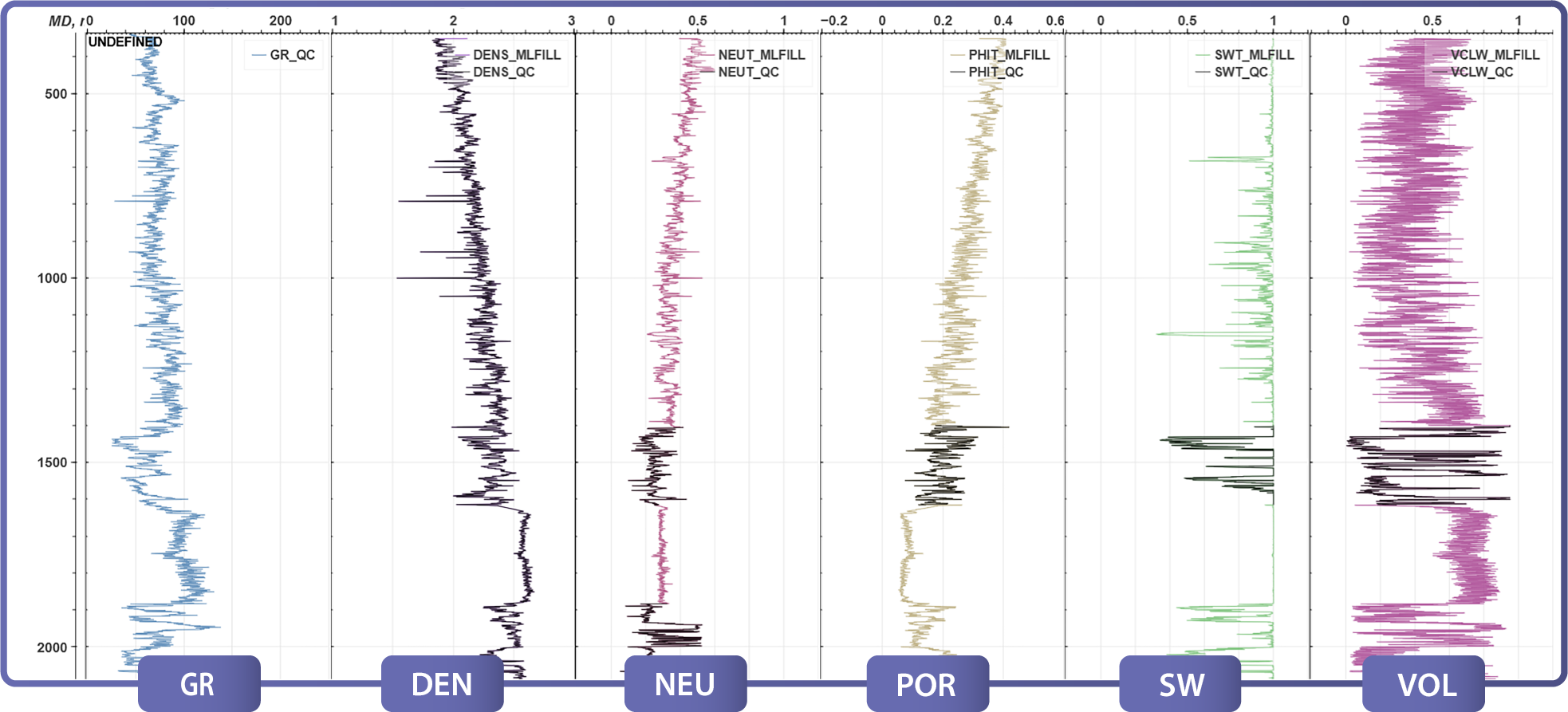
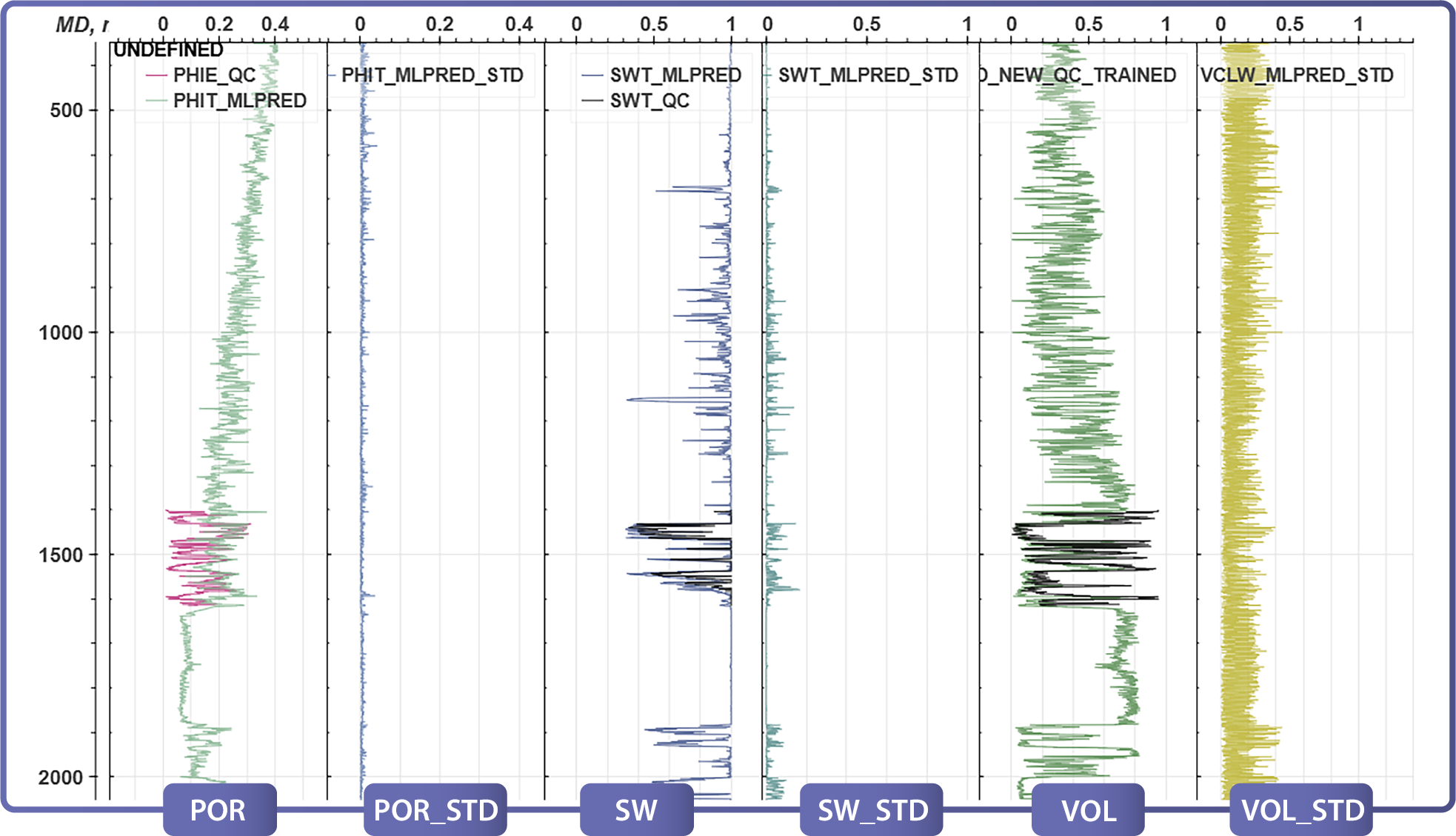
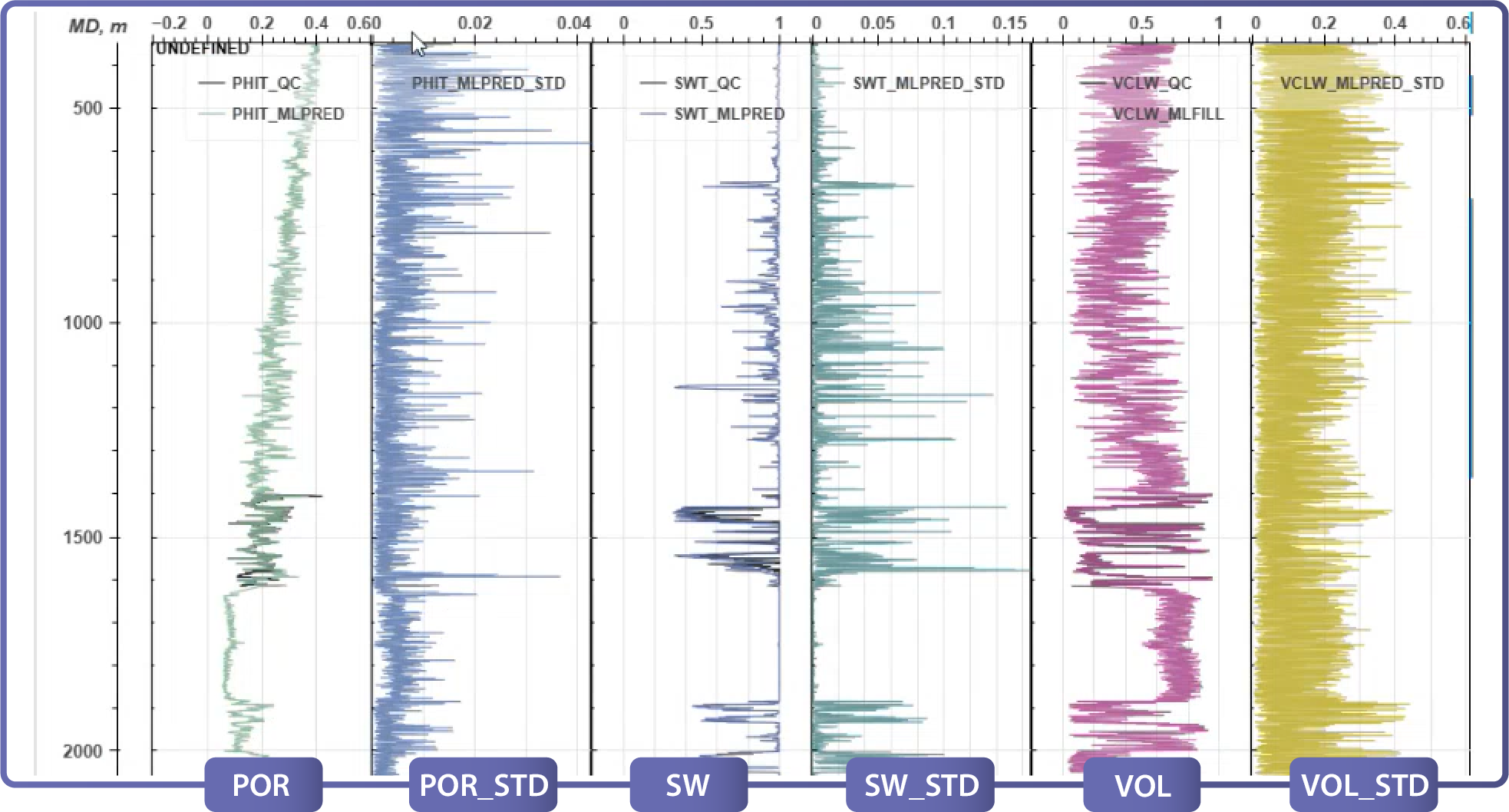
With expanded log coverage, the project advanced into reservoir property prediction. ML models were used to derive key properties (Figures 5 and 6) such as:
These properties enabled one-dimensional pay analysis and the classification of wells based on reservoir quality. Importantly, uncertainty quantification allowed geoscientists to differentiate between predictions with high confidence versus those requiring caution (Figures 5 and 6).
Visualization and analysis in EarthNET
Traceability and uncertainty management
Turning data into discovery
Contact us: contact@earthanalytics.noRelated Articles