Misha Isakov, Paolo Gabrielli, Emmanuel Nformi, Shona Culwick, CGG and Blanche Mahamat Achta Boubakar, Christophe Atangana Ndende, Société Nationale des Hydrocarbures
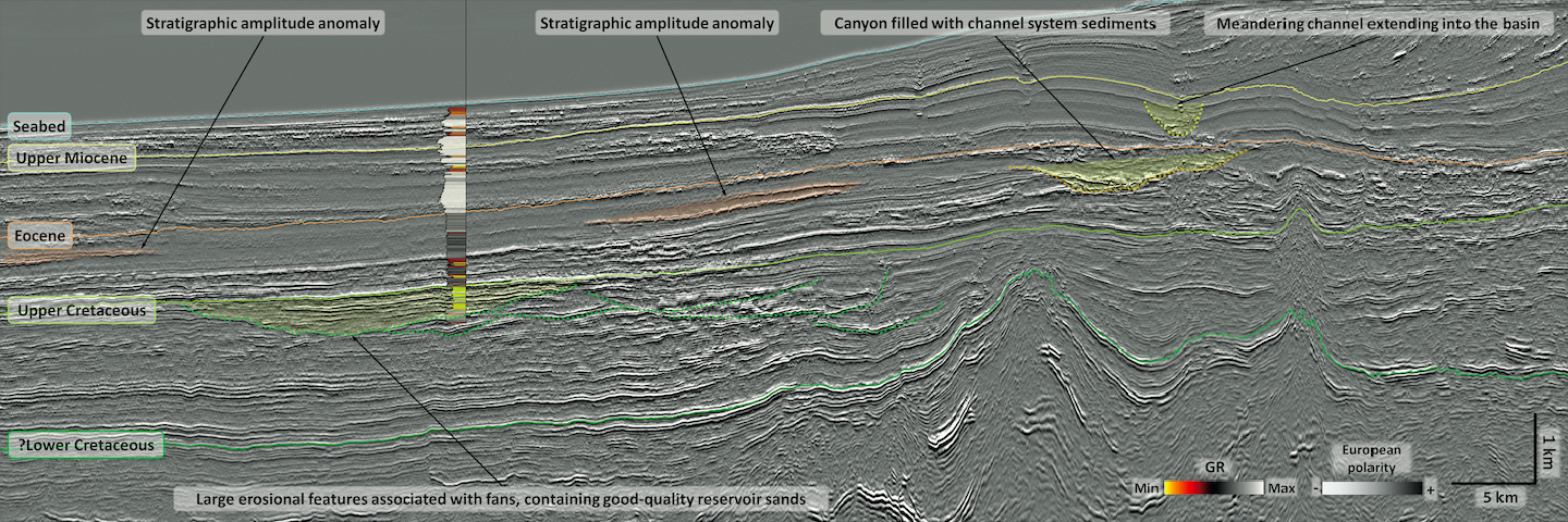
Location map showing CGG’s 3D seismic coverage in the DKC basin, well locations and hydrocarbon fields in the DKC and RDR basins. A close-up of a canyon – a seismic…
Neil Hodgson, Karyna Rodriguez and Lauren Found, Searcher
3D that’s fast, cheap and good! And all three together in the Hottest basin on Earth So far this year, approximately 18,000 square km of new 3D was acquired in…
Avril Burrell and Wole Oyetoran, PGS, and Ahmad Abdullahi, NUPRC
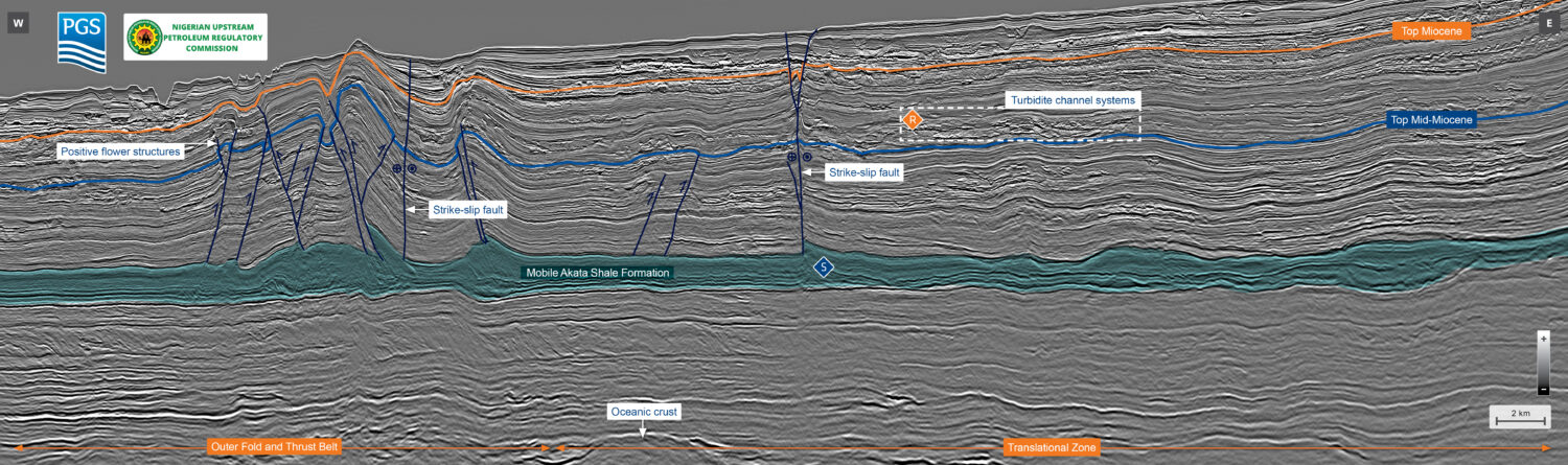
PGS MultiClient data library, offshore Nigeria. Location of the MegaSurveyPlus 3D data is shown in teal, with the area of interest highlighted in orange. Nigeria MegaSurveyPlus Reprocessing delivers excellent resolution of complex…
Adriana Citlali Ramirez, Simon Baldock and Stuart Fairhead, TGS
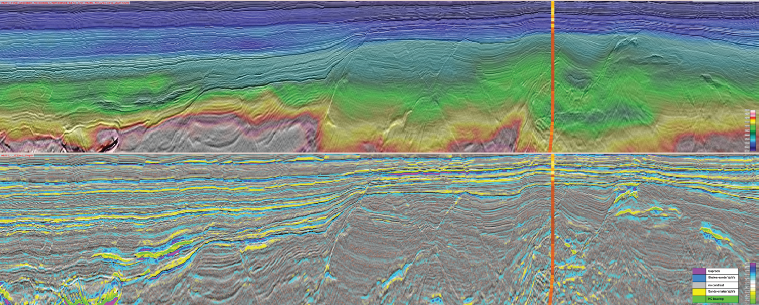
Map of Offshore Liberia with project location in orange. Figure 2: a) Tomography and 15Hz DM FWI (refraction) velocity model; b) Additional higher frequency DM FWI run up to 40Hz…
Neil Hodgson, Lauren Found and Karyna Rodriguez, Searcher
Two for the price of one: Source rocks aplenty fuel South America’s next exploration frenzy Across the globe, explorers are waking from a disturbing dream where the oil and gas…
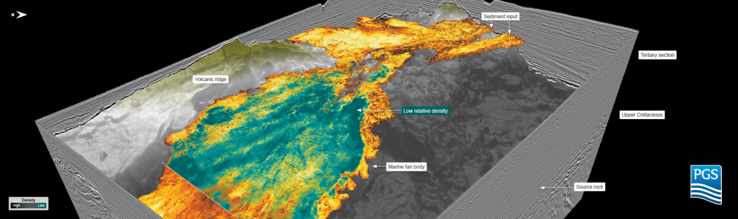
Joint PGS/TGS MultiClient data library. The study area is located in the Salar Basin. The South Bank 3D survey is shown in orange. Estimating reliable earth properties using PGS Ultima…
Map: CAMDI Seismic Lines over T&T Bid Round Blocks T&T: A closer look at oil and gas exploration prospects The Caribbean Atlantic Margin Deep Imaging seismic survey (CAMDI) spans 16,348 km, with…
Femi Makanjuola, director at Katalyst, US operations
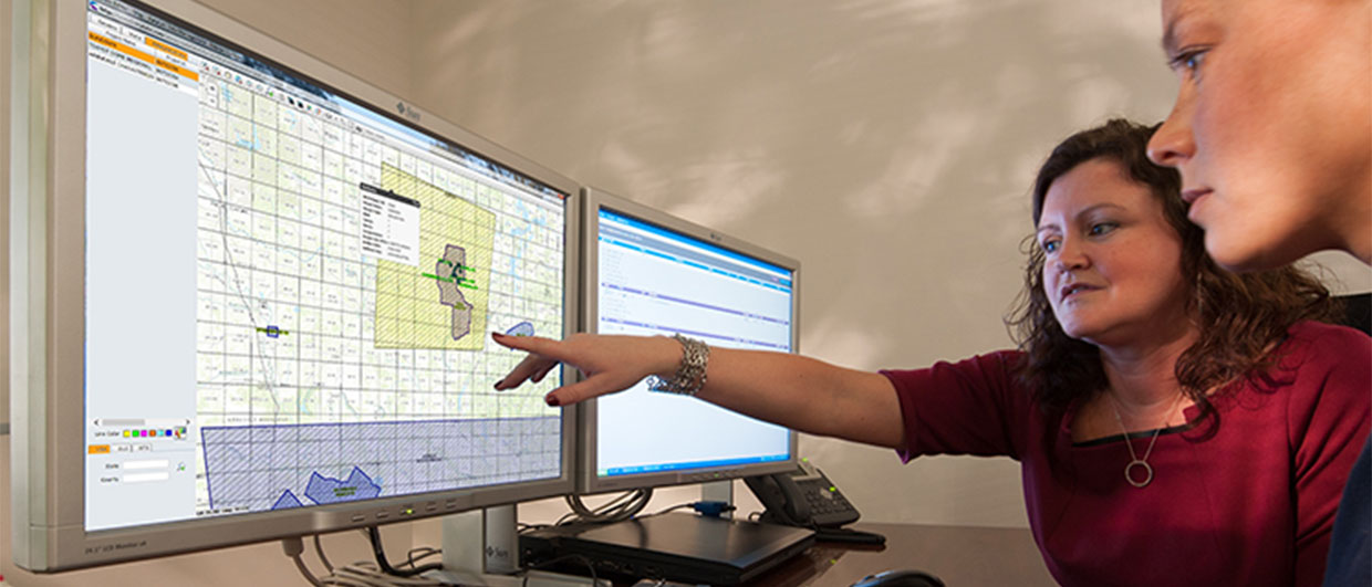
Data delivery challenges are attributed to rigid internal workflows or processes and a need for more capacity/legacy media infrastructure to handle data volume and data delivery media variability. Data vendors…
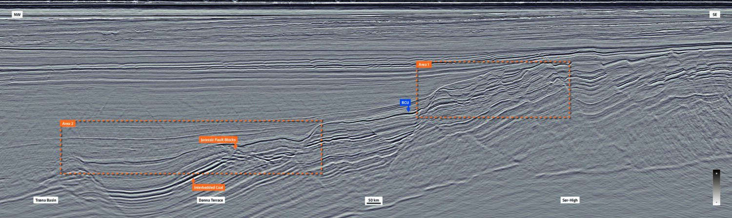
Bent Kjølhamar, Adriana Citali Ramírez and Reidun Myklebust, TGS
Gas to Europe: Refocusing exploration efforts in the Atlantic Margins According to the World Economic Forum, Europe has enough gas for the first quarter of 2023. However, there is no…
Global energy exploration equipment manufacturer Geospace Technologies recently spun-off technology from its OptoSeis® three-component fiber optical sensing permanent reservoir monitoring solution into a downhole system known as Insight™ by OptoSeis.…
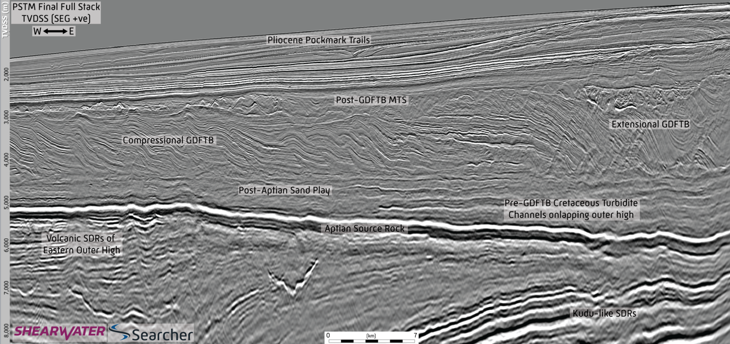
Fast and slow catastrophes trapping slope and basin floor plays How slumping, sliding and folding of passive margin stratigraphy creates the elements for successful exploration while the latest seismic imaging…
Kjetil Roverud, Stefan Möller and Jens Beenfeldt, PGS
The GeoStreamer X 2022 survey is shown in orange with the main seismic section highlighted. The survey area for the ongoing GeoStreamer X 2023 and the 2024 program is outlined…