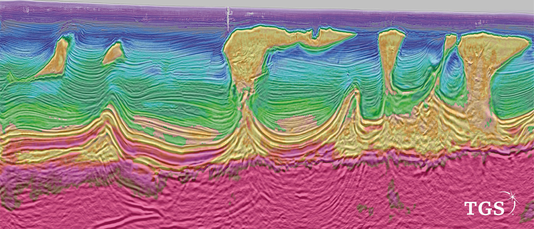
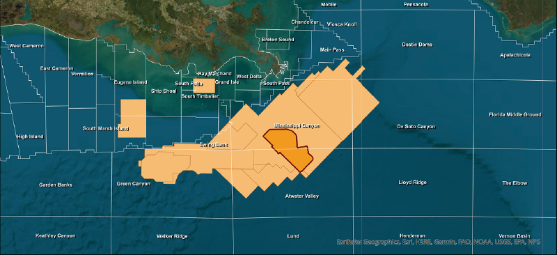
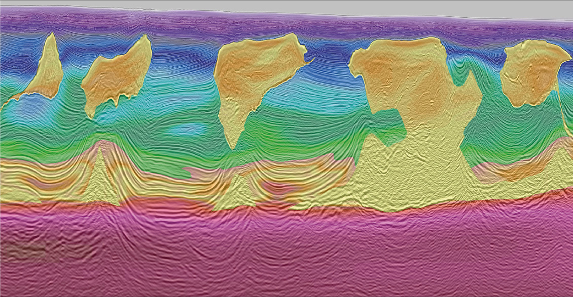
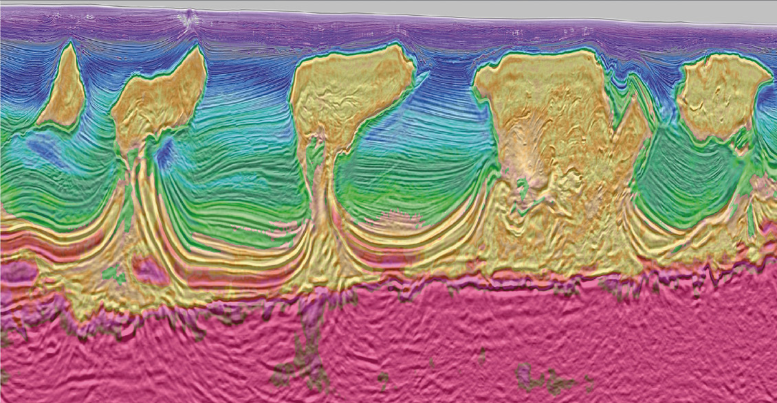
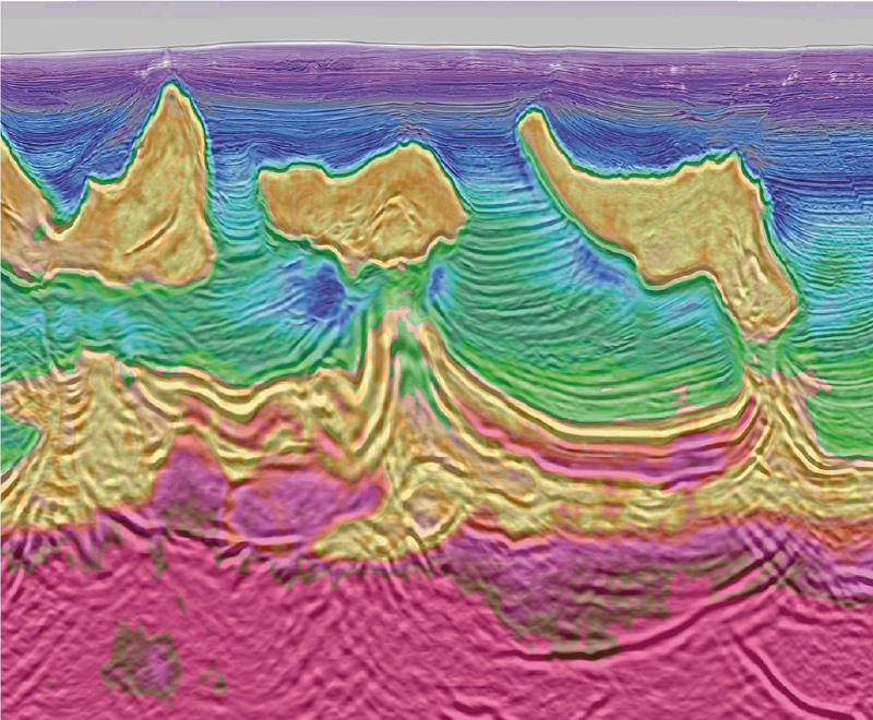
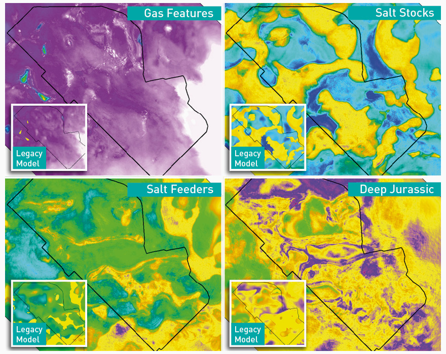
The US Gulf of Mexico (GoM) has always been one of the main engines for driving technical innovation in the offshore oil and gas industry. TGS’s Amendment Phase 1 is the latest proof positive of this. This ultra-long offset sparse node survey was optimized to acquire full azimuth 40 km offsets, one of many industry firsts achieved by this survey. The combination of a velocity model update and long offset, full azimuth imaging, has begun to unlock previously unimaged parts of this complex salt basin. Industry acceptance that this approach will drive exploration and field development in the GoM for years to come, is rapidly growing. This development poses an interesting question: Could this survey provide a window into the future of seismic surveys in other mature basins? It has been well understood for decades that Full Waveform Inversion (FWI) techniques can recover velocity information from seismic refraction and reflection data. Since the Wide Azimuth (WAZ) seismic acquisition in the US Gulf of Mexico (GoM) in the early 2000s, exploration teams have been gradually refining the velocity model with successive iterations of reprocessing. Each new update to the model has yielded an improved image. But the WAZ data lacked the offsets to use refraction-based FWI techniques at the depths of interest. The Amendment Phase 1 survey, undertaken by TGS in partnership with WesternGeco (Schlumberger), was acquired in water depths of up to 2,070m and covers 118 OCS blocks (2,765 sq km) The acquisition took place between April and August 2019. Before acquisition, survey design modeling resulted in a 1 km by 1 km receiver spacing and a source grid of 50m by 100m. Refraction information from the Louann level at about 15 seconds TWT, or approximately 12 km, was predicted to require at least 25 km offsets and >30 km in some geological settings. The new ultra-long offset refraction information was specifically acquired to help drive FWI methods to the correct velocity model and overcome larger errors at greater depths than before. Through this pioneering survey, many crucial lessons have been learned. Most Ocean Bottom Node (OBN) work was historically undertaken with node spacing of only a few hundred meters. Pushing the node spacing over 1 km required a whole new approach. The time spent tripping the Remote Operated Vehicles (ROVs) vertically in the water column is far less important, and conversely, the time taken to fly the ROVs between node locations becomes far more critical. When large offsets are essential, it is hard to get away from the fact that many shot locations need to be acquired. Simultaneous source acquisition has been pushed further with either three dual-source vessels or two triple-source vessels. This requirement results in a vast quantity of raw data (1.5 Petabytes), which demanded new seismic imaging techniques to be applied and necessitated the development of a sophisticated new method of velocity model generation. Dynamic Matching, Full-Waveform Inversion (DM-FWI), used here for the first time, created a high-resolution velocity-model update that focuses on solving the kinematic difference between synthetic input data. Dynamic Matching, Full-Waveform Inversion (DM-FWI) is an iterative technique that uses seismic reflection and refraction information to enable a unique workflow to update the velocity model. The technique was designed to overcome many of the limitations of standard FWI, such as cycle-skipping, which can cause erroneous model updates and therefore, incorrectly imaged seismic data. The velocity model’s data residual (the differences between observed and predicted values) were calculated in localized windows in time and space. This method produced a robust model update using the data’s total energy, including refractions and reflections. The result is superior, geologically coherent velocity models, improved subsurface analysis, and reduced uncertainty. Together, these benefits enable the end-user to cut their cycle-times and costs, in addition to their risks in complex imaging areas, particularly sub-salt. The application of DM-FWI to the Amendment dataset with its ultra-long offsets shows the technique’s capability to resolve large velocity errors and provide significant imaging uplift. Crucially, the inversion-based algorithm can reduce imaging cycle-time and interpretation ambiguity. It works in tandem with new survey designs for ocean-bottom nodes and is also applicable to modern towed streamer survey designs. The combination of existing OBN technology, innovative survey design, and DM-FWI technology is a real step-change in high-resolution model building from shallow to deep. Following the success of the Amendment project acquired in Mississippi Canyon in 2019, TGS has completed the Engagement project, also in collaboration with WesternGeco (Schlumberger). This phase has extended the footprint of ultra-long data in the Northern Green Canyon protraction area. Both the Amendment and Engagement projects represent a new generation of survey design and open up significant opportunities, both in the Gulf of Mexico and elsewhere, for improved subsurface analysis. There are many other parts of the world with challenging imaging conditions that could benefit from an approach similar to Amendment and Engagement.
Ultra-long offsets signal a bright future for OBN
 Results from the ultra-long offset Amendment survey in the Gulf of Mexico demonstrate a step-change in high-resolution velocity model building from shallow to deep.
Gulf of Mexico, a proving ground for OBN technology
Survey sesign and capture
DM-FWI brings greater subsurface knowledge
Amendment was just the start
Related Articles


