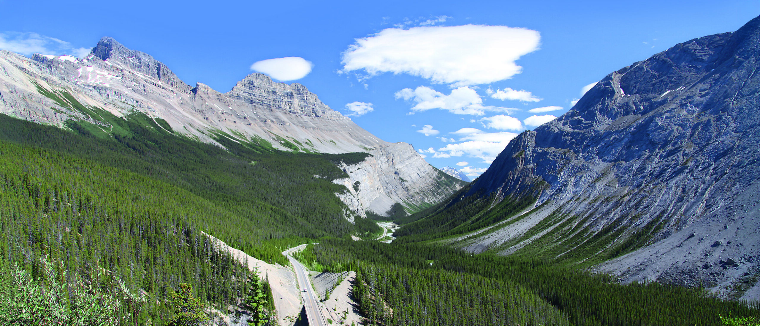
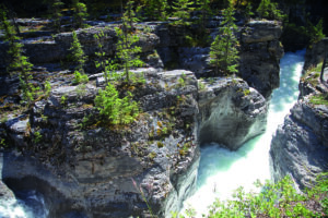
View of highway coming through the Big Bend after which it climbs to Sunwapta Pass. Palliser Limestone cliff is visible in the center topped by Exshaw and the recessive Exshaw shale, which is a marker bed seen in many well logs from the Interior Plains. The south summit of Cirrus Mountain is composed of the Rundle Formation. Across the valley to the right is also Palliser Limestone but from this angle resembles exfoliating granite. Source: Anne Hargreaves
Scenic geology of the Icefields Parkway
The drive from Lake Louise to Jasper on the Icefields Parkway, through the Banff and Jasper National Parks, Alberta, Canada, is a scenic tour that attracts people from all over the world. Cliffs and glaciers are visible along this three-hour drive, which is best stretched over at least a day, allowing time to stop often for photos, hikes and wildlife viewing. This article will focus on the area north up Highway 93, called the Icefields Parkway, between Lake Louise and the town of Jasper.
Geological setting
The Canadian Rocky Mountains rise majestically from the interior plains of Alberta. Let’s ponder the general geological setting of Canada. In a nutshell, where the central craton of the North American continent is exposed it is called the Canadian Shield, which occurs in northern Saskatchewan, Manitoba, Ontario, Quebec, Nunavut and the Northwest Territories. The gneiss underlying the Rockies as basement is of this same Archean age and is part of this craton. The shield area in the Archean was a mountainous uplifted area and shed sediments towards the future Interior Plains and future Rocky Mountain areas while at the same time lying in the southern hemisphere. At times underwater, most notably during the Cambrian when the famous Burgess Shale was deposited, and at times exposed, for example during the Silurian, the sediment layers built up with mostly shales and carbonates interlayered with some quartz sandstones and silt layers. Of economic importance today, during the Devonian a significant warm inland sea developed, creating reef deposits that later became viable oil- and gas-producing formations in Alberta. There is also evidence of glacial activity in the Proterozoic and Carboniferous as well as during the most recent cyclic Neogene and Quaternary glacial episodes.
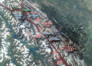
The Canadian Rockies extend from the US border in the south, trending north-west for almost 1,500 km following the Alberta-British Columbia (BC) border, crossing into BC and terminating just shy of the Yukon Territory. It is a long, narrow range, 180 km wide at most, and was created by thrust faulting from west to east, when older Cambrian rocks were thrust up and over younger Mississippian and even Cretaceous rocks. The Rockies consist of the Foothills, the Front Ranges and the Main Ranges, and end abruptly at the Rocky Mountain Trench which lies just inside the BC border. The Trench, visible from space, came into being about 60 million years ago as a huge downward trending fault and has the youngest sediments in the Rocky Mountain area.
Thrust faults occur in fold and thrust belts which are associated with orogenies, or periods of mountain building due to collision of plates. In this area, the Rockies were raised due to collision with terranes to the west of the central craton which collided, causing thrust faults which propagated themselves laterally and upward through the section. By definition, thrust belt faults move upward through the section and always result in older rocks overlying younger ones. Movement is usually along weaker shales and the uplifted rocks are often the hard, resistant cliff-forming carbonates from the Cambrian thrust over soft clastics from the Mesozoic. Glaciation and water erosion deepened the less resistant shale-filled valleys. The fault lines trend south-east to north-west. Complex folding and faulting associated with the thrust faults include drag folds and break thrust faults, where the anticline-syncline pair rupture leaving steeply dipping formations in either direction and occasionally sometimes backwards.
The most recent glaciation in the area was the Wisconsinan, which brought the Cordilleran ice sheet from the mountain areas over the city of Calgary, where it lay probably 1 km thick, approximately 31,000–14,000 years ago.
Glaciers and hikes
From this point we will travel back in time on our trip heading north-west along the Icefields Parkway towards Jasper. It is highly recommended to grab a copy of Ben Gadd’s Canadian Rockies Geology Road Tours for much greater detail than is offered in this article.
This beautiful highway follows the trace of the 330 km long Simpson Pass fault and the valley bottom, consisting mostly of shale, shaly limestone and gritstone of the Proterozoic Miette Group. The Icefields, or glaciers, high up on the watershed, feed valley glaciers and these are visible along the route. The Icefields themselves are supported by the hard resistant rock of the main ranges, the relatively flat thrust sheets of resistant Gog quartzite and the Middle Cambrian carbonates and dolomites such as the Cathedral, Stephen and Eldon Formations.
Bow Lake near the headwaters of the Bow River is fed from the Bow Glacier. An excellent half-day hike along the lakeshoretakes you to Bow Falls. For the best information on all hikes in the National Parks, consult Patton and Robinson’s Canadian Rockies Trail Guide.
Continuing on the highway, take the turnoff to the Peyto Lake viewpoint, and see the beautiful blue color of the water. Glacial runoff feeds this lake, and from the viewpoint you can see how the gray load is being dumped. A large delta has filled about athird of this lake since the Wisconsinan retreat 14,000 years ago.
From here we follow the Mistaya River, and peaks on the left-hand side of the highway are in the Gog, Mt Whyte, Cathedral, Stephen and Eldon Formations. Next, the Upper and Lower Waterfowl Lakes offer camping and two hikes with little elevation gain to Cephran and Cirque Lakes. Fishing is allowed with a proper fishing license.
At Saskatchewan River Crossing the North Saskatchewan River exits the valley and heads east to Edmonton, and of course, Saskatchewan. There is a tephra bed with two distinct layers visible by the highway bridge. One was from Mt Mazama, which blew in Oregon about 8,000 years ago creating the well-known Crater Lake; this layer is actually also visible in Calgary. Above it, the upper Bridge River tephra is from an eruption 2,700 years ago near Lillooet, BC. The huge mountain just north of and towering over the rest stop area is Mt Wilson, with rocks from Bison Creek, Mistaya, Survey Peak, Outram, Skoki, Owen Creek, Mount Wilson and Beaverfoot Formations; a thick carbonate succession of Middle Ordovician age.
Continental divide
Further along we climb the magnificent Sunwapta Pass. As the highway crosses a large glacial outwash plain with a sharp curve called the Big Bend, the road climbs and the view back down the valley shows Cirrus Mountain on the right-hand side. It is made from the familiar Mississippian Rundle and Banff Formations and the Devonian Palliser Formation package underlain by rocks of the Fairholme Group. Stop here for photos!
Carrying on up the pass, you will see a sign for Parker Ridge, which is an excellent place to stop and hike up the ridge and see the surrounding glacier as well as some fossil corals buried in dark dolomitic lime mudstone of the Devonian Southesk Formation – but remember that fossil-collecting is not allowed in National Parks. The view from the top of the ridge to surrounding peaks and rock formations is breathtaking.
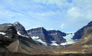
The Icefields Information Center is worthy of a stop, and visits can be made to the Icefield proper and to the Snow Dome. This is a special place because it is the center of the Continental Divide: to the west, all water drains to the Pacific, to the north via the Athabasca and Sunwapta Rivers it drains to the Arctic, and to the south-east via the North Saskatchewan River to the Atlantic Ocean.
Carrying on past the Icefield Center you lose elevation on a winding road with breathtaking views, passing through a ‘shooting gallery’ of random blocks of pink Gog quartzite boulders which are shed from the above outcrops.
Many photo opportunities!
Following the Sunwapta River, you event ually reach a stop for the Sunwapta Falls, where the river drops about 100m in stages down through the resistant limestone and dolomite of the Snake Indian Formation into the Athabasca River valley. Further along, you can stretch your legs at Athabasca Falls where large volumes of glacial melt water pound down 13m of McNaughton (Gog) quartzite.
As you near the town of Jasper, keep an eye out for the exit to Mt Edith Cavell and Angel Glacier. They are located approximately 14 km south-west of Jasper following a switch-backed paved road up an alpine cirque. The massive quartzite McNaughton Fm, part of the Gog group, towers 1,400m above you. You can hike around small icebergs in Cavell Pond, which have calved from the Cavell Glacier nearby.
Approaching Jasper, the valley lies in Miette group deposits. The Fairmont Jasper Park Lodge is worth a visit as it dates back to the early part of the previous century and has a beautiful setting and excellent restaurants, although it is several kilometers east of the Jasper townsite.
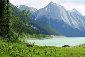
After passing the turn to the lodge, carry on up to Maligne Canyon. Maligne Canyon is a 55m deep canyon carved in Palliser Limestone. It is fed by underground rivers flowing out of some type of cave karst river system flowing from Medicine Lake as well as Maligne River at surface. Medicine Lake is a beautiful lake in the spring and summer, but low water flow in the fall and winter means that it dries up, refilling when the spring meltwaters begin to flow.
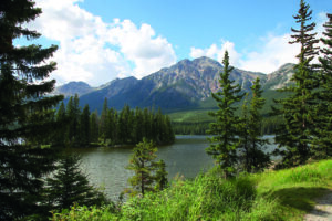
Other options for stunning views in the Jasper area are to take the Jasper Tramway up to the top of the Whistlers Mountain, or to drive to Pyramid Lake just north of Jasper with the Gog quartzite Pyramid Mountain rising above it.
There are so many boat and bicycle routes in the area to explore as well as hiking trails, a week could easily pass by. Jaspar has a very unique flavor, as most of the shops, restaurants and cafés are locally owned and operated. VIA Rail Canada has a station in Jasper, allowing you to take a scenic train ride to Vancouver, Prince Rupert or even out of the mountains and across the prairies and Canadian Shield to Toronto.
About the Author
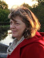 Anne Hargreaves has a B.Sc. in Geology from the University of Calgary. She has worked for over 20 years for several companies working with geological data and collections. Currently she is Vice-President of Canadian Stratigraphic Services (2000) Ltd, which is better known by the trade names of Canstrat and Amstrat, and which supplies well log descriptions from Canada and the US to the oil and gas industry.
References
- Eyles, N. and Miall, A., Canada Rocks, The Geologic Journey, Fitzhenry and Whiteside, 2007.
- Gadd, B., Canadian Rockies, Geology Road Tours, Corax Press, 2008.
- Hanus, C., Canada by Train, the Complete VIA Rail Travel Guide, Way of the Road Publishing, 2009.
- Patton, B, and Robinson, B, Canadian Rockies Trail Guide, 8th edition, Summerthought Publishing, Banff, 2011


