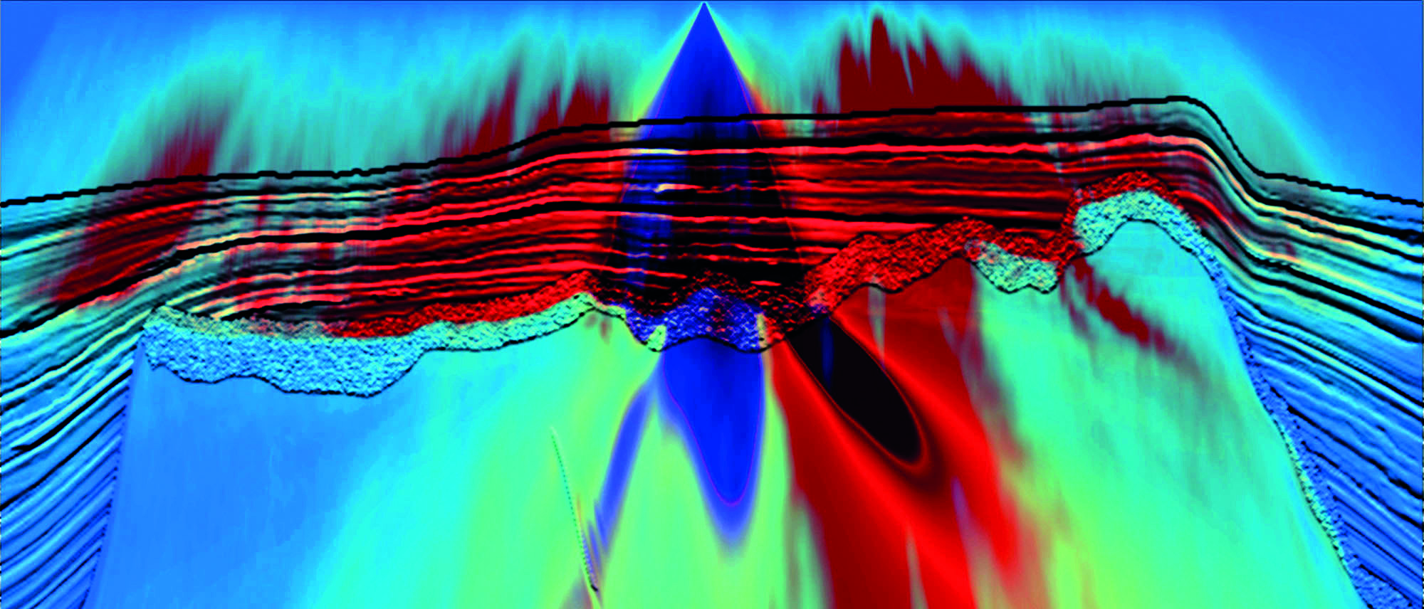
Increased illumination from multiple energy: s ingle source illumination over the SEAM model. Red – multiple energy Blue – primary energy. Source: PGS.
Broadband seismic technology and beyond – PART V: PGS’s GeoStreamer – A double win
The GeoStreamer, launched in 2007, was the first seismic acquisition system to offer a ‘broadband’ solution that improves subsurface seismic imaging and interpretation in complex geological settings. It has allowed PGS to overcome many historical geophysical and operational challenges of conventional hydrophone-only streamers. The GeoStreamer is a ‘double win’.

Part V: PGS’s GeoStreamer – A Double Win
“Discovery consists of seeing what everybody has seen and thinking what nobody has thought.” – Albert Szent-Györgyi (1893–1986) Hungarian physiologist, winner of the Nobel Prize in Physiology or Medicine in 1937.
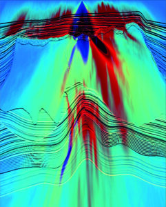
The first ‘win’ is that, by towing the GeoStreamer deeper than conventional streamers, it records very low ambient noise levels. Sea-surface swell motion (and thus induced noise on a seismic streamer) decreases exponentially with increasing streamer depth. If there was no geophysical compromise, seismic surveys would tow streamers as deep as physically possible, as the survey exposure to operational downtime would be reduced, survey windows would be longer in rough sea conditions, and project delivery would have less risk. With GeoStreamer technology, PGS can tow much deeper than conventional streamers, realising low noise and operational performance, thereby increasing both operational window and data acquisition productivity.
The second win is the dual-sensor design that allows unique data processing and imaging opportunities. This cascades through to better reservoir characterisation and interpretation, and more effective reservoir production monitoring.
The real strength of GeoStreamer technology is that it is shown to work in every setting. In this article, from the wealth of published applications of the GeoStreamer, we have selected two studies, one related to the use of multiples in imaging for improved near-surface mapping, important for geohazard analysis, and one related to time-lapse seismic.
SWIMming through multiples
Sixty years ago geophysicists argued over whether it was possible to see multiple reflections in seismic data or not. But as we know they are fascinatingly present, and the need to develop methods for attenuating multiples has remained over many decades. At the same time, speculation has occasionally surfaced as to if and how multiples can be used as a signal to image the subsurface, but success in this area has been limited until recently.
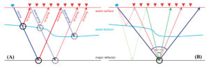
In case it is needed, here is a quick reminder on the meaning of primary signal and multiple. The seismic source sends pressure sound waves downwards into the earth. The pressure signals that experience only one single reflection at interfaces within the earth during their propagation from the source to the receiver are referred to as ‘primary reflections’. Those signals that have a more complex journey, maybe reflecting three (up-down-up) or more times before they arrive at the streamer are referred to as ‘internal multiples’. Those events that have reflected first in the subsurface, second at the sea surface and third again in the subsurface are given the name of ‘sea surface-related multiples’. All events on their journey pass the streamer either in the upward direction or the downward direction. The downgoing events have the common name of ‘receiver ghosts’.
Conventional seismic data processing builds on one key assumption: that each reflection event recorded at the streamer level is a primary reflection. Hence, any recorded reflections propagating with other modes or travel paths are not dealt with appropriately during traditional seismic processing. It is primarily for this reason that geophysicists spend so much time pre-conditioning seismic data to meet the assumptions and requirements of the subsequent processes such as imaging or migration.
Conventional seismic imaging in particular assumes that all phenomena associated with reflections from the sea surface have been removed from the recorded data, including receiver ghost effects and surface-related multiples. Efforts during seismic data processing to remove multiple energy are always challenging and can risk damage to the underlying primary signals from the subsurface.
However, PGS have now demonstrated effectively that with GeoStreamer data the surface multiples can be used for seismic migration, since wavefield separation of such data into their upgoing and downgoing constituents is possible in processing. PGS use both the upgoing and the downgoing wavefields in a migration process called separated wavefield imaging (or SWIM) to yield seismic images based upon surface multiples. This innovation promises to provide complementary and useful images at all target depths. Incorporation of surface multiples into the imaging process demonstrably improves subsurface illumination, hence it opens up a variety of benefits and applications. Deep imaging around and below salt bodies and other complex geology could be improved, particularly for multi-vessel survey scenarios (wide-azimuth, full-azimuth, etc.).
Shallow geohazard analysis
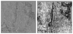
In particular, by running SWIM on GeoStreamer data, shallow geohazard analysis has proven successful. The examples in this section are from a shallow water case study from the Asia-Pacific region, where a 585 km2 area has been extracted from a full 3D GeoStreamer survey using 12 cables, with 4,050m cable length and 75m cable spacing.
The cross-line acquisition footprint is a common issue for shallow water towed streamer seismic imaging. Imaging of multiples significantly helps to suppress the acquisition footprint, as shown in the figures on this page.
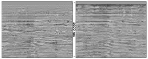
This example suggests nicely that 3D marine seismic survey efficiency can be increased (at lower cost) whilst the very shallow seismic images are in fact improved in terms of both vertical and lateral resolution. SWIM technology might be used to bridge the gap between standard site surveys and conventional 3D surveys. Potentially, marine 3D seismic could even replace conventional site surveys if the SWIM technology delivers according to its promise.
Time lapse and reservoir seismic
In time lapse seismic a major focus has always been to repeat two or more seismic experiments as accurately as possible. If you change technology between the baseline and monitor survey, this change might be a challenge for optimal 4D seismic analysis. Much research has been conducted in order to analyse which parameters are most crucial for achieving high repeatable 4D seismic. An important issue has been to repeat the vertical source and receiver positions as accurately as practically possible. Whereas minor variations in source and receiver depths can be compensated for in processing, gross differences cannot, due to different ghosting characteristics.
In particular, with GeoStreamer technology PGS can use the dual sensor information to duplicate the parameters of any existing survey, thus allowing an operating company to perform 4D matching with its conventionally acquired survey data. For this to work, it is necessary to calculate the receiver ghost for the original survey depth and add it back into the GeoStreamer data to perform a comparison.
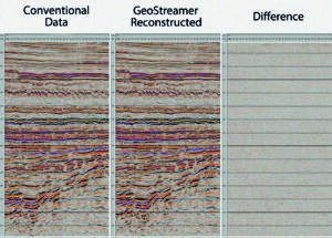
An example demonstrating that it is possible to use conventional data as baseline and a repeat GeoStreamer survey as monitor is shown to the right.
In this particular test, an NRMS-repeatability error of approximately 11% was estimated for the target zone, which demonstrates that it is feasible to combine a conventional data set with a newer GeoStreamer survey and obtain good 4D seismic data. One should be careful when comparing NRMS-errors from various regions, because these numbers are strongly linked to the complexity of the reservoir and especially the overburden geology. Despite this, it is interesting to note that typical NRMS-errors for permanent 4D seismic receiver systems range from 5 to 15%. After all, at the final stage, it is not this NRMS-number that counts, but how accurately you are able to map production-related changes in the reservoir. So far, there are no 4D field examples where both the base and the monitor survey have been acquired using GeoStreamer technology. It will be interesting to see 4D field examples, hopefully in the not too distant future.
In this repeatability test the NRMS-error for the full stack case was compared to near, mid and far angle stacks. As expected, the repeatability decreases due to lower fold in the angle stacks (less data). Furthermore, there is no significant decrease in repeatability going from near to far offsets, indicating that the repeatability does not vary significantly with offset. Most algorithms designed for pressure-saturation discrimination from time-lapse seismic data rely on high quality repeated angle stacks, and hence this is an important observation from this experiment.
In some cases (especially in rough seas) the receiver ghost might appear as an undulating event following the primary reflection from the seabed, as shown in the figure below. Due to the fact that the GeoStreamer actually provides two measurements, it is possible to attenuate these undulations significantly. Although there are no practical examples so far demonstrating this on two time-lapse seismic surveys, it is reasonable to expect that this type of surface-related 4D noise will be handled better with GeoStreamers when compared to conventional streamers.
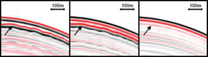
Since the desired accuracy of 4D seismic surveys is more demanding than for regular surveys, the weather conditions for 4D seismic surveys should be as close as possible to ideal. The example shown above is a strong indication that this narrow 4D weather window might be extended. There are two major reasons for this: firstly, that towing deeper means less noise and secondly, that the dual measurement (velocity and pressure) enables more effective removal of receiver ghosts. Assuming a rough sea surface, it is easy to imagine that the ghost signal will be less repeatable than the primary signal. An efficient attenuation of the receiver ghost signal will therefore lead to improved 4D repeatability.
Acknowledgement
We thank PGS for permission to show the data examples.
References:
Burren, J., Comeaux, L., Jangelme, G. and Melo, R., 2013. A MAZ case study from the Jequitinhonha basin, Brazil: Combining legacy conventional with dual-sensor towed-streamer data: SBGf Extended Abstract.
Day, A., Widmaier, M., Høy, T., and Osnes, B., 2010. Time-lapse acquisition with a dual-sensor streamer over a conventional baseline survey: First Break 28 79-87.
Lu, S., Whitmore, N. D., LeGleut, N., and Long, A., 2013. 3D High-Resolution Imaging Using Separated Wavefields: EAGE.
Whitmore, N. D., Valenciano, A., Söllner, W. and Lu, S., 2010. Imaging of primaries and multiples using a dual sensor towed streamer: SEG Expanded Abstract 29 3187-3192.
Follow link for Part VI