Pyrenees Mountains. Photo: chaossart via Adobe Stock.
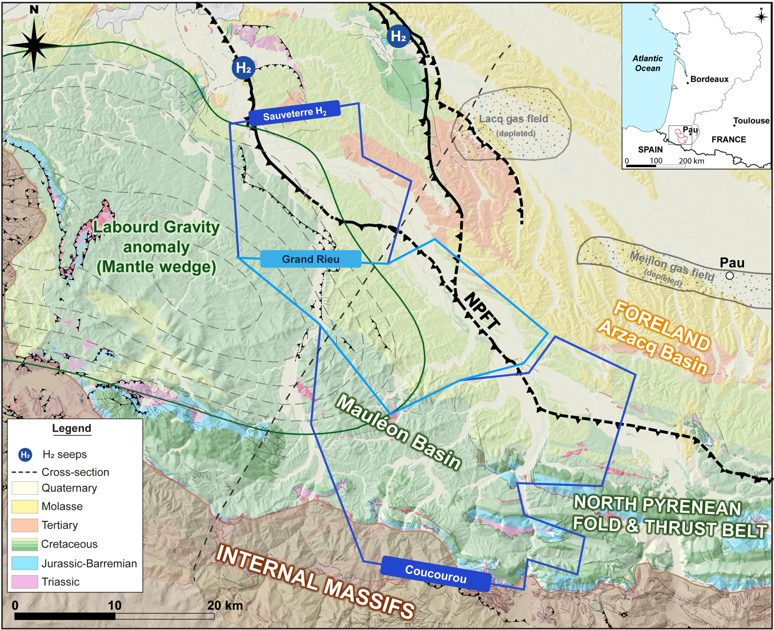
Western Pyrenees foothills – the hotspot for natural hydrogen
Play-based approach of exploration opportunities and challenges in the Mauléon Basin, France
The growing interest in hydrogen within the context of the energy transition has recently led to renewed scientific attention, resulting in the identification of numerous natural occurrences across a wide range of geological settings.
Academic studies have significantly improved the understanding of hydrogen generation mechanisms, in particular, water-rock interactions in continental environments. These advances suggested that significant quantities of hydrogen may be generated and trapped. It has led to the emergence of an exploration sector dedicated to natural hydrogen resources.
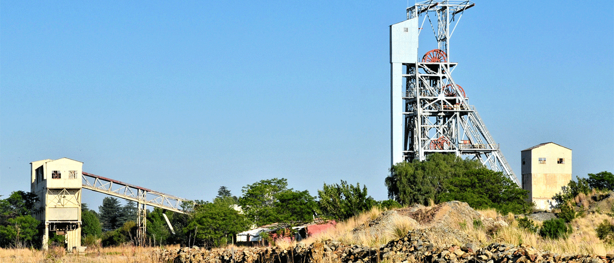
In April 2022, natural hydrogen was incorporated into the Mining Code in France. 45-8 ENERGY (associated with STORENGY) and TERRENSIS have already been granted exploration licenses in the south-west of the country, illustrating the growing momentum toward assessing native hydrogen as an economically viable energy sector.
Why the Western Pyrenees?
The Mauléon Basin, located along the western edge of the French Pyrenees, has recently emerged as a promising area for natural hydrogen exploration. This interest is supported both by sustained academic research, which has identified the key components of a regional hydrogen system, and by the extensive dataset inherited from a century of oil and gas exploration.
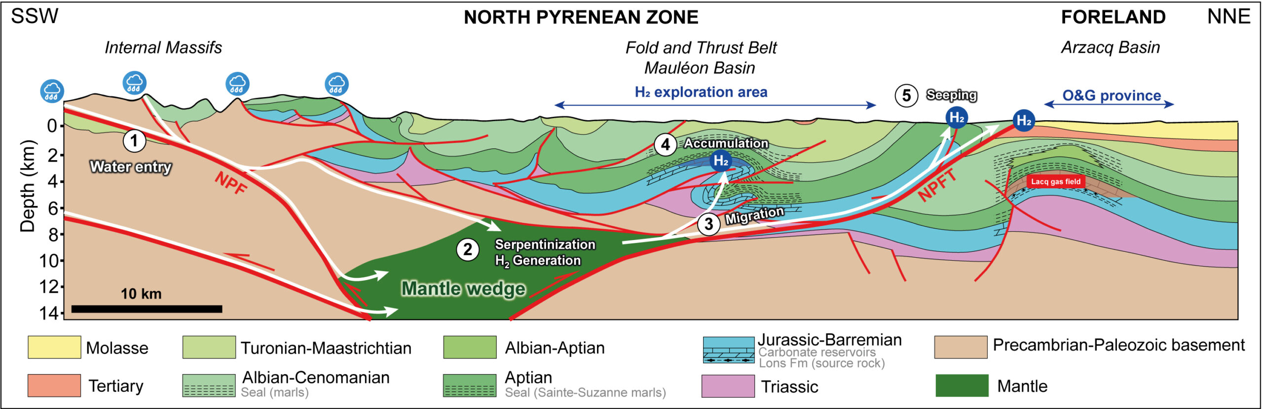
Large-scale passive seismic acquisition (Maupasacq, 2018), the reinterpretation of legacy geophysical data and documented shallow hydrogen occurrences collectively indicate the presence of an active hydrogen-generating system. This system is interpreted to be associated with serpentinisation processes affecting mantle-derived rocks beneath a structurally complex sedimentary basin, offering favourable conditions for hydrogen generation and potential subsurface accumulation.
A play-based approach
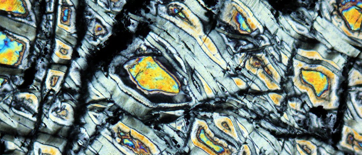
Source rock – the presence of a large gravity anomaly, the “Labourd Anomaly,” in the Mauléon Basin has been recognised for several decades. Recent reinterpretations, supported by passive seismic data derived from local earthquake tomography, have imaged an approximately 300 km² wide high-Vp body (~8 km/s), interpreted as fresh mantle material. This relatively shallow mantle occurrence (~8-10 km depth) is thought to have been exhumed during the Cretaceous basin hyperextension and subsequently incorporated into the orogenic wedge during the Tertiary Pyrenean compression.
Recent academic studies, based on gravity and magnetic modelling, further suggest the presence of partially serpentinised mantle rocks within this body, indicating ongoing hydrogen generation. Meteoric waters are inferred to circulate at depth through active hydrothermal systems, as evidenced by microseismic activity and the numerous thermal springs located along the northern edge of the mountain belt. Fluid circulation is likely to be facilitated by several major south-dipping frontal thrust faults, which could serve as efficient migration pathways from the crust into the overlying deformed sedimentary cover.
Reservoirs and Seals – extensive legacy oil and gas exploration data, primarily acquired in the Arzacq Basin during the 1960s and 1980s, have demonstrated the presence and effectiveness of regionally extensive reservoir-seal systems in Aptian-Albian high-porosity reefal carbonates and Barremian-Upper Jurassic highly permeable fractured platform carbonates. Deeper, more speculative exploration targets have also been identified beneath the evaporitic Triassic-Lias sequence. Many of these formations are further documented by numerous outcrops in the internal zones, particularly within the Chaînons Béarnais. In the nearby Lacq gas field, the presence of a large gas column has generated significant overpressure, providing a clear demonstration of the exceptional sealing capabilities.
Migration, trapping & preservation – natural hydrogen generated at depth can migrate upward or laterally toward targeted reservoirs through the well-developed Pyrenean fault system, within favourable structures such as faulted anticlines, efficiently focusing migration into effective traps. The optimal target depth for hydrogen preservation – minimising microbial activity – is over 2 km.
Exploration target identification
Ongoing efforts by both operators aim to characterise the structural configuration of the natural hydrogen exploration area. This work involves retrieving and reprocessing legacy 2D and 3D seismic data, integrating it with recent passive seismic acquisitions specifically designed to image hydrogen targets, and reinterpreting historical well data to better constrain the lateral extent of key reservoir and sealing formations identified in the petroleum system.
In 2024, Terrensis conducted a dense hybrid passive seismic survey (450 sensors over four months) to generate a high-resolution Vp model for future seismic planning and establish a baseline for local microseismicity. The resulting tomographic models significantly aided the reprocessing of vintage 2D seismic data, particularly due to the strong velocity contrast between the Upper Jurassic reservoir interval and its overburden. A similar survey is planned for late 2026 over the Grand Rieu license.
These integrated datasets will support the development of a consistent regional geological model of the Mauléon Basin. Depending on the outcomes of these investigations, future active seismic acquisitions may be required to further mature exploration leads already identified within the basin.
Ideal location for offtake
The Mauléon Basin has a unique set of exports route available for local markets, paving the way of the transition to a local carbon-free energy.
Several possible offtake pathways have already been identified. The region’s strong transport infrastructure supports hydrogen distribution for mobility applications. Existing natural gas infrastructure can accommodate hydrogen blends of up to 10 %, enabling integration into the domestic gas network and access to future cross-border hydrogen networks. Possible future demand potential could also arise from the opening of major industrial facilities nearby.