4D Geophysical Data
Building on ongoing IOR research efforts, StatoilHydro aims to be a leading company in quantitative integration of 4D data in reservoir modelling in order to meet challenges in the most complex reservoirs.
StatoilHydro has set ambitious targets for the recovery factor in their offshore operations. From platform operated fields the goal is 65% as an average, while for subsea-operated fields the goal is 55%. The company’s target will be obtained through intensified research and development (R&D) on selected topics, where key R&D results can be quickly adapted and applied in operated fields
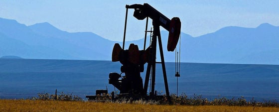
Towed streamer seismic time-lapse technology (4D) is the dominant geophysical reservoir monitoring method applied for the purpose of optimising reservoir drainage. It was introduced in StatoilHydro 20 years ago with the first ever 4D pilot run by the company on the Oseberg field, and was later followed by the full-field investigation and application on the Gullfaks field. The technology has proved to be an excellent enabler for improved reservoir management and hence an important source for value creation in the petroleum industry.
Today, approximately 75% of the StatoilHydro operated fields employ time-lapse seismic technology, and seismic monitoring is an integral part of its reservoir management. Cooperation with the contractors and the service industry has been of vital importance to produce the best technological solutions.
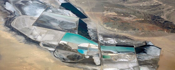
To date, StatoilHydro has operated more than 100 4D surveys and since 1998 has also successfully applied gravimetric monitoring of gas production from a number of its fields. In addition, it has applied 4D gravity to monitor CO2 sequestration.
Technological developments
4D seismic technology has a number of applications, including identifying drained areas, locating undrained reservoir compartments, optimizing well placement, reducing uncertainty in reservoir development and production decisions, discriminating between reservoir fluid and pressure changes, detecting compaction in the overburden, and monitoring subsurface CO2-sequestration.
4D seismic started in the early 1980’s and became commercial in the late 1990’s. In the North Sea, 4D seismic was investigated on a full field scale in 1995 in a joint StatoilHydro-Schlumberger project at the Gullfaks field. Detectable time-lapse signals were measured, and proved to be of economic value in identifying drained and undrained areas. Soon after this, 4D surveys were acquired over several Norwegian and UK North Sea fields, including Schiehallion, Foinaven, Draugen, Troll, Oseberg, Norne, Statfjord, Forties, Heidrun and Gannet.
In 1996 StatoilHydro started a research project to investigate the potential of 4D gravity as a way to monitor gas production and seafloor subsidence, realizing that gravity is sensitive to height changes resulting from subsidence. The 4D gravity method was proved over the Troll field, with benchmark deployment in 1997 and repeat surveys in 1998, 2000 and 2002. StatoilHydro is currently running gravity monitoring projects on five Norwegian offshore fields: Sleipner, Troll, Mikkel, Midgard and Snøhvit, and a trial at Ormen Lange.
The Gullfaks field
On the Gullfaks field, time lapse (4D) seismic data has played a significant role in management of tail end production. 4D seismic data have increased understanding of both the static properties and dynamic behaviour of the field, challenging the production strategy and driving the reservoir management decision process. The data have identified bypassed volumes in unswept reservoir compartments, improved the estimate of remaining reserves and the associated uncertainties, and have helped to identify drilling hazards that have evolved over the life time of the field. Since the first repeat seismic survey in 1995, 4D seismic data have been integrated into a multi-disciplinary increased oil recovery (IOR) effort that aims to recover 70% of the in-place reserves from a structurally complex and heterogeneous reservoir sequence.
4D seismic has contributed directly to more than 19 successful infill wells and generated a net present value of around US$1 billion, while the total cost of the 4D seismic is estimated to be US$60 million.
The Oseberg field
 4D seismic response (1992 –2004) at base reservoir of the Oseberg Field (left) compared to reservoir simulation results (right). The reservoir drainage points are marked in green and the platform areas are denoted with black ellipses. The recent vintages are actively used for monitoring both the GOC and the WOC in the reservoir. Illustration: StatoilHydroThe successful Oseberg 4D campaign is based on a feasibility pilot using repeated 3D seismic in a proper 4D setting. The initial exploration 3D was shot in 1982, but as a basis for modern 4D technology, new surveys for the pilot were shot by StatoilHydro in 1989 and 1991. These were the first surveys where the nominal parameters between the acquisitions were maintained unchanged, thus giving repeatability that even today will be considered useful for 4D work.
The 4D campaign on Oseberg has been a technical and economic success (based on surveys in 1992, 1999, 2004 and 2007), and Oseberg’s lifetime has been extended by 14 years by utilising various IOR techniques such as gas injection and horizontal drilling, in addition to 4D seismic.
The Troll field
 Total reflection amplitude Sleipner CO2 plume. Maps of absolute amplitudes, cumulative for all layers, illustrate how the plume has developed over ten years. Illustration: StatoilHydro
 High 4D response denotes clean sand and can be correlated to low clay content. The well plan (white trajectory) was updated in the low 4D area to avoid the assumed clay-rich area. While drilling, this update proved to have increased the amount of clean sand in the well by more than 100 meters. Illustration: StatoilHydroDue to the very large area of the Troll East gas field, repeated full 3D surveys was not considered a feasible solution in early field development due to the high cost. As an alternative, StatoilHydro proposed and is currently running a campaign based on repeated 2D seismic acquisitions, where the vessel is towing a very dense spread of streamers along the pre-defined 2D lines. In this way, a very high degree of receiver position repeatability is obtained, giving excellent 4D signal/noise ratios in the repeated 2D seismic data.
The repeated 2D lines have been used to map the pressure depletion due to gas production, and an average pressure drop of 15 bar has been detected and mapped from the seismic.
Full field gravity data have been acquired to complement the 2D time-lapse seismic data and to map the water influx, and to date 4 relative gravity repeats have been acquired. The gravity data have proven valuable in updating the reservoir understanding and locating remaining reserves.
Due to the encouraging results from the repeated 2D seismic lines, a full field 3D seismic repeat survey was acquired in 2008 in order to map water influx and pressure depletion in greater detail.
In the Troll west area, the main challenge is to monitor the production from the very thin oil column (10-20m) over a large area (770 km2). Before a full field 4D implementation was initiated, a 3D pilot was run in 1998 to demonstrate the ability of towed streamer technology to detect even very minute changes in the oil column. The successful pilot triggered the current 4D campaign, which is now an integrated part of the reservoir management of the field.
Workflows for qualitative and quantitative interpretation have been developed. The applications of this ranges from identification of IOR targets to optimized well placement for infill drilling, as well as well completion. As a result, every year an average of four new targets are identified from 4D data, while all drilled wells are being optimized with respect to both well placement and well completion, yielding increased recovery of the field. Accumulated value creation approximates USD 100 million per year.
The Sleipner field
 Seismic monitoring has proved to be a powerful tool at the Sleipner site, North Sea. This is the world’s first, largest and longest-running CO2 storage project. Six repeat surveys over 12 years have revealed both an expansion and compaction of the CO2 plume. Distribution estimates of the CO2 saturation have been made from 4D seismic data and have increased the understanding of CO2 flow, with reasonably accuracy.
Gravity monitoring has been tested at the Sleipner site, and a time-lapse signal from the injected CO2 has been detected. This constrains the in-situ density, which otherwise is poorly determined, because the CO2 has densities and temperatures which are close to the critical point
Future trends
The future holds requirements related to even shorter response times and shorter turn-around times for time-lapse geophysical data acquisition, processing, interpretation, and ultimately the model updating procedures. The challenge lies in reducing the time spent on this chain from months or years down to weeks or even days.
Today much of the 4D seismic application is qualitative, or at best semi-quantitative, i.e. the time-lapse seismic data is used to identify areas of changes in saturation and pressure distributions between seismic survey times. The need to be more quantitative is already here, i.e. to estimate not only what kind of changes but also how large are these changes in saturation and pore pressure. In the rapid workflows of the future the quantitative interpretation methods will be an integral part.
Experience indicates that time-lapse geophysical monitoring will steadily increase its importance as a reservoir management tool. In addition to proper integration of different types of geophysical measurements, future work will focus on development of workflows that honour the full information content in the geophysical data for reservoir model updating.
Acknowledgements
We thank StatoilHydro for permission to present this paper. Special thanks to the many StatoilHydro 4D specialists whose shared wisdom and knowledge are aggregated in this paper. Finally, thanks to the asset teams at Gullfaks, Troll, Oseberg and Sleipner fields for valuable input.