Leaving the emerald green island of Jamaica and travelling nearly due west for some 720 km, one arrives in the semi-autonomous Mosquitia region of eastern Honduras, a coastal swampy area occupying the plain formed by the Coco River as it drains from the crystalline basement interior into the Caribbean Sea. It is not an easy place to reach as there are no direct flights and the capital, Tegucigalpa, boasts one of the world’s most dangerous airports, nestled between several densely populated hillsides and with a very short runway complete with a vertical 30m drop at the end. The second city’s airport is marginally better but then there is a terrifying mountainous drive to Tegucigalpa.
I first came to Honduras in 2009 to meet with government officials and seek exploration rights, some 35 years after my father visited the country while trying to protect a patent infringement. I am now unable to compare stories with him but clearly remember his visit was not plain sailing.
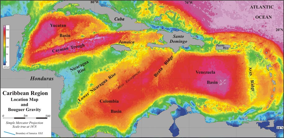
Regional gravity map: The Nicaragua Rise, represented by blue and green colours, is located between the ultradeep Cayman Trench to the North and Columbia Basin to the south. The Mosquitia and Walton Basins appear blue. Well data confirm that these are deep basins. Higher resolution data reveals the presence of multiple basins. Source: CaribX regional review 2009
Tectonic Similarities
As in Jamaica, my interest in Honduras was steered by plate tectonics, which has guided the search for hydrocarbons in that country as it now readies itself for new oil and gas rounds and the next wave of oil company investment and interest.
The two countries both lie on the Chortis Block, a partially submerged continental fragment which stretches from Honduras and Nicaragua in the west to Jamaica in the east. It originates from further west and is still moving in an eastward direction, having caused the uplift of the Blue Mountains in Jamaica. Chortis is characterised by strike/slip movement which has created a series of basins such as the Forimgas, Seagull, Blossom and Walton Basins, becoming more defined as we move westwards towards the Honduran/Nicaraguan Mosquitia Basin.
The Upper Nicaraguan Rise broadens with increasing distance from Jamaica. To the north of the Rise are the abyssal plains and new oceanic spreading ridge of the Cayman Trough and to the south the Lower Nicaraguan Rise (Suina) with its more attenuated crustal geology. As with Jamaica, it is the Upper Mesozoic and Cainozoic that hold the most interest for the petroleum geologist, though an understanding of the deeper geology is needed to build a picture of the regional fabric and tectonics.
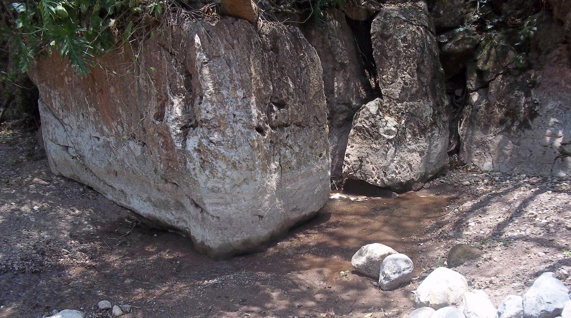
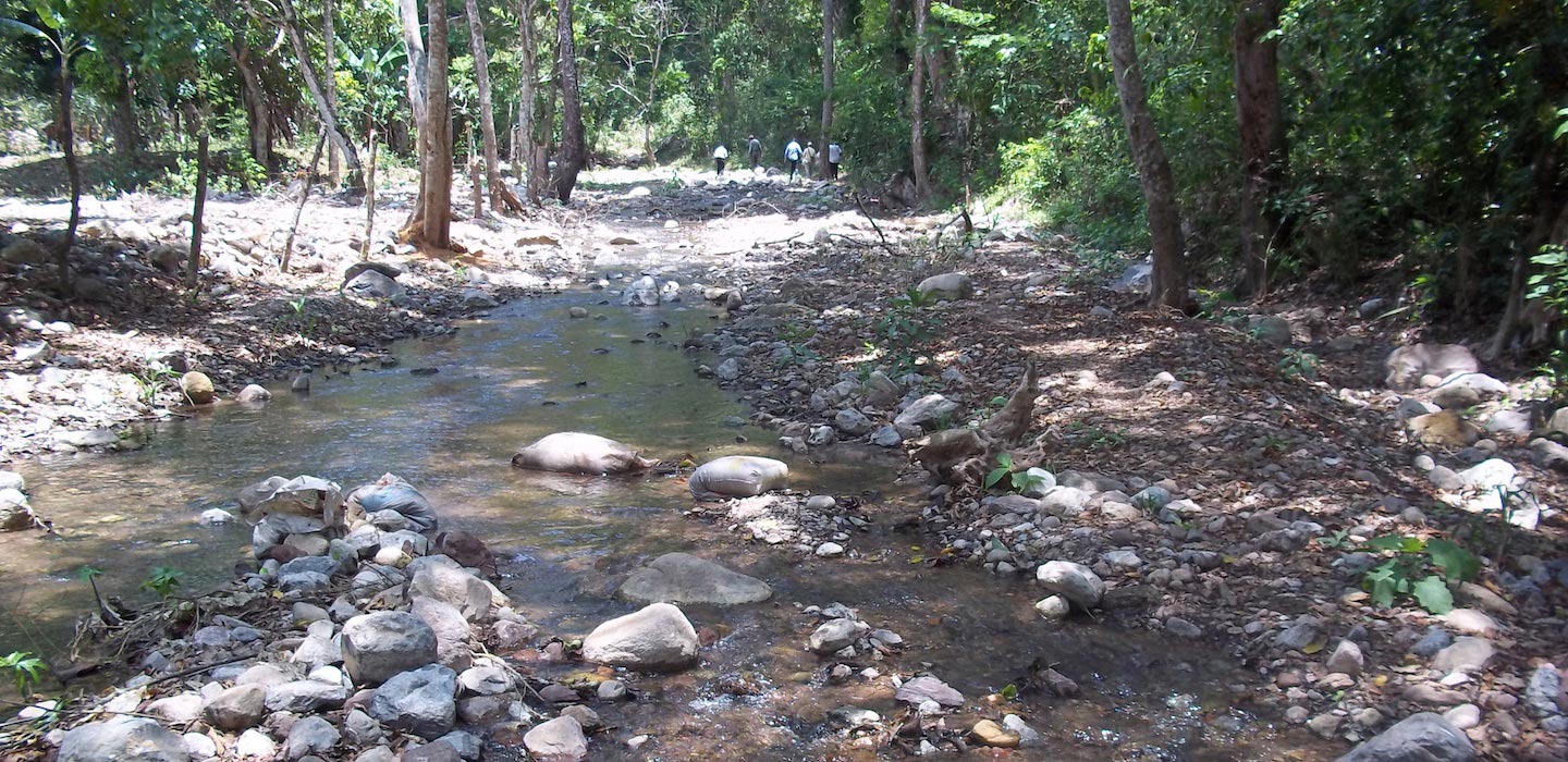 Exploring the rivers. Source: Chris Matchette-Downes
Same Prolific Source Rocks
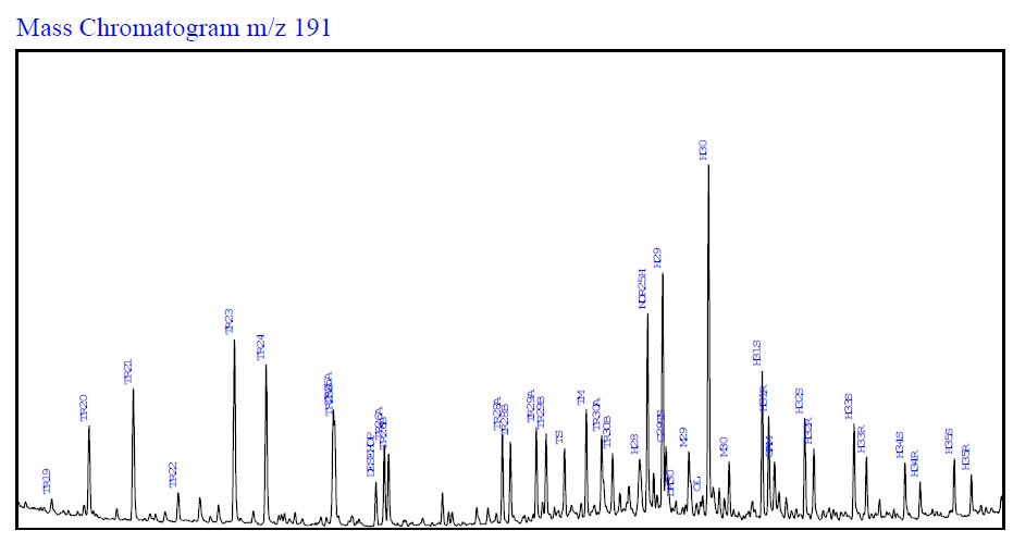 A study of Honduran offshore well Main Cape-1, analysed by Geochemical Solutions International for CaribX, suggests that the precursor source rock has at least reached the early part of the peak zone of oil generation. To refine this observation it is necessary to review other biomarker assemblages such as the steranes, but biodegradation has removed these diagnostic biomarkers. When reviewing the aromatic component separated from this oil it is possible to see evidence for greater maturities and perhaps for mixing. Other indicators such as Ni/V ratio and elevated sulphur content all indicate a restricted marine environment such as found within the robust, regionally extensive and prolific Tertiary Punta Gorda/Touche source successions.The CaribX approach to exploration is to determine source presence, quality, maturity and distribution. The early wells often contain considerable source information which can be overlooked if the well is labelled dry or non-commercial. Data from derived oil shows is particularly useful and often clues such as high S1 or S0 Rock Eval data, fluorescence observations and other optical petrological information can point to zones of hydrocarbon ingress. Once successfully extracted, these shows can then allow the precursor source system to be examined in terms of maturity and paleoenvironment of deposition by recourse to biomarker, stable isotope ratio determination and elemental analysis (nickel, vanadium and sulphur in particular). In the western Caribbean, the prolific and robust Punta Gorda and Touche source units have an Eocene equivalent seen in both outcrop and in well bores which further east is called the Chapleton Formation. In Jamaica’s Content #1 well the Chapleton Formation includes some 600m of elevated TOC and HI shales. The oil geochemistry from samples collected from Honduran wells not only supports the presence of a Tertiary source as in Jamaica, but also shows clear evidence for an older Middle to Upper Cretaceous source system as well.
The main Tertiary source unit in Honduras is thought to be the Punta Gorda Formation, which as explained above is equivalent to the terrestrial Chapleton Formation, except as we move westwards the depositional environment becomes more transitional. The Punta Gorda is encountered in boreholes and is responsible for the oil shows containing significant levels of the higher plant biomarker oleanane.
.jpg)
The bituminous Guare Limestone cleaves when weathered, exposing spectacular fossils. This is a potential Cretaceous source rock. Source: Chris Matchette-Downes
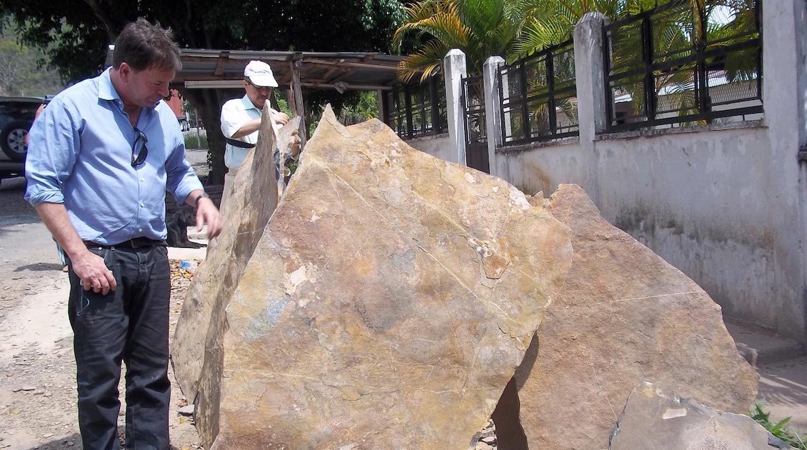
The bituminous Guare Limestone cleaves when weathered, exposing spectacular fossils. This is a potential Cretaceous source rock. Source: Chris Matchette-Downes
 The bituminous Guare Limestone cleaves when weathered, exposing spectacular fossils. This is a potential Cretaceous source rock. Source: Chris Matchette-DownesIn outcrop a possible candidate for the Cretaceous source is exploited in Honduras for paving material. The Guare Limestone is bituminous and is mined in shallow pits where surface weathering has resulted in the accumulation of loosely cleaved slabs which are easily separable. This is similar to the (although non-bituminous) Stonesfield Slate in the east Cotswolds area of the UK, which when mined and left out on a frosty night will cleave along the sandy bedding planes to make the rough tiling material characteristic of the area.
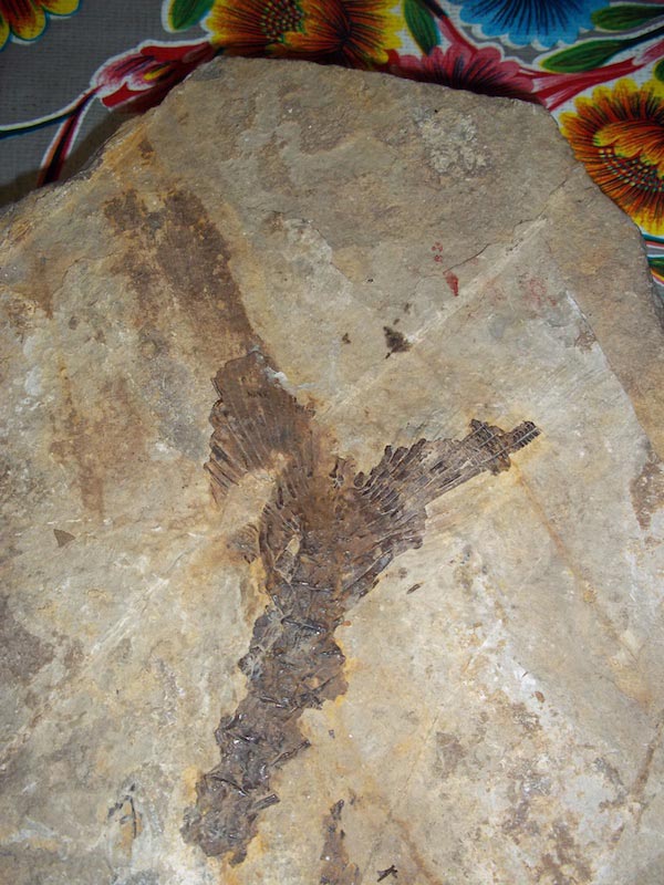
Another feature of the Guare Limestone is the preservation of some spectacular fossil fish. The fish evidence suggests that the limestone was deposited in some kind of restricted shallow environment perhaps alternating from brackish to near shallow marine conditions, as restriction (stress) is often associated with source rock development.
Reservoir structures include large structural closures, carbonate reefal build-ups and clastics derived from the Paleo Coco river.
Underexplored Area
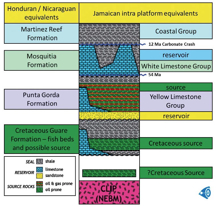 The Nicaragua/Honduras source (Nicaraguan Rise) is within the Punta Gorda to Touche section (earliest Eocene to Oligocene), while the Chapleton Formation source is in the lower part of the Yellow Limestone Group (early Eocene).Political turmoil throughout the eighties and nineties prevented any serious interest in the region. However, there are maps with three seep localities in eastern Honduras, and previous wells recorded plenty of shows, with two of them, the offshore Main Cape #1 (1973, Union Oil) and onshore Lempira #1 (1956, Unocal) both flowing oil to the surface. The latter is reputed to have flowed at 2,000 bopd but this is unsubstantiated at the moment.
The last well to be drilled before political turmoil switched off international investment was Castilla, drilled by Texaco in 1980, which proved dry. There followed a long period of inactivity with some minor indigenous activity. With only 31 wells drilled in the whole country, the first being in 1920, the area remained relatively underexplored until CaribX began its two year-long review in 2009 and coincidently PGS acquired a new regional, widely spaced 2D seismic grid in the same year.
In 2010 CaribX opened an office in Tegucigalpa and submitted its application to explore the Sang Sang graben, which had been newly identified through satellite and airborne imagery in the very deep onshore of the Mosquitia Basin in eastern Honduras. At the time of writing this was under consideration, as are eight similar CaribX applications in the greater region. Progress can be slow; one unfortunate company’s application has been lodged for nearly 20 years. On a brighter note, at the end of July 2013, BG International were awarded the 35,000 km2 Main Cape offshore block.
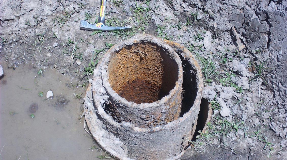
Evidence of previous drilling. Source: Chris Matchette-Downes
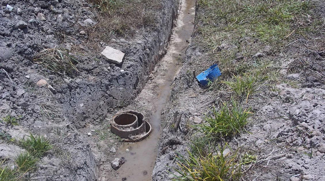
Evidence of previous drilling. Source: Chris Matchette-Downes
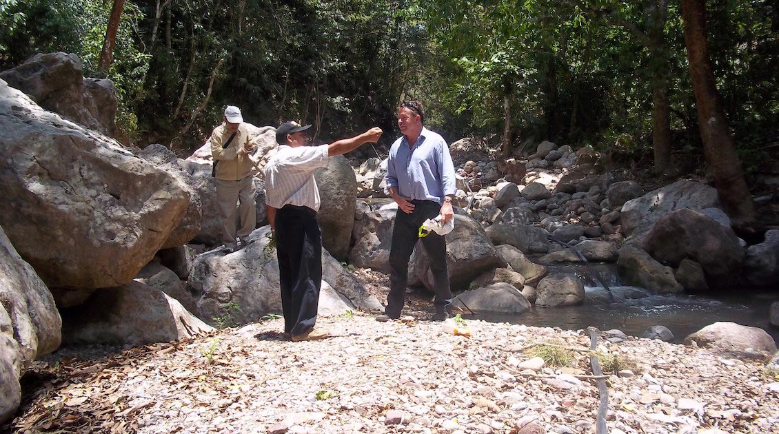
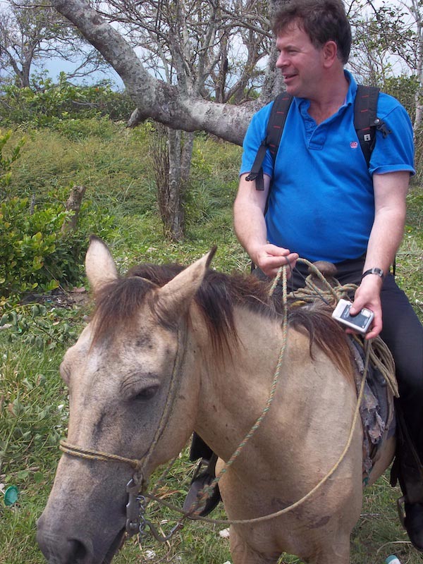
As with all new areas, field trips are necessary, and I was lucky enough to explore part of the Caribbean coast following a conference (‘Honduras is Open for Business’) in Honduras’ second city, San Pedro Sula. In the western Omoa region outcrops of the Cretaceous fish beds had been reported, along with seeps and shows, so we set off to collect what we could. We found several well heads and the fish beds, but regrettably no evidence of seepage. On the coast our efforts were frustrated by a recent earthquake which had caused the coast to sink some 1.5m and the sea had encroached, the water table rising so much that the paths and roads had become elongated lakes. We had to resort to securing horses from a local farmer and wade through water sometimes up to the animals’ nostrils to navigate the sunken lanes and tracks.
While in CaribX’s area of interest there is also a lot of farmland, plus the ongoing development of Porto Lempira, it lies outside any of the national parks, which would have added extra challenges.
Problems to Overcome
The geology is encouraging with all the ingredients being in place: two robust sources, with both carbonate and clastic reservoirs, as well as structure and seal, and with oil flowing to the surface.
Source: Chris Matchette-Downes
Source: Chris Matchette-Downes
Source: Chris Matchette-Downes
However, the main block to success in the unexplored frontier Caribbean and Latin American regions is not actually the geology. It is instead the overly complex and outdated hydrocarbon laws, coupled with the loss of expertise since the last wave of exploration, which came to an end just about the time I joined the business in 1981, as well as unrealistic expectations of what may be present due to optimistic comparison with producing nations and little understanding of risk. The latter, however, is not the exclusive domain of this region; it is perhaps the hall mark of governments generally.
These are hard problems to overcome and can be quite draining. The idea that a small company can come in and open up the region, start to de-risk and that larger companies will then follow is not understood, despite the success of this approach in the mining sector. However, occasionally one gets an opportunity that with perseverance, patience and suitable backing becomes a possibility, and it is hoped that CaribX will be able to announce a successful award in the region in the near future.
About the Auhor – Chris Matchette-Downes
 A petroleum geochemist, Chris has been in the O&G business for over 30 years and has worked for a number of oil companies and consultancies. His extensive E&P business development experience has seen him focus on specific plays in the UK, Europe, Africa, Middle and Far East, Australia and America. He is well-respected for work done in East Africa, where he has personally carried out geochemical field work along the East African coast and has published a number of papers on East African exploration. Chris is the founder and Chief Executive Officer of CaribX (UK) Limited and has undertaken several geoscientific reviews of the greater Caribbean region. He is a renowned expert on the O&G industry and has a track record of finding and securing commercial deals and often speaks at international conferences and seminars on the subject of exploration.


