Most companies are aware of the value of doing post well analysis (PWA). But it is often done in spreadsheets. In that case, there is a high risk for myths to propagate, especially when it comes to charge and the presence or absence of a source rock.
The reason for that is simple. With each well, we have a test of reservoir and seal presence and quality, in addition to the trap configuration. However, just looking at a single well, it becomes much harder to make claims about charge and source rock presence, because that requires more of a regional overview and even the construction of a burial history model. In other words, the charge element is an interpretative step and is not only data-driven.
And will you get this sort of information from press releases? No. Press releases always carefully avoid any statements on the regional petroleum system because it could downgrade their wider licence, which investors don’t like. On that basis, any post well analysis that is based on scouting information should be taken with a pinch of salt.
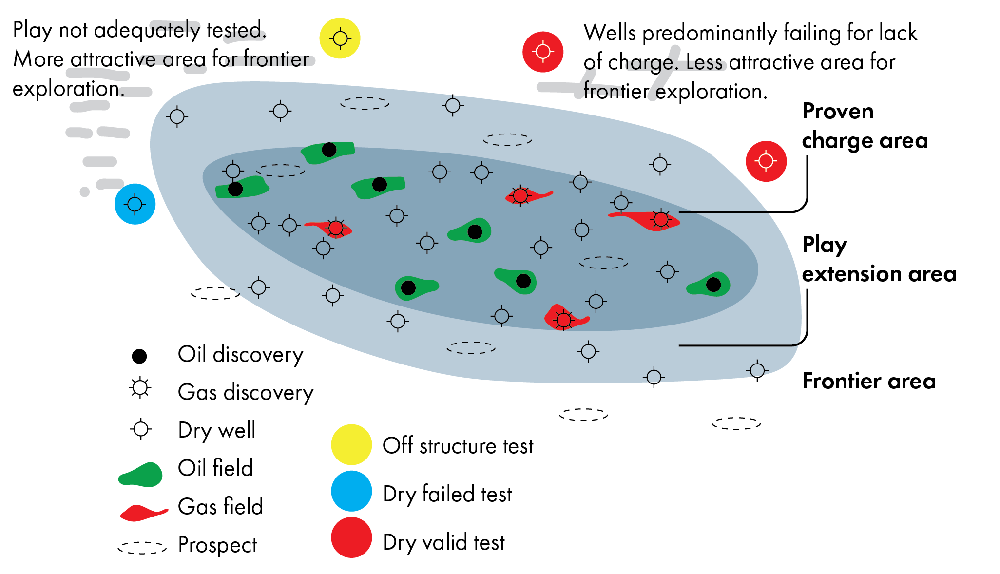
The only way to do it properly is to look at the observations, without making inferences about source rock presence or migration pathways. In addition, the results always need to be plotted spatially, which allows users to high-grade areas for exploration much more easily, and done in software rather than spreadsheets because the input data can change all the time. It is a dynamic exercise.
What PWA is especially useful for is the ability to tell us quickly where to focus our exploration efforts. And when doing so, just by plotting results on a map, we can very quickly highlight areas where it would be interesting to have another look, which is something you would not be able to do when only doing regional mapping alone, or by having spreadsheets only.
Another very important reason to do PWA is to identify areas of a certain play where the source rock interval is definitely at the right depth and temperature to generate hydrocarbons, but the quality of the source rock is too poor to be effective in expelling any hydrocarbons. That’s not something a basin model will predict, since these models often infer source rock quality because of a lack of well evidence. Yet, identifying these areas early can save a lot of money.
That is why a rigorous, spatial and dynamic post well analysis is a lot more significant than what people often realise.
This is the seventh of a series of articles based on work and experience from the GIS-Pax
team in Australia, as presented by Ian Longley in a series of videos on LinkedIn.
Find the previous articles here:
Why the Term “Fault Block” Is a Useless Way to Describe a Trap
Why Traffic Light Play Maps Are Useless
Why Peer Reviews Often Don’t Work
Why P10/P90 Prospect Ratios Are Meaningless Without Involving the Geology
Understanding the “Minimum Economic Field Size” concept and aggregating targets