About 300 million years ago, the Permian Basin, which now covers a large area of central USA, was situated along the western margin of Pangaea, about 10° north of the paleo-equator. Being on the southern flank of the North American craton, the region was subject to moderate subsidence and primarily carbonate sedimentation. Two large, south-extending platforms, the Diablo and Central Basin, separate four basin areas, the Orogrande, Delaware, Midland and Val Verde. Basin formation resulted during the onset of a major continental collision event (the Pennsylvanian Ouachita- Marathon orogeny). During regional subsidence through most of the Permian, the basins accumulated 2,100m to over 4,200m of clastic, carbonate, and evaporate strata. At the start of the Permian, the basins were very shallow, and near the end of the Guadalupian (Late Permian) time water depths exceeded 500m.
Permian Basin stratigraphy has been substantially influenced by sea-level changes, as the illustration to the right shows. While most of the shelf margin sequences are dominated by carbonate deposits, the basinal section is dominated by detrital sandstone and siltstone. During the high sea level stands, reefs and carbonate shoals developed along the platform margins. The shelf areas were covered by broad carbonate and evaporate lagoons while only thin carbonate turbidites were deposited in the basins. During periods of lower sea levels, eolian and fluvial terrigenous deposits were transported across the shelf areas and accumulated along the shelf margins, to be finally transported into the basin forming thick sandstone and siltstone turbidite deposits.
During the Mesozoic, the region was a stable, non-depositional platform province. Uplift to the west during late Tertiary Basin and Range faulting produced a 5 to 10° east dip to the pre-Tertiary strata and erosion of the Permian topography. Ground-water circulation led to dissolution and some replacement of the Permian evaporates and cavern formation in the limestones. The outcrop exposures seen today in the Guadalupe and Glass mountains as well as high-angle faulting across the region are a direct result of this Tertiary uplift.
The Road to Discovery
In 1920, a trickle of oil (10 barrels per day) at the Westbrook Field started a flurry of exploration activity in the region. Just three years later, the Santa Rita #1 well was shut-in when the driller saw gas bubbles in the casing head after the well drilled into dolomitic sands called the ‘Big Lime’. A day later, the well blew oil into the sky, becoming the first in a long list of major discoveries for the Permian Basin region, including the super giant Yates Field in 1926, which set the table for a productive future in one of the world’s great oil basins.
The early finds were followed by more discoveries, primarily in the carbonate sections (75% of total production). Deeper sections were explored and over 1,300 significant discoveries have been made here. After the 1973 peak in production, a steady decline in production ensued, slowed by enhanced recovery and ‘rediscovered’ oil in older fields in the 1980s and 90s. That decline has now been reversed, rising steadily since early 2011, using both new and old technologies. Waterflooding and CO2 injection, horizontal drilling, deeper drilling, and multi-stage hydraulic fracturing are all being used to recover and discover new reserves.
The Permian Basin production is currently estimated at over one million barrels of oil daily after reaching a peak production of 2.085 MMbopd in 1973. Some experts expect the output to reach 1.8 MMbopd by the end of 2016. The area also produces 4 Bcf of gas per day.
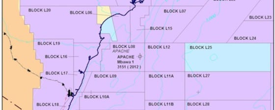
The deeper drilling has found new, unconventional oil plays in some of the older strata, such as Wolfcamp, Cline shale, Strawn and Atoka formations, all located below traditional producing horizons. Targets for unconventional gas include the Devonian Woodford Shale, the Mississippian Barnett Shale, and the Permian Wolfcamp Shale. Low permeability reservoirs in the basinal deposits of the Brushy Canyon sandstone have also added significant oil production.
With over 500 rigs active and more than 30 Bb of producible oil remaining, expect the Permian Basin to stay among the largest and most active hydrocarbon-producing areas in North America.

If the Permian Basin (illustration near left source: Dr. Scholle) could have been seen from a satellite, it may have looked much like the modern Bahama platform region east of the state of Florida (image above source: NASA-GSFC). The primary differences would be the water depths and climate. The Permian depths were generally less than 600m while some of the Bahamian basins are four kilometers deep. The Permian climate was also much drier, more similar to that of the Persian Gulf region.


