Early 2019, Wintershall Norway shut in production from the Maria field. It was a major blow to the company, as it was a flagship development and the company’s first own-operated on the NCS. The problem? Lack of communication between the injection and production wells, caused by a low-permeability barrier. It is this kind of issues a new Norwegian company aims to identify before a field development plan is sanctioned.
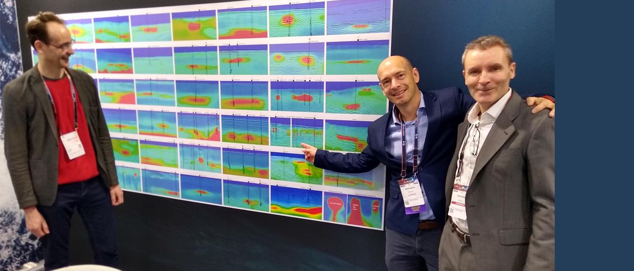
We spoke to Karl Berteussen, who is a key player in setting up the company.
Can you provide some more background as to what the company aims to do?
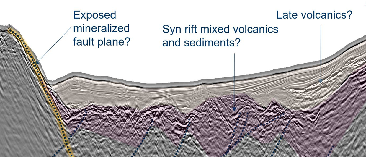
“In the oil industry we are able to determine the flow characteristics, permeability, of a reservoir at the wells, but so far we have not had a good method to determine this parameter between wells. This implies that there often are flow barriers or the opposite, flow channels, that the operator does not know about when the production strategy for a field is being determined. Figure 1 below shows an example of this.

This often has disastrous consequences in terms of lost production, many million dollars cost overrun and/or excessive water production problems. We are coming up with a technology to solve this problem.
The working name of the company is Permeability Diagnostics Services (PDS), and we aim to do just that, diagnose the flow characteristics of the reservoir. Typically, the product we deliver is a permeability map.”
Permeability: The ability, or measurement of a rock’s ability, to transmit fluids, typically measured in darcies or millidarcies. Schlumberger Oilfield Glossary
Karl further explains: “In 2004 I started working with a theoretical geophysicist, professor Dr. Yufeng Sun (formerly a research scientist at Colombia University and now professor at Texas A&M, the Wilford Chair). He had worked on this difficult problem since the 1980-s and has built the so-called Sun model. It is an advanced poro-elastic model that utilizes the hydraulic and elastic properties of the rock to arrive at a predication of permeability variations in a field.”
A group around Dr. Sun, led by his student Dr Qifeng Doe has carried the work further to a number of practical applications. “We now have several tens of examples where we use the model to give important advice for oil field exploitation both at startup and during production and are ready to further commercialize it,” Karl points out.

Greener way of developing fields
“It is also important to stress the energy savings and thereby the emission reductions that can be made through developing fields more smartly. A lot of energy is being used to produce by-passed oil that would not have been necessary in case the wells were landed with a better picture of permeability barriers in mind,” Karl emphasizes.
What input data do you need?
“In order to utilize the technology, we need at least one well with ordinary logs and a 3D seismic survey, which should be available in most cases already. We then perform data inversion and for example obtain permeability volumes as illustrated below (figure 2). In this case we predicted that the marked area would represent by-passed oil since it was surrounded by a low permeable barrier. This was subsequently proven by drilling.”

How does this work relate to the advances made in 4D seismic?
“4D is a great technology and has been instrumental in efficiently exploiting geologically complex fields. The disadvantage of 4D is that it can only be used after the field has been producing for a while, so after the development design was sanctioned. Our technology supports the way the first development wells will be drilled, so at an early stage of the field maturation process. 4D can then be used to monitor how these wells are performing.”
Karl continues to point out that if the permeability estimates are wrong, as illustrated in figure 3, the operator will make wrong estimates on the producible oil. This is illustrated in figure 4.

“Most of the cases we have been involved with are connected to the problem of identifying high permeable zones (illustrated in figure 1) where we help reduce by-passed oil and avoid early water break-through. The consequence of using our technology is increasing the recovery factor and at the same time reduce the un-necessary use of compressors and separators, i.e. a greener oil production.”
What kit is needed and how long does it take for the model to run?
“In order to run the models, we do need extensive computing power, which obviously comes at a cost. However, it is important to bear in mind that this investment is dwarfed by acquiring seismic data or drilling a single well. Once we have got the right data to perform the model runs, it should take less than three months to come up with a recommendation as to where the field barriers or flow channels are.

You have had a long and successful career in both academia and industry. What drives you to throw yourself in the deep end again?
“I feel we as geophysicists have done a great job the last decades in finding reservoirs and assisting in production optimization, especially through 4D. Today, however, we see an oil industry that is focusing less on exploration but is concentrating on cost efficient and green production; we fit directly into this picture.”
With the technology we are introducing, we can not only do much more in the production phase of existing fields to make them more efficient and greener, but perhaps more importantly, we can in addition influence the development stage significantly and thus make production more efficient and greener from the very start.
Also, we have already seen the first seismic data sales where the intention is to look for suitable locations for Carbon Capture Storage (CCS). I expect that this will become an important industry and the ability to map flow characteristics will be an important part of it. And “Yes”, I am passionate about introducing our more advanced geophysics technology to help solve these issues and be a part of the transition to a more environmentally friendly energy system.“
HENK KOMBRINK