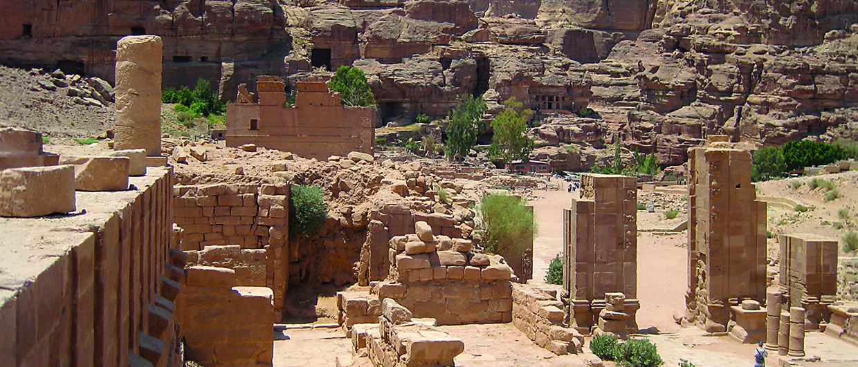
Petra is a ‘must-see’ tourist location for every geologist, not just for its archeology, but also for the rocks which make up the famous monuments.
Petra the rose-red wonder
Petra, an ancient red city in the middle of the Arabian Desert of southern Jordan, reveals its glorious archaeological past in addition to its deep chronological history. In 2007, Petra was designated one of the Seven Wonders of the World.

The present site of Petra was originally built by the Nabataean Arabs during the 4th century BC, and was known in Arabic as Sila’a سلع, and Ar Rakeem الرقيم, or biblically as ‘Rqm’, which all mean ‘cut in rock’. The site was conquered by the Romans in AD 106, and was renamed in Greek as Petra, or in Arabic Al Betra البتراء, which also means cut in rock. It is believed that Petra was destroyed by several earthquakes, ending in complete destruction and eventual evacuation during the 6th century AD.

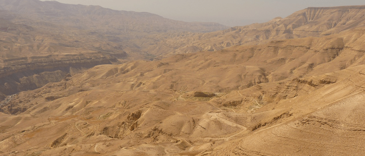
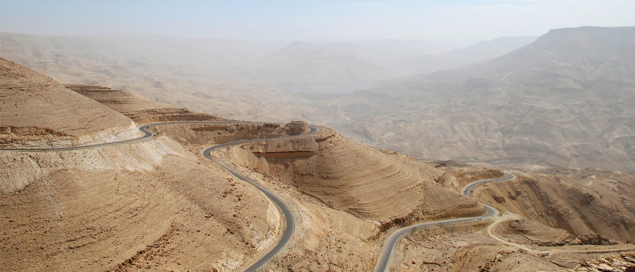
Petra is located in the heart of the mountainous desert of southern Jordan, half way between the Red Sea and the Dead Sea, but importantly, was adjacent to an ancient route down from the high plateau eastwards to Wadi Araba. The site can also be reached from the city of Ma’an to the east. The town surrounding the site of Petra is called Abu Mousa, as well as the valley (wadi) leading to Petra. In detail the site occupies an open valley (occupied by the town itself) surrounded by mountains, which were used for religious ceremonies, tomb building and water collection in cisterns. Routes through the mountains follow deep gorges or ‘siqs’. Although the formal entrance was through the main Siq in the south, general access is also possible from the north.
Although Petra is now a major archaeological tourist destination, receiving nearly one million visitors each year, in this article we will highlight the geological perspective of Petra.
Petra’s geology
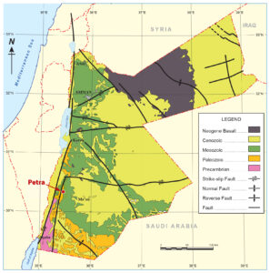
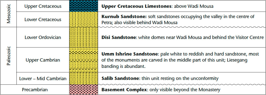
The mountains to the south of Petra are composed of Precambrian igneous rocks of the Aqaba Granite Complex, cut through by a series of intrusive dikes. These are unconformably overlain by the massive quartzose sandstones of Middle Cambrian to Lower Ordovician age which make up the rocks and monuments of Petra. The properties of the rock itself may have persuaded the Nabataeans to site their city here, as it was evidently suitable for rock carving and excavating, and also pleasing to look at. After 2,000 years, however, much of the worked and excavated stone is showing signs of decay, not least through the footsteps of many tourists.
The impressive gorges were formed when the force of desert flash floods over many thousands of years exploited lines of weakness in the rocks such as faults, joints and fractures, a process which is still continuing today.
A walk through Petra
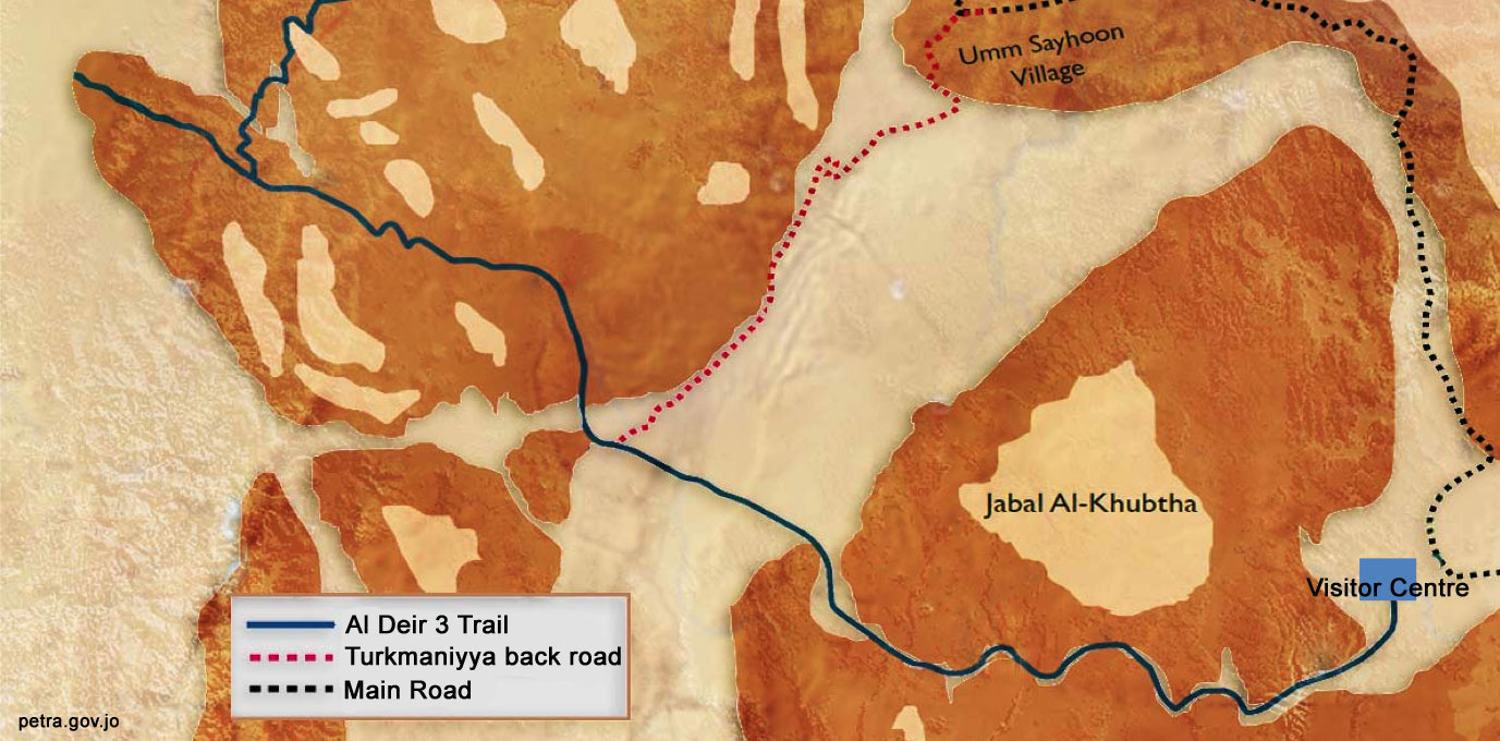
Following the archeological route in Petra, there are five sectors with important geological features. These are from the Visitor Center outside Petra to the entrance of the Siq; the Siq itself; the Khazneh or Treasury and the Street of Façades; the Roman Theater; and the museums and surrounding mountains.
We will look at each of these individually.
1. From the visitor center to the Siq
The hills surrounding the Visitor Center and Wadi Mousa are covered by whitish-colored Lower Cretaceous Kurnub Sandstone. This form ation lies unconformably on the pale white sandstones of the Lower Ordo vician Disi Formation. The Disi in this area is characterized by tabular cross-bedded sand stones and several tombs have been cut in this sandstone.
2. The Siq
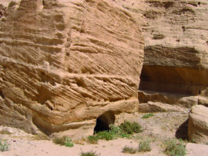
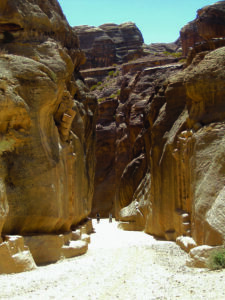
The Siq, a narrow winding cleft in the rock made by water cutting of the fracture system, is basically the road to the ancient city of Petra. At the top of the cliffs is the white sandstone of the Lower Ordovician Disi Formation. It is underlain by red mudstone, and following downward in sequence there is the thick, cross-bedded, very hard sandstone of the Upper Cambrian Umm Ishrine Formation, pale white to reddish in color, with vertical fractures and joints. This is the formation which represents all the famous rose colored sandstone in Petra.
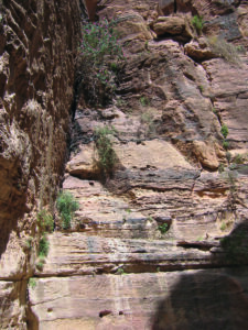
The Siq is about 1,000m long, over 80m high and in some places only three meters wide. In addition to numerous archeological writings, there are several sedimentary features to be seen on its high walls. These include sets and cycles of cross-bedding, where secondary iron oxides can be seen filling joints and sedimentary sets, and most importantly there are mudstone beds, often showing mud cracks, all of which presumably represent playa deposits. These last are often wrongly mistaken by ill-informed tourist guides as bone fossils (as can be seen on internet videos!). There are no fossils in Petra, only pseudo-fossils of dendrites which have been observed on fallen sandstone slabs, although trace fossils have been recorded in rocks from beyond the immediate Petra area.
An important engineering feature are channels which can be observed running all the way along both walls of the Siq from its entrance. These are the remnants of cisterns used for water collection for the use of the citizens of Petra. The settlement was only made possible by the creative genius of the extensive water distribution and storage system.
3. The Khazneh and the Street of Façades
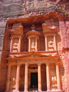
After passing through the dark narrow Siq, the façade of the Khazneh, (Treasury) suddenly appears, bathed in sunlight – one of the most dramatic and stunning sites for even the most jaded tourist. Besides the façade, there is a magnificent view of the thick, red-colored, cross-bedded sandstone, reflecting the original sedimentary structures of presumably huge fossilized sand dunes, interbedded with playa mudstones. Some previous workers have interpreted them as dunes of a coalescing braided river system. However, looking at the regional areal distribution of these sandstones from Aqaba in the south to the Dead Sea in the north, and also in north-western Saudi Arabia, I would rather interpret them as fossilized coalescing desert sand dunes of Cambrian age, some 500 million years ago.
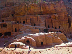
Turning right and then left from the Khazneh, in front of you is the Street of Façades, where tombs and monuments are to be observed on both sides of the road. All these archeological features are located in the same thick red cross-bedded sandstone facies of the Umm Ishrine Sandstone. Some of the façades have been exposed to high winds and their surfaces are weathered more than other sheltered façades, and show more internal features such as Liesegang banding. At Petra the sandstones are spectacularly color-banded in yellow, orange, red, gray, brown and mauve.
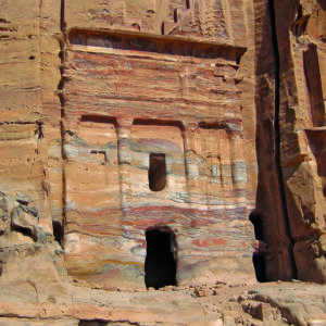
These patterns, termed Liesegang banding (or rings), were presumably formed prior to uplift, deep underground by the rhythmic deposition of various iron and manganese compounds from mineral-rich water that once flowed within the rock.
The Street of Façades descends down ward to the Roman Theater, which is located on the western side of the Street of Façades. Here, the sequence is descending stratigraphically within the Umm Ishrine Sandstone. Two thick sandstone cycles separated by thin claystone beds can be seen. The theater steps were actually cut in a lower sandstone unit of interbedded redder sandstone and mudstone facies, which shows more weathering, being of softer nature as well as more exposed to erosion.
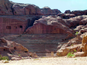
On both sides of the street there are a lot of monuments and tombs. The lower ones in the same stratigraphic level as the theater show more erosion than the higher monuments and tombs, which were cut into the thick sandstone units stratigraphically above.
After leaving the Roman Theater and the old Petra City, the road turns left to the younger Roman road and museums, including the Byzantine Church. Most of the monuments here are younger, built by the Romans and not the Nabataeans. Beyond, to the west, is the rise of the Umm Ishrine Sandstone, with a thick sandstone facies. The mountain is full of monuments and there are also two archeological museums. At the top lies the important monument, the Monastery. At this site, the Ordovician Disi Sandstone lies over the Umm Ishrine Sandstone. Viewing from the top of the mountain further west one can see the dark rocks of the Precambrian Basement Complex.
An essential visit
The sedimentary sequence in Petra and the surrounding area along the Dead Sea in southern Jordan is a must-visit for amateur and professional geologists. For geological students, it is field laboratory to observe and study geological features and sedimentary structures. In sequence stratigraphy, it is a surface analogue to correlate seismic stratigraphy and borehole information, while for petroleum geologists, the sequence at Petra is an excellent example to help understand reservoir geometry.
References
Dumon, F. C., 2010. The Cambro-Ordovician Sequence in the Petra Area, Jordan – Sedimentology and Stratigraphy. MSc Thesis. TA Report number : AES/TG/10-38. Section for Applied Geology, Department of Applied Earth Sciences, Delft University of Technology.
Makhlouf, I., & Abed, A. (1991). Depositional facies and environments in the Umm Ishrine Sandstone Formation, Dead Sea area, Jordan. Sedimentary Geology, Amsterdam, Vol.71, pp.177–187.
Naylor, D., Al-Rawi, M., Clayton, M., Fitzpatrick, M.J., and Green, P.F., 2013. Hydrocarbon Potential of Jordan. J.P.G., Vol. 36 (3), July 2013, pp. 205–236.
Selley, R. (1970). Ichnology of Paleozoic sandstones in the southern desert of Jordan: A study of trace fossils in their sedimentological context. In: Crimes, T.P. and Harpe, J.C. (eds), Trace Fossils.
Selley, S. (1972). Diagnosis of marine and non-marine environments from the Cambro-Ordovician sandstones of Jordan. J. Geol. Soc. London, Vol. 128 , pp. 135–150.