“While we initially considered shear waves to be of greatest importance for the purpose of predicting lithology and fluids, it has turned out that the breakthrough in 4C seismic has been to produce improved imaging from full azimuth PP data,” says Eivind Berg, Business Development Manager of SeaBird Technologies, out of Trondheim, Norway, a wholly owned subsidiary of SeaBird Exploration.
The innovative Norwegian geophysicist has been instrumental in developing 4C seismic using nodes planted on the sea bottom instead of cables (OBC) since the technique was first introduced in the 1990’s, and he is still a key person in a continuous, ongoing process of improving the node technology and operational efficiency while serving a market that finally seems to appreciate geological details.
Without Berg’s enthusiasm, knowledge and determination, 4C seismic would be way behind its current level.
Quality comes first
 4C seismic using nodes planted on the sea bottom allows for both PP and PS waves to be recorded based on signals from air guns in the water. Here we see the CASE (“Cableless Seismic”) Abyss nodes being moved towards the correct location by an ROV and planted on the sea bottom in a predetermined position. © SeaBird TechnologiesThe need for high quality data is a strong, driving force in the geophysical industry. This is certainly true in exploration with the increased use of 3D seismic, CSEM and potential field data. Consequently, contractors present incremental improvements on a continuous basis.
The need for high quality data is even higher in exploitation. With the increased price of oil as an important incentive, the sensible operator will focus on getting the last drop of oil out of the reservoir. That requires detailed reservoir models, in the first place, then seeing and understanding how the fluids move within the reservoir, in the second place.
This is why 3D followed by 4D (time-lapse) seismic data is taking an ever larger share of the seismic market. In addition, 4C seismic data with receivers on the sea bottom, recording both PP and PS-waves instead of only PP-waves, as happens with streamers in the water, is also increasing in popularity. For good reasons, it turns out.
“We know that we are serving a niche in the seismic market, but we do see that the use of 4C seismic is increasing. The oil companies are slowly starting to see the value of high quality data. Moreover, they are now willing to pay for the added value,” says Berg.
“What we are also seeing is that the oil companies have 4D in their mind when they are planning an initial 3D over a field, even if repeated surveys are not yet part of a plan for increased recovery, or budgeted for. That realisation actually means that the operators will benefit from doing some long-term planning, and make a decision whether to use streamers, ocean-bottom cables or nodes in the very first survey,” Berg says.
While a series of companies offer streamers in a 3D configuration, and a few have specialised in ocean-bottom cables (OBC), Berg and SeaBird are offering a technology which is in competition with only two other companies.
4C-aquisition, as done by SeaBird, involves nodes firmly planted into the seabed and deployed in a regular grid on the seabed. The customer has two choices, square or hexagonal, the latter being more time-efficient. Each of the nodes is fitted with three fixed geophones and one hydrophone; two of the geophones are used for particle velocity measurements in horizontal directions, one is used for particle velocity measurements in the vertical direction, and the hydrophone for pressure measurements. This setup enables the recording of reflected shear-waves (S-waves) on the horizontal components that cannot travel in liquids.
Operational advantages
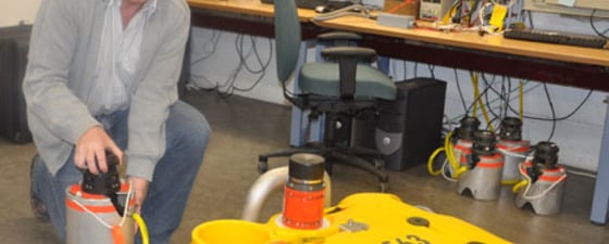
 During deepwater operations several CASE Abyss units are placed in a launch and recovery basket. Aided by an ROV, the units are taken out, one by one, and installed on their respective, planned locations. The CASE Abyss is more compact than its predecessor, allowing huge numbers to be stored on the combined source and data recording vessel. The unit is designed for both deep and shallow water use. © SeaBird Technologies“Up to now, the main interest in our data has been in using the PP-waves, but we are now also seeing oil companies starting to request PS-waves,” Berg says, fully aware that SeaBird then has a competitive edge over marine streamers.
The whole system can be operated with nodes and source on a single vessel, but for larger surveys it pays to use one source vessel and one node-operating vessel working simultaneously. The main operational method for deep waters is to use a basket with several nodes which is lowered towards the sea bottom where an ROV will deploy or retrieve the nodes one at a time. For shallower depths the nodes are deployed and recovered directly from the node handling vessel.
The recorded seismic signals are stored on a hard-disk within each node until it is on deck and the data can be downloaded. The disk has a capacity for 65 days of uninterrupted operation.
Auxiliary signals used for quality control are sent from the transducer by hydroacoustic waves directly to the source vessel through the water. Berg is proud to say that SeaBird is the only technology provider capable of doing this.
Operationally, the main advantage with using nodes is flexibility in areas with infrastructure like platforms, oil tankers and other obstacles.
The vessels can safely be located outside the security zone without the need to move around and make life difficult for the production facilities.
Improved imaging
Berg admits that using nodes planted on the sea bottom is time consuming compared with using streamers. But he also maintains that the operational advantage in congested areas, as discussed above, and the greater accuracy that can be obtained resulting in higher data quality, may fully compensate for the disadvantages.
“When doing reservoir monitoring, accuracy is of primary importance, and we have demonstrated our capability to re-find the receiver locations for the individual nodes. Actually, in some cases we have even seen imprints from a previous survey on the sea bottom with the video camera when moving towards the location.”
“At the SEG conference in Denver last fall, representatives of both BP and Shell gave talks stating that the accuracy of nodes is as good as permanent cables buried into the sea bottom,” Berg proudly says. The overall theme of that conference was “Imaging our Future”, which is actually what SeaBird Technologies is working towards. One session was dedicated to the use of nodes in seismic acquisition, and Berg – a receiver of the Virgil Kauffman Gold Medal (Society of Exploration Geophysicists) in 1999 – gave the keynote, entitled “Origin and Advances of the Planted 4C Seismic Node Technology”.
Accuracy with respect to careful planting and geographic location of the receivers ensures repeatability. SeaBird has demonstrated that both these factors are crucial when it comes to frequency content and data quality.
“In our view, there is no doubt that increased accuracy in positioning improves imaging,” Berg says.

Comparison of PP OBC (top) and PP node data (below) from the Cantarell Field in the Gulf of Mexico. © Pemex/SeaBird Technologies

A long way
 One of the advantages using nodes for 4D data acquisition is that it can be operated over fields with a complicated infrastructure. © SeaBird TechnologiesStarting companies that are introducing new technology is not the easiest thing to do – there are better ways to grow grey hair!
“The lead time for acceptance of our node technology has been long and difficult,” Berg admits. He has been dealing with this concept since the 1980’s when working for Statoil. In the geophysical industry it is well known that 4C, using nodes, is his brainchild. “The original idea leading to the node technology concept was a proposal to use a submarine with a streamer behind to acquire data under the ice offshore Greenland. However, it soon became clear that it should be possible to obtain better data if the sensors were fixed to the seabed.” By placing the sensors at the interface between the solid sediments and the water layer, the introduction of a four-component concept became a natural consequence.
The breakthrough for the node (and ocean bottom seismic as a whole) was the full scale 4C-2D pilot survey on a small field in the Central North Sea in 1993. It demonstrated for the first time that it was possible to image the reservoir through a gas chimney by using converted shear waves (PS).
For the impatient Berg, the time was now right to leave Statoil, and together with a colleague he formed SeaBed Geophysical in Trondheim and embarked on an extensive research and testing program, using the deep Trondheimsfjord with unconsolidated sediments above basement.
But the node still needed further development to make it a reliable and cost-effective seismic acquisition system for the future. A new compact node was developed and extensive testing showed that all three geophones gave stable and robust results independent of seabed conditions.
“The first demonstration with autonomous nodes was on the Statoil operated Volve Field in 2002. The operational flexibility and efficiency of node deployment and retrieval exceeded all expectations, and resulted in high quality PP and PS data,” Berg says.
Their first commercial job was for Pemex in the Gulf of Mexico on the Cantarell Field in 2003/2004. Imaging was difficult, which is easy to understand knowing that the reservoir consists of fractured carbonate in a field influenced by both salt movements and overthrusting. “In addition to acquiring full azimuth data, we clearly demonstrated that the nodes could be placed as planned independent of obstacles and infrastructures on the field, without leaving holes in the final image,” Berg says. “Compared to previous OBC, the node data produced a PP image of increased resolution,” he says. In short, Pemex was pleased. The technology proved that it had a merit on the Cantarell field.
Since then, the company has acquired five surveys; in North West Europe, offshore West Africa and in the Gulf of Mexico. Their only crew has been operating continuously for the last 2 years. When GEO ExPro was preparing this article, Berg was busy putting together a new tender for an existing customer. Naturally, he was quite excited about another opportunity. Repeat customers are as good as repeat surveys.
Multipurpose use
“We are certainly pleased to see that the technology is making its way, but we are, nevertheless, still focusing on improvements in both the technology itself and in more efficient operations,” Berg maintains.
Future trends clearly indicate that more efficient operations are required to cover larger and larger fields with more complex and advanced reservoir mapping challenges (e.g. fracture prediction in carbonate reservoirs) with the use of shear waves (PS).
“In the future we see node technology being capable of handling larger fields through more efficient operations, both in shallow and ultradeep waters, as well as resolving more complex mapping challenges by combined use of PP and PS data for lithology and fluid prediction,” Eivind Berg concludes.

PP (top) and PS (below) images after PSTM from the Cantarell Field. PS compressed to PP time. Upper right part: Note topset that are now visible. Lower left part: Note difference between PP and PS, indicating the possibility of seismic hydrocarbon indicators below the overtrhrust (not visible on PS-data). © Pemex/SeaBird Technologies


