Over a million barrels of oil a day flow through Georgia – but not a drop comes from the Eurasian country. Much of the vast oil and gas reserves of Azerbaijan on the Caspian Sea is exported via three main pipelines which pass through it, but the Georgia itself produces less than 1,000 bopd, which is exported, not via the pipeline infrastructure, but by rail and the Black Sea port of Batumi.
“Much of Georgia lies in the Southern Caspian petroleum system; the very same system which has sourced the giant discoveries in Azerbaijan,” says Vincent McDonnell, CEO of Blake Oil and Gas, one of a handful of companies actively exploring in Georgia. “Only 220 MMbo have ever been produced from the country, but we believe that it offers considerable potential.”
Long Regional History
_RegionalMap_GeoExpro_(21-4-11).jpg) Georgia is bounded to the West by the Black Sea. The Greater Caucasus Mountains rising to the north form a boundary with the Russian province of Chechnya. Turkey and Armenia lie to the south and Azerbaijan to the south and east.Hydrocarbons have been recognised in the region for centuries – in fact Marco Polo noted in the 14th century that oil was being collected from oil seeps in Georgia and used for heating and lighting. In 1846, more than a decade before the Americans made their famous Spindletop oil discovery in Pennsylvania, Azerbaijan drilled the first oil well in the Caspian region in Bibi-Heybat. By the beginning of the 20th Century, Azerbaijan was producing more than half of the world’s supply of oil.
Georgia is bounded to the West by the Black Sea. The Greater Caucasus Mountains rising to the north form a boundary with the Russian province of Chechnya. Turkey and Armenia lie to the south and Azerbaijan to the south and east.Hydrocarbons have been recognised in the region for centuries – in fact Marco Polo noted in the 14th century that oil was being collected from oil seeps in Georgia and used for heating and lighting. In 1846, more than a decade before the Americans made their famous Spindletop oil discovery in Pennsylvania, Azerbaijan drilled the first oil well in the Caspian region in Bibi-Heybat. By the beginning of the 20th Century, Azerbaijan was producing more than half of the world’s supply of oil.
In 1865 alone, more than 100 shallow (i.e. <100m deep) wells were drilled in eastern Georgia, and by 1869 some 15.7 Mbo had been produced from this area. Three further fields were discovered in Georgia before World War II, but exploration thereafter was sporadic, resulting in a total of only 18 oil and gas discoveries to date, of which the Samgori-Patardzeuli and the Ninotsminda fields are the best known.
“Fifteen of the known discoveries in Georgia are in the Kura Basin, in the eastern half of the country and which extends into Azerbaijan and the South Caspian Basin. This is the area which we believe holds the greatest potential,” says Vincent. “The basin is a Late Tertiary back-arc feature, but we are interested in the older sediments, particularly the Upper Cretaceous carbonate rocks. These have been very prolific oil and gas producers on the other side of the Greater Caucasus Mountains, where more than 200 Cretaceous fields exist, with individual wells flowing at rates greater than 15 MBopd. Prior to the civil strife in Chechnya, fields such as Karabulak-Achalukskoye and Malgobek-Voznesensko-Alkhasovo, among others, were producing over 300,000 bopd. They may seem a long distance away, but the geology is the same – it was all the one basin before the North Caucasus mountains popped up.”
Intramontane Basins
The geology of Georgia is dominated by an east to west trending Neogene foreland basin system running through the centre of the country. The region marks the final zone of convergence between the Eurasian and Afro-Arabian plates and the development of the Alpine mountain system, which began during the late Mesozoic and continues today. The central basin originated in the Mesozoic as an inter-arc basin which underwent late Mesozoic and Palaeogene transformation and became a relatively passive foredeep environment as the Afro-Arabian plates moved progressively northwards.
This foreland basin system is split into two intramontane basin systems. Rioni in the west, bordering the Black Sea, is separated from the eastern Kartli and Kura Basins by the Dziruli Massif, which is composed of acid intrusive and metamorphic rocks covered by Upper Triassic-Cretaceous sequences. To the north is the predominantly carbonate Greater Caucasus thrust belt with the volcanic rocks of the Lesser Caucasus Mountains to the south, both of which exhibit complex nappe features.
Sedimentation in the Rioni Basin started in the early Jurassic, with maximum subsidence taking place in the Miocene and Pliocene. Volcanics, vulcaniclastics and carbonates were deposited in the Cretaceous and the main reservoirs units of the Rioni Basin are the Upper Miocene molasses. Potential traps have been identified in structural closures such as anticlines and faulted anticlines, as well as stratigraphic plays related to facies change, but to date the basin has not proved very prospective.
The Upper Kura or Kartli Basin, which is the western end of the Kura Basin lying in Georgia, is composed of Palaeozoic igneous rocks and Carboniferous limestones, unconformably overlain by Jurassic to Quaternary sequences. It has a similar depositional history to that of the Rioni Basin. The entire Kura Basin today is under inversion and compression, resulting in a number of fault-bounded, east – west trending, high relief features, which have been the main targets in the northern part of the basin, where younger megasequences have been overthrust over Mesozoic rocks. They have resulted in the Samgori-Patardzeuli Fields, which were discovered in the 1970s and have produced approximately 200 MMbo so far.
New Play Opened
_XSection_GeoExpro_(21-4-11).jpg) Schematic cross section south-west to north-east across the Samgori-Ninotsminda field and Manavi discovery.“I have been involved in Georgia since 1994, initially working for JKX Oil & Gas – at this time the first Production Sharing Contract (PSC) in Georgia was signed,” says Vincent McDonnell. “This covered the Ninotsminda Field, later acquired by CanArgo Energy Corporation, a US AMEX listed company where I worked for ten years. CanArgo added two further large high potential blocks to its portfolio in the Kura Basin, close to the capital, Tiblisi. In addition to the undoubted potential in the shallow Tertiary Caspian system, where CanArgo discovered oil in a structure analogous to the Samgori-Patardzeuli-Ninotsminda complex of fields, our work in the area has also opened up a new oil play fairway in the South Caucasus in Cretaceous fractured carbonates.”
Schematic cross section south-west to north-east across the Samgori-Ninotsminda field and Manavi discovery.“I have been involved in Georgia since 1994, initially working for JKX Oil & Gas – at this time the first Production Sharing Contract (PSC) in Georgia was signed,” says Vincent McDonnell. “This covered the Ninotsminda Field, later acquired by CanArgo Energy Corporation, a US AMEX listed company where I worked for ten years. CanArgo added two further large high potential blocks to its portfolio in the Kura Basin, close to the capital, Tiblisi. In addition to the undoubted potential in the shallow Tertiary Caspian system, where CanArgo discovered oil in a structure analogous to the Samgori-Patardzeuli-Ninotsminda complex of fields, our work in the area has also opened up a new oil play fairway in the South Caucasus in Cretaceous fractured carbonates.”
“The acreage includes the undeveloped Manavi and Norio discoveries: the former partly underlies the Ninotsminda Field and was identified on new seismic acquired in 2000. The Manavi 11 exploration well drilled in 2003/04 proved up the deeper Cretaceous hydrocarbon system, which is directly analogous to the prolific fields to the north of Georgia in the southern provinces of Russia. The subsequent M12 appraisal well found a 148m hydrocarbon column of 40.5° API oil which remains to be tested. We also expect to be able to produce significant gas from the field, due to the very high gas-oil ratio.” The Norio discovery, where 46.8o API oil has been flowed to surface, comprises a stacked reservoir analogous to the adjacent Samgori and Ninotsminda Fields, but larger.
“Unfortunately, political and economic developments, including the Georgia-Russia five day war in August 2008, the global financial crisis, and the collapse of the oil price, meant it was difficult to find sufficient funding for exploration and development, culminating in CanArgo filing for Chapter 11 in 2009. After a corporate re-organisation and refinancing these promising assets, including the producing Ninotsminda Field, the Manavi and Norio oil discoveries and significant leads and prospects, are now owned by Blake Oil and Gas.”
“Independent consultants have estimated that the blocks could contain combined reserves and upside contingent resources of 835 MMboe recoverable, with a further upside of 957 MMboe recoverable in unrisked prospective resources” Vincent adds.
Geochemical studies suggest that the primary source for Tertiary and Mesozoic reservoirs is Oligocene to Middle Miocene aged “Maykop Formation” organic-rich black mudstones, which can be as much as 2,500m thick in the region and which contain TOC`s of between 1.5% to 10%. Peak generation seems to have occurred during Miocene-Pliocene, after the development of the major anticlines and traps. The Maykop is the primary source for the hydrocarbon charge of the Kura Basin, South Caspian Basin and the North Caucasus.
Modern Seismic Reveals Potential
 Vincent McDonnell is CEO of Blake Oil and Gas, which has promising acreage in Georgia. Photo: Martin Riddle“During the Soviet era, most of the obvious structures with surface expression in Georgia were drilled, and many found hydrocarbons,” Vincent explains. “However, the seismic at the time was not able to effectively visualise the deeper horizons. As a result, the structures tested were generally small and detached by faults from the deeper and larger structures located in the sub-thrust zone which can be seen on modern seismic data. There is therefore significant future exploration and development potential in the Georgian Kura Basin.”
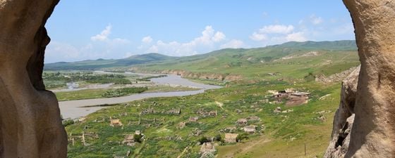
“Georgia is a good place to do business,” he adds. “It has a supportive government, and PSCs have good terms; the first 50% of production goes to the company for the recovery of expenses, with the remaining split with the state. It is also very beautiful, flanked by two impressive mountain ranges, with friendly people – who incidentally make very fine wine!”
“We’ve done the difficult job and found what appear to be large quantities of hydrocarbons in this hospitable and beautiful country. Come and join us!” Further information about the Blake acreage in Georgia can be found at www.envoi.co.uk.


