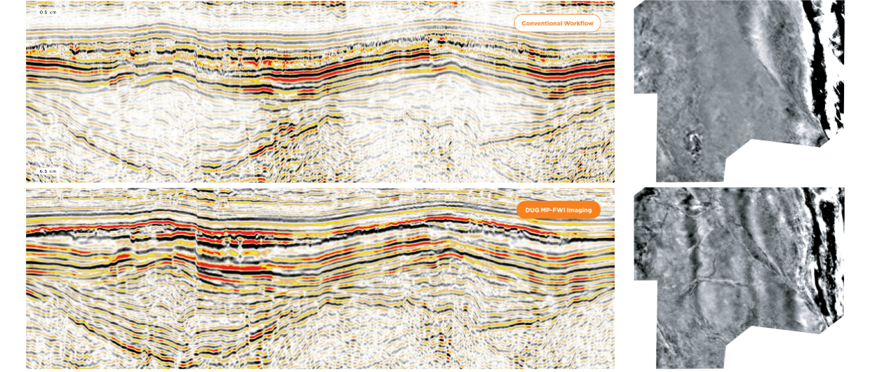
Resolving subtle structural and stratigraphic features in land seismic datasets is an arduous task for conventional processing and imaging workflows. In the examples above DUG MP-FWI Imaging has produced a spectacular uplift, with significantly less effort.
Even with the additional complexity that comes with onshore data acquisition (such as topography and near-surface effects), DUG MP-FWI Imaging produced far superior results. Significantly better illumination and event continuity is obvious when comparing the sections above, thanks to least-squares imaging of the full wavefield—that includes interbed multiples. Incredible near-surface detail has been resolved, as can be seen on the shallow depth-slices to the right. This example highlights why DUG MP-FWI Imaging is now the technology of choice, and a must-have for any seismic project, either land or marine. A land of opportunity awaits!
Get in Touch
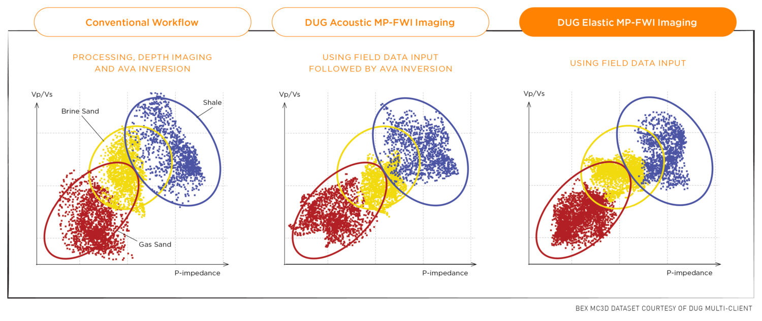
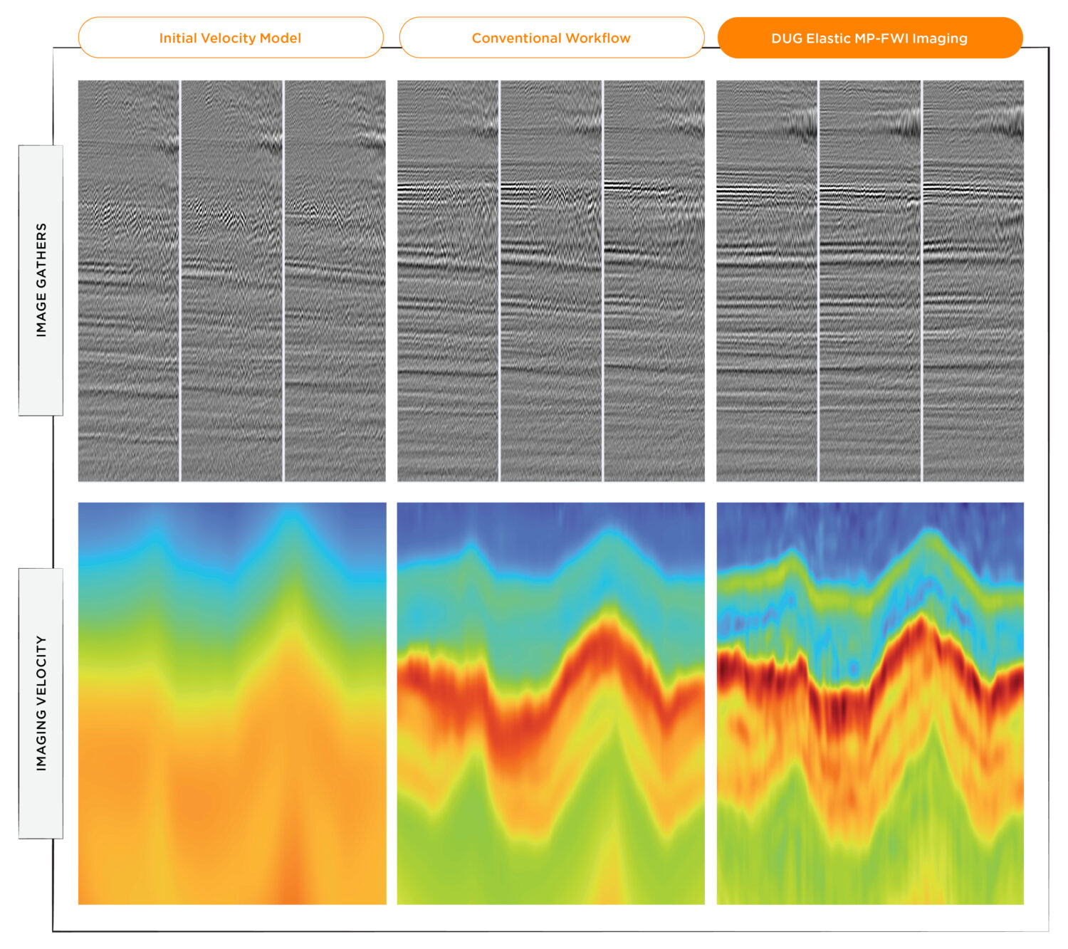
Imagine producing a subsurface image, ready for interpretation, straight from field data. Imaging receiving better results in weeks, not months. Using superior physics, DUG Multi-parameter FWI Imaging completely replaces the traditional processing and imaging workflow, making all that possible now.
Don’t wait another day to ask us how. Contact info@dug.com