The pullout shows a sample Pre-Stack Depth Migration (PSDM) of a reprocessed 2D seismic line from a 2002 survey in this area.
Recent seismic reprocessing work performed by geophysical contractor, Spectrum Geo Ltd., under an agreement with the Indian Directorate General of Hydrocarbons (DGH) has shown that the application of modern seismic processing techniques (specifically Radon Demultiple, PSTM and PSDM) to data acquired in 2002 has considerably improved the final result, allowing the geoscientist to recognise a sedimentary section below the Tertiary-aged Deccan basalts which have in the past masked any pre-Tertiary section in the northern half of the deep offshore area. Basalt thickness ranges from a few 100 m to over 1,000 m.
Exploration and production off the West Coast of India has generally been concentrated in the shallow waters of the Mumbai High area in the northern part of the western offshore, targeting the thick (post-basalt) Tertiary section found in this area. Further offshore, where the Tertiary section is thinner, some of the Miocene reefs have been drilled in the deepwater parts of the Gujurat-Saurashtra basin, just north of the 2002 survey area, but showed no reservoir development. Tertiary targets still remain to be examined by the drill-bit but in the past doubt has been cast on whether a valid petroleum system exists at this level in the deep water due to concerns regarding both depth of burial (too shallow?) and presence of source rocks. However, the recognition of a possible Mesozoic section (Cretaceous, Jurassic and older) below the basalt extends the petroleum potential of the area, allowing plays to be present at both the Mesozoic and Cenozoic (Tertiary and younger) levels. The reservoirs are thought to have been charged with hydrocarbons from Triassic to Cretaceous source rocks.

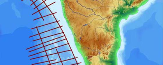
Location of the 2002 survey and main structural elements. The survey was acquired for DGH in 2002 with a 6,000 m cable and 4,050 cu in airgun source. A total of 12,000 line kilometres was acquired. Image: Spectrum

Postulated stratigraphy: offshore West coast India (modified from Jenkins 1992). Image: Spectrum
Mesozoic shows and seeps
Mesozoic sediments have been recognised in the Kutch Graben and Saurashtra Basin to the north and in the Seychelles to the south-west, where evidence of a thick Mesozoic sequence has been proved by drilling, and where Mesozoic source potential was confirmed by oil shows in wells drilled in the 80’s. The same oil characteristics have also been found in numerous tar balls stranded around the islands of the Seychelles archipelago.
Potential source and reservoir rocks of the Western Offshore area of India range from Triassic Karoo fluvial sandstones and shales, through Jurassic marine shales and sands, to Early Cretaceous restricted marine shales and shelfal sands, which persisted into the Late Cretaceous between India and the Seychelles. Elsewhere shallow marine limestones and basinal shales may have developed prior to major outpourings of Deccan lavas.
In the southern half of the deepwater western offshore area, in the Lakshadweep or Kerala-Konkan basin, the basalts are thin to non-existent, but modern processing here has also improved the imaging of the Mesozoic section. This is well illustrated on the depth migrations shown here, which demonstrate that these Mesozoic sediments lie at depths which can generate oil and gas (e.g 3,000 m and 5,000 m plus below sea floor respectively).
Direct hydrocarbon indicators (DHIs) such as gas chimneys indicate the presence of an active hydrocarbon system, as do the presence of seeps recognised from satellite. In some cases, these seeps can be correlated with faults seen on the seismic. They occur both along the platform edge and in deeper water, the latter particularly in the Kerala-Kokan basin.
Potential in unlicensed acreage
The deep offshore West Coast of India has undoubted hydrocarbon potential, with new evidence pointing to a deeper Mesozoic province. In addition to extending the area of interest to hydrocarbon explorers in depth, this study extends it geographically into the deeper offshore.
Further work needs to be done to understand fully the petroleum systems (e.g hydrocarbon charge, timing, preservation etc.) and in gathering new seismic data, including surveys with long offsets. This can then be integrated with potential field gravity and magnetic and geochemical information to give a fuller picture of the potential of this huge offshore area.
A considerable percentage of the area is unlicensed and expected to be offered in future license rounds.

Pre Stack Depth Migration example from Kerala-Konkan basin. Timing lines every 1000 m; Section width:80 km; Vertical exaggeration approx 7.5:1. Image: SpectrumrnttttGas chimney on a W-E line from the Kerala-Konkan area. Data is PSDM and displayed in depth with timing lines every 1000 m. Main Horizons: Pink & Yellow: Intra Tertiary events; Turquoise: Base Tertiary; Light Green: Top syn-rift. Section width 38 km; Vertical exaggeration approx 3.5:1. Image: Spectrum

Acknowledgement: This article is based on reprocessing work done by Spectrum Geo Ltd on 12,000 km of DGH data off the West Coast of India for the Nelp VII and future license rounds. Interpretation and geological analysis of the reprocessed data was performed by Colin O’Brien and Ken Rutherford for Spectrum and presented in a paper at GeoIndia in September 2008. Thanks are due to DGH for permission to publish this material and to Fugro-NPA for the information on the satellite seeps.


