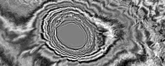
The Tano Basin – revealing late cretaceous depositional styles in a frontier basin A recent seismic stratigraphic analysis demonstrates the presence of key petroleum system elements and the potential to…
Illustrated here are the two GeoStreamer X surveys (2019 southern polygon and 2020 northern polygon), the rockAVO wells used in this study and the random line for the main seismic…
Elisabeth Gillbard, Senior Geologist, ION Paul Bellingham, VP New Ventures, Eastern Hemisphere, ION
An overview map of the Mauritanian Margin. PSDM transverse with velocity overlay through the Mauritania 3D data, showing the syn-rift section (including allochthonous and partially migrated Triassic salt, deposited in…
Upstream projects for the global transition A Mongolian opportunity with local markets, appraisal/development and exploration upside, and generating fewer emissions than coal. Whether the world likes it or not,…
Felicia Winter, Anongporn Intawong and Jason Robinson, TGS UK
The Orange Basin – An underexplored oil giant? The Orange Basin offshore Namibia and South Africa The Orange Basin is part of the volcanic-rifted passive margin south of the Walvis…
Felicia Winter, Anongporn Intawong and Paolo Esestime, TGS
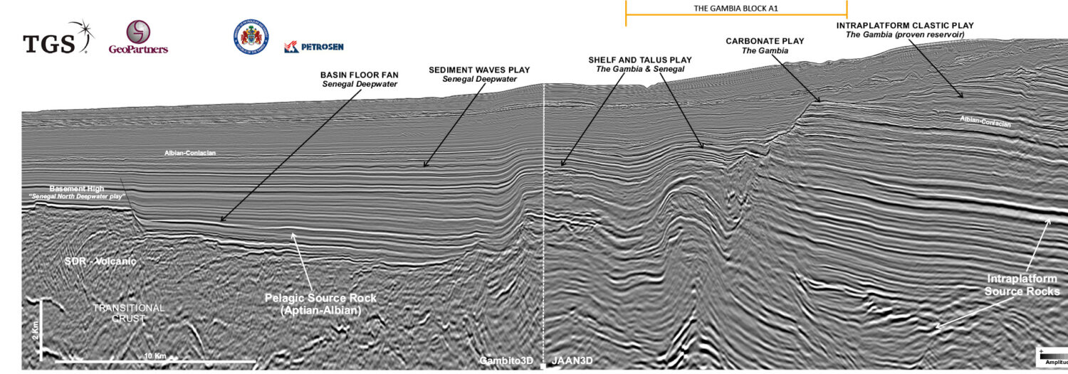
Credit: TGS, GeoPartners. Connecting the shelf to the deepwater A flurry of hydrocarbon exploration activity continues in The Gambia and Senegal, and it is fuelled by drilling successes. The Gambia,…
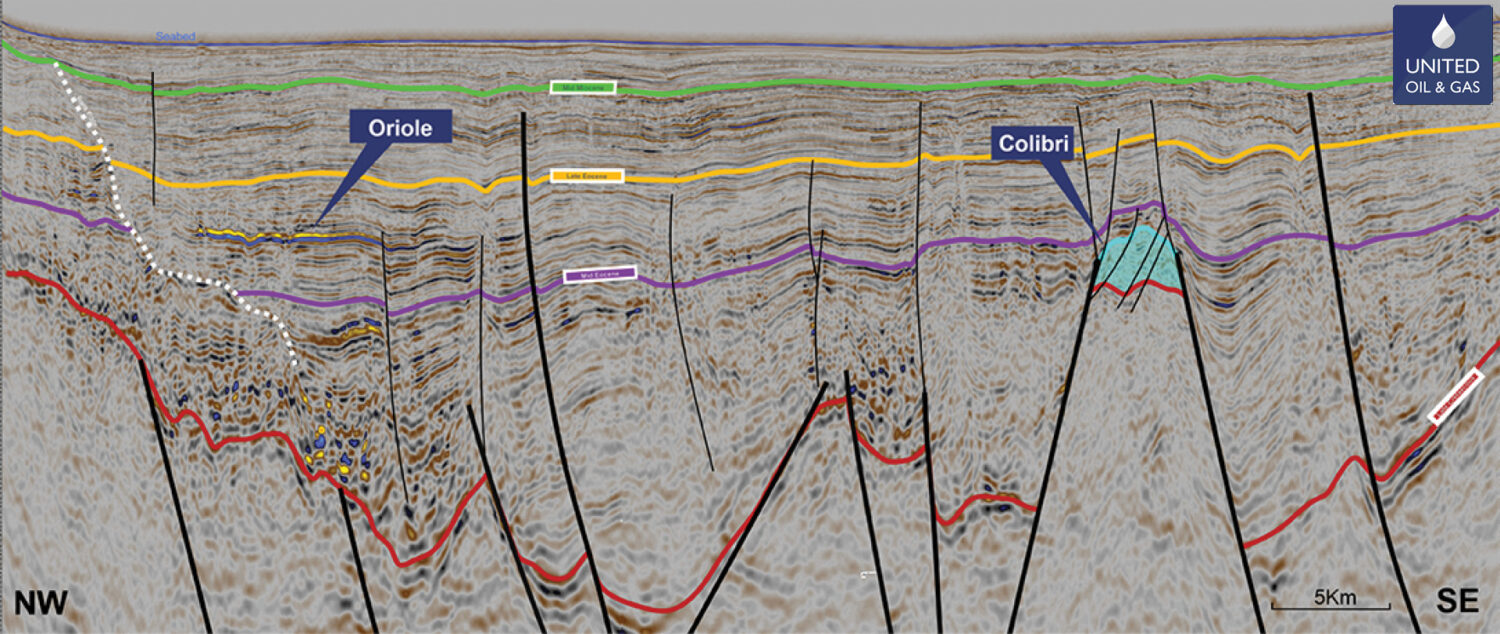
Mike Lakin, Envoi Limited; Paul Ryan and Myles Watson, United Oil & Gas
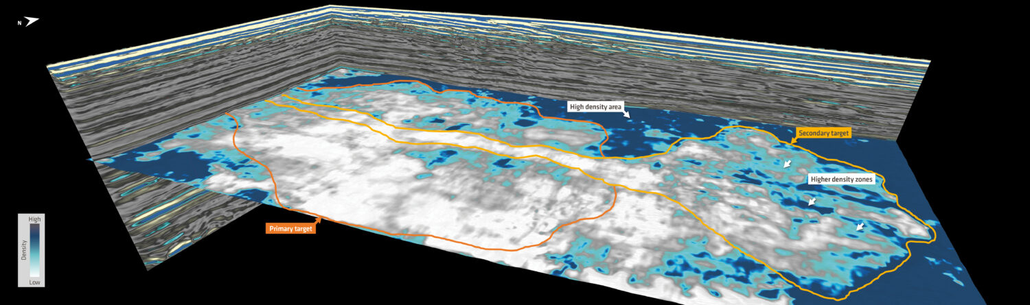
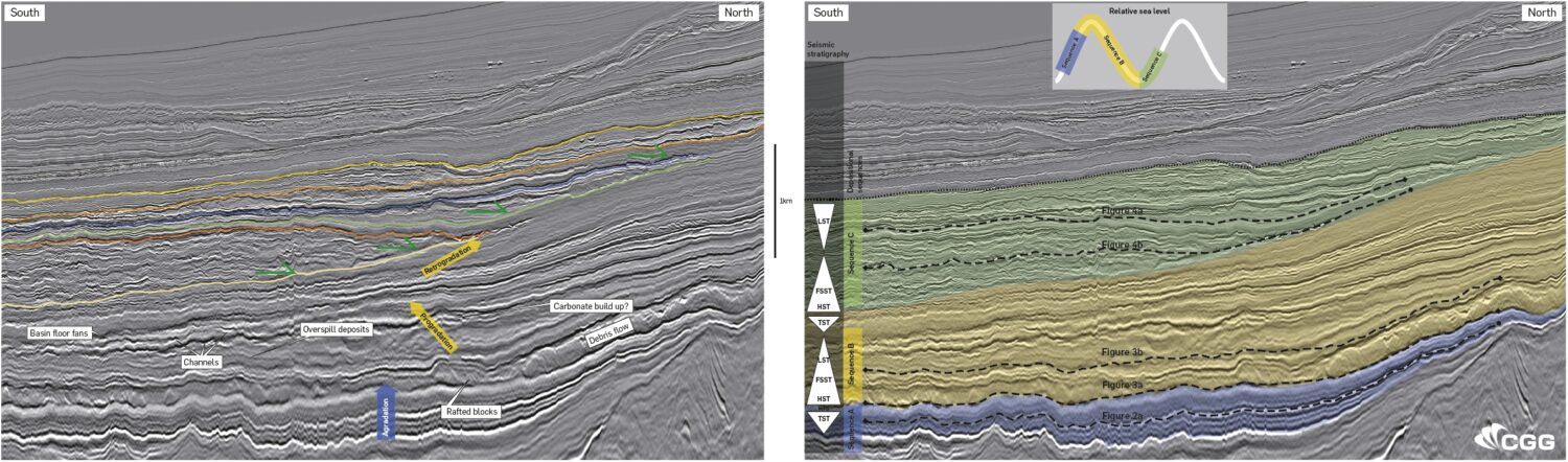
Figure 1: Generalised map showing the Walton Morant Licence area, the identified prospectivity, well locations and seismic coverage. Geoseismic cross-section A–A’ is shown in Figure 7. Figure 2: A prominent…
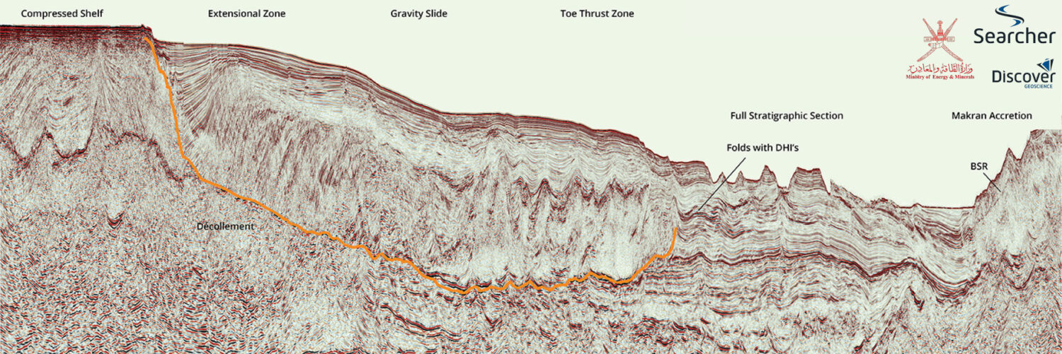
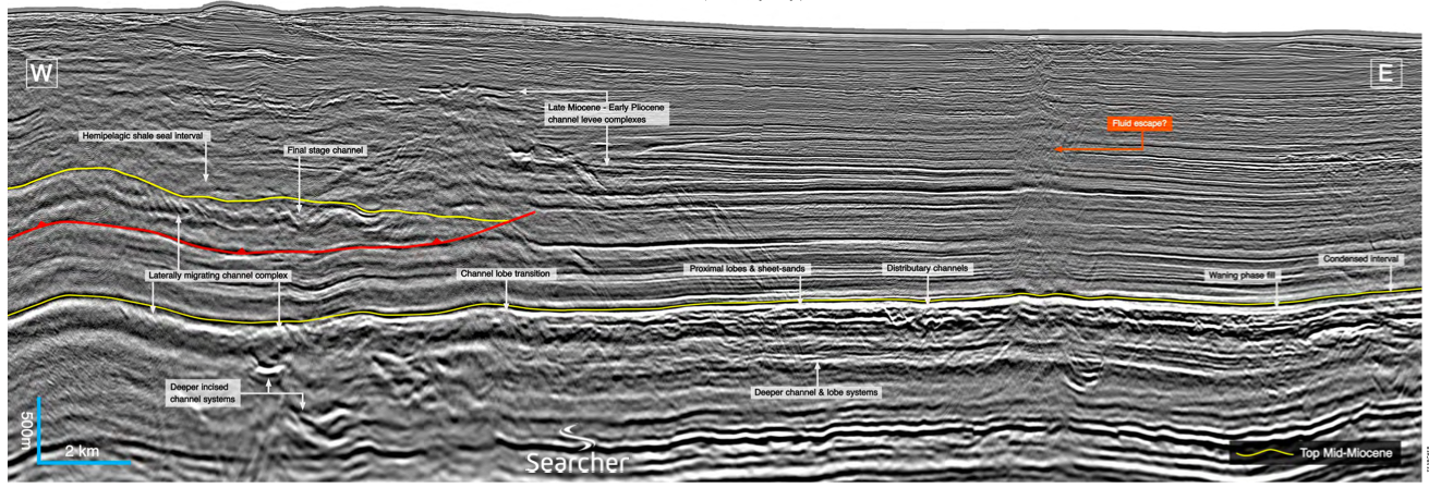
Neil Hodgson, Karyna Rodriquez: Searcher; Julia Davies, Peter Hoiles: Discover Geoscience; Dr. Saleh A Al Anboori: MEM
Location map showingposition of composite line. Searcher. Offshore Oman Unexplored and tantalisingly prospective. The Eastern Oman Mountains are widely known as an ophiolite range of rugged and dramatic beauty,…