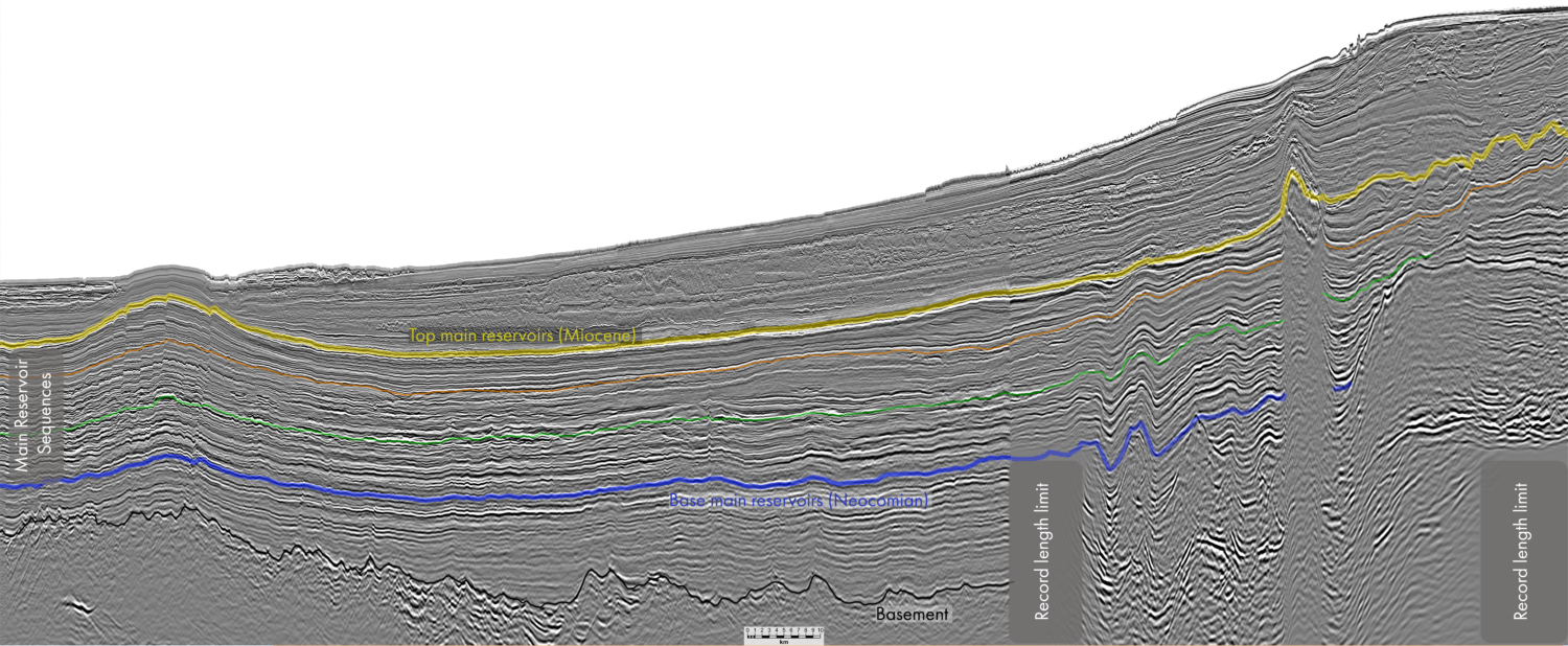
Harnessing AI-driven analytics for subsurface insights in East Coast Peninsular Malaysia
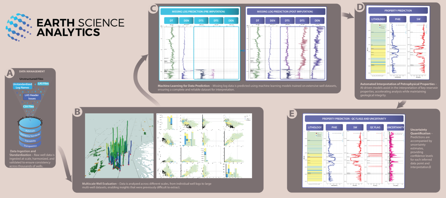
Project structure and objectives The initiative was divided into two major tasks: Task One – Integration of PETRONAS myPROdata with EarthNET The objective was to enable seamless data integration and…