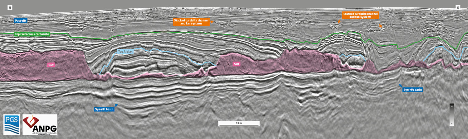
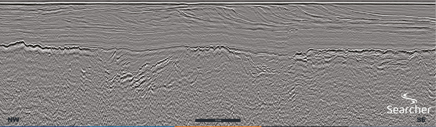
Discover

Overcoming Seismic Imaging Challenges in Highly Congested Areas

Combining streamer and node technology to provide high resolution seismic in congested areas with a fast turnaround. This year, Polarcus was challenged by Dubai Petroleum to provide a high-resolution, fast-turnaround,…

Exploration opportunities in the Mediterranean

Figure 1: Interpreted section of seismic outlined in black on foldout line. Integrated seismic datasets The offshore Mediterranean basins are the focus of renewed interest since the 2008 discovery in Libya, the Tamar…

Caribbean Atlantic Margin Deep Seismic Imaging

A new regional study of the South-Eastern Caribbean hydrocarbon exploration opportunities using deep seismic imaging. In March 2019 MCG completed acquisition of 16,433 km of long-offset high resolution 2D seismic…

Discover New Value in Legacy Data with Denmark 3D

ION’s newly reprocessed PSDM 3D seismic data provides the perfect platform to support any renewed oil and gas exploration efforts in Denmark. With a successful history of 3D proprietary processing,…

De-risking a turkish delight

Spectrum’s Black Sea MC 2D data. An extraordinary underexplored basin New data reveals the potential for a new super basin – an accessible oil play lying within the world-class Maykop oil…

Pre-Salt: The Brazilian shining star

  Location of the XArray Triple Source project which will cover the Aram, Carcará and Uirapuru areas. Map showing fields and location of newly awarded acreage (Uirapuru) and the Aram,…

Cuba re-launches offshore oil exploration

Explore Madagascar’s open acreage The West Morondava Basin: Let the bidding commence!  After over 100 years of exploration, the offshore part of the West Morondava Basin remains largely underexplored. Only six…

São Tomé and Príncipe

Base map showing the territorial waters of the STP-EEZ together with neighbouring countries. The PGS MultiClient seismic and well datasets are shown together with annotations showing the major fluvial input…