PGS

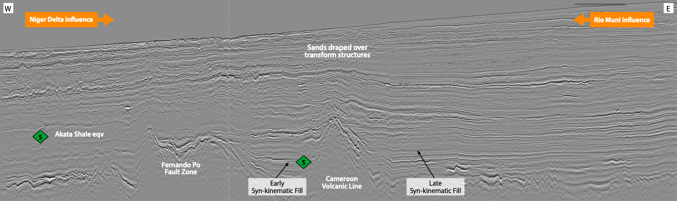
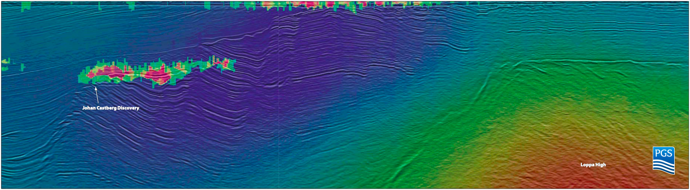
Côte d’Ivoire: regional understanding to unlock hydrocarbon potential

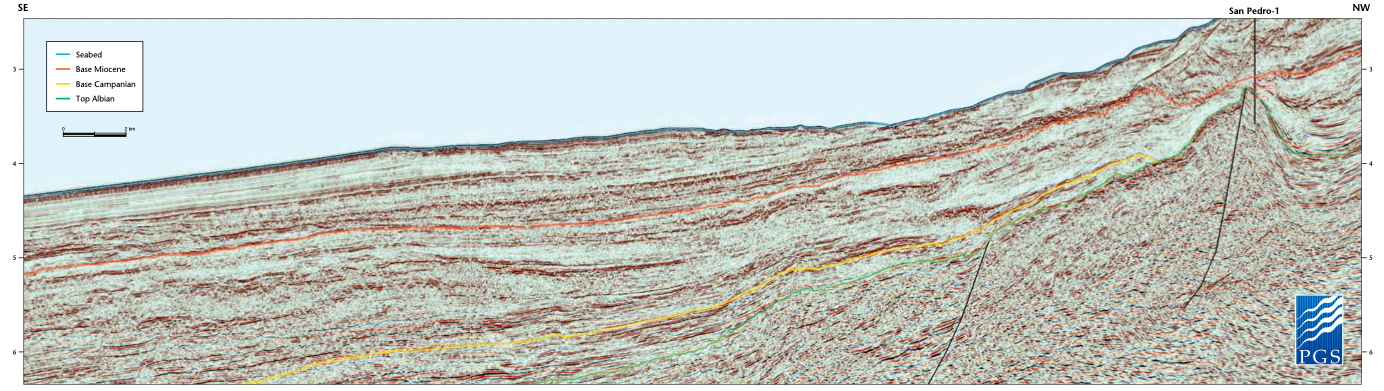
Map showing location of seismic line. Extending Oil and Gas Exploration Potential to Western Côte d’Ivoire Regional seismic data allows petroleum plays to be interpreted in full for the first…

São Tomé and Príncipe

Base map showing the territorial waters of the STP-EEZ together with neighbouring countries. The PGS MultiClient seismic and well datasets are shown together with annotations showing the major fluvial input…

Namibia: Frontier exploration in West Africa

Hydrocarbon Potential of Offshore Namibia In 2012 and 2013, PGS shot approximately 15,000 line km of broadband seismic data in the deep and shallow waters offshore Namibia, with a view…

Imaging the next hydrocarbon province

Map of Greece showing the new data coverage and the exploration blocks extending along the western and southern offshore area. Schematic map showing the external geotectonic zones onshore and offshore…

Côte d’Ivoire: completing the jigsaw

Base map of central offshore Côte d’Ivoire showing the PGS multiclient seismic data library, together with the location of the four wells discussed in the text. Awaken your structural geologist!…

Towed streamer EM for success

Close-up of Johan Castberg area. Example comparison between the measured resistivity at wells in the Johan Castberg and Caurus areas and the resistivity recovered via anisotropic inversion. See the big…

Offshore Côte d’Ivoire: a modern exploration frontier

Section detail showing some of the key features identified in the area. Location map showing the offshore Côte d’Ivoire region, PGS 2D data coverage in yellow and approximate loca- tion…

Exploration potential of the Nigerian transform margin

The Nigeria Transform Margin GeoStreamer® MC3D seismic survey, which was acquired in 2010 using innovative dual sensor technology, has resulted in a significantly improved data set, with coverage which extends…