Karyna Rodriguez, Neil Hodgson, Searcher Seismic and Julia Davies, Discover Geoscience
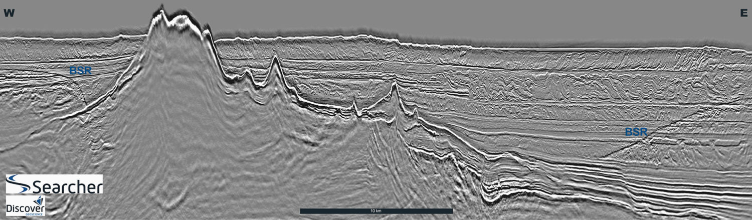
Map showing location of Searcher Seismic’s coverage of newly acquired and reprocessed datasets in the Gulf of Papua (GOP). The foldout line is located within the GOP. Bottom simulating…
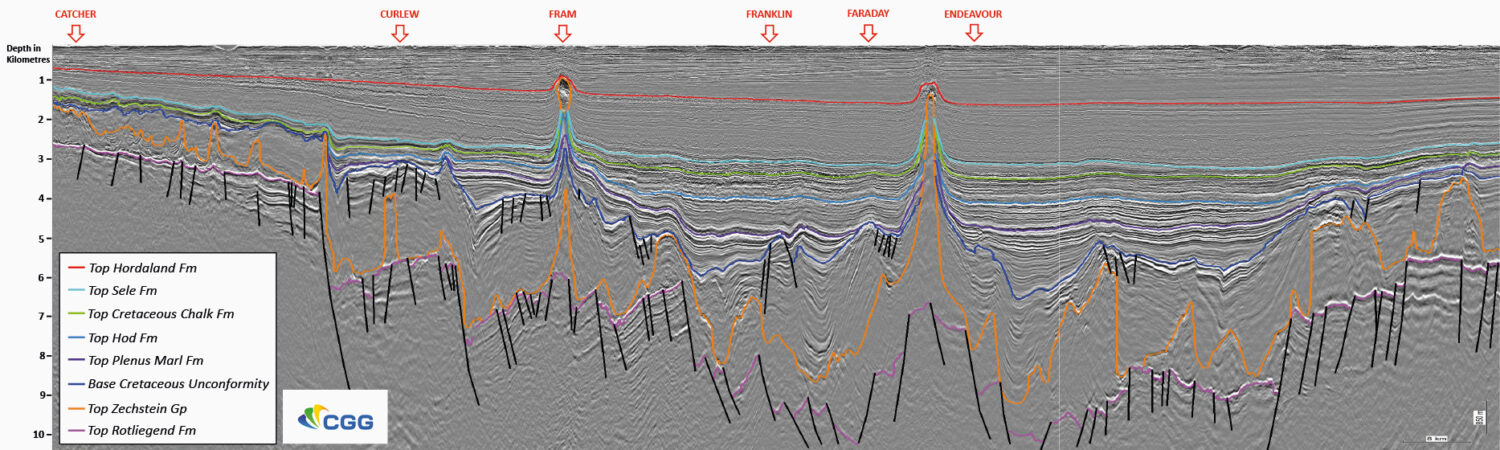
Exploring the deeper potential of the Central North Sea With recent successes, such as the Glengorm and Isabella discoveries, the Central North Sea is proving that the deeper potential may…
Kyle Reuber, Antara Goswami, Darren Judd and Shihong Chi; ION
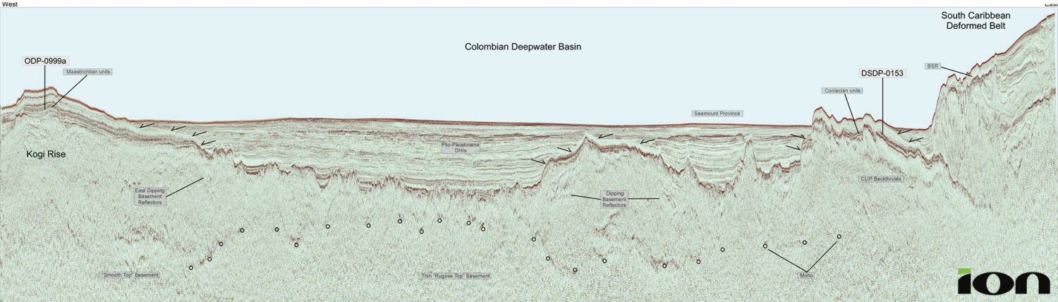
Figure 2a: Basemap showing ION’s Colombia Caribe Reprocessing project, highlighting the 18 vintage surveys in offshore Colombia, PanamaSPAN and AntillesSPAN of the western Caribbean. Figure 1: Regional tectonic framework…
Jeroen Hoogeveen, Geoex MCG; Kristen Berli, Seismic Partner; Lars Ivar Leivestad, Geoex MCG and Tor Åkermoen, Geoex MCG
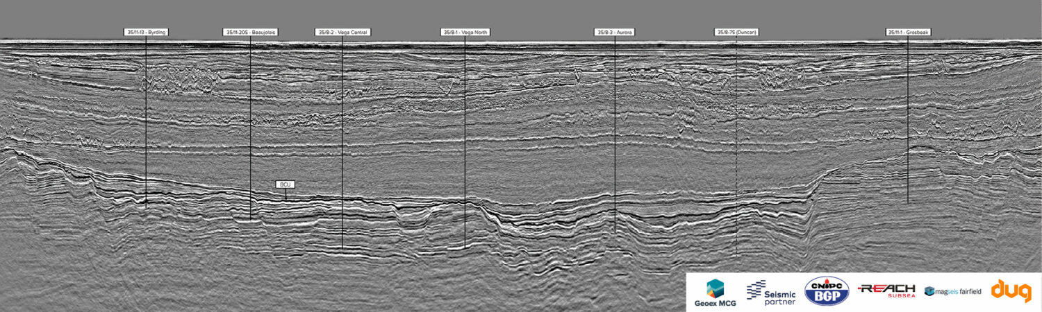
Figure 1: Map showing the location of the Quad 35 survey in the Norwegian North Sea and long arbitrary line through the main discoveries inside the Quad 35 survey…
Figure 1: The GeoStreamer X Viking Graben location (left) and acquisition conu001F gurations (right). Two new azimuths were acquired in 2019 in addition to the 2011 survey; the new azimuths…
The OBN survey, named Amendment, was acquired in the Mississippi Canyon area of the Gulf of Mexico. Gulf of Mexico, a proving ground for OBN technology Survey sesign and capture…
Will Bradbury, Alex Kurobasa and Bent Kjølhamar; TGS
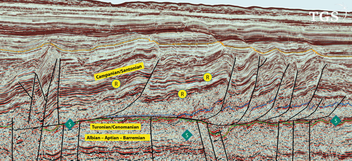
Figure 3: Three seismic sections through TGS’s 3D data over the Acorn CCS site, the Northern Endurance CCS site and a 2D line from TGS’s CFI-NSR dataset over the Northern…
Paul Bellingham, Will Reid, Emily Kay and Neil Hurst; ION Geophysical
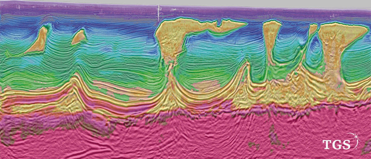
A newly acquired 3D seismic survey, covering the entire Zechstein play fairway in the UK Mid North Sea High, reveals the hydrocarbon potential of the complex and highly variable Intra-Zechstein…
Karyna Rodriguez and Neil Hodgson, Geoscience Team; Searcher
Location of Searcher’s seismic datasets offshore Mexico with geological basins outlined and the location of major recent Talos and ENI discoveries. Offshore Mexico: extraordinary hydrocarbon play systems identified Improvements in…
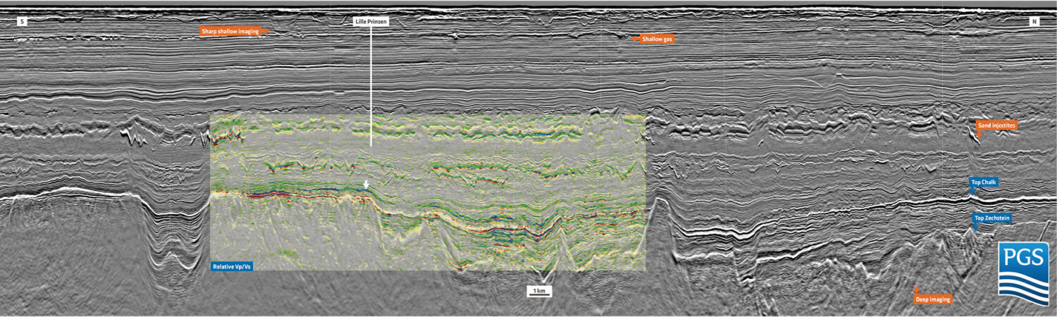
Scott Opdyke, Cyrille Reiser, Tiago Alcantara and Elena Polyaeva; PGS
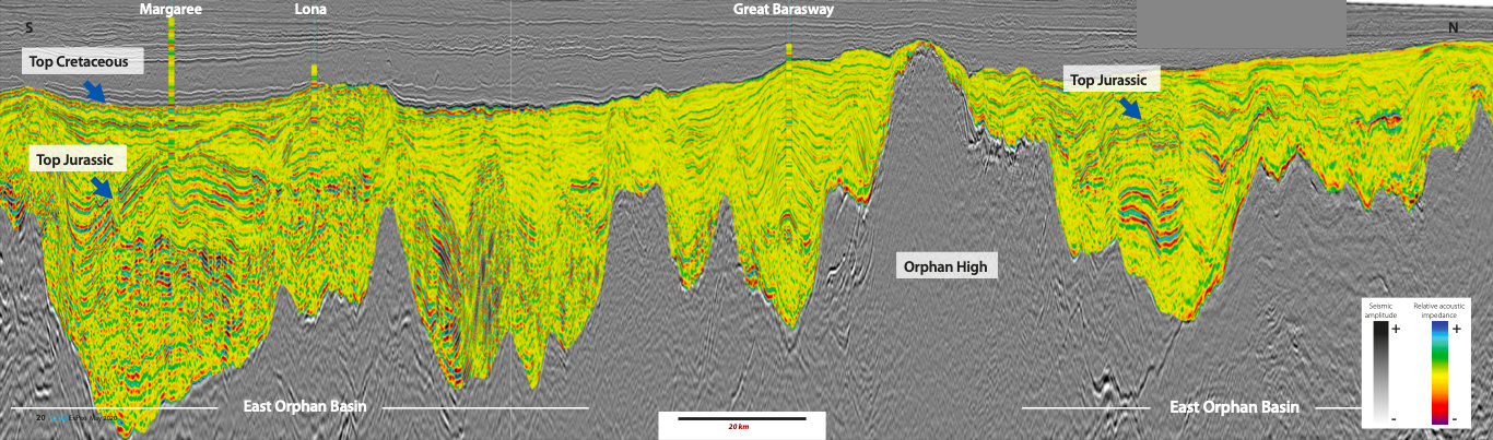
Figure 2: (a) Location of the Long Range, Tablelands and North Tablelands 3D surveys; (b) Locator map looking north across the surveys. The amplitude extraction on the seafloor demonstratesthe modern…