Felicia Winter, Anongporn Intawong and Jason Robinson, TGS UK
The Orange Basin – An underexplored oil giant? The Orange Basin offshore Namibia and South Africa The Orange Basin is part of the volcanic-rifted passive margin south of the Walvis…
Felicia Winter, Anongporn Intawong and Paolo Esestime, TGS
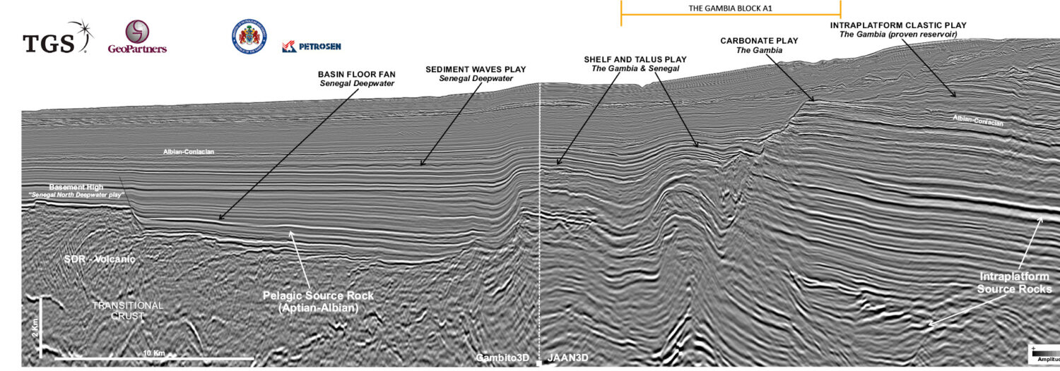
Credit: TGS, GeoPartners. Connecting the shelf to the deepwater A flurry of hydrocarbon exploration activity continues in The Gambia and Senegal, and it is fuelled by drilling successes. The Gambia,…
Mike Lakin, Envoi Limited; Paul Ryan and Myles Watson, United Oil & Gas
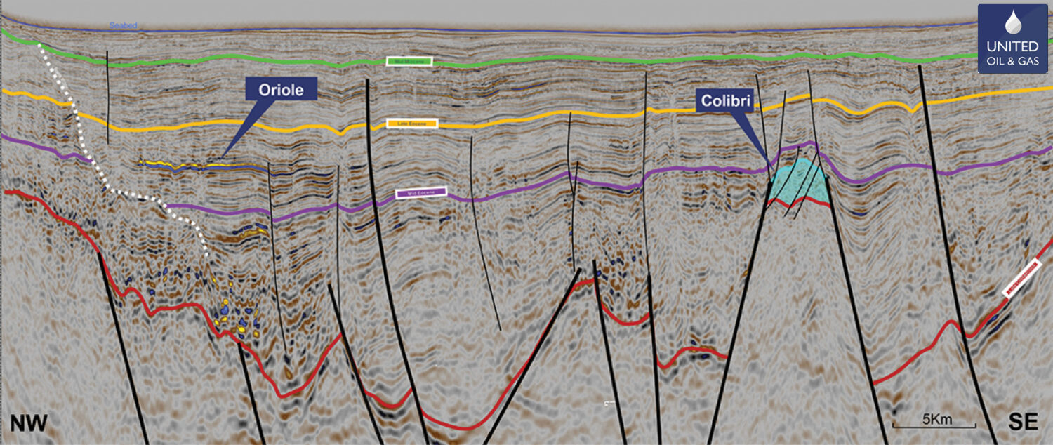
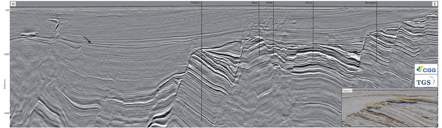
Figure 1: Generalised map showing the Walton Morant Licence area, the identified prospectivity, well locations and seismic coverage. Geoseismic cross-section A–A’ is shown in Figure 7. Figure 2: A prominent…
Neil Hodgson, Karyna Rodriquez: Searcher; Julia Davies, Peter Hoiles: Discover Geoscience; Dr. Saleh A Al Anboori: MEM
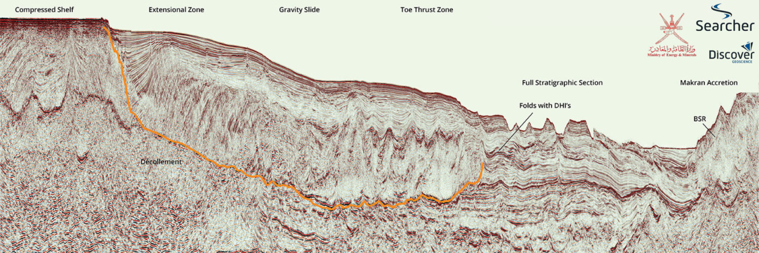
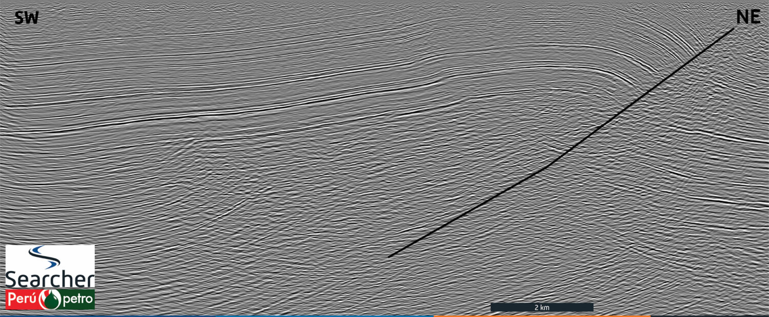
Location map showingposition of composite line. Searcher. Offshore Oman Unexplored and tantalisingly prospective. The Eastern Oman Mountains are widely known as an ophiolite range of rugged and dramatic beauty,…
Figure 1A: Regional map with red line cross-section location. 3D processing integrates regional seismic, offshore Brazil The new Picanha 3D dataset provides the ideal foundation for an exploration and production…
Anna Rumyantseva, Jaswinder Mann-Kalil and Idar Kjørlaug; CGG
Figure 1: Overview map.The Northern North Sea is very active for oil and gas exploration with several commercial discoveries made over recent years. CGG’s Northern Viking Graben (NVG) multi-client survey…
Neil Hodgson, Karyna Rodriguez, Dennys Uyen, Searcher; Julia Davies and Lauren Found, Discover Geoscience
Please note: due to online file size limits we have had to scale down the resolution of this foldout. You can find the higher resolution version on pp42-46 of GEO ExPro…
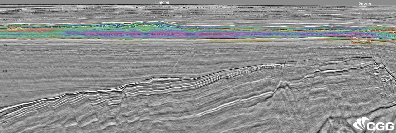
Map showing location of CGG/TGS Greater Castberg TopSeis survey (5,168 km²) acquired in the Barents Sea in 2019, and the main structural elements. Greater Castberg Survey – A catalyst for…
Ryan Williams, Chris Han, Peter Szafian, Mark Brownless and James Lowell; Geoteric.
Figure 2: Base map showing the location of the Southern North Sea study area used throughout this project. A catalyst of change for net-zero How can state-of-the-art AI tools be…
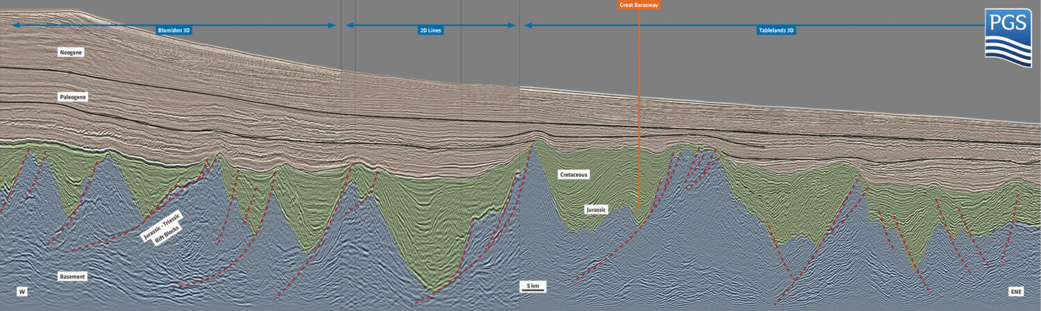
Hermann Lebit, Yermek Balabekov and Taylor Buckley; PGS
Figure 1: Major tectonic and structural elements of the Grand Banks. The pull-apart geometry of the Orphan Basin is well outlined by the breakup (Cretaceous) unconformity as well as the…
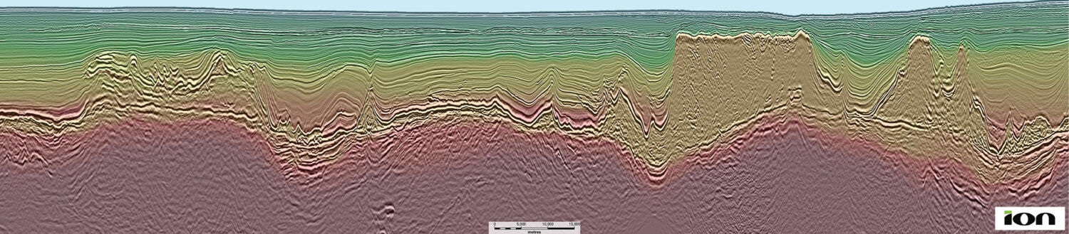
Yannick Cobo, Rodrigo Felicio, Carlos Calderon and Paul Farmer; ION
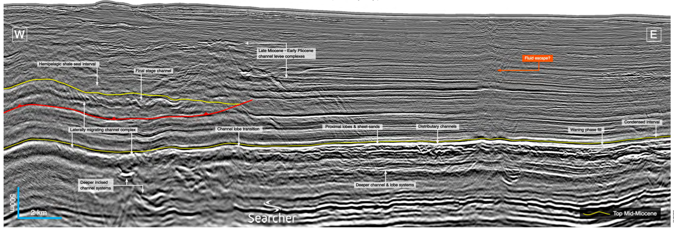
Geology The study area is in ultradeep waters (2 km) of the Santos Basin and the geology is comprised of a 2–4 kilometer-thick sequence of mostly clastic sedimentary rocks overlaying…