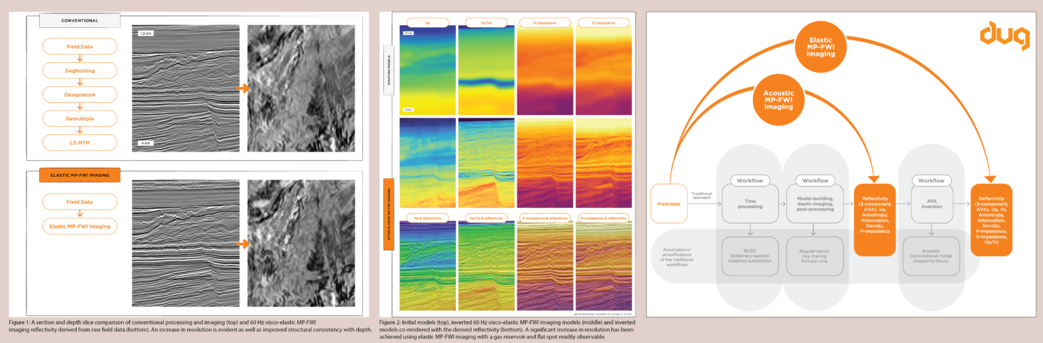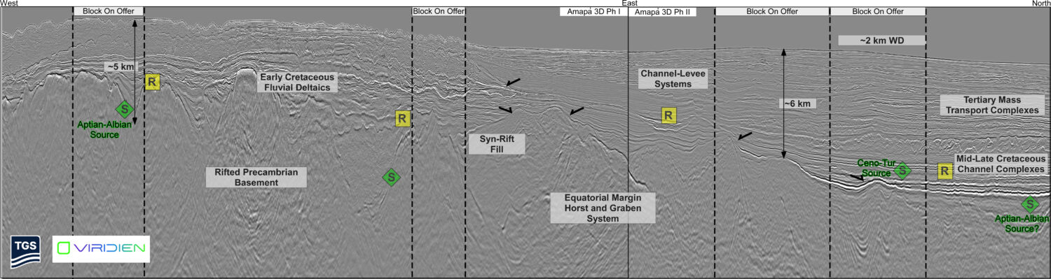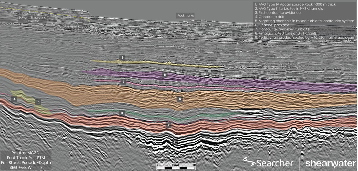
Onset of maturity: A tool for getting your oil finding game on
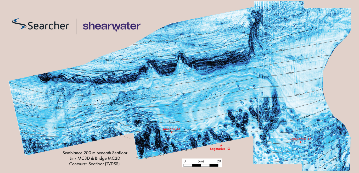
Decoding the spatial correlation of pockmark evolution and oil discoveries Integrating fluid flow indicators, seismic DHI, and source rock modelling to reduce exploration risk In 1752, at the height of…