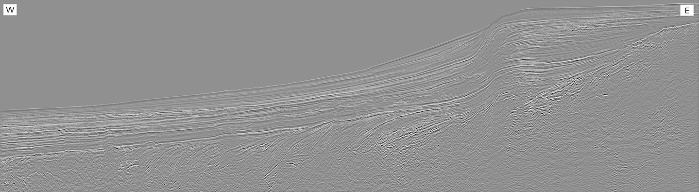
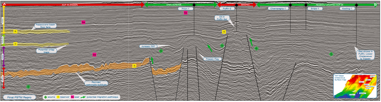
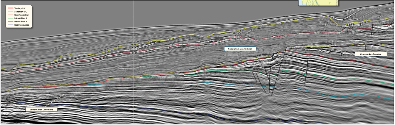
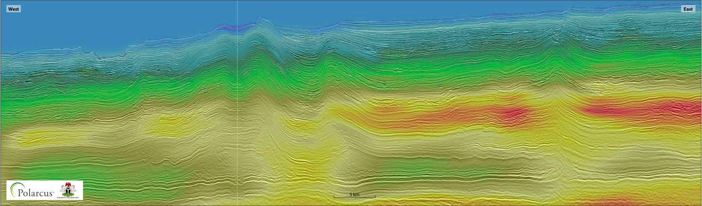
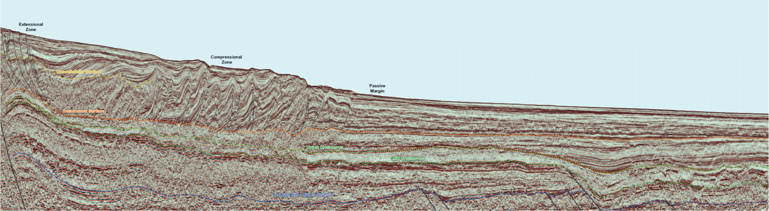
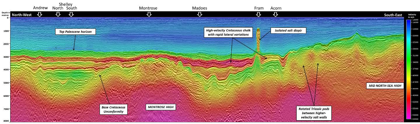
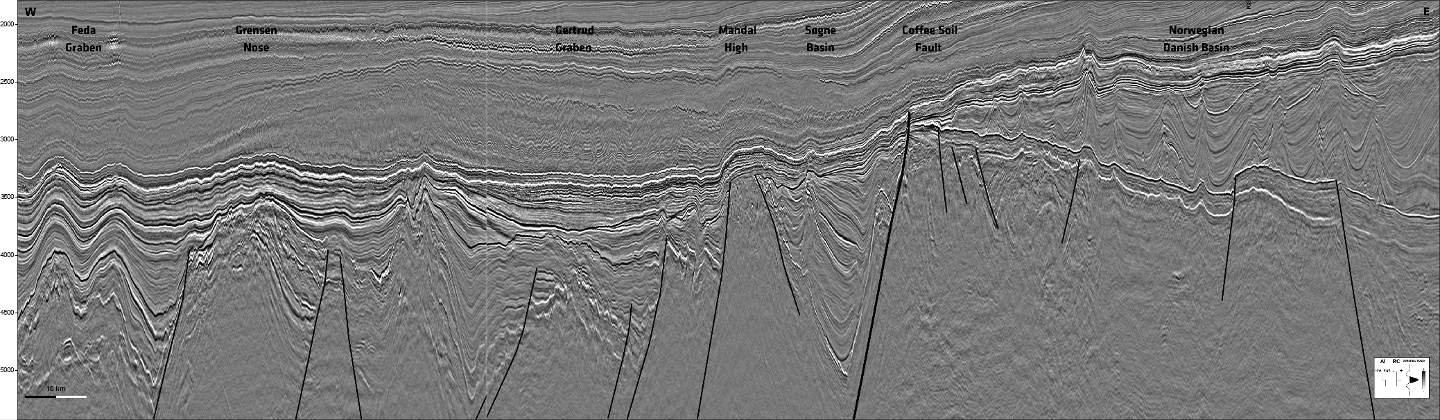
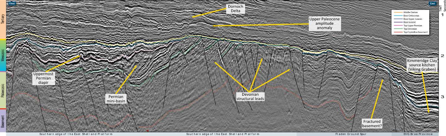
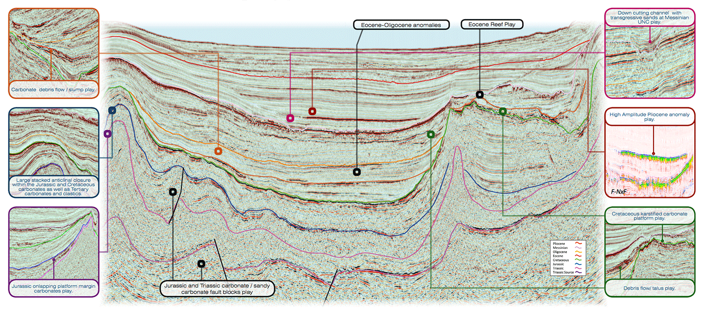
Olivier Galland, University of Oslo, and Caroline Sassier
Map showing the location of the new CGG multi- client survey. The annotated seismic line runs from south to north-east across the area. Cretaceous reservoirs in the Northern North Sea…
Robert Ruiz, Cyrille Reiser and Avril Burrell, PGS; Jean Afonso Colsoul and Naire Judith Ricardo Cahumba Quenge, ANPG
Location of the new PGS multisensor GeoStreamer survey over the Kwanza Shelf, Offshore Angola (orange polygon). The 2021 licence round blocks are shown in yellow. Kwanza shelf potential petroleum systems…
Nicolas Hand, Azzurra Cillari, Ian Edwards and David Jackson. Dolphin Geophysical Multi-Client New Ventures.
Location of main foldout line. Slope/Channel Complexes Offshore North West Africa Newly acquired and reprocessed seismic reveals potential masked by complex geometries. In 2011 TGS and Dolphin Geophysical acquired a…
Nicolas Hand and David Jackson, Dolphin Geophysical Multi-Client New Ventures
3D seismic and SHarp Broadband 2D from the UtStord and South Viking Graben areas of the UK-Norwegian North Sea show improved imaging throughout the entire geological section. In 2013 Dolphin…
Lauren Penn, Paolo Esestime and Karyna Rodriguez, Spectrum
Exciting opportunities and new play concepts The underexplored Foz do Amazonas Basin has huge potential, revealed through integrating seismic and CSEM data. The Foz do Amazonas Basin, the most northerly of…
Phillip Hargreaves, Neil Hodgson, Karyna Rodriguez and Ashleigh Hewitt (Spectrum)
3D seismic risk reduction for license round Phillip Hargreaves On Australia’s North West Shelf, acreage in shallow water multi-TCF neighborhoods is highly prized and competitively sought. To assess the value…
Nicolas Hand and David Jackson, Dolphin Geophysical Multi-Client New Ventures
Figure 1: An intra-Jurassic TWT surface over the 3D survey area with incised feeder valleys and karstified carbonate terrain. Downdip, there is an amplitude extraction highlighting the Late Cretaceous slope…
Constrained By Data Well and seismic data can be very sparse in frontier regions; however Getech’s extensive global gravity and magnetic database, the largest commercially available dataset of its kind,…
Hunting the carboniferous play New regional broadband 3D seismic data reveals more information about the geology of this poorly understood region. CGG recently undertook the acquisition of a large 3D…
Mike Saunders and Dan Negri (Spectrum); Christopher Ross (Cross Quantitative Interpretation); Scott Bowman (Petrodynamics)
Map showing the Sergipe Basin, the location of the Barra discovery well and seismic lines discussed in this article. (Source: Spectrum). AVO signatures help identify hydrocarbons In the relatively mature…
Bent Kjølhamar, Christopher Sæbø Serck , Camilla Broch Pedersen, Reidun Myklebust, TGS
The Hoop Basin The integration of several data sets will be essential for hydrocarbon exploration in the Hoop Fault Complex area of the Barents Sea. The Hoop Fault Complex has…
Tony Pedley, Polarcus and Gerrard Spear, Lyme Bay Consulting
Improved imaging and new insights A detailed reconnaissance study of Polarcus’s 3D multi-client data has revealed a complex shelf to basin sediment transport system feeding into classic deepwater West African…