Regional seismic lines indicate that the Pelotas Basin in Brazil contains the same play ingredients as the Orange Basin in Namibia where the Venus discovery was recently made.
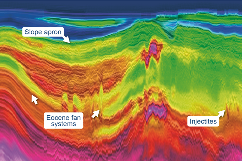
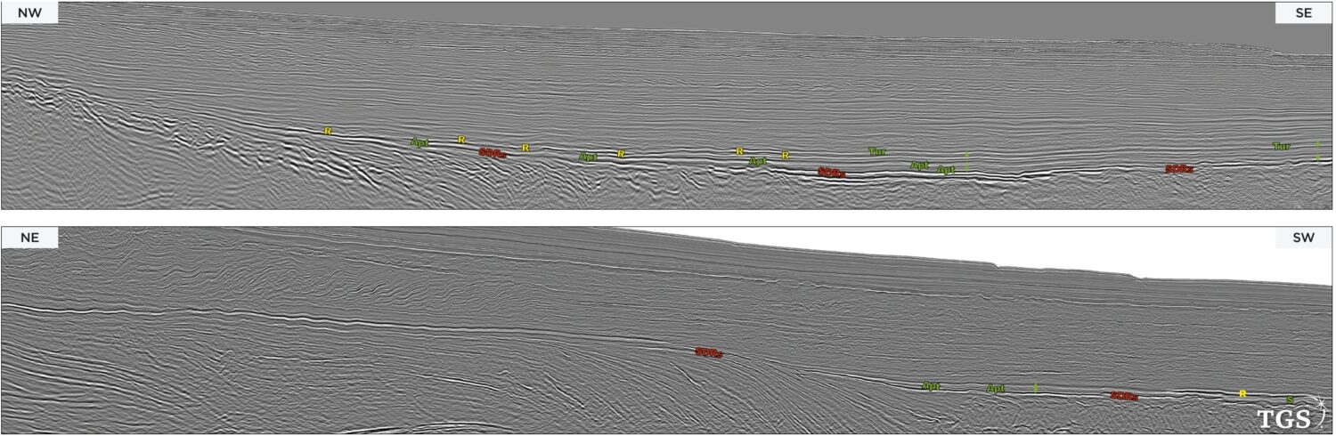
The Sudanese Red Sea is one of the world’s most exciting underexplored passive margins. Here, we show how legacy 2D seismic reveals a stunning array of super-giant syn-rift plays in…
Natural hydrogen and helium exploration is booming worldwide. The combined production of hydrogen, helium and carbon dioxide in the Earth’s subsurface provides alternative resources that could revolutionize the path to…
Felicia Winter, Anongporn Intawong and Paolo Esestime, TGS
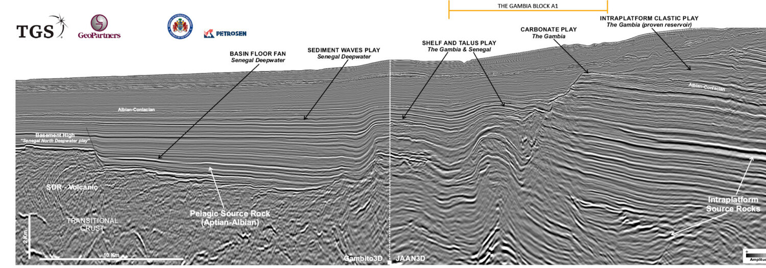
Credit: TGS, GeoPartners. Connecting the shelf to the deepwater A flurry of hydrocarbon exploration activity continues in The Gambia and Senegal, and it is fuelled by drilling successes. The Gambia,…
Will Bradbury, Alex Kurobasa and Bent Kjølhamar; TGS
Figure 3: Three seismic sections through TGS’s 3D data over the Acorn CCS site, the Northern Endurance CCS site and a 2D line from TGS’s CFI-NSR dataset over the Northern…
Karyna Rodriguez and Neil Hodgson, Geoscience Team; Searcher
Location of Searcher’s seismic datasets offshore Mexico with geological basins outlined and the location of major recent Talos and ENI discoveries. Offshore Mexico: extraordinary hydrocarbon play systems identified Improvements in…
Reidun Myklebust, Bent Kjølhamar and Aurélien van Welden, TGS
Seismic image from the Erlend Wild West survey showing two well paths: Tobermory gas discovery (left) and the Bunnehaven gas discovery (right) the latter penetrating Cretaceous sub-lava. Improved seismic imaging…
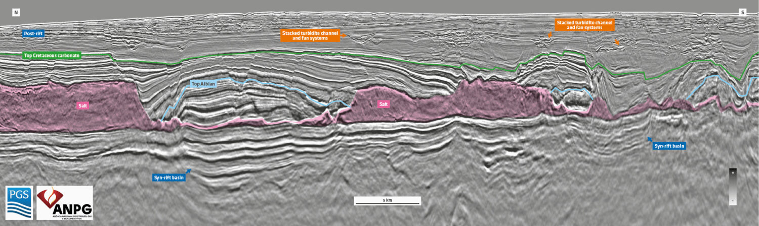
Georgina Katzaros and Avril Burrell, PGS; Jean Afonso Colsoul and Naire Judith Ricardo Cahumba Quengue, ANPG
Location of the new PGS 3D multisensor GeoStreamer survey over the Kwanza Shelf, offshore Angola. Unlocking prospectivity on the Kwanza shelf New broadband 3D seismic data shows that the evolution…
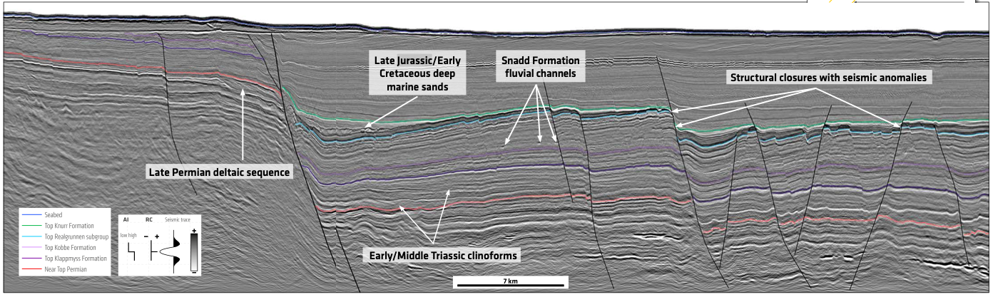
A novel solution tailored for the Barents Sea An unusual acquisition configuration resolves the challenges of the Barents Sea through an innovative combination of streamer setup and advanced imaging technologies. The…
Rune Sakariassen, Nicola O’Dowd and Sören Naumann, PGS
A Vast, Underexplored, Complex Geological Province Brand new, high resolution, 3D multicomponent seismic data from PGS has enhanced the geological understanding of one of the last remaining frontier basins in…