Interview with Tor Åkermoen – CEO Europe Geoex MCG DUG: Tell us a little bit about your seismic data? Tor: Well, Geoex MCG, along with our partners, recently acquired two…
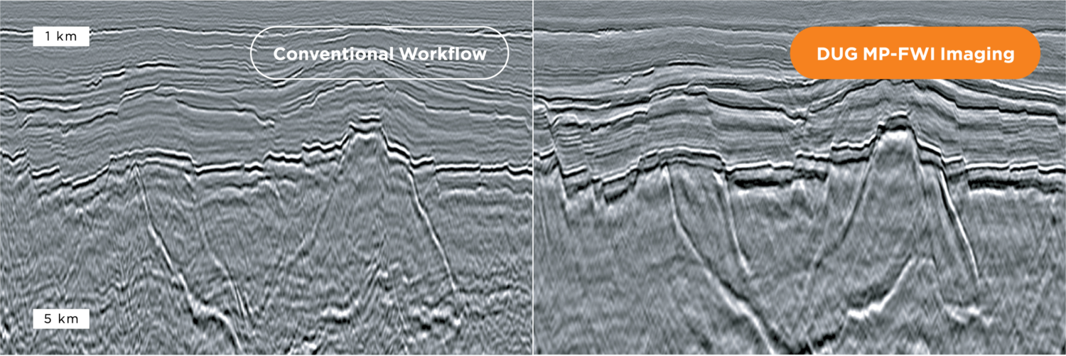
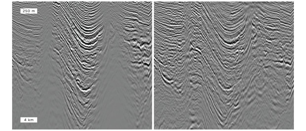
Resolving subtle structural and stratigraphic features in land seismic datasets is an arduous task for conventional processing and imaging workflows. In the examples above DUG MP-FWI Imaging has produced a…
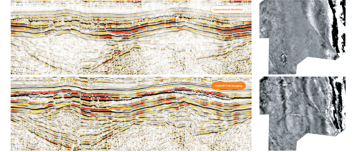
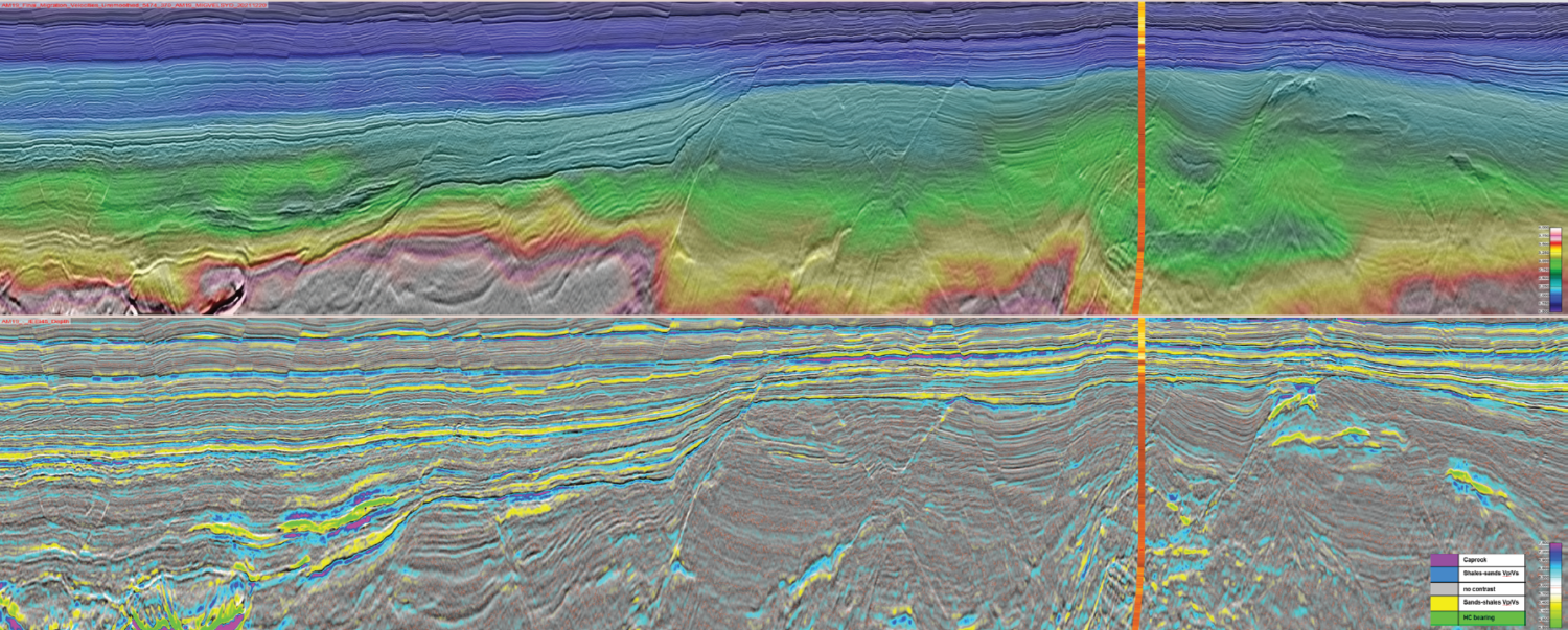
Shallow-water environments are notoriously challenging for conventional processing workflows due to the presence of strong, short-period multiples that obscure primary signal. Limitations in common multiple-prediction schemes often result in derived…
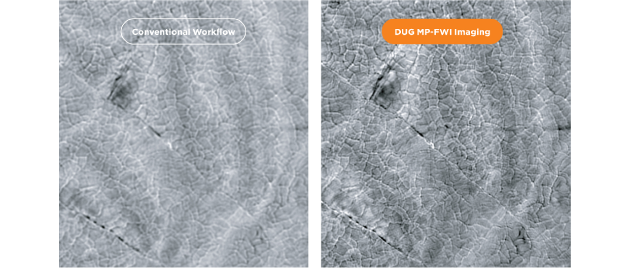
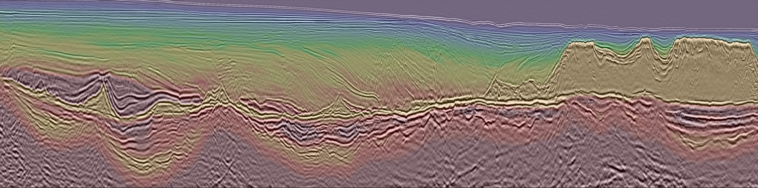
Resolving illumination issues caused by complex salt bodies has been a persistent geophysical challenge. DUG MP-FWI Imaging uses all parts of the scattered wavefield to reconstruct the reflectivity and kinematic…
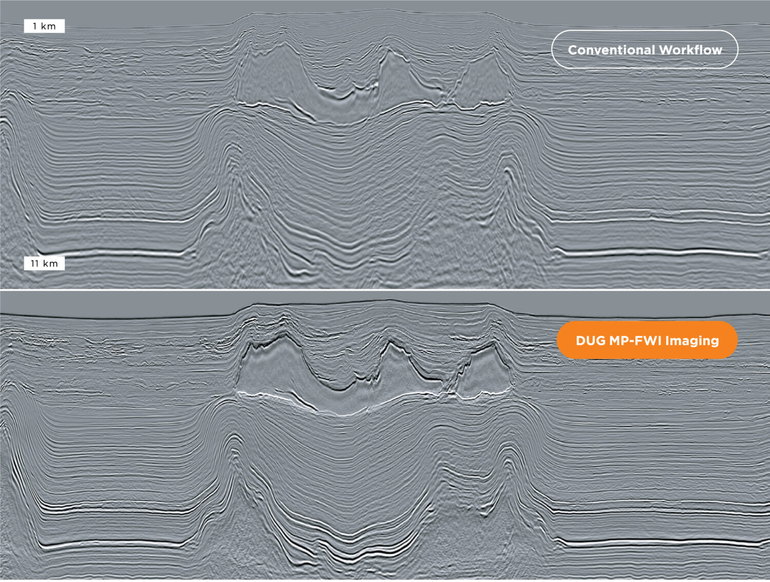
DUG MP-FWI Imaging is not just a solution for modern acquisition. It’s not just for high-density, full-azimuth, long-offset data. While modern acquisition has many benefits, significant uplift can still be…
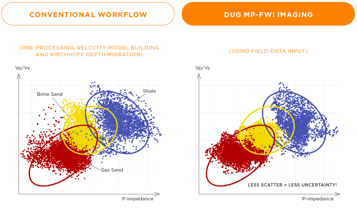
Quantitative interpretation requires true amplitudes and high signal-to-noise ratio. DUG MP-FWI Imaging delivers superior pre-stack reflectivity outputs for both AVA analysis, and, elastic rock property and fluid prediction—directly from field…
The Katalyst advantage With over 25 years of expertise and the management of over 100 Petabytes of information, we are your trusted partner for streamlining your data management processes and…
Adriana Citlali Ramirez, Simon Baldock and Stuart Fairhead, TGS
Map of Offshore Liberia with project location in orange. Figure 2: a) Tomography and 15Hz DM FWI (refraction) velocity model; b) Additional higher frequency DM FWI run up to 40Hz…
Bent Kjølhamar, Adriana Citali Ramírez and Reidun Myklebust, TGS
Gas to Europe: Refocusing exploration efforts in the Atlantic Margins According to the World Economic Forum, Europe has enough gas for the first quarter of 2023. However, there is no…
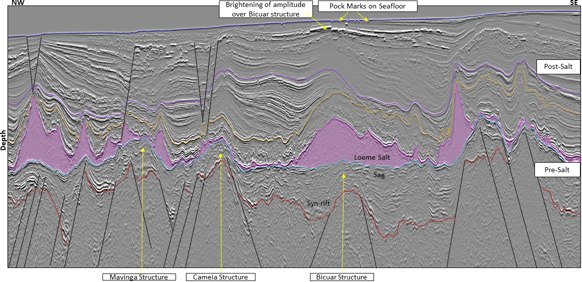
Coloured Pre-Salt Isopach Map relating mature Lagoa Feia source rock presence with Base of Salt structure contours displaying the fetch and hydrocarbon migration pathways to the pre-salt lead. Interpreted seismic…
Kwanza Basin – a pre-salt success story? Historically, exploration activity has focused on the prolific Lower Congo Basin in Northern Angola, concentrating on the post-salt Upper Cretaceous and Tertiary reservoirs.…
Spectral decomposition methods are widely used to highlight geological features according to their frequency content. However, the frequencies characterising the targeted event might vary spatially, which complicates their extraction as…