Exploitation of onshore shale gas resources in North America has, in the past few years, reversed a decline in domestic natural gas production and helped reduce gas prices. This has driven a surge in the evaluation of similar resources in other countries such as the UK to determine if the North American success can be replicated.
The most extensive shale gas play in the UK is in the Carboniferous Bowland-Hodder unit that is located, at prospective depths, across Northern England in a strip stretching from the Lancashire coast in the west to the Yorkshire coast in the east. In 2010, the UK Department of Energy and Climate Change (DECC) commissioned the British Geological Survey (BGS) to evaluate the potential of the Upper Bowland Shale. The study used simple basin-sized analogies to evaluate the yield at from about 2.1 to 4.7 Tcf of gas.
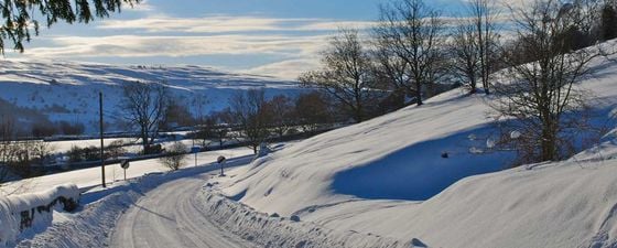
There are many technical and social challenges ahead for the exploitation of shale gas in the UK, much of which is located in environmentally sensitive areas of Northern England. (Source: Paul Wood)
The fracking ban has now been lifted provided operators can demonstrate that they have the proper controls and seismic monitoring in place. (Source: Paul Wood)
The UK government also announced incentives for communities near boreholes where fracking takes place. (Source: Paul Wood)
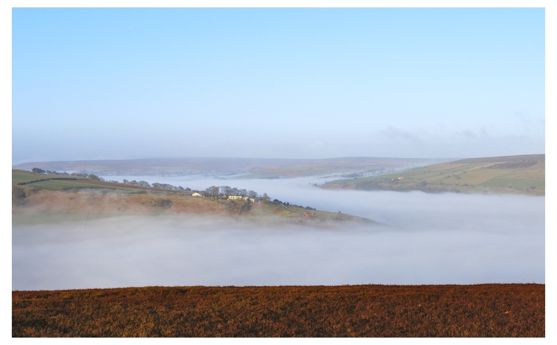
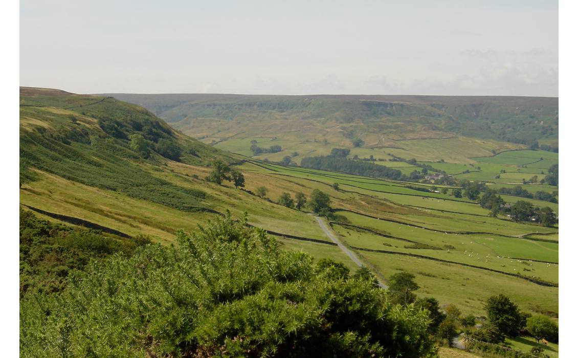
Valley in the mist. North Yorkshire (Source: Paul Wood)
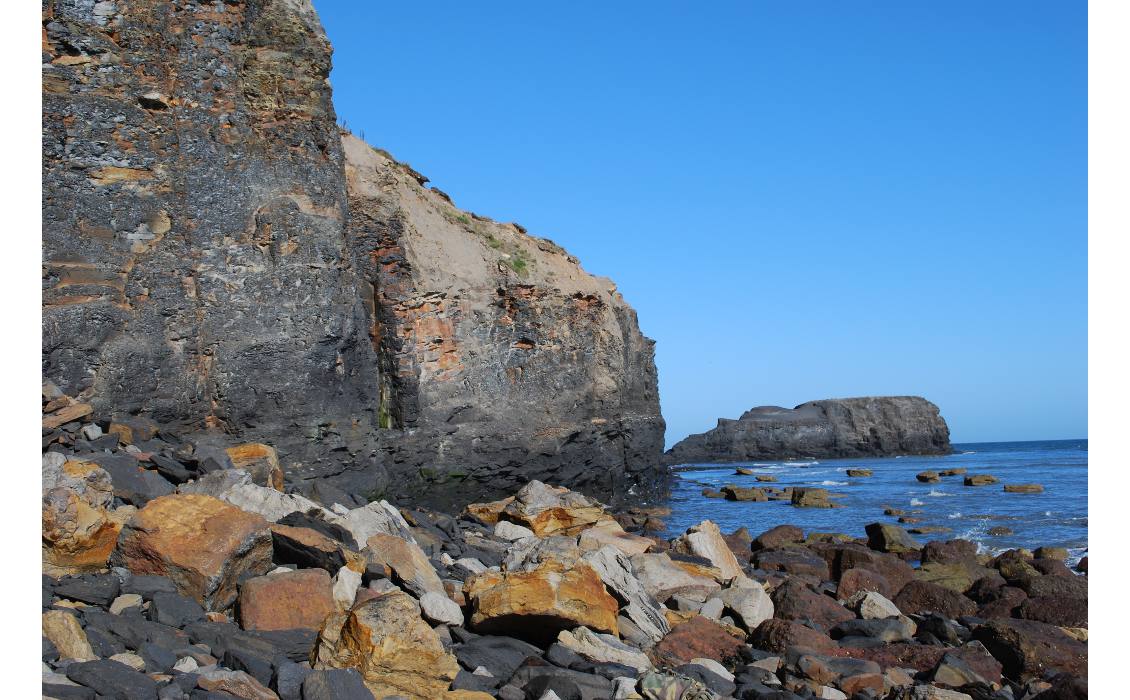
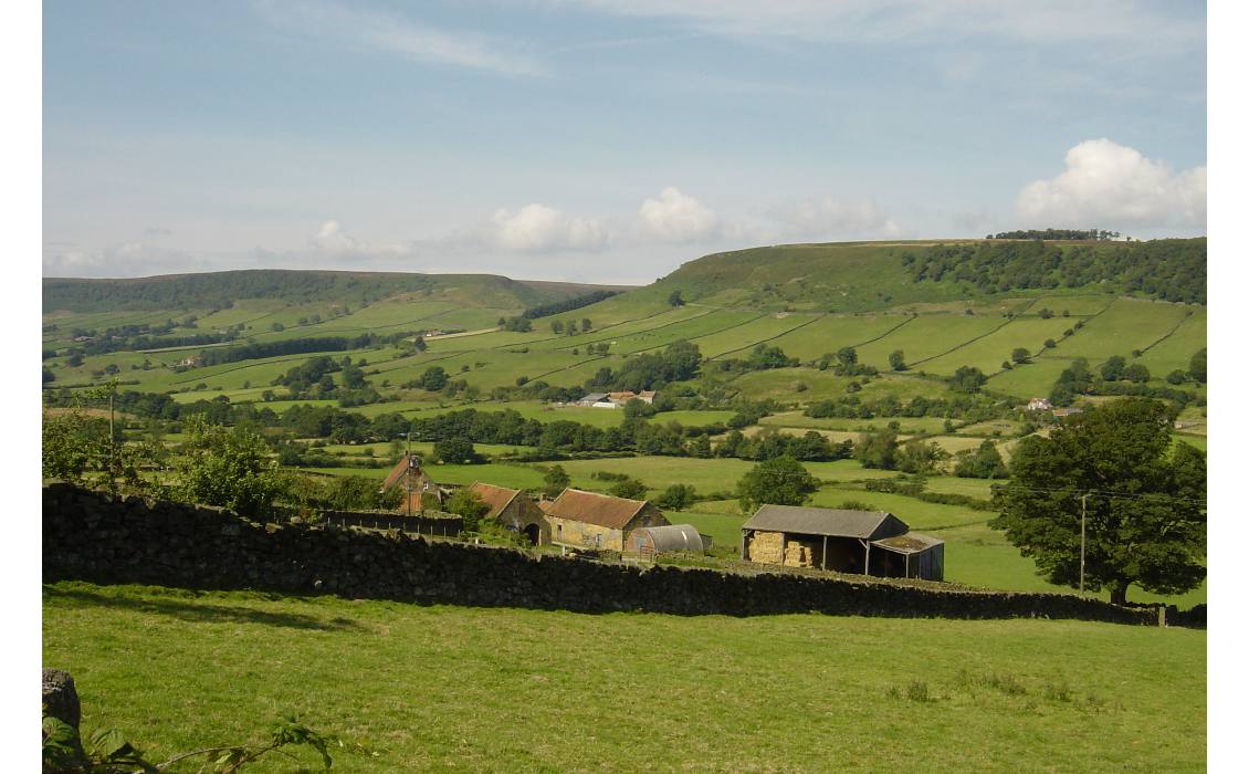
Shale outcrops on the coast of North Yorkshire (Source: Paul Wood)
In 2011, the UK company Cuadrilla Resources, a specialist in exploitation of unconventional hydrocarbons, started hydraulic fracturing (fracking) tests at a site near Blackpool on the Lancashire coast. The tests were suspended when they were shown to have induced minor earthquakes and a ban on fracking was imposed. In 2012, DECC/BGS started on a more detailed resource estimate for the Bowland-Hodder unit, using all available data including outcrops, boreholes and seismic data. The results were published in a report issued in July 2013 and are available online.
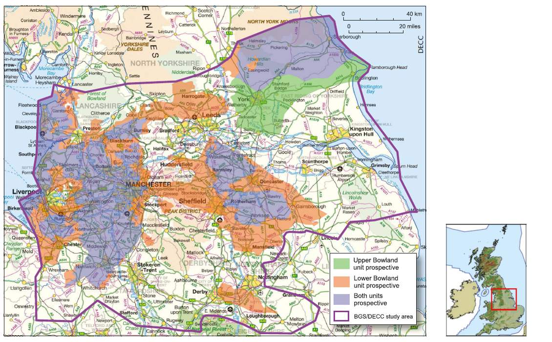
Summary of areas prospective for gas in the upper and lower parts of the Bowland-Hodder unit in relation to urban areas of central Britain. (Source: DECC/BGS)
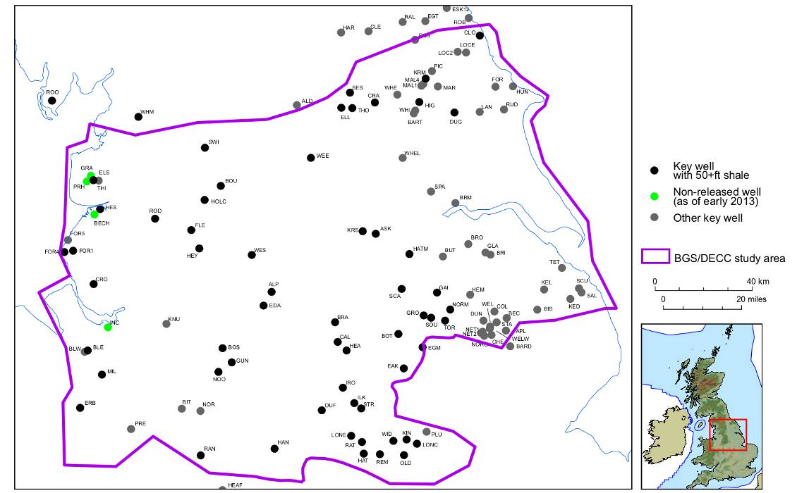
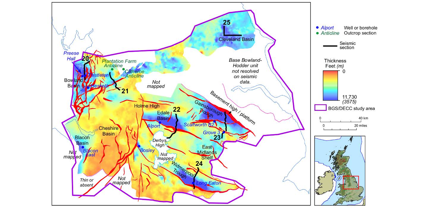
KEY WELLS – Locations of wells used in the DECC study. See Appendix C of DECC report for well names. (Source: DECC/BGS)
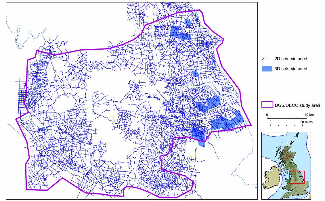
SEISMIC – Location of seismic data used in the study. Most seismic lines are available on the UKOGL website. (Source: DECC/BGS)
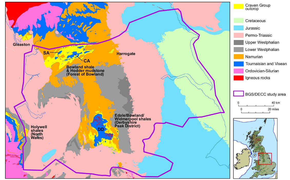
CRAVEN GROUP – The five main Craven Group outcrops in central Derbyshire. (Source: DECC/BGS)
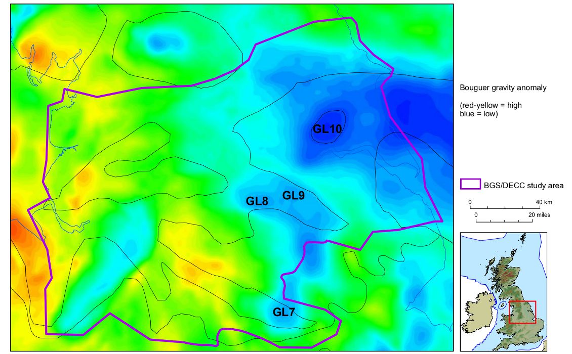
GRAVITY – Bouguer gravity anomaly map for Central Britain. GL indicates numbered gravity lows. (Source: DECC/BGS)
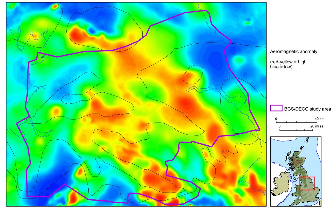
MAGNETIC – Magnetic anomaly map for Central Britain. Early Carboniferous structural framework is indicated by black lines. (Source: DECC/BGS)
The new study has split the Bowland-Hodder into two separate intervals – the upper and lower units. The upper unit is up to a few hundred metres thick and reasonably well constrained in terms of borehole penetrations, core samples and seismic definition. The lower unit is up to thousands of metres thick but much less explored with few well penetrations and, in general, poor seismic resolution.
DECC calculated the total volume of potentially productive shale using a 3D geological model generated by integrating seismic mapping with outcrop, deep borehole and other information. The volume was truncated upwards at 5,000 ft (1,500m) below land surface, based on US analogues or the depth where the shale is mature for gas generation. The volume was one of the input parameters into a Monte-Carlo simulation of the in-place gas resource.
 ThistletonPendle LineEdaleLong EatonGainsboroughE. Irish Sea to Cheshire Basin SectionDerbyshire High to Gainsborough Trough SectionCleveland Basin Section
DECC used a wide variety of criteria that in its estimate define a shale gas play, including TOC (total organic matter content), gamma-ray values, kerogen type, mineralogy, thermal maturity, pressure regime, tectonics and burial history. In many cases data were sparse or not available and analogue data (for example from the US) were used. Seismic data were taken from the UK Onshore Geophysical Library.
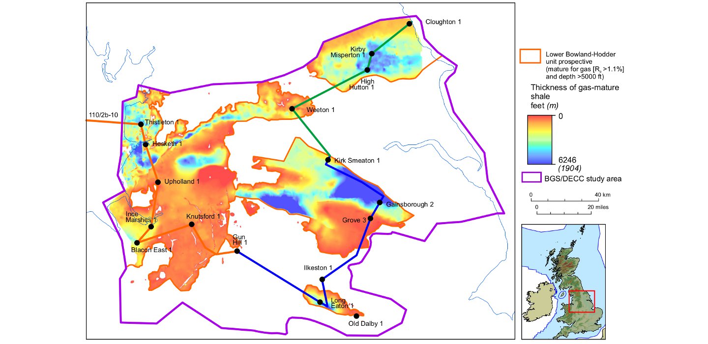
Thickness and distribution of shales of the lower Bowland-Hodder unit that are within the gas window and at a depth greater than 5000 ft. Coloured lines shown relate to sections on map above. (Source: DECC/BGS)
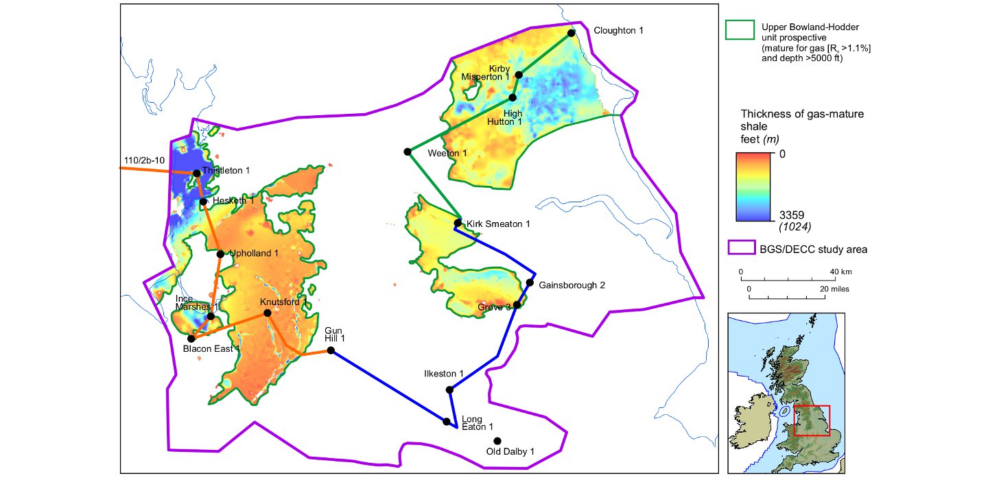
Thickness and distribution of shales of the upper Bowland-Hodder unit that are within the gas window and at a depth greater than 5000 ft. Coloured lines shown relate to sections on map above. (Source: DECC/BGS)
Challenges Ahead
The report states the resource estimate of the upper unit as a P50 (50% probability) of 264 Tcf (7.5 Tcm) and, for the lower unit, a P50 of 1,065 Tcf (30.2 Tcm) total gas in place (GIP). Because of the uncertainties, in particular for the higher risk and poorly defined deeper unit, there is a wide range in the estimate, with the P90-P50-P10 for the whole of the Bowland-Hodder unit stated as 822-1329-2281Tcf (23.3-37.6-64.6 Tcm).
The report notes that this GIP estimate is very large when compared with the Ultimate Recovery (UR) of the total offshore UK gas, which currently has a P50 of about 100 Tcf. The Bowland-Hodder play is much more complex than US analogues as it is broken up over several basins and troughs and has experienced significant tectonic activity. Because of the geological uncertainties, lack of knowledge about producibility and the significant social and environmental concerns in the UK of shale gas production, the report has not attempted to state an estimate of recoverable volumes.
The DECC report contains a comprehensive description of the methodology used to arrive at the estimates. Data and figures are reproduced here under the Open Government Licence V2.0.
The fracking ban has now been lifted provided operators can demonstrate that they have the proper controls and seismic monitoring in place. The UK government also announced, coincident with the DECC report, incentives for communities near boreholes where fracking takes place. Cuadrilla with partners Centrica have now announced plans to restart their evaluation of the Bowland-Hodder play.
DECC and the BGS are now evaluating the shale gas and oil shale potential of the Jurassic Weald Basin along the south coast of England. There has not been an onshore hydrocarbon licence round in the UK since 2008, but the 14th round is now expected in 2014. The DECC website also contains many documents about the environmental and legislative framework that will apply to shale gas exploration and production.
Press reports have appeared that imply that shale gas could provide enough gas for the UK for the next 40 years. But clearly it is too early to make such estimates – very little is known of the play and there are many technical and social challenges ahead.


