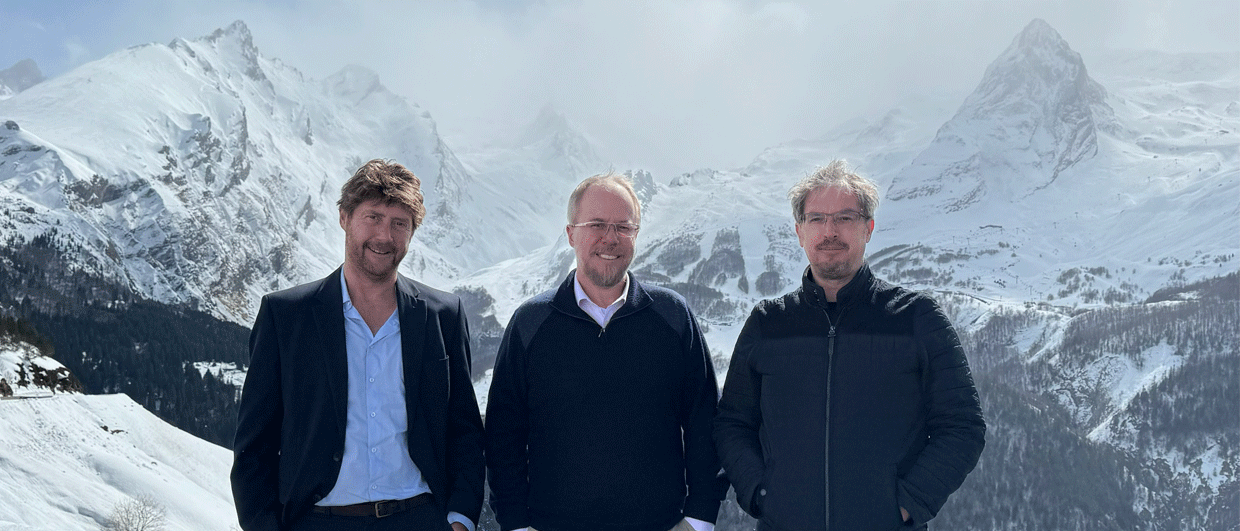
Tim Debacker, Jon Teasdale, and Phil Henley in the Pyrenees in 2024. Photo: Geognostics.
The basement tapes
A conversation with Phil Henley and Tim Debacker on SEEBASE and the origin of Geognostics
“You’re the only company that tells us where their model could be wrong.” It is an observation that Phil and Tim have had from clients when presenting the latest version of their Global SEEBASE® basement model.
“We are open about the uncertainties inherent in our work,” says Phil, Managing Director of Geognostics. “As we continue to integrate new research, literature, and the variety of data used in the interpretation, it can be a bit like detective work, but new data or insights are always opportunities to improve the interpretation.”
The fundamentals
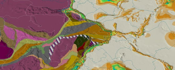
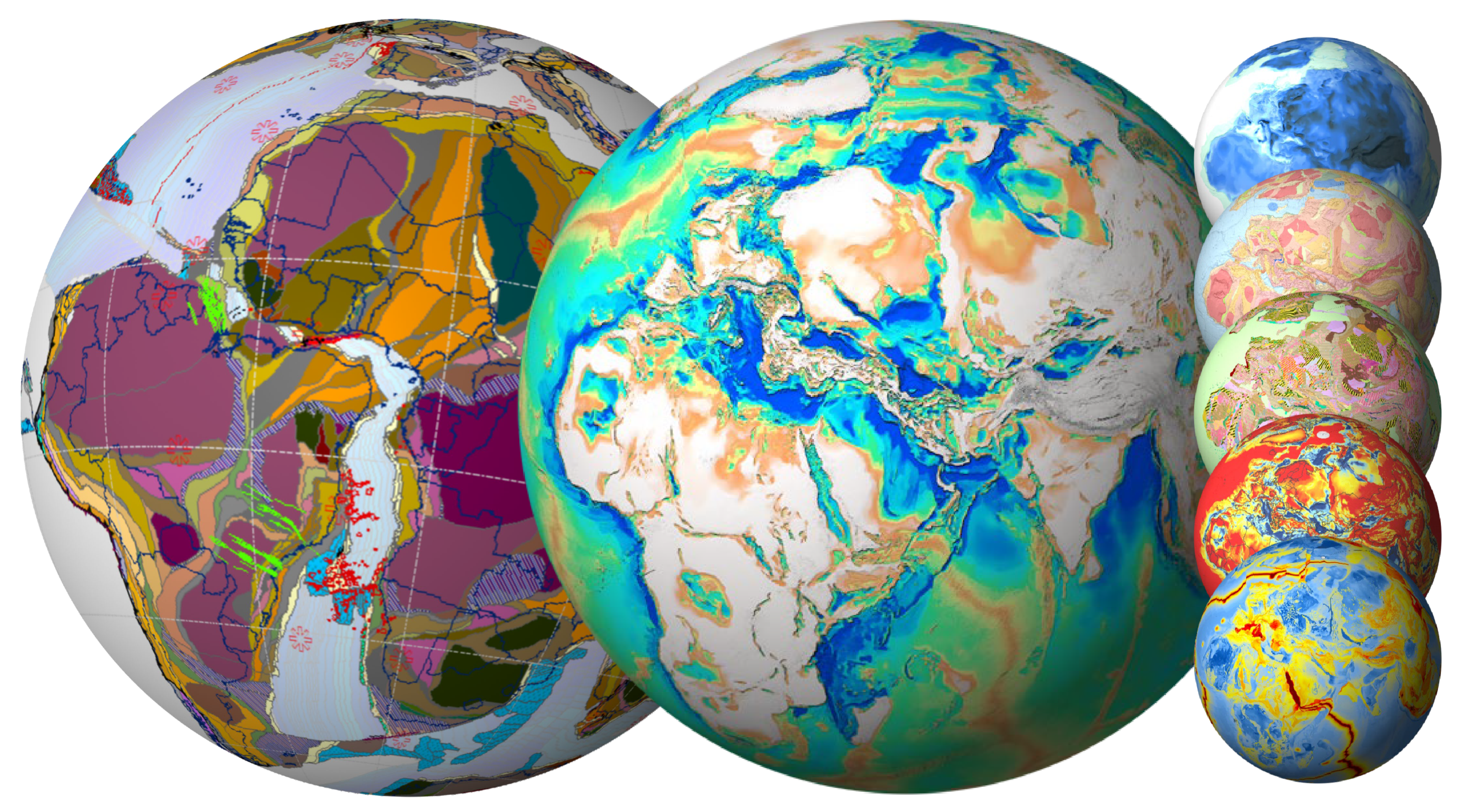
Geognostics is a small team, distributed around the globe, and focused on exploration through a bottom-up approach that starts with characterising basement. They do this for the industry through detailed plate reconstructions in the Geognostics Earth Model (GEM), the high-resolution Global SEEBASE® basement model, and tailored proprietary studies. SEEBASE also provides fundamental regional datasets used by governments, such as the long-running OZ SEEBASE project and the Central Europe SEEBASE funded by OMV.
“Basement is not this homogenous grey zone at the bottom of a seismic section,” says Tim. Tim is Geognostics’ principal geoscientist and brings more than 20 yrs of experience working as a structural geologist. “It is highly heterogeneous in terms of composition and rheology, and it is the response of this heterogeneous basement to tectonic activity that controls sedimentation, erosion, basin formation and preservation.”
Geognostics specialise in understanding regional tectonics, interpreting basement architecture, and determining its influence on basin formation and heat flow. It requires piecing together clues from the integration of structural geology, potential field data interpretation, seismic interpretation, and an array of other datasets.
The geological interpretation of potential field data in the form of gravity and magnetics is key to a regional characterisation of basement, as it allows the interpreter to move away from geological observation points such as outcrop, well and seismic data. But this requires a thorough understanding of the geological history and processes in any given area.
For instance, the team is currently working on an update for the South Atlantic, where seaward-dipping reflectors (SDRs) frequently occur. “However, SDR interpretations are not always consistent,” Tim says. “Interpretation of SDRs in literature can vary considerably, but, with our regional bottom-up approach, in which we have to map top basement in the presence of SDRs, we can see when, for example, SDRs have been mislabelled as volcanic basement or have been misidentified within basement rocks when they are in fact post-rift lava flows.”
Later in 2026, Geognostics will move on to SE Asia where they will have to tackle a complex plate-tectonic puzzle and map heterogenous basement that contains a large number of intrusive bodies, within an area rich in carbonates. “Think of solving a plate tectonic puzzle, but first having to define the puzzle pieces, which in SE Asia can be difficult because of the strong influence of carbonates and magmatic bodies on the potential field data,” says Tim.
These ongoing updates build on nearly two decades of work on SEEBASE by the company Frogtech, before Geognostics came into play. What is the story behind that?
Going back in time
“Seebase has been continually developed over many years, by many great people, but I would really like to mention Henri Tykoezinski at this point,” Phil says.
We need to go back a while to understand why. In 2004, Frogtech formed an Australia-based company that pioneered SEEBASE and brought together the team that is now Geognostics. That group of people originally included Jon Teasdale, who then moved to Shell for a decade, working as a global geological consultant.
Jon and Henri had been close friends since working together for Shell in Aberdeen. In 2017, Jon left Shell to form Geognostics with Henri and develop GEM, the Geognostics Earth Model. A couple of years later, in a London pub, Jon mentioned to Henri that Frogtech had entered Administration and the IP had been put up for sale. “It was totally out of the blue for us, but Henri decided to purchase the IP, and that is how all that work, by so many people, lived on. It would have been a huge shame for such a unique body of work to disappear,” says Phil.
Phil had met Henri only very briefly during the PETEX Conference in 2018. “It was one of those critical conversations you only realise the value of when looking back,” he says. “Unfortunately, Henri is no longer with us, but everyone still working with SEEBASE owes him a debt of gratitude – particularly us.”
There is more to basement
The Geognostics team has steadily expanded the product beyond the initial release focused on SEEBASE depth to basement; something initially made possible by the long hours of COVID. The product now includes interpretation of depth to Moho, basement terranes, and the dominant composition of the basement.
Last year, a predictive basement-focused heat flow grid was introduced, SEEBASE Geothermal, which leverages the SEEBASE model to predict heat flow where data is sparse. “It is a heat flow model utilising our crustal model – and a product that only we could do on the back of SEEBASE,” explains Tim. “But instead of starting with the heat flow data, we have developed a bottom-up conductive model, generated entirely from our geological SEEBASE model, and used the heat flow data to assess the outputs. This process either validates the results or pushes us to question our model and improve our understanding of the geological setting.”
Again, finding a discrepancy between the data and the model results is seen as an opportunity rather than a problem. “Obviously, as it is a conductive model, zones of convection will stand out. But also, areas with very thick salt deposits or areas with radiogenic shales can be recognised from the mismatches. This is actually good news,” says Tim, “as that tells you something the heat flow data on their own could never do. Once we understand the reasons, we can correct for them, and the model continues to improve.”
With future development supported by a client base including both conventional and emerging energy sectors, and increasing interest from governments looking to replicate the Australian success of OZ SEEBASE, the Geognostics team is excited to see SEEBASE is becoming a default basemap for exploration and natural resource management.