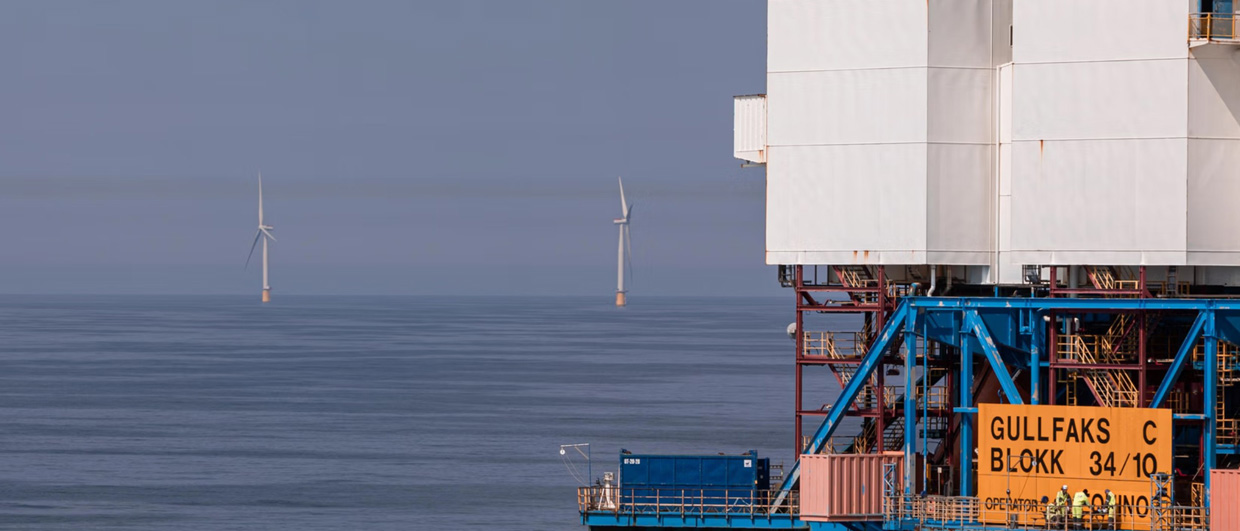
Photo: www.equinor.com.
How can we monitor North Sea carbon stores under wind farms and production platforms?
The UK North Sea is now a multi-energy basin, with carbon capture and storage (CCS), offshore wind, and oil and gas facilities increasingly competing for geographical and seafloor space
Repeat time-lapse seismic surveys can track CO2 plume migration, but where the seabed is obstructed by wind turbines or oil and gas platforms, access by vessels towing long multi-streamer arrays is impractical.
Research in the Centre for Energy Transition, part of the University of Aberdeen’s Interdisciplinary Institute, has sought solutions allowing wind and carbon storage projects to co-exist. Sponsored by The Crown Estate (TCE) and Crown Estate Scotland (CES), Project Colocate focused on areas of potential cross-sector overlap in the Outer Moray Firth (OMF) and East Irish Sea (EIS), reviewing the operational and depth limitations of alternative monitoring technologies and the adaptation of Measurement, Monitoring and Verification (MMV) plans to specific store characteristics.
For example, gravity monitoring may offer partial assurance in an area of wind farm and CCS overlap at Morecambe Net Zero (EIS; Sherwood Sandstone reservoir, 700-1,100 m), but exponential decay of signals with depth sees gravity as unsuitable for the deeper Cretaceous Captain and Cenozoic Mey sandstone reservoirs at 2,200-2,500 m in the Acorn and East Mey stores of the OMF. Similarly, microseismic surveys may identify and locate seal failures but cannot adequately image CO2 migration in typical reservoirs.
Amongst alternative seismic methods, single-source (‘spot’) seismic has allowed point calibrations for the Southern North Sea Poseidon project, but recent modelling at Acorn shows that aquifer displacement following CO2 injection should be imageable across the wider store, with repeat time-lapse 3D (4D) seismic coverage therefore preferred.
Smaller vessels towing short streamers are more manoeuvrable but offer limited imaging below 1 km, while access to windfarms may still present collision risks. High-density Ocean Bottom Node (OBN) seismic is expensive, and sparse OBN lacks the short offsets needed for accurate shallow velocity fields. Promising tests of fibre-optic seafloor arrays (DAS, Distributed Acoustic Sensing) at Norway’s Johan Sverdrup oilfield, now support future application to MMV, but the technology is as yet immature.
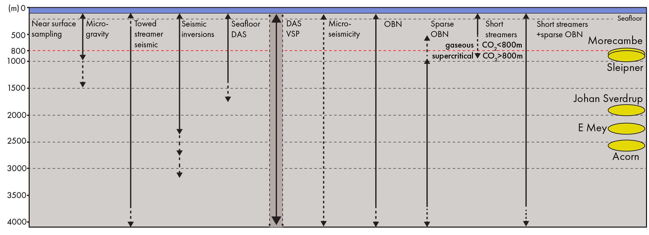
Adapting workflows tested by Equinor at Sleipner in Norway, our study proposes a hybrid solution with short streamer seismic acquired prior to construction, complemented by initial baseline and later time-lapse sparse OBN.
Processing these datasets together through Full Waveform Inversion captures both long and short offsets. Re-using the short streamer data assures shallow velocities, with reservoir fluid changes at depth then imaged via merged repeat sparse OBN, which can be acquired with obstructions in place.
Project Colocate highlights the technical and commercial compromises arising from the co-location of CCS with offshore wind and oil and gas, concluding that coordinated multi-sector licensing should avoid creating new co-location scenarios wherever possible. Nevertheless, a bespoke and hybrid MMV approach, combining short streamer data with time-lapse sparse OBN, may offer a solution for carbon stores where wind farms or other obstructions are already built or planned.