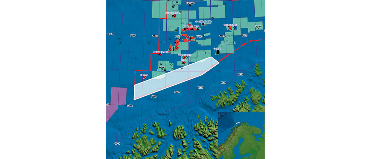
The new multiclient survey lies close to a number of recent discoveries. Source: Searcher Seismic.
New Barents Sea survey
One of the hottest areas in north-west Europe at the moment is the Barents Sea, where a number of major discoveries have been made in recent years, including the giant Skrugard and Havis finds, which have estimated combined reserves of between 400 and 600 MMbo. With annual licensing rounds and increasing infrastructure in the region, the need for additional information about the area is always strong, with industry demand for acreage in the Barents Sea at an all-time high.
Searcher Seismic, in partnership with Dolphin Geophysical, have recently announced that they are about to undertake a non-exclusive 3D high resolution survey, which will cover 2,880 km2 of the Troms area in the southern Barents Sea, about 100 km from the coast. This acreage recently opened for exploration and is located immediately adjacent to proven oil and gas fields. Interpretation suggests that the survey, which is known as Rødspurv, covers an area which is thought to be charged from the north by the Mesozoic rocks located down dip of the Troms-Finnmark fault complex, with potential reservoirs being Permian and Carboniferous clastics.


