Leveraging Complex Geologies
The ability of reservoir models to leverage seismic and accommodate complex geologies ensures robust and reliable models, improved decision-making, more justifiable investments, and improved field performance.
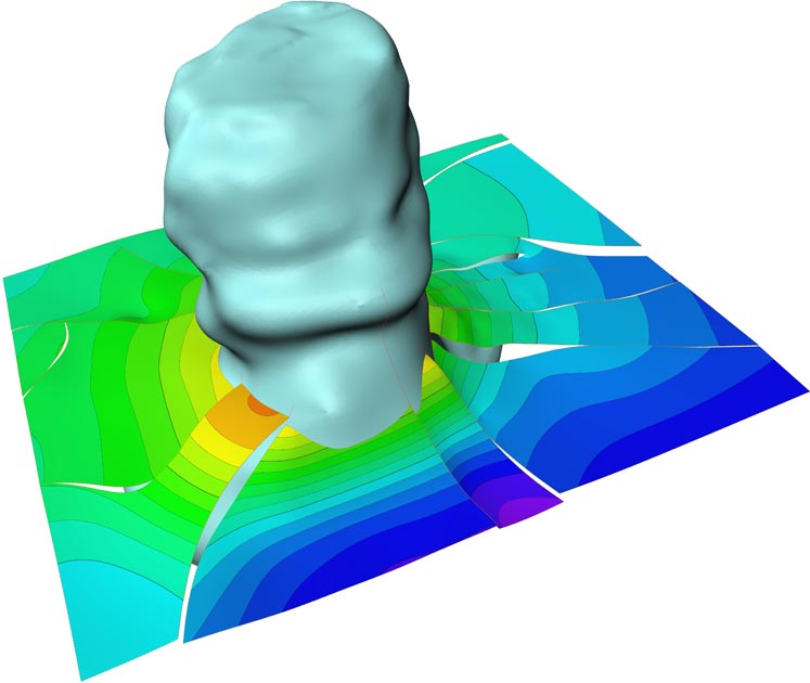
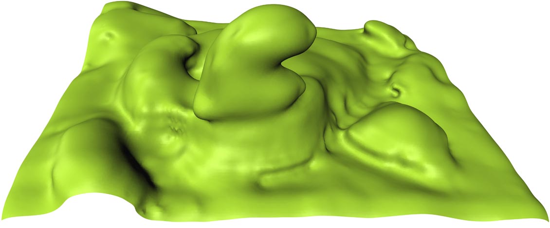
Including the building of intrusion objects in structural modelling helps better model salt. Source: Emerson
The last few years have seen 3D reservoir modelling become the standard platform for the mapping, understanding and predicting of oil and gas reservoir behaviour.
As reserves continue to dwindle, however, and as operators are faced with deeper and more complex geological settings, it has become increasingly clear that any reservoir models that oversimplify the obvious geological complexities are not going to deliver the vital information operators require. The result will be reduced field productivity and even, in the worst case scenario, misplaced wells.
Recent developments in 3D reservoir modelling, however, are ensuring that this oversimplification does not occur, by absorbing and interpreting ever more complex geologies into the models.
Property Modelling
The better you can incorporate seismic and reservoir heterogeneities into your reservoir models and extend the depth of your static modelling, the more accurate and realistic your reservoir models are likely to be.
Integrating seismic data, however, can be a challenge. Take property modelling, for example – an area where seismic data can be combined with other data, such as well data, to generate accurate and well constrained reservoir models. In these cases, the resolution of the seismic is often too coarse to resolve the true geometries, scale can be a challenge, and uncertainty in depth can make it difficult to represent wells correctly. There is a need to integrate seismic more tightly into reservoir models.
A new object-based, facies modelling tool, recently developed by Emerson, combines data extracted from seismic with geostatistical tools, such as guide lines and trends, to generate well-constrained sedimentary bodies. This ability to access both deterministic and statistical techniques gives the modeller access to the grey area between seismic resolution and data-constrained statistical modelling. The net result is a realistic property model conditioned to well observations and with accurate volume calculations.
Another Emerson property modelling device is a multi-point statistics tool, which uses a pixel based (grid cell by grid cell) approach for building stochastic facies realizations. This allows the user to condition 3D training images of the interpreted heterogeneities in the reservoir, in addition to wells and seismic.
The Case of 4D Seismic
It is not just 3D seismic which is being incorporated into reservoir models. To date, 4D data has been primarily used in enhanced oil recovery programmes, but the expansion of reservoir modelling’s seismic functionality has enabled 4D seismic data to be incorporated into the reservoir model, alongside existing data types such as geological, geophysical and simulation data. This has been achieved by combining observed and synthetic 3D and 4D seismic data with elastic parameters, where the synthetic seismic generated from the simulation model is compared to already observed seismic. This forward modelling of seismic is often referred to as petro-elastic modelling.
The new solution enables the analysis of observed and synthetic seismic attributes, the extraction of 4D geobodies, and the management of 4D vintages to identify production effects and obtain key information on the state of the reservoir. The differences between observed and synthetic elastic parameters are then used as input for improving geological and simulation models and production forecasts.
Incorporating 4D seismic into the reservoir model improves the quality of interpretations, structural and property models, simulation models, and well plans. It can also be the basis for a more quantitative use of 4D seismic data, especially towards history matching with both production data and 4D data.
Tackling Complex Structures: Sub-Salt
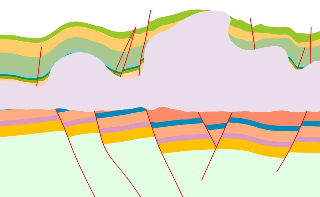
As well as incorporating 3D and 4D seismic into the reservoir modelling workflow, reservoir modelling is today playing an important role in addressing complex geological structures, such as pre-salt.
Pre-salt sequences come with significant challenges, as a result of being under two kilometres of salt and often at depths from sea surface of up to seven kilometres. Reservoir modelling is supporting reservoir management systems in both locating and extracting the oil.
One of the key benefits of building a 3D reservoir model in these geologies is the ability to have the entire geological section in one model from target to surface, tying all the elements of the structure together – vital to the model when looking at migration, trapping, pressure regimes, compartmentalisation and ultimately predicting reservoir presence.
The top surface of a salt wall and diaper with over-hangs – a geological feature commonplace in sub-salt exploration. The section shows the deformed post or supra-salt section (in green) and the deformed salt body (grey) sitting on the rifted and eroded pre-salt section (pink and blue). Through reservoir modelling, a complex model can be handled as a single entity. Source: Emerson
Another geological challenge occurs when we observe the top surface of a salt wall and diaper with over-hangs – a geological feature commonplace in sub-salt exploration. The accurate handling of this through the reservoir model – not just of the shape of the salt but also the shape of the sediments as they intersect the salt structures – is essential to future reservoir management decision-making in extracting the oil in place.
While the major lineaments may be well-defined in pre-salt, the details of where the reservoirs are and how they communicate with each other are often controlled by second order faulting. This requires accurate model building to capture fault linkages and complex fault populations. Whereas previously such geometries could only be modelled with specialist tools, today they are part of the general reservoir modelling workflow. This ensures that complex features, such as complicated fault inter-relationships and overturned beds, are not simply ignored in an attempt to simplify the model.
Populating the model with appropriate reservoir properties is another challenge in pre-salt. However, using structurally constrained grids, the combination of sampling of seismic into the geological grids, geostatistical facies modelling tools and geological QC tools, a realistic, if rather uncertain, facies models for the fields can be produced.
Further down the line, the ability to test multiple model variants of both facies models and fracture models against the accumulating production history and the increasing amount of available well data will allow the uncertainty levels in the models to decrease and subsequent confidence in our understanding of the petroleum system to increase.
Uncertainty Management
It is this focus on uncertainty management in reservoir modelling that is central to helping to better model complex geologies and petroleum systems.
Uncertainties in depth conversion, structural modelling, geological property modelling and dynamic reservoir simulation all need to be simultaneously evaluated, ensuring that the full impact of these often independent uncertainties is captured through realistic 3D static and dynamic reservoir models.
Today, integrated reservoir modelling systems are providing geoscientists with the possibility of identifying and quantifying uncertainties in their models (static and dynamic) and creating multiple realisations where the uncertainties are taken into account. The result is a better quantification of the uncertainties than the standard spreadsheet approach based on Monte Carlo simulation. Reservoir modelling is not only able to quantify this uncertainty and identify what factors affected the uncertainty in volumes, but can also generate maps and grids that illustrate the areas of structures that have the highest uncertainty.
The top surface of a salt wall and diaper with over-hangs – a geological feature commonplace in sub-salt exploration. Source: Emerson
Recent Developments
The twin needs of incorporating ever more complex reservoir geologies into the reservoir model, alongside the need to make the reservoir modelling more accessible and easier to use, have been the key drivers behind the latest version of the Roxar RMS 2011 reservoir modelling software.
This has seen an enlarging of the domain footprint of the reservoir modelling workflow. This has been achieved through enhancements to the seismic architecture to allow 4D seismic to be incorporated into the workflow, in combination with geological correlation improvements, such as True Vertical Thickness (TVT) and True Stratigraphic Thickness (TST) support.
Additional modelling functionalities include building intrusion objects in structural modelling to better model salt and a new grid data structure for improved performance, scalability and more flexibility in the grid geometry. The structural modelling improvements will also help handle overturned unfaulted surfaces as well as diapiric structures. The new release will also see a number of new QC tools, producing charts and maps to check consistency between the property models and the input data with just a few button clicks.
With two-thirds of the world’s proven reserves lying in areas of the world with acknowledged issues with fracture-affected recovery, the developments in fracture modelling are an important tool in tackling complex, fracture-prone geologies. The software therefore integrates fractures into the reservoir modelling workflow through a DFN-based (Discrete Fracture Network) model which enables robust, fractured models to be built faster.
Finally, new usability features include updated data analysis charts and a new unified multi-viewer environment, making it easier and faster to create and update models.
All Models Are Wrong
“All models are wrong, but some are useful” – so said the famous statistician, Dr. George E Box.
While there will always be a certain degree of uncertainty, 3D reservoir models are narrowing the uncertainty gap and remain arguably the most important decision-making tool E&P companies have at their disposal in reservoir management today.