Deepwater Frontier Exploration
Offshore Indonesia, TGS has recently come up with innovative ways of combining data from a number of sources to examine the prospectivity of underexplored deepwater frontier basins in a cost-effective manner.
When a company is considering a new frontier area for exploration, a number of crucial questions require a rapid answer. The most foremost of these is whether or not there is an active petroleum system. TGS-NOPEC Geophysical Company (TGS) believes that the answer lies in integrating a number of investigative methods at an early stage in exploration.
Paul Tredgett, Geophysicist with TGS in Perth, Australia, summarisied the results of a major project at a recent TGS forum in London. Speaking on behalf of the large number of people who had contributed to the project, he explained how, for some areas, offering seismic alone was not enough.
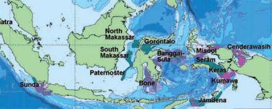
“Indonesia, although a well established producer of hydrocarbons, has seen reserves decline in recent years, so much so that it has recently become a net importer of oil. The country, however, has at least 30 prospective basins, with significant reserves in 18 of them. Eight of these basins are thought to contain over 1 Bboe, but many are seriously underexplored. In fact, with the exception of the deepwater Mahakam Delta, all deepwater portions of Indonesian offshore basins are either underexplored or completely unknown.”
Seabed sampling – simple solution!
 Sometimes seeps are obvious, but other times less so (a). By identifying an area of possible interest on the sub-bottom profiler record (b), and adjusting the sonar settings in that area to emphasise areas of high backscatter (c), a potential seep is recognised and a core location defined (d) Images: TGS“The petroleum potential and geology of Indonesia’s frontier basins is poorly understood, and there is very little data available to justify the financial commitment required for an oil company to start to look seriously at the country,” Paul continues. “Crucially, there is a paucity of high quality seismic data available to prove the existence of hydrocarbons and working petroleum systems. Acquiring seismic in a remote region with a large areal extent is not difficult – it’s what we’ve been doing at TGS for over 25 years after all – but proving the presence of hydrocarbons is more challenging. We have therefore been working on the concept of integrating seismic data with seabed sampling to reveal the crucial missing pieces of the puzzle.”
The existence of hydrocarbons seeping from the seabed into the water column has been known for a long time, as Paul explains. “In the absence of salt, all oil fields leak, as there is no such thing as a perfect seal, and faults often act as conduits for the vertical migration of oil and gas seeping from subsurface reservoirs. Faults rising to the surface are routinely identified using bathymetric measuring methods such as multibeam or sidescan sonar, while deeper ones are recognised using 2D and 3D seismic in deepwater frontier areas. Having identified seeps, we sample the seabed using cores and any hydrocarbons they contain are investigated.”
“So, the solution is simple: we map and sample the sea bed to determine if hydrocarbons are present.”
Seabed topography reveals seeps
 A large mud volcano, 12 km wide, off Timor in approximately 1,600 metres of water. The red shows areas of strong backscatter, indicating harder material. Image: TGSThe first step in mapping the sea floor is a bathymetric survey, using multiple swaths of sonar to paint an accurate image of the seafloor topography. “Sonar bounces high frequency sounds off the seabed, and the reflections are recorded by the transmitting vessel,” Paul explains. “The width and resolution of the sonar are functions of the water depth and the frequency at which the sound is reflected from the seabed. The deeper the water, the wider the transmitting beam will get before it hits the seabed, making this technique ideal for deepwater, as a single path will cover a broad sweep of the seabed. Shallower water requires more passes and the survey therefore takes longer and is more expensive.”
“If the seabed is very uneven, the sonar is reflected in different directions and with different intensity, known as backscatter. We can therefore use sonar to identify different types of seabed, as well as to map the topography of the seafloor.”
Having delineated the seafloor, the results are studied for evidence of seeps, which often have a bathymetric expression. They can show positive relief, including mounds, pinnacles or mud volcanoes, which vary in size from less than a metre to more than ten kilometres. Negative relief can also indicate seeps, in the form of pockmarks and craters caused by gas blowouts.
Biological evidence of seeps
 Paul Tredgett works as a Geophysicist for TGS in the Perth office, where his role includes marketing and supervision of the data library within the Asia Pacific area. He graduated from Exeter University with a degree in Geophysics, and spent 15 years in various positions within the seismic data processing business prior to taking up his current role. Photo: Paul Tredgett“Seabed topography is not the only indicator of seeps that swathe bathymetry gives us,” Paul adds. “Contrast in backscatter can indicate hard carbonate mats, gas hydrates and particular biological communities, all of which can be evidence of seeps. Hydrocarbons at the seafloor attract a particular type of chemosynthetic community, which has identifiably different acoustic properties. Tube worms, mussels and bacterial mats can all be evidence of seafloor seeps.”
Having identified the location of possible seeps, a more detailed investigation is undertaken, by actually sampling the seabed. “Accurately placed piston cores around sediment surface features such as mud volcanoes often display detectable seepage of oil and gas. Analysis of the seeps can yield information valuable for understanding the petroleum system and reducing exploration risk,” Paul explains. “For example, we have discovered that seepage is not continuous, but that oil and gas fields leak episodically, just as active volcanoes do not erupt continuously. Cores can be used to identify the recent geologic history of seeps, as well as more active events, which tells us a lot about the underlying hydrocarbons.”
A basic screening analysis of all cores is undertaken, followed by a detailed analysis of selected samples.
Indonesian petroleum systems identified
Using this approach of initial screening with swathe bathymetry and seafloor sampling to identify the most prospective areas, TGS has investigated an area of over a half a million square kilometres in frontier Indonesia, with very encouraging results. By using seafloor features to help identify possible seeps from underlying reservoirs, more than half the 1,238 cores the recovered revealed evidence of hydrocarbons, proving the existence of working petroleum systems.
“Using this data, oil companies can differentiate between opportunities and focus their seismic and further exploration on the most prospective areas. “We firmly believe that this new approach of integrating seafloor investigations with seismic will open frontier basins to new exploration and allow better risk assessment of each of the petroleum system elements,” Paul Tredgett concludes.”


