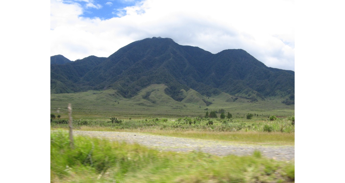
Papua New Guinea is stunningly beautiful, with scenery varying from flat swamplands and dense rainforest to cloud covered mountain ranges reaching over 4,500m, separated by deep ravines and fast flowing rivers. Volcanoes, both extinct and active, are common features of the landscape. Source: Phil Magor
Like Everywhere You’ve Never Been
One of the last intact wildernesses left on earth, Papua New Guinea is experiencing an unprecedented resurgence of interest from the hydrocarbon industry. Is it possible to encourage the advances of modernisation and the oil industry without jeopardising the ecology and culture of this amazing country?
Sea shells are no longer the currency of Papua New Guinea, but it remains one of the last countries in the world to be relatively untouched by modern man. Lying at the eastern end of the Indonesian archipelago, it still has less than 700 km of paved roads, and much of the country is virtually inaccessible except on foot or by helicopter or small plane.
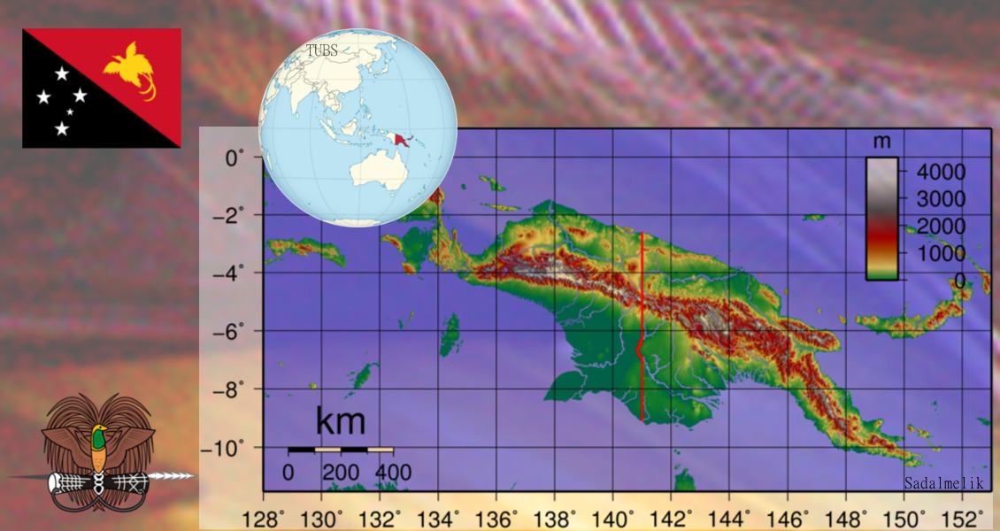
Topographic map of New Guinea. The flag of Papua New Guinea and the national emblem of a bird of paradise over a traditional spear and a kundu drum are also shown.
Spectacular landscape and wildlife
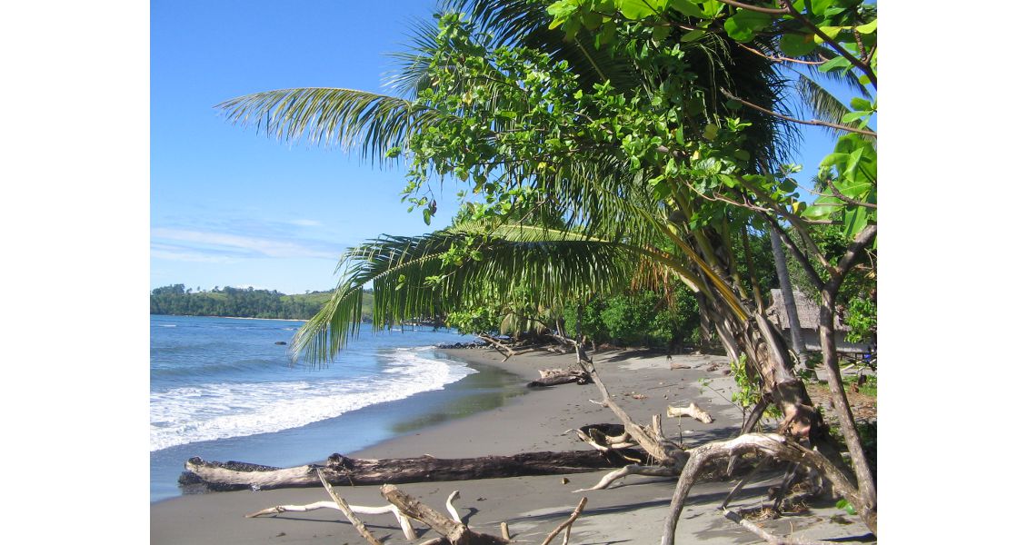
It is, however, a stunningly beautiful country, as Phil Magor, Papua New Guinea Asset Manager for Transeuro Energy, describes enthusiastically. “The combination of geology and climate means that the country has a unique and beautiful identity, ranging from white coral to black sandy beaches, clear azure seas to towering volcanic peaks, and from mist-enshrouded mountain ranges separated by deep ravines to the rolling rainforests of the deltas, all washed by two metres or more of rainfall each year.”
As well as being blessed with spectacular scenery, Papua New Guinea (often called simply PNG) is richly endowed with natural resources, including gold, copper and, of course, hydrocarbons. Oil seeps were first recorded as early as 1910, and the first wells drilled a few years later, but it was only in 1991, after several unsuccessful waves of enthusiasm from oil companies, that hydrocarbons were produced in the country. A resurgence of interest, fuelled by high oil prices and more attractive petroleum terms, saw the first gas exports in the early 21st century. PNG now faces the difficult task of encouraging further exploration without endangering the fragile ecological and anthropological systems of this unique country.
Complex and varied geology
Papua New Guinea lies in one of the most tectonically complex and active parts of the Pacific, on the converging margin of the Pacific and Australian Plates. As a result, the petroleum geologist is constantly presented with structurally difficult challenges and questions.
The country covers a number of sedimentary basins with tectonic settings ranging from passive margin continental shelf and thrust belts to rift basins. The central core is the Central Highlands, reaching over 4,500m, and up to 100km wide. It is tectonically part of the Papuan Fold Belt, which is composed of metamorphics and granite intrusions with younger material and volcanics. In places there are up to 12,000m of sediments, often with sections repeated due to recurring episodes of folding and thrusting.
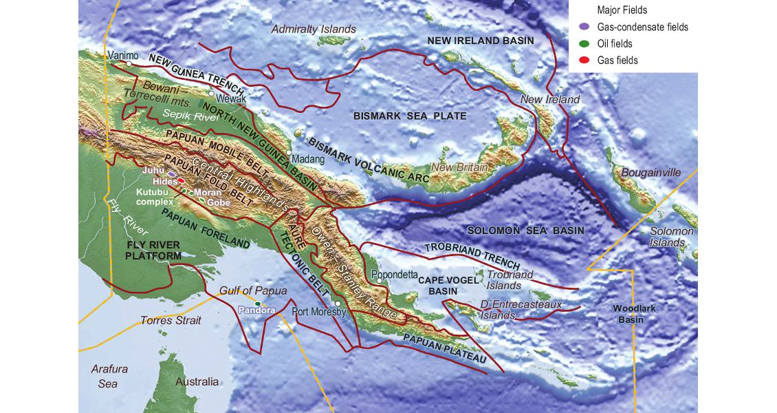
South and southwest of the mountains lie the Papuan Foreland and Fly Platform, an area of flat rain forest, traversed by the meanders of the 800km long Fly River. The geology here is composed of flat Cretaceous to Quaternary sediments overlying block-faulted crystalline basement. This extends offshore into the Gulf of Papua, where Jurassic sediments onlapping basement ridges have been preserved, and there is evidence of Tertiary pinnacle reefs. The area north of the Central Highlands, dominated by the valley of the Sepik River and the Bewani-Torrecelli Mountains, forms the North New Guinea Basin. Rapid subsidence led to the development of thick platform carbonates alongside deep water basins, filled with volcaniclastics. Sub-basins in this area could contain up to 10,000m of Late Tertiary sediments, and oil and gas seeps are common along fault zones, revising hydrocarbon interest in the region.
Southeast of the North New Guinea Basin lies the Cape Vogel Basin, which covers the northern side of the Papuan Peninsula and the offshore to the Trobriand and Woodlark Islands. It is filled with up to 7,500m of Tertiary sediments lying on ophiolitic oceanic crust. Widespread volcanism has been a feature here, with the formation of island arcs and the basinwide deposition of pyroclastics and volcanoclastics.
The eastern end of the Papuan peninsula is dominated by the metamorphic rocks of the Owen Stanley Range, formed as a result of arc-continent collision. To the south west of these lies the 400 km long Aure Tectonic Belt, thick folded and faulted Mesozoic and Cenozoic sediments with complex structures.
Undrilled anticlines and unexplored basins
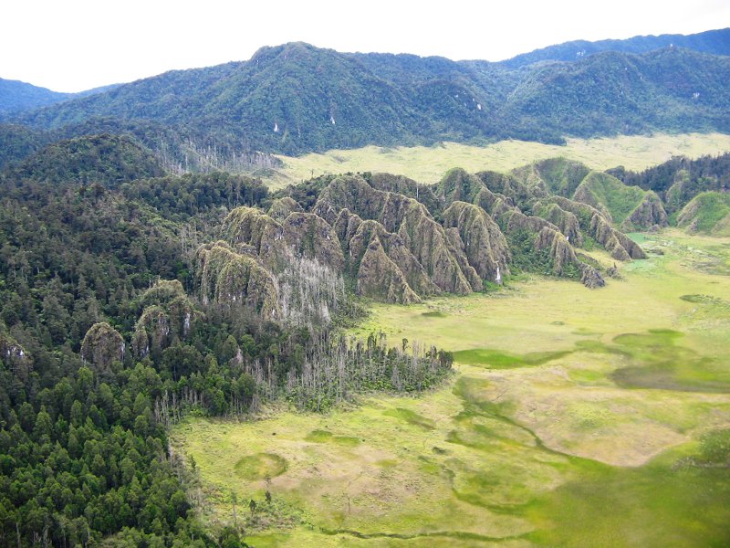 A dominant feature of the geology ,particularly in the west, is the Late Oligocene Darai Formation. This massive limestone, up to 1,750m thick, is a known reservoir in the south, in the Gulf of Papua. Further north, however, it crops out at the surface, and erosion has produced an intensely karstified terrain which hinders the acquisition of conventional seismic data. (Source Phil Magor)Most of the petroleum exploration activity and discoveries have been concentrated in the Central Highlands. A total of 12 fields have been found here, in large northwest to southeast trending anticlinal structures, all reservoired in sandstones of the Late Jurassic or Early Cretaceous. A number of large undrilled anticlines remain in the main Foldbelt fairway, and improvements in seismic imaging, including methods of seeing through the ubiquitous dolomitised and karstified Darai Limestone, mean that subthrust structures in the foldbelt also offer potential.
Outside the Central Highlands and Papuan Foldbelt, PNG is virtually unexplored. The Papuan Foreland and Fly Platform, for example, with its simple, flat-lying geology, has 12 as yet undeveloped discoveries, found from very few discovery wells. In fact, all eight wells drilled in the Foreland Basin in the last ten years had shows or evidence of hydrocarbons.
The Aure Tectonic Belt is also underexplored, although there is evidence of a new petroleum system, while offshore in the Gulf of Papua stratigraphically trapped biogenic hydrocarbons have been proven in Miocene reefs. The North New Guinea Basin, where seeps were first noted back in 1910, has only nine exploration wells but no commercial discoveries. Potential here is also centred on Miocene reefs, although turbidites and basin floor fans may prove prospective.
The largely offshore basins in the eastern part of Papua New Guinea offer some of the most virgin territory available in the industry. The Cape Vogel Basin, for example, is virtually unexplored. It contains a number of thick depocentres, with potential for Tertiary anticlinal, fault and pinch-out plays and reef structures. TransEuro Energy recently proved its faith in this area by taking an undrilled coastal block near the town of Popondetta, hoping to drill in 2008.
Encouraging developments
Estimates of proven natural gas reserves in PNG range from 14 to 17 Tcf, but the government consider the potential to be over 40 Tcfg. Proved oil reserves are in the region of 200 million barrels, with estimated possible reserves up to 500 MMbo. Total production of oil to date is over 400 million barrels, with 1.6 million barrels of condensate and 66 billion cubic feet of gas having been produced for sale, significant quantities of gas having been reinjected.
Keen to attract the oil industry, the PNG government introduced new fiscal terms in 2003. Measures included the reduction of corporate tax from 45% to 30%, leading to an attractive marginal company take of 69%, especially favourable when compared to the fiscal regimes of other counties in the region. These incentives appear to have been very successful, as applications for new exploration licenses rose from five in 2002 to 45 by the end of 2004.
Since many of the discoveries in the country have tended to be gas-prone, there have been a number of initiatives to develop systems for both utilisation and export of gas. There are refineries in Port Moresby and processing plants at some of the Central Highland producing fields. Plans for a gas pipeline linking PNG with Australia were finally shelved earlier this year, but several countries and organisations have expressed interest in building LNG and other gas utilisation plants on the island.
Although starting from a low base level, infrastructure in the country is developing fast. There are access roads to the current producing fields. River transport is important for both freight and passengers, particularly on the Sepik River, and there are a number of deep water ports. The main method of trans-country transport, however, is flying, using small planes or helicopters, and PNG boasts nearly 600 airports, most with mud runways!
Land ownership is always a concern in negotiations over mineral rights in Papua New Guinea, as traditional communities own the land communally and do not recognise a permanent transfer of ownership when land is sold.
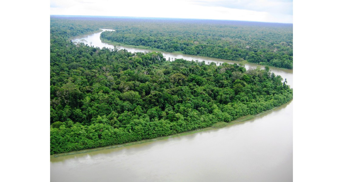
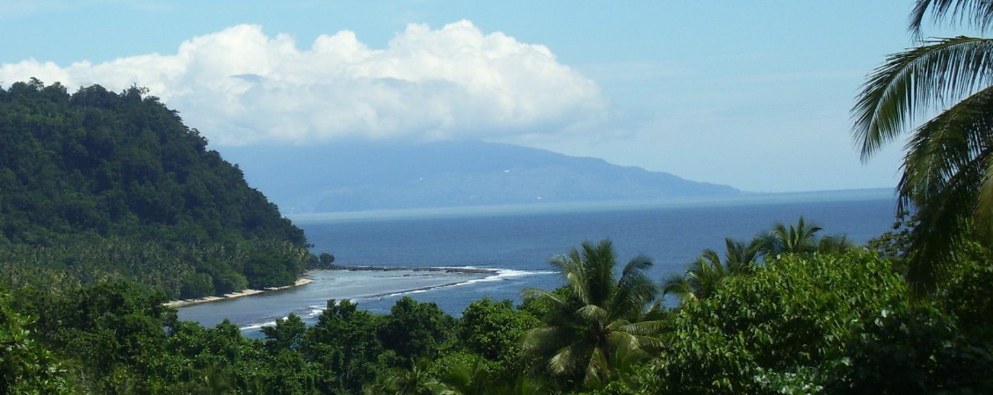
Papua New Guinea boasts one of the largest contiguous tracts of rainforest outside the Amazon. (Source: Phil Magor)
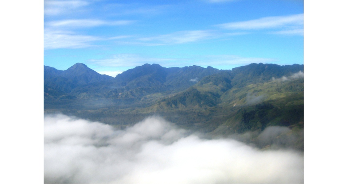
Papua New Guinea is one of the most picturesque countries in the world, dominated by the Central Highland ridge, rarely seen without an ever-changing covering of cloud. (Source: Phil Magor)
The Trobriands, coral islands 130 km north of the eastern tip PNG, have been called ‘the islands of love’. This stems from the beauty of the people and their islands, and is also a reference to their famous yam festival, when the local beauties are reputed to be very free with their favours. With regard to the hydrocarbon industry, the islands almost completely unexplored. (Source: Phil Magor)
Grass huts and internet cafes
Phil Magor considers the people the greatest asset to living in PNG. “They have a disarming friendliness that has been their trademark for centuries. Their pride in their ethnic diversity can be seen not only in the villages, but in the cities, with the juxtaposition of the traditional and the ultramodern, with woven grass huts and internet cafes, street vendors and shiny hotels, open-air craft markets and air-conditioned supermarkets.”
It is this ability to relish their difference, their culture and their land that encourages the people of Papua New Guinea to embrace the promise of progress, while retaining their traditions and ensuring the protection of their natural world. With careful and sympathetic planning, the development of a hydrocarbon industry need not be incompatible with maintaining the ecology and landscape of this unique country: a country which, in the words of the Papua New Guineans themselves “is like everywhere you’ve never been.” Long may it remain that way.


