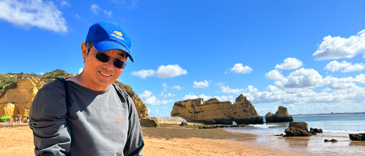
ohn is Professor of Stratigraphy at the University of Edinburgh in Scotland, having moved to academia after a number of years in the oil industry. Whilst maintaining his links with industry, John specialises in the use of seismic and sequence stratigraphy to investigate and quantify the structure, stratigraphy and depositional history of sedimentary basins, using both fieldwork and subsurface interpretation. He also has an interest in the Neotectonic geology of the Eastern Mediterranean – and it was this that led to his association with the renowned Cambridge classicist, James Diggle and author, Robert Bittlestone.
Mythical Ithaca
 Digital Elevation Model of Kefalonia and Ithaki highlighting the contrast between Paliki’s low elevation of and the higher, rugged terrain of modern Ithaki. The yellow names are those that would apply to the islands if “Strabo’s Channel” once ran beneath the Thinia Valley. Source: DEM data from NASA Shuttle Radar Topography Mission (SRTM-90), processed by Global Mapper.“Robert and James had been trying to identify the location of ancient Ithaca, the homeland of Odysseus in Greek mythology, using geographical references in Homer’s Odyssey, and realised that they needed to get a geoscientist involved,” explains John. “They came to me because they discovered my interest in the area, as I undertook my Ph.D research work on the Greek Ionian islands and have published papers on Kefalonia.”
Realising that John knew the geology well and that his expertise in integrating various branches of geoscience would be vital to their project, they invited him to participate. His initial thought on the theory that the western Kefalonian peninsula had formed a separate island 3,000 years ago, was that it would be relatively easy to disprove. That was over seven years ago and John remains on the trail of geo-clues that may settle a centuries old controversy over a key passage in the Odyssey. As he explains:
“In classical texts, Ithaca was always portrayed as an island, and is described as low-lying, the furthest westerly point of Odysseus’ kingdom, facing dusk, and surrounded by three other islands. Taking Homer’s quote literally, Ithaca could have been located on the western Kefalonian peninsula of Paliki, if it had been an island at the time. Furthermore, Strabo, writing around the time of Christ, stated that there was a marine channel between Paliki and the rest of Kefalonia, precisely where the island is narrowest.”
“So, the key question was: could Strabo, and Homer 1,000 years before him, have been correct? Was this peninsula once an island? Could geophysics solve a problem that has perplexed classical Greek scholars and archaeologists for centuries? We have been undertaking geological, geophysical and geomorphic tests to investigate the subsurface geology of the key Thinia Valley since 2003 and have now come up with a lot of data which suggests that the hypothesis that Paliki was Ancient Ithaca may well be right.”
Integrating Geosciences
Crucial to the success of the Geo-Ithaca project has been John’s experience of using different branches of the geosciences to illuminate geological problems and questions. “Experience has taught me that a multidisciplinary approach is key to success in geosciences, whether allied to sedimentary basin analysis, structural geology, petroleum exploration, carbon storage, field mapping or indeed, classical Greek scholarship,” he says. “It is something that I try to convey to students when lecturing or supervising. In developing a complete picture of an area, they need a wide bandwidth of expertise in the sub-disciplines of geology, geophysics, geochemistry and physical geography, together with stratigraphy, environment geosciences and an understanding of palaeoclimatology.”
John has built up a wide expertise in geosciences over the years. “After my first degree in Geology from Bristol and a doctorate from Cardiff in 1985, I moved into the oil industry and worked for Shell in Holland and London for a number of years. That period gave me a wealth of great experiences, as I was involved in a number of different basins and structural settings, and learnt a lot about the different aspects of petroleum geology. It will always be something that I remain extremely grateful for.”
However, life in the petroleum business did not really give John enough time to satisfy his curiosity on the more academic aspects of oil industry expertise or his sporting interests, so in 1989 he accepted a lectureship at the University of Edinburgh. “Moving here allowed me to be more of a master of my own destiny,” John explains. “Whilst the University’s Department of Geology & Geophysics was a world-leader in many areas, it didn’t have a significant petroleum or basin analysis expertise at that time.”
Two years after arriving, and with assistance from Shell and Esso, John set up the first 3D seismic lab in the academic world. “Thanks to the generosity of Schlumberger and Seismic Micro-Technology, who provide us with their software for the students to use, I was eventually able to develop that side of geoscience in the Department to the extent that Edinburgh now offer highly-regarded Master’s degrees in Exploration Geophysics and Carbon Storage, the latter being the first of its kind in the UK.”
Oil company benefit
“I think it is very important that oil companies work with academics,” John says. “It helps the former to think away from the commercial pressure of prospect and lead generation and instead, understand how individual prospects and licenses may be placed in their proper regional context. Companies have been extraordinarily generous in giving data for research and teaching purposes, but can be surprised by the things we in the academic world can give back in return, often reaping rich rewards for them.”
“For example, it has been well known for many years that some of the gas fields in the Southern North Sea produce ‘fizzy’ gas, due to their CO2 content. In 2008 WesternGeco and Tullow kindly permitted us access to high fidelity 3D seismic. Using these data, we were able to show that the CO2 was trapped in the Rotliegend Leman Sandstone Formation reservoir over geological timescales, thereby demonstrating that evaporites belonging to the Zechstein Group could be used for carbon sequestration in the Southern North Sea. This has wide ramifications for carbon sequestration and was research that the commercial geologists may not have undertaken themselves. The companies had not expected a return when they allowed us to use their data, but the fact that it helped turn the exploration risk of finding carbon dioxide into a carbon storage opportunity has proved of great benefit to industry and academia alike.”
“Experiences like this mean that our students get fantastic datasets to interpret, using state-of-the-art software and the chance to apply their skills to enigmatic geological problems,” he adds. “In addition, we are afforded a unique opportunity to use oil and gas information to put geological experience into a regional context, which is in its turn is very useful to explorationists.”
Access to well-calibrated and extensive 3D seismic data coverage means that John and his students have been able to demonstrate and quantify topics as diverse as the effects of thermal doming in the North Sea and Faroe-Shetlands Basins, normal fault growth in rift systems, the impact of igneous dykes on seismic velocities in the Southern North Sea, as well as elucidate the tectonic controls on sediment dispersal and the petroleum habitat in salt-influenced basins such as the North Sea, the Gulf of Suez and the South Atlantic; all very useful to the hydrocarbon industry.
Oil companies clearly appreciate that the training gained through an undergraduate degree in Geology or a vocational Masters in Edinburgh is invaluable. They also support a number of postgraduates through their MSc and PhD research studies each year. “The high calibre of the students applying for our courses and undertaking research projects embedded in our Masters always impresses me,” John admits.
Refereeing worldwide
 John Underhill describing asymmetric folds in the Hellenide (Pre-Apulian) foreland at Agia Efimia in Kefalonia.This year John Underhill is the Vice-President of the EAGE (European Association of Geoscientists and Engineers), leading up to the role of President in 2011-12. He is the recipient of a number of numerous prestigious awards, including the Geological Society’s President’s Award in 1990 and their Wollaston Fund in 2000, and awards from the EAGE and AAPG. John is also now an editor on the international journal Petroleum Geoscience and was the convenor of the highly acclaimed Geo-Controversies debates at last year’s Petroleum Geology Congress, as discussed in recent issues of GEO ExPro.
John has also contributed to the UK All-Party Parliamentary Group for Earth Sciences at Westminster and to the Scottish Government’s Oil & Gas Group discussions in Edinburgh. “Both provide a forum through which MPs and MSPs can be briefed on matters relating to Earth Science,” he explains. “The UK Group meets regularly at the Houses of Parliament in London, and in recent years has debated issues such as ‘blood diamonds’, Carbon Dioxide’ Sequestration and controls on coastal erosion.”
With his various teaching, research and lecturing commitments, John has a busy schedule, but still found time for sport and top-flight football in particular. Until recently hitting the retirement age for international referees, John represented Scotland on the FIFA (Federation of International Football Associations) list and officiated at high octane matches including World Cup Qualifiers and Champions League games. He hasn’t hung up his whistle entirely since retiring and now plies his trade in “Masters’” tournaments, one of which saw him become one of the first western officials to officiate in Vietnam. John admits that this was quite time-consuming – “my University employers, staff colleagues and students were very understanding, supportive and accommodating when lectures were moved at short notice to fulfil European ties!” he adds. “Whist I don’t do much refereeing now, I coach young footballers locally – plus I now have more time to spend with my students, both undergraduate and post-grads, which is very fulfilling.”
3,000 year riddle solved?
And what of the search for Odysseus’ homeland?
“Field work along the edges of the valley, through which the marine channel is presumed to have run, revealed steeply dipping beds, which erode easily, and there is a lot of evidence of modern rock slides in the area,” explains John. “Seismic and coring showed that the deep valley which bisects the Paliki peninsula, and which continues offshore, is filled with up to 180m of major rock fall debris cones derived from major co-seismic events like the magnitude 7.2 earthquake that rocked the island in August 1953.”
The Geo-Ithaca project has proved to be a multi-disciplinary project rooted in geology and geophysics. It has received a lot of publicity, with slots on news programmes and interviews on national radio. One of the most satisfying aspects of the work for John was being able provide an excellent visual exemplar of techniques developed for exploring for oil and gas, demonstrating that they had other worthy academic uses. The studies have also generated good publicity for the co-sponsoring commercial partner in the project, Fugro, who have been able to showcase the results in a way that they are sometimes unable to do in their commercial work, clearly a winning situation for everyone.
It remains to be seen if radiocarbon age-dating of the land and marine cores currently being acquired by Fugro Geotechnique and Seacore will show that the valley infill occurred in the last 2,000-3,000 years as the classical works of Homer and Strabo describe. However, taking all the evidence together, there is good reason to believe that the westernmost part of Kefalonia, Paliki, may have been the site of the mythical island of Ithaca: “so integrated geosciences may well have solved a 3,000 year-old riddle!” concludes John Underhill.


