
One of the last true hydrocarbon frontiers
In recent years the Government of Somalia has made significant and sustained progress towards lasting stability within the country. Legitimate public institutions such as the Somali Petroleum Authority (SPA) have been established and legislation has been passed by both the president and the representatives in the bicameral Somali parliament to pave the way for the announcement of the country’s First Licensing Round, which has a closing date in March 2021.
Ibrahim Ali Hussein, Chairman and CEO of SPA, and his newly formed team at the Petroleum Agency have been busy finalising the bid round protocols as well as contractual and fiscal terms and these will be published on their website in the coming weeks (http://somalialicensinground.com/).
Two regional seismic surveys have been acquired offshore. The first was shot in 2014 by SOMA Gas & Oil, a private oil company founded chiefly to explore for natural resources in Somalia and the second by Spectrum (now part of TGS) in 2016. Both surveys are modern, high quality, long offset seismic.
Southern and Central Somalia
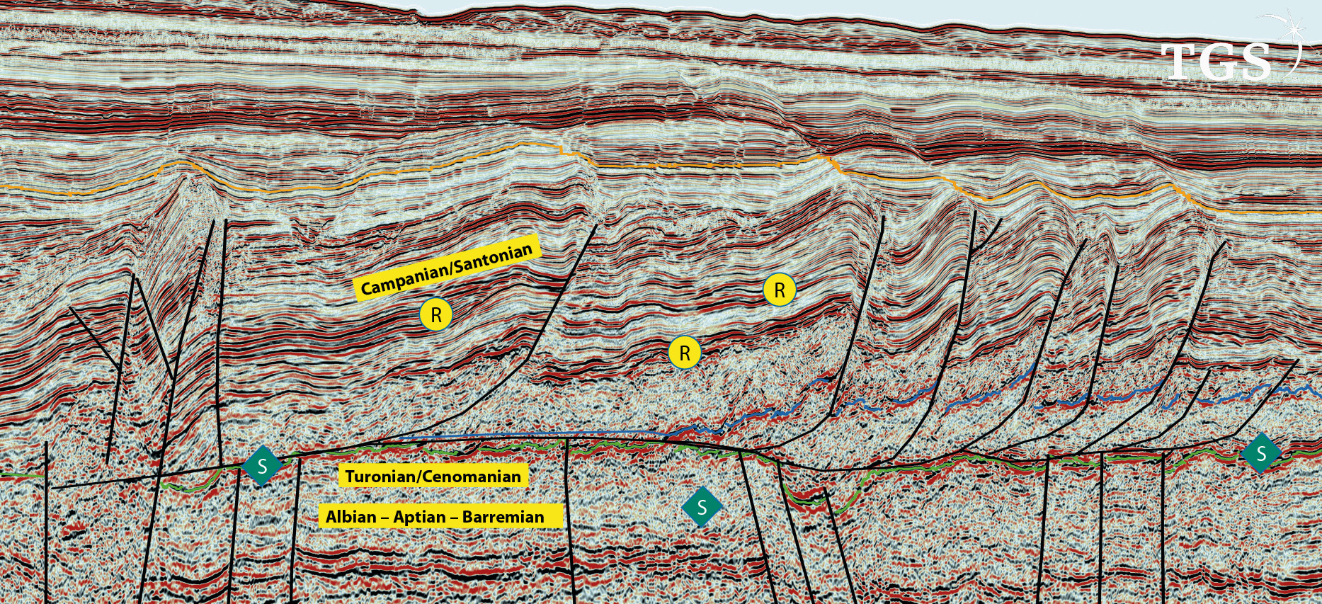
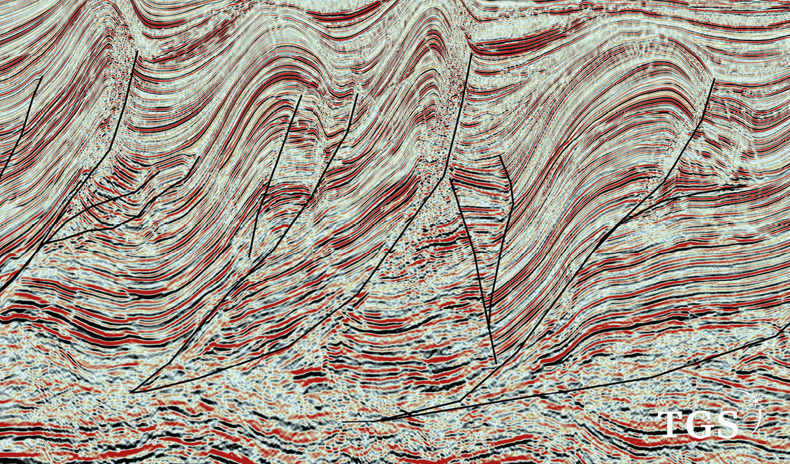
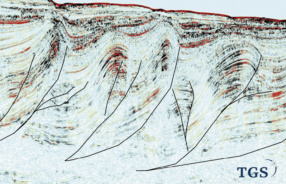
The seismic data reveals several large fold and thrust belts including a predominantly Tertiary fold belt, similar to offshore Mozambique in the Rovuma Basin. There is also an older Cretaceous fold belt involving Cenomanian to Maastrichtian shelf and slope sediments that have been thrust up and folded into a plethora of large anticline structures.
The interesting thing about this fold belt is that all the thrust planes sole-out on a common detachment surface that we interpret to be Cenomanian–Turonian (CT) shales. It is well known that shales rich in organic carbon, and particularly those in the oil window, can act as regional detachment surfaces. The model predicts that the shales that act as slip surfaces for the thrusts can also be the source rock that supplies the oil to the overlying structures.
The Cenomanian–Turonian was a period of intense global anoxia with euxinic conditions developed throughout the ocean floor deep water as well as along the upper continental slopes and outer shelves. The resulting CT sediments are rich in organic matter owing to a combination of two factors: high phytoplankton productivity caused by increased nutrient supply in upwelling zones and greater preservation at the seabed under anoxic conditions.
Geoscientists reading this article will rightly ask why thick, high TOC source rocks of CT age have not been encountered in wells drilled in nearby Kenya and Tanzania. There could be several reasons for this, including the fact that during CT times the Somali Basin was a long narrow basin orientated north–south; a shape not conducive to oceanic circulatory patterns that result in upwelling currents. A second reason could be related to the presence of the Davie Ridge Transform. This long linear feature is an underwater high that parallels the continental slope offshore Tanzania and Kenya which will have strongly influenced oceanic currents in these areas. Most of the wells offshore Kenya and Tanzania are drilled on the shelf and slope west of the Davie Ridge and therefore have not sampled the basinal facies to the east of the ridge. The jury is still out waiting for concrete proof of a ubiquitous CT oil source rock in East Africa – but our model provides some hope.
We can glean a lot of information about source rocks by looking on the opposite side of Africa. During Cenomanian–Turonian times, the Central Atlantic was a wide basin with well-developed upwelling zones. Thick layers of organic rich shale were deposited in both the shelf/slope setting and also in the deepwater setting. The thick oil shales of Tarfaya in Morocco and the La Luna Formation in Venezuela are examples of thick, high quality source rocks deposited in a shelf/slope setting. The recent Guyana and Suriname oil discoveries testify to high quality oil-prone source rocks also deposited in the deepwater basinal setting. We expect similar conditions were present in the deepwater Somali Basin during CT times.
The probability of finding good quality reservoirs is high. Thick, quartz-rich sandstones of Cretaceous and Tertiary age with high porosity are expected in the southern and central Somalia basins as a result of erosion from largely Precambrian granitic basement plus reworking of older Karoo sandstones. The burial depths are not high, so we expect good porosity to be maintained. All things considered, the fold belts have all the ingredients for success in finding large volumes of oil and gas in commercial quantities.
Northern Somalia
The northern part of offshore Somalia has a very different geology to that found to the south. The reason for this is related to the creation of a huge uplifted structural arch, known as the Somalia Arch, at the start of the Late Cretaceous. Strong transpressional forces in the crust were created as a result of India separating from Madagascar and this produced long wavelength buckle folds across a wide area of East Africa.
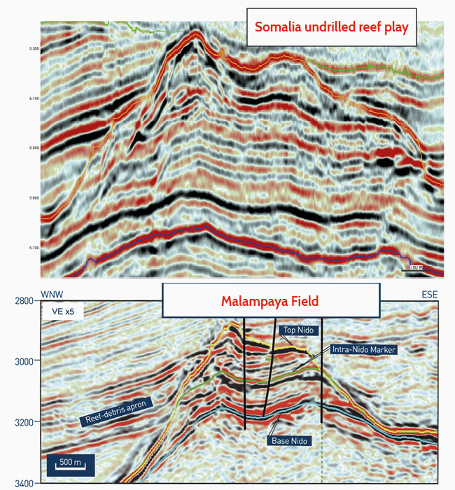
Within the Somalia Arch we can clearly see the Permo-Triassic–Early Jurassic (Karoo) syn-rift fault blocks truncated by the break-up unconformity. Above the unconformity, and at good drillable depths, are monstrously big Jurassic reefs with enormous four-way closures (see image above). One mapped closure is more than 1,000km2.
On the conjugate margin in Madagascar, the Karoo has high quality proven source rocks in the Early Triassic (lacustrine Type I) and Early Jurassic (marine Type II). The Early Triassic lacustrine source rock has sourced more than 22 Bbo in the Bemolanga/Tisimoro oil fields of Madagascar. Similar aged source rocks may be present in northern offshore Somalia. Another possible source rock would be coeval Late Jurassic shales on the basinward side of the reefs. These onlap and eventually drown the reefs – perhaps acting as both intraformational source and seal.
Exciting new basin
Overall, the offshore Somalia Basin promises to be an exciting new basin to explore in the years ahead. Hopefully, there will be success there, and as a result future oil revenues will help Somalia continue its path of reform, bringing prosperity to its people.


