Over the last few years, significant advancements have been made in the field of seismic quality, fundamentally transforming the landscape of geological exploration. The increase in bandwidth coupled with improved migration and inversion algorithms has provided interpreters with unprecedented detail, enabling a more nuanced understanding of subsurface structures. However, despite these technological advancements, exploration success rates have remained relatively stagnant. The primary reason for this is that the key uncertainties in prospectivity evaluation, whether at play or at prospect scale, are not resolvable through increased understanding of seismic properties and detail only.
The primary challenge lies in the link between the properties being measured by seismic data and the existing geological uncertainties. While seismic data excels in revealing variations in compressional and shear wave velocities, which are influenced predominantly by lithology and porosity contrasts, it falls short in areas where permeability and fluid contact location or saturation calculations are critical. Permeability, the ability of the rock to transmit fluids, and the precise location of hydrocarbon-water contacts are essential factors in the determination of the viability of a reservoir as an economic producing field. This is particularly true offshore, where high operating costs make flow rate a key economic factor. Flow rate is itself heavily driven by permeability and pressure. Seismic data, despite its increased detail, cannot directly resolve these aspects because the parameters being measured, elastic properties and density, are not primarily influenced by factors such as permeability, column height, pressure or saturation.
Inferring permeability
In contrast, resistivity measurements provide valuable insights into these critical areas. Resistivity is mainly driven by the amount of water present in the sediment, with low resistivity indicating high water content and high resistivity indicating low water content. The amount of water in the sediment if hydrocarbons are present is intrinsically linked to the reservoir’s permeability and pressure. The amount of water removed from the sediment and, hence, the amount of hydrocarbon filling it, directly correlates to the difference in pressure existing between the different fluids present and the permeability that allows the movement of those fluids. The ability to detect changes in resistivity allows geologists to infer variations in total water content and, by direct extension, the permeability and pressure in the reservoir.
Locating hydrocarbon-water contacts
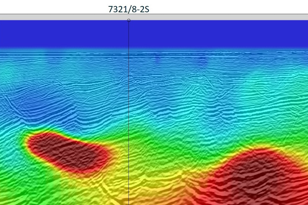
Moreover, resistivity is a powerful tool for locating hydrocarbon-water contacts. Hydrocarbons and water have distinctly different resistivity values, so by mapping lateral changes in resistivity within the same formation, geologists can identify the boundaries between these fluids. This capability is crucial for improving the understanding of a reservoir’s extent, its pressure, and permeability before drilling. This can significantly improve exploration performance, by allowing the identification of low potential targets and altering the drilling sequence, favoring higher potential, in terms of the volume and flow rate, targets to be drilled early in the sequence.
A more comprehensive understanding
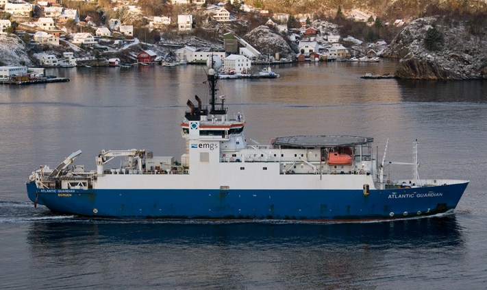
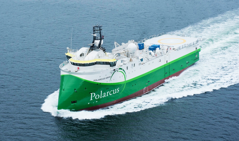
To achieve a substantial improvement in exploration success rates, integrating resistivity data derived from Controlled Source Electromagnetic (CSEM) surveys offers a promising solution. CSEM technology involves generating an electromagnetic field at the surface and measuring the response due to the propagation of that field through the subsurface. This response is sensitive to variations in resistivity, that can be assessed through imaging methods equivalent to seismic full waveform inversion. By combining seismic and CSEM data, geologists can achieve a more comprehensive understanding of subsurface’s prospective potential, addressing the limitations of each method when used in isolation.
The effective deployment of CSEM technology needs to be carefully planned and executed to maximize its impact. It requires inclusion in the exploration work program from the outset, making sure it is deployed in a timely manner and at the right scale, so that results are available to the team when decisions are made, and that enough data is available to impact all potential opportunities. Another key factor is to ensure that the right personnel and resources are available to carry out a fully integrated evaluation of the prospectivity. This includes geophysicists who specialize in CSEM data interpretation, as well as experts in seismic data, and geologists, to collaboratively analyze and integrate the datasets in a common geological model. The success of this approach hinges on the seamless integration of seismic and CSEM data, allowing for a more holistic assessment of the subsurface.
THE PROOF IS IN THE PUDDING
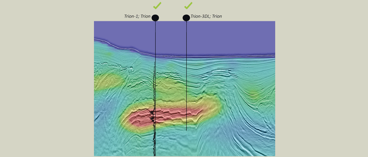
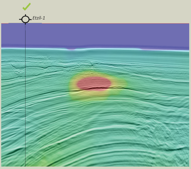
The Etzil and Trion wells offshore Mexico prove the point that resistivity can help identify hydrocarbon contact location through the lateral changes in resistivity. In the Trion case, a large hydrocarbon column was proven through drilling, while in Etzil’s case the drilling proved the absence of a hydrocarbon-water contact at the well location as could be interpreted by the absence of a lateral change in resistivity.
The recipe for greater exploration success
While seismic advancements have greatly enhanced the detail available to interpreters, they have not significantly improved exploration success rates due to inherent limitations in addressing key geological uncertainties. Resistivity measurements derived from CSEM technology offer a valuable complementary tool by providing insights into reservoir permeability, pressure and fluid contact placement. To realize this step change in exploration success, it is essential to incorporate CSEM into the exploration workflow, supported by a team of specialists who can deliver an integrated evaluation of the existing prospects. By doing so, the industry can better address the challenges of exploration and improve the likelihood of discovering economically viable hydrocarbon reservoirs.