The roughly south-east to north-west trending 420 km long seismic line 1060 shown here crosses the southern Rockall Basin. This 30 km depth section (PSDM) shows up to 6 km of sedimentary fill and large rotated fault blocks or half graben that contain potential Jurassic source rocks. The red line thought to be the top of crystalline basement or continental crust at depths of 23 – 27 km, rising to 16 – 17 km under the center of the Rockall Trough, is derived from gravity modeling and is interpreted to be the Moho. Note the significant thinning and extension of the continental crust under the Rockall Trough to about a 6 km thickness. Results of gravity inversion studies (Welford, J.K., Shannon, P.M., O’Reilly, B, & Hall, J. 2010. Lithospheric density variations and Moho structure of the Irish Atlantic continental margin from unrestrained gravity inversion. Geophys. J. Int., 17 pp.) show similar thinning and major crustal stretching across the Rockall Trough.
Ireland’s Wild Western Frontiers
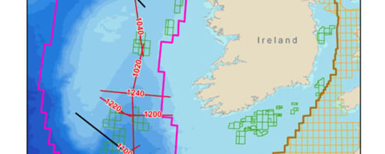
 Bathymetric map and 3D relief of the offshore western Ireland. The Rockall and Porcupine basins open southwards into the Atlantic Ocean. The traces of the long regional seismic lines used in this evaluation are shown in on the maps. Line 1060 is highlighted. © ION Geophysical
 The Irish government is looking off its west coast at the Rockall and Porcupine basins for a recently announced new exploration licensing round, scheduled to close in May 2011. Photo: Deb BertossaWith proven hydrocarbon accumulations and very large structural closures, the Rockall and Porcupine basins off Ireland’s west coast could be put on the front burner for the next licensing round.
The Rockall Trough has been the center of political and geological controversy for the last two hundred years. The area is named after the remote rocky island of Rockall and has been variously claimed by Iceland, Denmark, Ireland, and the United Kingdom. It was first claimed by the British in 1955 during the cold war to help prevent the Soviets spying on guided missile testing from the Outer Hebrides. Since then, various adventurers have placed flags or lived for short periods on the rock. Greenpeace occupied it for 42 days in a solar-powered capsule in 1997 and renamed the rock as Waveland in a protest against oil exploration west of Britain. The ownership remains in dispute and is providing yet another headache for the United Nations Convention on the Law of the Sea.
The geological controversy stems from the area having been described as both a continental and oceanic-floored basin. In addition, the age of the main rifting phases remains unknown. Seismic imaging traditionally has been poor because of the presence of numerous intrusive sills and shallow extrusive basalts that mask the underlying strata. In the summer of 2007, as part of the regional NEAtlanticSPAN TM program, ION GX Technology (GXT) shot more than 2,000 km of seismic data across the Rockall Trough and adjacent areas in an attempt to resolve the deep geological structure of this enigmatic area and evaluate the area’s hydrocarbon potential.
The Irish government has recently initiated a trans-Atlantic research program, using state of the art technology, building plate reconstruction models that accurately depict the geometry of the basin at the time of “break-up”. Studying palaeographic reconstructions will help to better understand the Atlantic shelf sedimentary sequences and possible derivation of clastics from the North American Plate.
Unexplored Rockall Basin
 Green: Top Cretaceous/Base Tertiary – Light Blue: Base Upper Cretaceous – Dark Blue: Base Cretaceous – In rotated fault blocks below base Cretaceous: Jurassic to Top mid Jurassic sedimentary packages. State-of-the-art 2D regional reconnaissance seismic data such as this seismic depth section (30 km) across the southern Porcupine Basin have shed new light on the hydrocarbon potential of an area that has remained an exploration backwater for many years. Since rifting occurred in the Jurassic, the basin has remained underfilled and a prominent 2 km deep depression is present at the seabed. Eight kilometers of post rift sediment fill is present in the central axis. Rifted continental crust appears to extend across the whole basin. ((Vertical exaggeration 2.5) © ION Geophysical
 Rockall Island measures just 33m in diameter and is 19m high and the highest oceanic wave ever recorded at 29m crashed over it in 2000. The rough sea conditions this area is known for have helped it remain a wild frontier. This photo was taken by the RAF in 1943.The area remains largely unexplored with its remote location, harsh weather and wave conditions. No wells have been drilled in the main deep central part of the Rockall Basin, and the few wells drilled thus far are located on the perched eastern margin rift shoulders or in the northern sub-basin. Most recently, Shell drilled the Dooish well 12/2-1 and sidetrack -1z in 2003 proving a gas condensate sandstone reservoir of probable early Permian age. A second deep-water well, 12/2-2, was drilled on the West Dooish Prospect in 2008, but the results remain confidential.
The presence of Jurassic rocks is perceived to be crucial to successful oil exploration in this basin. They occur in surrounding basins in the Slyne-Erris Trough to the east, and the Goban Spur and Fasnet Basin to the south. There is no direct evidence to confirm or disprove their presence in the central Rockall Basin. The sediment fill averages 4-6 km throughout the main basin which is thick enough to ensure hydrocarbon maturation from any Early or Late Jurassic source rocks (refer to seismic foldout line 1060).
A large part of the basin was affected by volcanism during the Paleogene period (54-59 million years ago) and several major seamounts are present in northern Rockall, as are extensive lava flows and intrusive sills. These volcanics have caused major problems for seismic imaging and have impeded exploration efforts for deeper targets so far. However, in the southern part of the basin the volcanics are absent. Large inversion fold traps have been imaged at Cretaceous levels in the southern part. These folds probably developed during Oligocene-Miocene times when regional basin inversion took place in the Faroes-Shetland Basin farther north.
Cretaceous and Early Paloecene sandstones would be the most attractive reservoir targets. Sands may well have been derived from Greenland, similar to the inferred sediment provenance in other North Atlantic margin basins such as the outer Faroes-Shetland and Vøring basins. The seismic data indicate these large fold closures are viable exploration targets, although a more detailed seismic grid will be required to confirm this.
Proven sources in Porcupine Basin
 Large inversion anticline imaged at Cretaceous level in the southern Rockall Basin. Seismic imaging is good in this part of the basin as there are no volcanics present. © ION GeophysicalTo date, exploration in the Porcupine Basin has found several non-commercial fields. In the 1970’s, BP discovered two oil accumulations at Connemara (200 MMbo in place) and in 1981, Phillips discovered the 100-200 MMbc Spanish Point gas and condensate field. GXT acquired more than 1,600 km of reconnaissance seismic across the Porcupine area in 2007.
This basin is a sediment starved Jurassic rift which opens southward into a bathymetric low reaching up to 4 km water depth at its southern end. There are good quality Jurassic source rocks of Kimmeridgian and Middle Jurassic age.
In the deep central part of the basin these rocks are buried to 8 km or more below sea bed where, at present, they are probably generating gas. Perched large rotated fault blocks occur along the margins of the basin and may contain mature sources in the oil window. Vertical gas chimneys and deep water carbonate mounds are present above seabed seeps indicating that the southern part of the basin is capable of generating hydrocarbons.
Providence Resources and Exxon currently hold license blocks over this ridge known as the Dunquin prospect. They were attracted by the large closure where carbonate reservoirs have been interpreted on the crest of the structure.
While the remote location and harsh conditions found in Ireland’s western offshore basins have limited exploration, this new data clearly show promising source rocks and large untested prospects like Dunquin. The new leasing round should spur companies to re-examine this area.


